
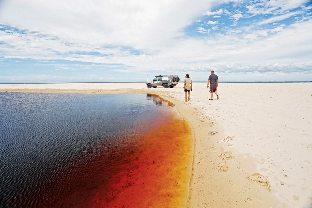
You can drive to the edge of Mermaid Lagoon behind Ocean Beach
Once a well-kept, secluded retreat for holidayers, Bribie Island / Yarun is now a popular destination for day trippers, nature lovers and water sport enthusiasts. From stunning natural landscapes to a rich cultural history, Queensland’s Bribie Island is one not to miss.
Bribie Island is the smallest and most northerly of the three so-called ‘Brisbane Islands’ that partially enclose Moreton Bay / Quandamooka. It lies just 70km from the Brisbane CBD via the Gateway Motorway and Bruce Highway (M1) and is linked to the mainland by an 830m bridge across the narrow Pumicestone Passage.
The sand islands
Together with Moreton and Stradbroke / Minjerribah islands, Bribie was formed over the past million years or so from sand eroded from the mountains of northern New South Wales which was swept up the coast by wind and ocean currents. The grains became trapped by rocky outcrops and gradually accumulated into large deposits several hundred metres thick. When the ocean dropped to its present level about 10,000 years ago, the sand banks became exposed and isolated as islands with the familiar shapes we see today. K'gari (Fraser Island) was created in the same way and is the largest sand island in the world; North Stradbroke and Moreton islands are the second and third largest.
For a full print guide on the islands, check out the Hema Maps K'gari (Fraser Island) and the Brisbane Islands Atlas and Guide.
First inhabitants
Indigenous people have lived in the Moreton Bay area for at least 26,000 years. They call it Quandamooka, meaning 'place of the creator sea spirit Quandamook', who took the form of a dolphin. Various groups inhabited Quandamooka and frequently interacted across loose tribal boundaries to maintain social and cultural relationships. The area around the Pumicestone Passage was occupied by the Djindubari (Joondoobarrie) people, who occupied the island and called it Yarun. These early inhabitants left behind a rich archaeological record of their occupation and use of the island and the calm waters of Moreton Bay. Native title has been recognised over most of Moreton and North Stradbroke Islands.
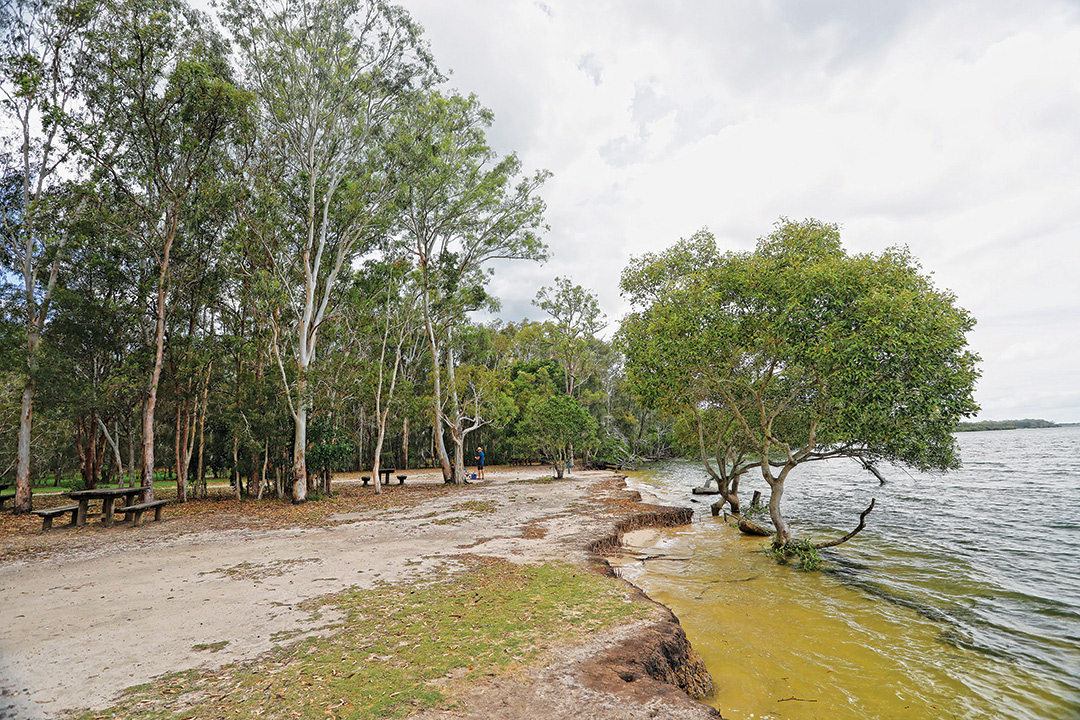
The shore of Pumicestone Passage at Poverty Creek camping area
European contact
James Cook was the first European to record the existence of the islands during his voyage up the coast in May 1770. He named Moreton Island and many other landmarks but did not enter the large bay behind it. Matthew Flinders did so in July 1799. While exploring the bay in the sloop Norfolk, Flinders led a small party ashore on Bribie’s southern beach, where they encountered a group of Aboriginal people. The meeting was initially friendly, but an altercation broke out in which one of the natives threw a spear and Flinders responded by firing a musket, injuring the assailant and causing the group to flee. Flinders named the site of the confrontation Point Skirmish (today called South Point). Needing to repair the leaking Norfolk, Flinders beached the vessel some 8km north of Point Skirmish along a narrow waterway which he called the Pumice Stone River (now Pumicestone Passage). Repairs complete, he continued exploring the bay and departed 15 days later.
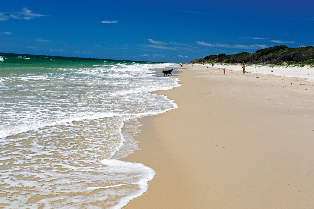
The south end of Ocean Beach near Skirmish Point
From convicts to colony
In 1823, John Oxley entered Moreton Bay on a mission for Governor Sir Thomas Brisbane to find a possible location for a penal settlement. On Oxley’s recommendation, a penal colony was established at Redcliffe in 1824 but was moved a year later to a site on the Brisbane River which offered a more reliable water supply. This settlement was known as ‘Moreton Bay’. Bribie Island takes its European name from a convict who earned his freedom as an expert mud-crabber for the officers and settled on the island with a local Djindubari woman.
Under the command of Captain Patrick Logan, the settlement flourished and became the focus for pioneer farmers along the river. The catchment was cleared for crops and grazing, and the timber was floated downstream for shipment to Sydney. Coal mines and a limestone quarry were opened at Ipswich. In 1834, the settlement was declared a town and renamed Brisbane. From 1835, the region was opened to free settlement and the European population quickly expanded with the influx of German, Scottish and Irish immigrants. Free settlers soon outnumbered convicts and, seven years later, Brisbane officially ceased as a penal colony. In 1859, Queensland was proclaimed a separate colony from New South Wales, with Sir George Bowen its first governor and Brisbane as the capital.
Development of the island
Located close to the northern entrance to Moreton Bay, Bribie was an obvious choice for development and from the time of early settlement it was used for a variety of agricultural activities, including timber harvesting, grazing and beekeeping. In the process, the Djindubari people were dispossessed of their land and forced into a nomadic life. In 1890, the Queensland Aboriginal Protection Association established a mission for them on the island. However, this was closed after two years, and its residents moved to Myora Mission on North Stradbroke Island. Sea mullet was so plentiful in the Pumicestone Passage that two canneries operated on the island from 1898 until 1914.
‘Fort Bribie’
On the outbreak of World War II, the Moreton Bay islands became the front line for the defence of Brisbane, and a series of forts were established to defend the seaways leading to the city port. Due to its strategic location close to the bay’s northern entrance, Bribie Island was considered vital to the defence of that shipping channel. Fort Bribie was constructed at the northern end of Ocean Beach and Fort Skirmish at the south end, each housing artillery batteries, observation posts, searchlights and anti-submarine monitoring stations. At the end of the war, much of these coastal defences were removed, leaving only a few concrete bunkers and other basic structures. These weathered remains are listed on the Queensland Heritage Register and are popular sightseeing attractions for visitors.
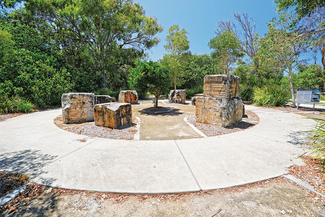
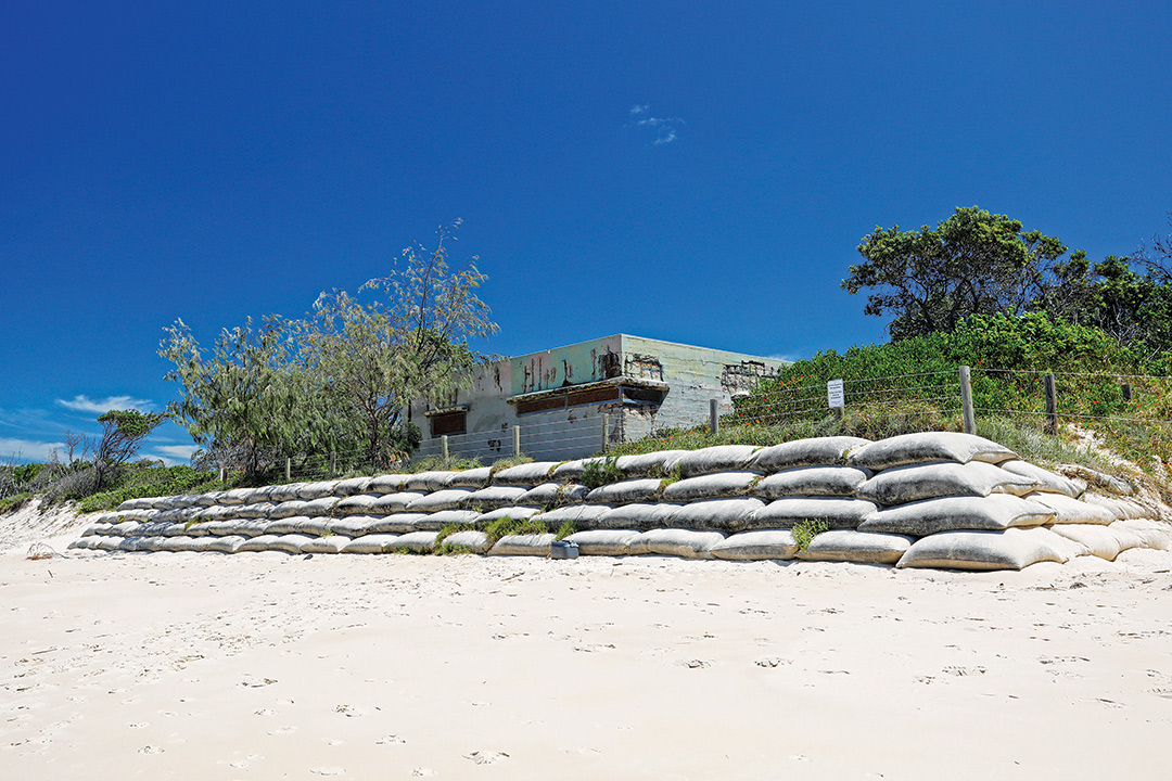
Remains of some WWII fortifications at Fort Skirmish near Woorim
Urban development
Up to the 1950s, Bribie Island was a secluded retreat for dedicated fishers and get-away-from-it-all holidaymakers, with very little in the way of amenities or public services. All that changed when the bridge over Pumicestone Passage was opened in 1963, paving the way for a population surge that urbanised the southern end of the island. Today, Bribie is home to around 16,000 people, and is a popular destination for day trippers from the mainland cities and a playground for nature lovers and water sport enthusiasts.
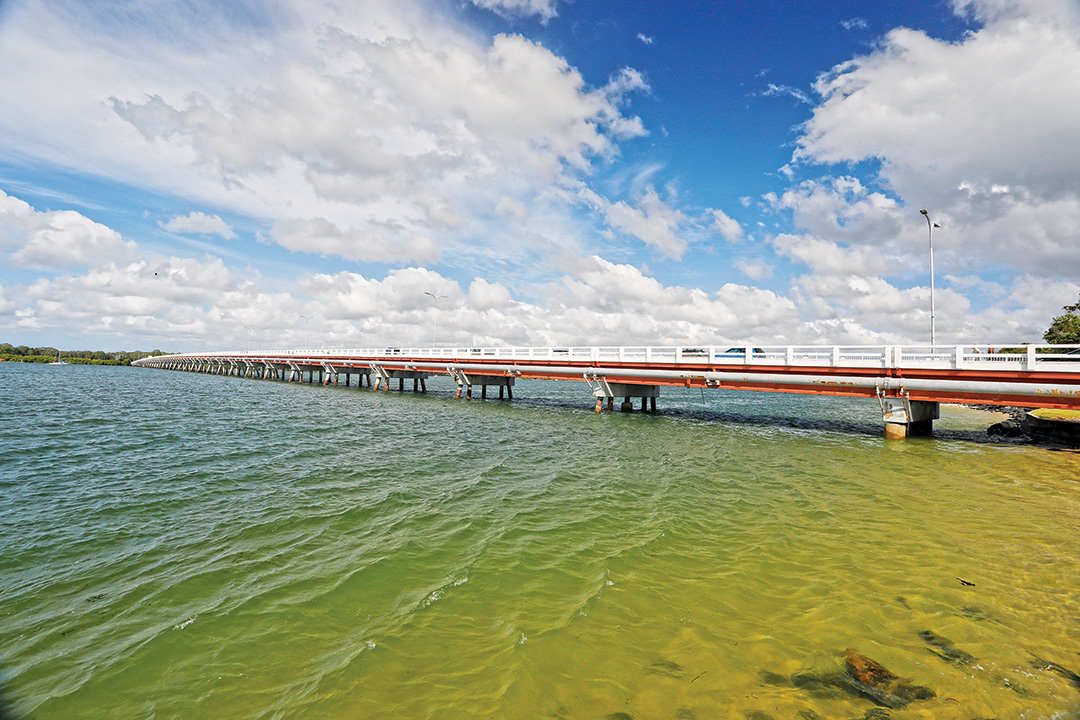
The island is accessed by a bridge over the Pumicestone Passage
The island's main shopping centre is at Bellara, the first suburb entered after crossing the bridge. North of Bellara is the canal estate of Banksia Beach and the quiet residential enclave of White Patch abutting the Bribie Island National Park. Occupying the south-west corner of the island, the suburb of Bongaree has a pleasant recreation park fronting a beach on the Pumicestone Passage, with a jetty that is a popular fishing spot. Seven kilometres east of Bongaree is the busy beachside hub of Woorim, with hotels, holiday accommodation and a small shopping centre. The island’s only Surf Life Saving club is located here among shady parkland overlooking the Ocean Beach, which stretches 20km to the north and a comfortable walk to Skirmish Point in the south.

Woorim Beach has a view across the northern entrance to Moreton Bay
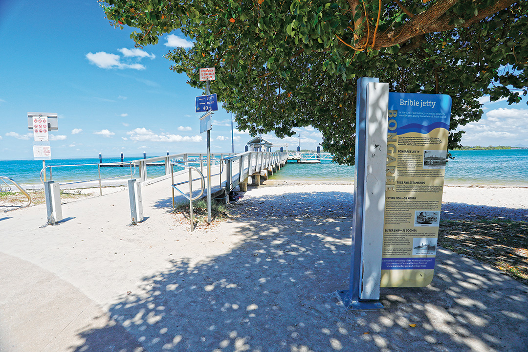
Bribie jetty at Bongaree Foreshore
While Bribie may not be as sophisticated as Brisbane or the Sunshine Coast, the island has a host of accommodation options to suit all budgets and lifestyles: hotels and motels, apartments and villas, hostels and holiday parks, bed and breakfasts, and private holiday rentals. There are three caravan parks on the island and another four in close proximity on the mainland shore of the Pumicestone Passage, each offering cottages, cabins, camping and caravan sites (powered and unpowered).
The natural environment
Bribie Island is 34km long and only 8km at its widest part. Ancient sand ridges form the core of the island, shaped by prevailing trade winds into north-westerly spines of low-lying dunes that rise to no more than 10 metres. The island’s sheltered western side comprises low sand plains, muddy tidal flats and freshwater swamplands. The exposed east coast is a long ocean beach of dazzling white sand backed by foredunes. The sandy shoreline extends around the southern end of the island and is somewhat protected from ocean swells by Moreton Island to the east. In the north, the island tapers to a long, low sandspit which has been severely impacted by king tides and cyclonic weather over the past three years.
The eastern foredunes are bound by spinifex, she-oaks and acacias, while the north-western shore is protected by extensive mangrove forests around tidal flats, salt marshes and brackish lagoons. The hinterland’s eucalypt forests and banksia heathlands feature brightly coloured wildflowers that are a constant delight to botanists and bushwalkers. Freshwater creeks feed an extensive system of wetlands fringed with sedge, paperbarks and swamp oak.
These diverse habitats contain 320 species of native plants and more than 380 native animals, some of which are rare and endangered. The most prolific animals are shorebirds, including 52 migrant species which flock to the island in numbers exceeding 15,000 during the summer feeding season. Green turtles and endangered loggerheads nest in the dunes of Ocean Beach between October and March.
Conservation areas
The northern three-quarters of the island is undeveloped bushland, accessible only by 4WD vehicle or boat. Most of it is covered by the Bribie Island Recreation Area (BIRA), which incorporates the 5580ha Bribie Island National Park. The tidal zones and waters surrounding the island are protected as part of the Moreton Bay Marine Park. All vehicle access to the BIRA is via the Beach Access Track at Woorim or the QPWS ranger station at White Patch and requires a permit before entry. At the southern tip of the island, Buckleys Hole Conservation Park is an important bird habitat, while other parts of the BIRA are designated Ramsar wetlands of international significance.
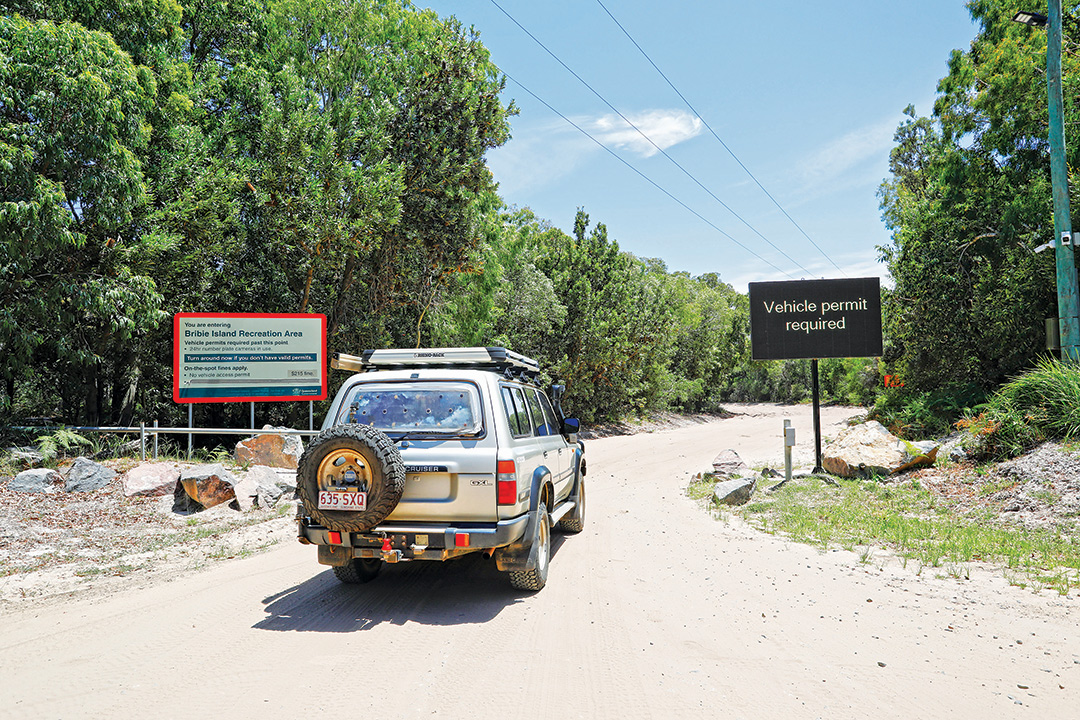
A vehicle permit is required to access the Recreation Area
Four-wheel driving
Outside the southern townships, the BIRA’s beaches and inland tracks are tailor-made for the four-wheel driving enthusiast. You must have a vehicle access permit before entering the BIRA and these can be obtained online, by email, at a QPWS over-the-counter booking office (click here for locations), or by phone (13 74 68).
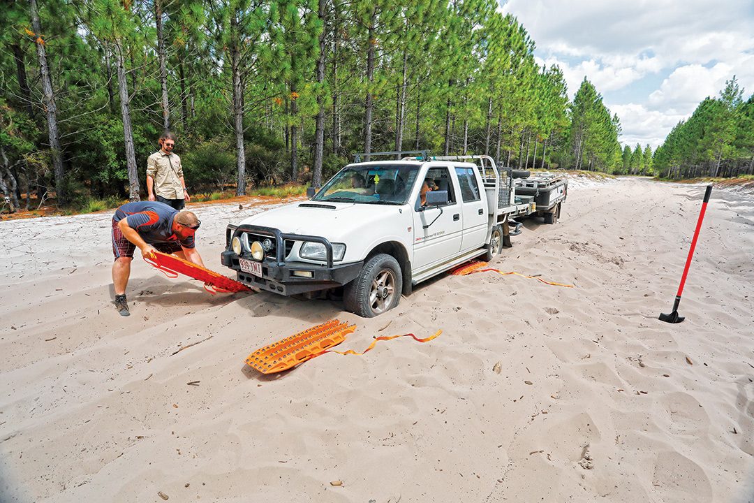
Some tracks in the Recreation Area are very sandy
The most popular scenic drives are the 23km run up Ocean Beach to the Fort Bribie Day-Use Area, and the Poverty Creek Access Track through heathlands, eucalypt woodlands and pine forests to camping areas on the edge of the Pumicestone Passage. The two are normally joined by the Northern Access Track through the centre of the island. However, at the time of writing, this track was closed for repair of erosion damage caused by severe weather.
Sand driving does require a certain amount of preparation, and lowering tyre pressures is a must. For learn more about how to drive on sand check out this feature: Beating the sand bog blues.
Camping
There are five camping areas within the BIRA: one at the north end of Ocean Beach and four on the west coast adjacent to the Pumicestone Passage. The Ocean Beach camping zone contains 63 sites suitable for tents and camper trailers along a 3km stretch of foredunes at the northern end of the beach. The zone is protected from onshore winds by thick vegetation and has facilities that include toilets, cold showers and water (not suitable for drinking). On Bribie’s western side, Lime Pocket and Mission Point camping areas are only accessible by boat. Gallagher Point offers low-key bush camping suitable for tents and camper trailers, with no facilities apart from fire rings. However, the spacious Poverty Creek camp has shady sites spread over an open grassy area ideal for large groups and camper trailers. Facilities include toilets, cold showers, water (not suitable for drinking), picnic tables and fire rings. Camping permits must be obtained in advance and fees apply.
The free RV camping at Port Albert is right near the wharf
Bushwalking
The endless beaches and shady foreshore parklands are excellent places to stretch your legs, but if it’s a true bushwalking experience you’re after, head to the Bicentennial Bushwalks. Beginning near the Community Arts Centre (at Banksia Beach), the walking trails fan out on three interconnected circuits over 3.8km (return), which can be covered by a leisurely stroll in about one hour. Each walk showcases a particular plant community endemic to Bribie Island – eucalypt forests, wallum heathlands and paperbark wetlands. The experience is enhanced by seasonal wildflowers (July–September) and a host of native birds which offer good opportunities for birdwatching and photography. A free brochure from the Arts Centre contains a map and colour images of 18 plants which you may encounter along the trails.
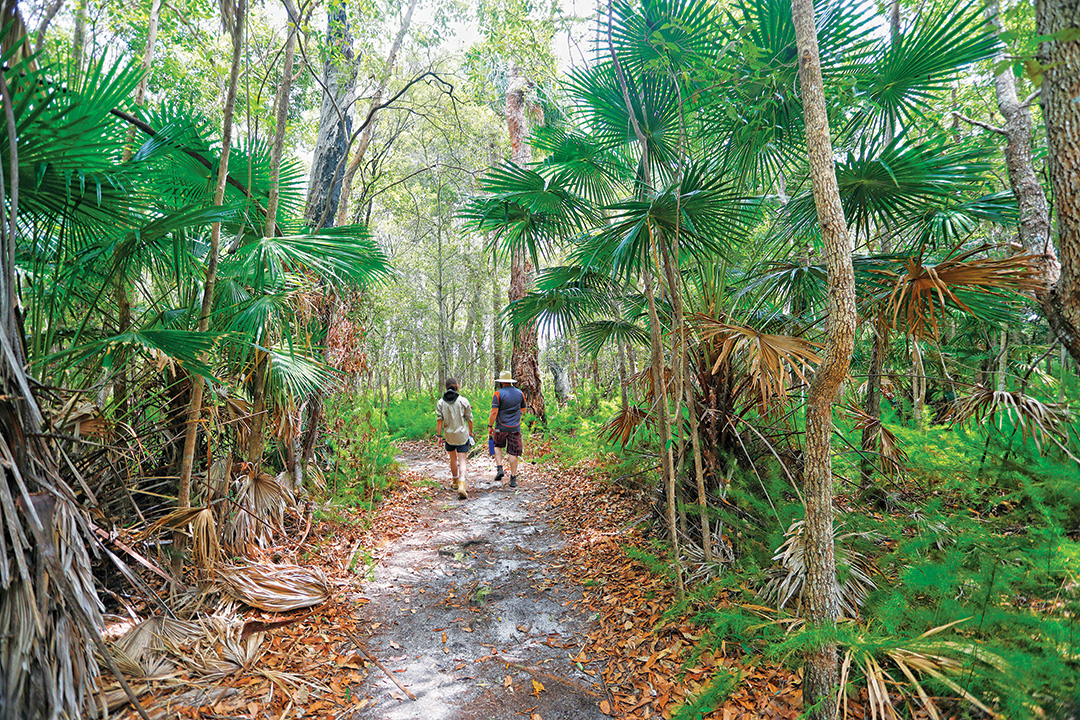
On the Palm Grove Circuit at the Bicentennial Bushwalks
Boating and fishing
Keen fishers will find many ways and places to land a memorable catch at Bribie Island. Boats can be launched on the island at Bongaree and Bellara, and on the mainland at Sandstone Point, Toorbul, Donnybrook, Coochin Creek, Bells Creek and Golden Beach boat ramps. Mission Point, Lime Pocket and Lion's Park are accessible only by boat with picnic facilities located at Lion's Park and Mission Point. Mission Point and Lime Pocket camping areas have relatively protected boat anchorages. Wherever you go, with whatever bait and tackle you’re using, you’re almost guaranteed to find a dozen or more species that taste good off a barbecue. Just remember that Bribie is surrounded by the Moreton Bay Marine Park and zoning regulations apply.
Water sports
Bribie’s reputation as an island paradise is well-deserved for its balmy sub-tropical climate, stunning white sand beaches and warm azure waters. It’s hard to imagine a better place for enjoying your favourite water sport, be it beach swimming, windsurfing, ocean kayaking or paddling a canoe on the coastal lagoons. The soft sand beaches serve just as well for throwing a frisbee, kicking a footy or a game of beach volleyball. Or you could just stretch out under an umbrella with a good book – whatever floats your boat.
Contact information
Bellara Caravan Park
1-7 Eucalypt St, Bellara
P: 07 3408 7436 / 0417 726 170
BIG4 Sandstone Point Holiday Resort
1820 Bribie Island Rd, Sandstone Point
P: 07 3450 0732
Bongaree Caravan Park
25-47 Welsby Pde, Bongaree
P: 07 3408 1054
Bribie Island Caravan Park Woorim
40 Jacana Ave, Woorim
P: 07 3408 1134/1800 649 831
Bribie Island Visitor Information Centre
Benabrow Ave, Bellara
P: 07 3408 9026
Donnybrook Caravan Park
10 Alice St, Donnybrook
P: 07 5498 8219
Silver Shores Caravan Park
1 Kal-Ma-Kuta Dr, Sandstone Point
P: 07 5497 5566
Toorbul Caravan Park
119 Esplanade, Toorbul
P: 07 5498 8701
Queensland Parks and Wildlife Service
P: 13 74 68
THE NEXT STEP
If you want to learn the latest caravan news, find the most innovative new caravans and camping gear or get inspired to plan your next adventure to some of Australia's best getaway destinations, subscribe to our weekly newsletter. We promise to send you only the best content.
Related Articles:


Bribie Island / Yarun, Qld: Best things to see and do