
Six weeks and 4788km after leaving Melbourne, Caravan World Deputy Editor Allison Watt and her partner reached the northernmost tip of Australia at Cape York towing their caravan and ticked off one of their bucket list destinations.
Cape York. It’s on many a traveller’s bucket list of must-see destinations. It’s a mecca for nomads escaping cold southern winters, families taking advantage of mid-year school holidays and adrenaline-seeking four-wheel drivers.
We set off from Melbourne at the end of May towing our Crusader Musketeer Warrior X Country with a 2018 Holden Trailblazer. Our route was inland up the Newell Highway, with a couple of work and family-related detours, and then across to the Queensland coast at Rockhampton.
An estimated 80,000 people visit Far North Queensland (FNQ) each year during the dry season. About 60,000 choose to stay on the bitumen and travel as far as Cooktown, while 20,000 will tackle the notorious red dirt corrugated roads all the way to the tip at Cape York.
It’s challenging trip to the most stunningly beautiful, rugged and remote northernmost point of the Australian continent. The ultimate reward is the picture you get of yourself standing under that sign at the very tip that we’ve all seen on hundreds of Instagram posts and YouTube videos. But there will be many more memorable moments along the way that will stay with you forever.
Before setting out
As with any big road trip, preparation is key. This article is not about what you need to do to prepare, but there are some basics which shouldn’t be ignored: get your van and vehicle serviced; carry appropriate supplies of fuel, food and water; carry tools and spares, a compressor to deflate/inflate tyres, maps, navigation and communications equipment; and book camping spots in advance, particularly during school holidays.
The drive
While there are a few long stretches of good, sealed roads to the Cape, the vast majority is unsealed and the road conditions will vary from pretty good to downright terrible, depending on when the road was last graded. The sheer volume of traffic during the dry season means that a newly graded road can turned corrugated and gnarly in just a few days so it really is pot luck.
Let the tyre pressures down on the car and the van when you get to the gravel — we reduced ours to 25–30psi but it will depend on your rig and the size of your tyres so you might have to play around with this a bit.
Carry a UHF radio — this is essential for communicating with other drivers, letting them know when it’s safe to pass, letting others know that you intend to pass and advising of hazards. Visibility is reduced significantly by the dust created by passing vehicles so don’t underestimate the importance of this communications tool.
The dust also means you keep your headlights on. If you are travelling in convoy don’t drive too closely behind other vehicles. The dust created by one oncoming vehicle will blind a driver for mere seconds, but multiple vehicles travelling closely together will create enough of a dust cloud to blind oncoming drivers for longer and that’s dangerous.
Heed the road condition signs and check road conditions on the Queensland government website, as even small amounts of rain can render some roads impassable. Be prepared for the road topography to change often. While there are many long, straight flat sections, there are also some hills (Bamboo Range), blind corners, dust holes, floodways, crests and wandering stock. Drive to the conditions is the mantra, taking into account a whole lot of variables that will differ depending on individual rigs.
The journey
Mareeba to Laura
Our journey started in FNQ’s rural town of Mareeba where we’d spent a few days sightseeing and stocking up on supplies. On day one we hit the road for Lakeland, following the Mulligan Highway through Mount Molloy and Mt Carbine to our first stop at the Palmer River Roadhouse for lunch.
Palmer River is the first of the many roadhouses along the way which offer essential services for travellers such as fuel, food and toilets and a place to camp for a night or two to break up the drive. All roadhouses will have a range of burgers on their menu and Palmer River has 10 burger choices, including falafel. Expect to pay higher than city prices for food and supplies everywhere along the way — the logistics of getting freight into this part of the country is mind-boggling.

Just a few kilometres up the road, Lakeland is considered the gateway to the Cape. This intersection sees the Mulligan Highway continue straight ahead to Cooktown. Turn left and you’re on the Peninsula Development Road (PDR) to Weipa. There’s fuel and a pub here and lots of picture opportunities to capture the start of the journey.
Our destination for the night was Laura, about 60km along the PDR on good, sealed road with some decent climbs and stunning views to the vast country ahead. We had intended to camp behind the Laura Pub for the night, but it was closed due to the tragic death of the publican Kevin Darmody a few weeks earlier — killed by a croc while fishing. Laura has a general store and a roadhouse for supplies and there is good phone signal.
We pulled into the campground at the nearby Quinkan and Regional Cultural Centre, owned and operated by the Ang-Gnarl Corporation. The campground was busy due to July school holidays and lots of people in town for a local dance festival being held up the road. The park is basic with hot showers, toilets and drinking water. There are about six powered sites. The Centre showcases all aspects of Quinkan country including its Aboriginal and non-Aboriginal heritage and the natural environment.
It was closed on a Friday afternoon, so I left our $15 for an unpowered site in the honesty box. It was a reasonably quiet night despite being camped right on the highway. Most of the noise came from the bloke living across the road playing loud music until the wee hours.
Laura to Coen
The PDR is sealed almost all the way to the Hann River Roadhouse about 70km up the road from Laura. The first section of gravel starts about 15km before reaching Hann River. It is a lovely little treed oasis which serves very good coffee. Fuel, food, toilets and camping are all available here.
From Hann River, we hit the dirt again for our next stop — Musgrave Roadhouse — which is 63km up the road. We pulled in here for a bit of lunch and end up chatting to a lovely couple from Victoria who were limping southward after breaking the rear suspension on their tug just before Coen. It was such a shame as they were so close to the Tip. The RACQ does a brisk business up here. Seeing vehicles on the backs of tow trucks which are then towing caravans is not uncommon.
Musgrave has fuel, food (including more of Cape York’s renowned burgers), accommodation, camping, toilets, showers and a payphone. There is no phone service.
Coen was our destination for the night and the 108km section of road between Musgrave and Coen was the worst we’d yet encountered. The corrugations were deep — really deep — sometimes slowing us to a crawl. Driving is challenging. There is constant slowing, almost stopping to cross dips and floodways — some of which have a bit of water in them. Through the Bamboo Range the dust is beach-sand white — not red dirt — and it’s harder to see the corrugations. Signs warn of large dust holes. We were glad to see the tarmac about 30km out of Coen and had a smooth drive into town.
We camped behind the Exchange Hotel which is a flat rate of $30. There are some powered sites, but they get snapped up early. This is a nice, grassed campground on the banks of a little creek which is a tributary of the Coen River. There are shady trees, toilets and hot showers, firepits, a little camping bar with vending machine offering an array of canned alcoholic beverages, plus some outdoor tables and chairs where you can sit and chat with fellow campers. There is also good phone signal here if you need to organise any repairs, or perhaps just call friends and family back home to brag about your success so far.
The pub serves meals — the usual fare — and you can take them back to your camp to eat if you choose. Many travellers also stop at the popular free camp at The Bend on the way out of town.
Coen to Moreton Telegraph Station
The next morning, we fuelled up at the well-stocked general store in Coen and made the run to the famous Archer River Roadhouse 66km up the road. There is sealed road for about 25km out of Coen.

The burgers at Archer River have cult status but it was way too early in the day for me to try one and it was just a quick stop. There was lots of roadwork going on to build a new bridge over the Archer River, but delays were minimal.
From Archer River the road is sealed all the way to the T intersection where the PDR continues on to Weipa, and Cape York travellers will turn right onto the Telegraph Road. The road was in surprisingly good condition along this section, and it wasn’t long until we reached the Morton Telegraph Station to camp for a couple of nights so I could get some work done.
Located on the Wenlock River and 293km from the Tip, Moreton Telegraph Station was completed in 1887 as part of the Overland Telegraph Line. The only transport at this time was by horse, so electric telegraph stations were strategically placed close to water. Moreton ceased communication operations in 1987 with the introduction of the modern era of telecommunications.
It is a great place to camp or just stop for a few hours; a spacious six-hectare clearing on the edge of the Batavia National Park (CYPAL) with big shady trees and grassed camping sites (powered and unpowered), amenities, a cafe, shop, museum and internet available via Starlink for $5 for 24 hours. There is a 2.5km walking track around the property, off which is the Barra Hole for fishing, but we were warned that the resident croc had been spotted there in recent days.
Moreton Station to Fruit Bat Falls
Our destination the next morning was Fruit Bat Falls to have a swim and free camp for the night. This was the section of road we had been dreading.
It was a relatively smooth run about 40km up the Telegraph Road to Bramwell Junction where there’s, you guessed it, a roadhouse with food, fuel and camping. This is the junction where the serious four-wheel drivers proceed straight ahead up the Old Telegraph Track (OTT), while the rest of us follow the bypass road — Bamaga Road — 109km around to Fruit Bat Falls and onto to the Jardine River ferry.

We felt as if we had won the lottery because a grader had gone through here in the previous 24 hours and the road was in really good condition. We made good progress until the road veered around to the left and then we hit the monster corrugations we’d heard about. It was a slow and frustrating drive for the last 30km or so into Fruit Bat Falls.
It is here that the Bamaga Road and OTT intersect. There’s a number of small areas off the road to free camp and we squeezed into one with another four vans, unhitched and drove the 2.5km into the falls. Eliot Falls and Twin Falls are a further 10km up the OTT.
The Fruit Bat Falls are among a few places along the OTT where you can swim without fear of being eaten by crocs, so we had a lovely dip in the beautiful, refreshing water. There was a steady stream of visitors, including busloads of travellers. It’s a welcome relief from the corrugations and red dust and offers terrific Insta-worthy picture opportunities.

Fruit Bat Falls to Bamaga
From Fruit Bat Falls, we only had 100km to travel and before long we were at the Jardine River Ferry. For the most part this section of road was good, but we soon overtook the grader and then it got gnarly, and we were driving in the soft sandy swales beside the road. The return ferry trip for a car towing a van is $192 which includes the permit required to visit the Northern Peninsula Area (NPA). The ferry is open from 8am to 5pm daily. It can get busy in the dry season so leave plenty of time. If you miss the ferry, there is a campground on the southern side where you can prop for the night.

We had a quick crossing and tackled the last 40km or so of gravel before we reached Bamaga and the other NPA communities, which are all sealed roads. We did the trip up in five days, taking our time and driving conservatively, but there are many interesting side trips to fishing destinations, national parks and remote stations so you can take weeks if you have the time.
The destination
The Northern Peninsula Area (NPA) is the area north of the Jardine River and comprises five First Nations Communities settled by clans from across Cape York and the Torres Strait. There are three Aboriginal communities: Injinoo, Umagico and New Mapoon; and two Islander communities: Seisia and Bamaga. It’s the only place in Australia where these two First Nations cultures merge on country.
Everyone who crosses on the ferry gets a very useful information book about the NPA which outlines the services and facilities available. And it sets expectations. This is not a tropical resort, so don’t expect cafes and dress shops. It is a collection of very remote Aboriginal and Islander communities. Horses and dogs wander the streets. Basic facilities and services are available across the five communities, and most are located in Bamaga which is the largest of the five.
In Bamaga there is a well-stocked supermarket with ample fresh fruit and vegies. The prices are eye-watering, but all freight comes via ship as the big road trains can’t get across the Jardine River. There’s also a tavern, pharmacy, service station, public pool, medical facilities, post office, Centrelink, police station and auto services.
There is some opportunistic youth crime in the NPA, and travellers are advised to keep valuables out of sight and locked away. Vehicles and vans should never be left unlocked. There are also alcohol restrictions which are spelled out in the info booklet that everyone receives.
Campgrounds are located at Umagico (Alau Beach Campgrounds), Seisia (Seisia Holiday Park) and New Mapoon (Loyalty Beach Campground and Fishing Lodge) and another Cape York Camping a bit further up the road at Punsand Bay.
I had not booked any accommodation ahead and, based on the recommendations from other travellers, we headed straight to the Loyalty Beach Campground and Fishing Lodge and picked out a spot with power and water. It wasn’t right on the beach because tents get priority for those spots, but we could see the sea through the trees.

Facilities at Loyalty Beach are great and include a kiosk which serves good coffee and DJ’s Beach Garden which serves meals and drinks on a lovely, grassed area right on the beach. A State of Origin match was being televised at DJ’s on the night we arrived so we enjoyed a sausage sizzle and a couple of beers and watched the sunset over the ocean — just beautiful.

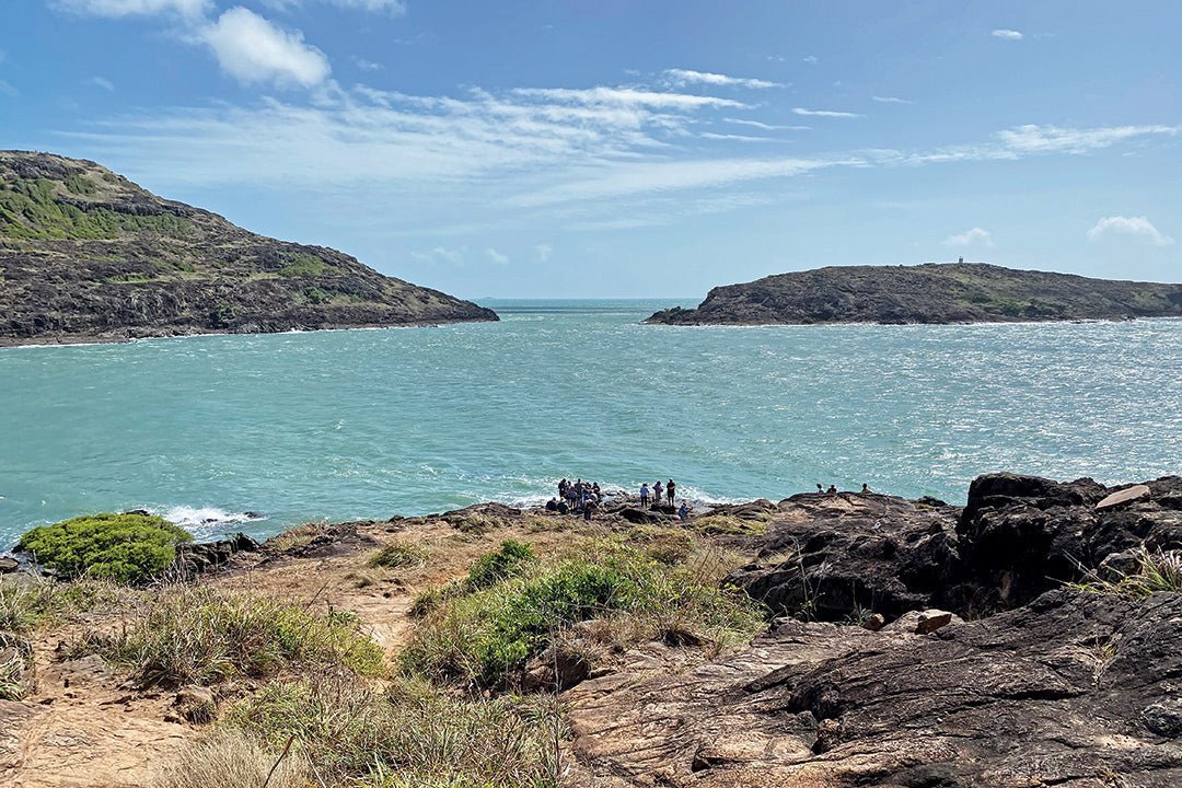
The Tip (Pajinka)
The Pajinka lands (the Tip) were handed over to the Gudang Yadhaykenu Aboriginal Corporation in 2017. It’s an easy drive from Bamaga, out past the BP Service Station on the Pajinka Road. After about 16km or so we arrived at The Croc Tent, which is worth a stop to stock up on T-shirts, fishing shirts and a myriad of other souvenirs.

From The Croc Tent it’s about 17km to the Tip. The road narrows and the topography turns into beautiful tropical rainforest and then clearings of scrub. It was wet in places and there was one shallow creek crossing. The small car park was full of 4WDs and tour buses. There was a couple of portaloos and not much else, other than a stunningly pretty beach framed by palm trees. There is no signage to ‘the sign’ so we followed an obvious trail which entails a 700m walk over the top of the rocks to the famous sign and sundial. It was very windy but sunny and the view from the top was amazing.
There was a bit of a queue to get our picture at the sign. Like us, people are happy and relieved to have reached their destination. For us it was a real sense of achievement and relief to finally get here after six weeks and 4788km. One group celebrated with a bottle of champagne. Another bloke threw in a line hoping for his northernmost catch.
After getting the obligatory pics and taking some time to absorb the rugged beauty of this popular location, we headed back to the car the less hilly way and emerged on the beach.
That night we celebrated at DJ’s Beach Garden with fish and chips for dinner, watching our last stunning sunset over the Torres Strait and toasting ourselves for ticking an item off our bucket list.
While getting to the Tip and having the obligatory picture taken at the sign is what every traveller to Cape does, there’s plenty of other things to do if you have the time including fishing charters, helicopter flights, boat tours to Thursday Island and the other islands and visits to World War II plane wrecks.

For work reasons and some other commitments, we decided to do the return journey in three days: Bamaga to Moreton Telegraph Station; Moreton to Hann River Roadhouse and then Hann River to Mareeba. They were long days of driving and our recollections of the road conditions varied greatly, but we made it back to Mareeba at a decent hour on day three and headed straight for the car wash.

Can you get a caravan all the way there?
It’s the question that everyone asks: can you take a caravan all the way to the top? The answer is yes. Well, not all the way to the tip. Leave the van wherever you are camping — from Bamaga it’s about 35km to the tip, less from Punsand Bay. The road from the Croc Tent to the tip is narrow, heavily forested in places and there is a creek crossing. Once you get there, the car park is small with very little room to turn around. Don’t take your van this far. Surprisingly, on the day we visited a couple of people did.
We and our Crusader made the return trip relatively unscathed. After the first day on the gravel, we lost some electrics in our kitchen, including the ignition to the gas hot water which meant no hot water while free camping. We got it fixed in Townsville — some wires had come loose behind the oven. The metal guard on the front of one of our Sirocco fans came off. And we bent the electric step a little bit (our fault). That was the extent of the damage. No cupboard doors fell off thanks to the piano hinges and independent TuffRide suspension and very little red dust got in thanks to our Dometic DRS.

In short, our van was up for the trip, but we drove to the conditions. Sometimes that meant crawling along at a snail’s pace and often it meant pottering along in the sandy swales on the side of the main road, if they were available.
Caravans are big expensive assets, and there’s a risk that things can go wrong, no matter how careful you are. And it is a long way from anywhere. If you break down and need roadside assistance it will take time and it will be expensive. Plenty of folks choose to leave their vans somewhere along the route for a few weeks and push on with vehicle only. Others start with their vans, and then abort the mission leaving the van in a safe place to be picked up on the way back.
We heard about and saw first-hand some of the damage that the relentless corrugations can cause — mainly screws working their way loose and cupboard doors falling off. And these were vans that market themselves as tough offroaders.
We saw plenty of Kedrons, Bushtrackers, Zones and the like that are designed and built to withstand those conditions. We also saw plenty of Jaycos and other brands, whether they be ‘outback’ or touring versions that clearly survived the trip. So, it’s very achievable. A word of advice, before you take any van offroad, check the fine print on the warranty.
Advice from fellow travellers is a great thing, however we learned pretty quickly that individual interpretations of the road conditions will differ greatly, depending on the vehicle they’re travelling in, what they’re towing, their age and their sense of adventure. One person will say, ‘Yeah, it’s fine once you get past Bramwell Station.' Someone else will tell you it’s terrible and it took them five hours to travel 100km. Somewhere along the spectrum will be your truth. And you might be lucky and have the grader gods smile upon you.
Getting to the top gives you a real sense of achievement and satisfaction. It’s stunningly beautiful, rugged and largely unspoiled country. It’s country that humbles you greatly. It is a vast and tough wilderness, and we are mere trails of ants making the pilgrimage up and back when the weather permits.
It’s a tough trip and, for a couple of oldies, at times challenging. But it is rewarding. If you have it on your bucket list, it’s a huge tick.
Fast facts
Alau Beach Campground
Namok Road
Umagico Qld 4876
P: 07 4069 3029
Exchange Hotel
Regent Street
Coen Qld 4871
P: 07 4060 1133
E: ehcoen@hotmail.com
Jardine River Ferry
P: 07 4069 1369
Loyalty Beach Campground and Fishing Lodge
1 Loyalty Beach Road
New Mapoon Qld 4876
P: 07 4069 3808 / 07 4069 3456 (May-Nov)
E: fishcapeyork@loyaltybeach.au
Moreton Telegraph Station
P: 07 4060 3360
E: info@moretonstation.com.au
Northern Peninsula Area Regional Council
P: 07 4090 4100
Punsand Bay Cape York Camping
Lot 11 Punsand Bay via Bamaga Qld 4876
P: 07 4069 1722
E: frontdesk@capeyorkcamping.com.au
Quinkan Cultural and Regional Centre
Lot 2 Peninsula Development Road
Laura Qld 4871
P: 07 4060 2239
E: admin@anggnarra.org.au
Seisia Holiday Park
Koraba Road
Seisia Qld 4876
P: 07 4203 0992
E: info@seisiaholidaypark.com
THE NEXT STEP
If you want to learn the latest caravan news, find the most innovative new caravans and camping gear or get inspired to plan your next adventure to some of Australia's best getaway destinations, subscribe to our weekly newsletter. We promise to send you only the best content.
Related Articles:
A guide to exploring the Daintree Rainforest, Qld


The ultimate caravanning trip to Cape York, Qld