A guide to exploring the Daintree Rainforest, Qld
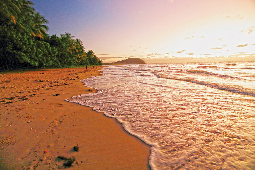
The lush and steamy Daintree Rainforest, 100km north of Cairns, is as old as time itself, a relic of nature as it was when Australia was part of the Gondwana supercontinent.
It is a spectacular landscape of rugged forest-clad ranges which plunge steeply to sandy beaches on the sparkling Coral Sea. This tropical wonderland is a ‘living ark’ of the earliest flowering plants and primitive marsupials, and home to one of the world’s oldest Aboriginal cultures. At its heart stands Cape Tribulation, a prominent landmark in Australia's European history and an icon of modern-day conservation.
Highway through heaven
Travelling to and through the Daintree is an adventure in itself. From Cairns, the Captain Cook Highway hugs the stunning coastline as it weaves 90km to the Daintree River, the southern boundary of the national park. Crossing the river by ferry only takes 10 minutes but queues can cause long delays at busy times, especially during the peak season (July to September).
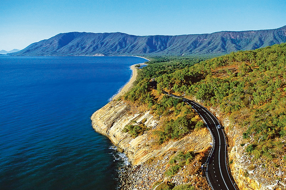
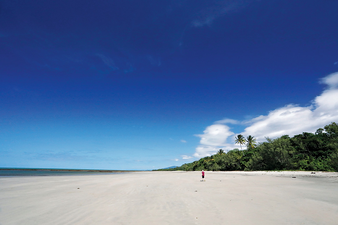
From the ferry crossing to Cape Tribulation, a 35km sealed road twists and rollercoasters through tunnels of trees, with glimpses of the Thornton Range rising to the west and palm-fringed beaches to the east. It crosses several creeks, but causeways make the drive mostly floodproof in all but the most severe rain events. Drivers towing caravans should proceed with caution as the road is narrow and winding, and everyone needs to be alert for wildlife, especially cassowaries.
The bitumen ends 1.5km north of Kulki (Cape Tribulation), and gravel continues to Emmagen Creek. Beyond the creek, the Bloomfield Track is a challenging 33km adventure to Wujal Wujal on the Bloomfield River. It is strictly 4WD due to steep grades and creek crossings, which may flood after heavy rain. It’s rated unsuitable for caravans and trailers. If you’re determined to make the journey, be sure you visit the Bloomfield Falls, the Bana Yirriji Art and Cultural Centre in Wujal Wujal and the quirky Lion’s Den Hotel.
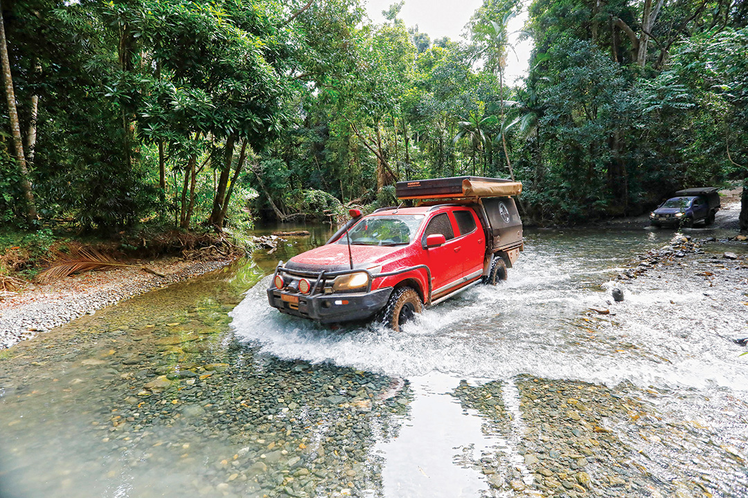
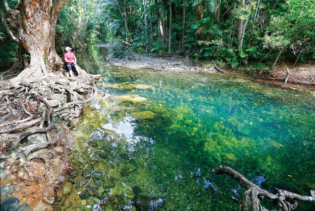
The construction of the Bloomfield Track in 1983 brought the region into headlines worldwide as hundreds of environmental activists clashed with police and chained themselves to trees to prevent the bulldozers carving through the pristine rainforest of what was then the Cape Tribulation National Park. The conservationists lost the battle when the Track was completed but they won a significant victory in the overall campaign to preserve large swathes of the northern rainforest.
Conservation heritage
In 1981, Cape Tribulation National Park was declared to protect 17,000 hectares of the Daintree Rainforest. Two years later, it was amalgamated with the Mossman Gorge section (56,500ha) to form the Daintree National Park, which was subsequently incorporated into the Wet Tropics of Queensland (WTQ). In 1988, the WTQ was inscribed by UNESCO as a World Heritage site in recognition of its ‘outstanding universal values’: superlative natural features and areas of exceptional beauty and aesthetic importance; exceptional biological diversity and habitats for the conservation of threatened species; an outstanding representation of the major stages of Earth’s history; and as a living record of on-going biological evolution of Australian flora and fauna. The WTQ has also been added to the Australian National Heritage list for its natural and Indigenous cultural values.
The Daintree landscape
The ‘Cape Trib’ section of the Daintree National Park is bounded by the Bloomfield River in the north and the Daintree River in the south, with the dramatic McDowall Range at its western perimeter. The Thornton Range connects a series of granite peaks that overlook a narrow coastal strip, where dense rainforest fringes long sandy beaches fronting the Great Barrier Reef Marine Park. These coastal ranges create one of the few equatorial climate zones in Australia, trapping moisture-laden ocean breezes off the Coral Sea to produce around 4mm of rainfall annually and incubate summer temperatures in the mid-30°s with high humidity. The pleasantly mild, drier months from May to September is the best time to visit.

The rugged hinterland is a crumpled terrain of sinuous ridges, lofty crags and deep valleys. The slopes and peaks above 800m are shrouded in ‘cloud forests’, while tall forests of stringybarks, bloodwoods and turpentines occupy the slopes between the uplands and valley floors. Much of the national park is blanketed by the Daintree Rainforest, the single largest tract of tropical rainforest on the Australian continent. It has existed continuously for more than 110 million years, making it one of the oldest surviving tropical rainforests in the world, with many plants descended from ancient Gondwana stock.
Through its heart flows the magnificent Daintree River. From headwaters high on the flanks of the Great Dividing Range near Mossman, the river meanders northward through deep valleys to the ramparts of the McDowall Range, then loops southeast to enter the Coral Sea north of Wonga Beach. Its lower reaches are lined by dense mangroves and estuarine wetlands. Below the ferry point, dynamic shoals constrict a serpentine channel that debouches through a sand bar across the river mouth below Halls Point.
Biodiversity hotspot
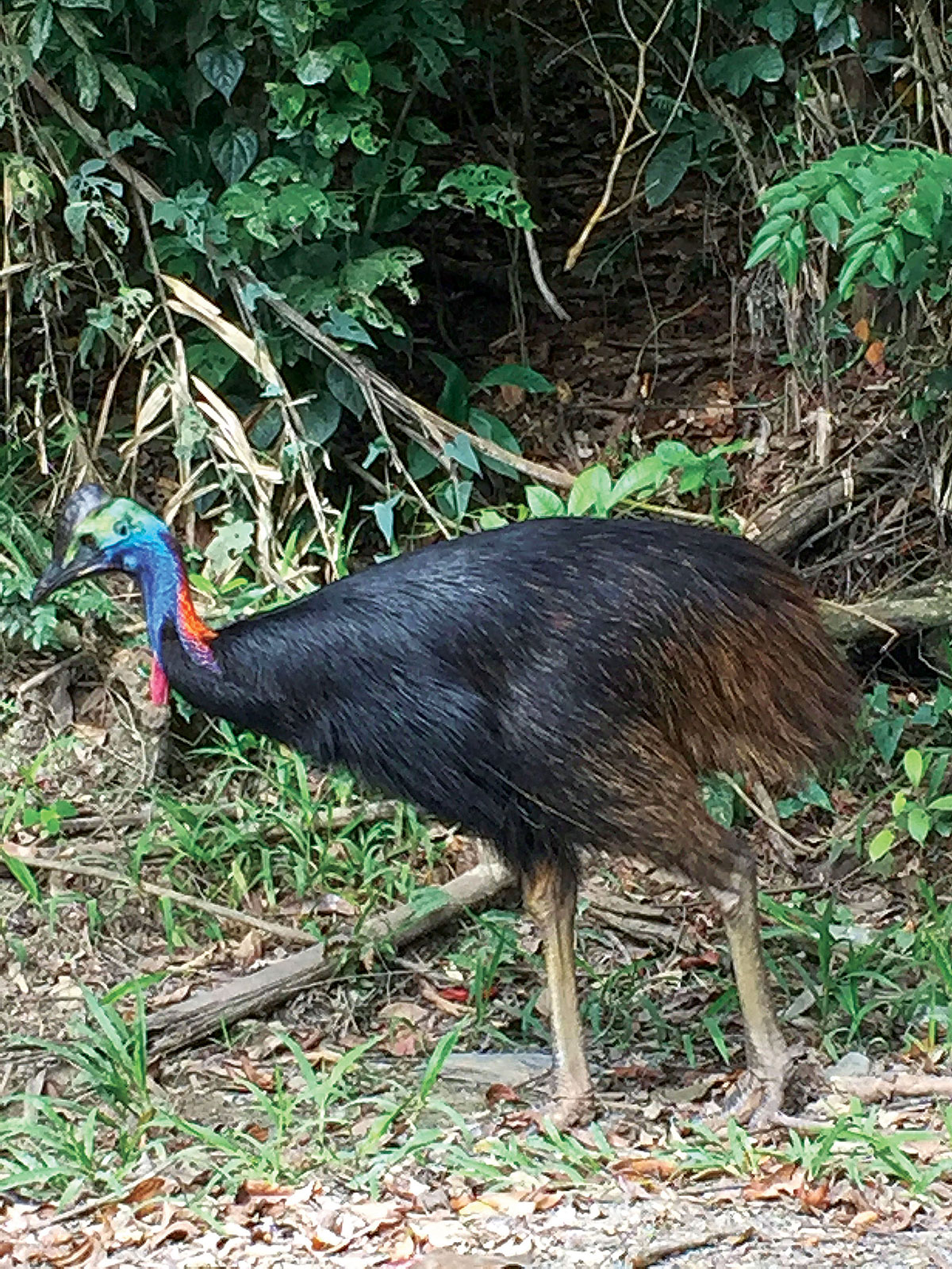
The Daintree is a ‘living museum’ of some of the most primitive forms of plant life on the planet and a record of their evolution since Australia separated from Gondwana. This primordial Garden of Eden also harbours animals descended from fauna that existed around 60 million years ago, such as primitive kangaroos, possum-like marsupials and the ratite ancestor of the modern cassowary.
The Wet Tropics is a world-acclaimed biodiversity ‘hotspot’ and home to many rare or endangered plants and animals that are found nowhere else. As an integral part of it, the Daintree can claim its rightful share of the extraordinarily rich array of species that inhabit this world heritage wonderland: more than 3000 vascular plants, of which 700 are endemic; 669 kinds of vertebrate animals, the highest vertebrate biodiversity of any region in Australia; 107 mammals, including 30 per cent of Australia’s marsupials; 430 bird species, including a large population of endangered cassowaries; 90 per cent of Australia's bats and butterflies; 113 species of reptiles and 51 amphibians; 150 fish including 42 per cent of Australia’s freshwater species; and more tahn 12,000 insects. All this in an area that is a tiny fraction of the Australian landmass.
The Indigenous landscape
Aboriginal people have lived in the Wet Tropics for more than 40,000 years. Before European settlement, the rainforests were one of the most populated areas of Australia and the only region where Aboriginal people permanently inhabited a tropical rainforest environment. Today, the ‘Rainforest Aboriginal Peoples’ of the Wet Tropics number more than 20,000 across 20 tribes, 120 clans and eight language groups, each with ongoing traditional connections to Country and customary obligations for its management according to Aboriginal lore. Native title and other Aboriginal land interests now encompass more than 87 per cent of the World Heritage Area.
The Daintree National Park lies within the traditional country of the Eastern Kuku Yalanji people, whose ancestral domain extends from the Annan River, near Cooktown, to the Mossman River in the south, and inland to the Palmer River. Their name for the Daintree area is ‘Kurangee’, meaning ‘place of many cassowaries’.
The Daintree people were hunter-gatherers who camped in groups of eight to 12 along the river in the dry season (May to November), living on a plentiful array of plants and animals harvested from the surrounding forest. They also used outrigger canoes to access resources on the coast, reefs and islands. In the wet season (December to April), when the coastal lowlands usually flooded, they moved to higher ground where they lived in large, thatch-roofed huts that could house up to 30 people.

Through the ages, they developed a distinctive culture determined by their Dreaming and creation stories, which identified many features of the landscape as places of deep spiritual significance, including Wundu (Thornton Peak) and Kulki (Cape Tribulation).
By an historic deal with the Queensland Government in 2021, the Eastern Kuku Yalanji people were granted formal ownership of 160,200 hectares of Country, including the Daintree National Park which is managed by them jointly with the Queensland Parks and Wildlife Service, in collaboration with the Wet Tropics Management Authority.
European history
Cape Tribulation was given its European name by James Cook “because here began all our troubles”. He was referring to the incident on the night of 11 June 1770 when HMB Endeavour struck a reef northeast of the Cape, “an alarming and terrible circumstance that threatened immediate destruction to us”. For two days, the crew worked feverishly to lighten the vessel’s load and winch it off the reef. Eventually, the stricken bark floated clear and limped, for another two days, north along the coast to anchor in the mouth of a river that would later bear the ship’s name.
Here, they transferred stores, livestock and equipment to shore, established a forge and erected tents for makeshift accommodation while the ship underwent repairs. It was, in effect, the first British settlement on Australian soil, which lasted 48 days until Cook and his crew departed on 4 August. The landing was later chosen as the site for Cooktown, which grew to prominence in the 1870s as the main port and supply base for the Palmer River goldfields.
In 1873, at the time of Cooktown’s ascendancy, the Daintree River was explored by George Dalrymple during his search for another suitable port to serve the region. He named the river in honour of his friend, Richard Daintree, an eminent geologist and the Agent-General for Queensland in London at the time. The port never eventuated because the large, ever-shifting sandbar in the river mouth proved too difficult for safe navigation. Dalrymple’s expedition followed the river deep inland, through “a valley surrounded by jungle-clad hills … a panorama of great beauty … a perfect picture of rich tropical country”. In his report to the Queensland government, Dalrymple noted “many thousands of acres of rich agricultural lands” and huge tracts of red cedar.
Soon after, hordes of timber-getters arrived with hopes of growing rich from ‘red gold’ but by the 1880s the Daintree had been decimated of these much-prized trees and the ‘timber rush’ petered out. Many settlers left disheartened, but others stayed, determined to make a living by raising cattle or growing crops such as rice, vegetables, coffee, maize and sugar. Extensive areas of lowland rainforest were cleared as farming and settlement expanded along the fertile river floodplains.
By the 1930s, settlers had reached Cape Tribulation to establish ventures such as fruit and vegetable farming, fishing, cattle grazing and timber cutting, all with limited success. The rainforest soils were ill-suited to agriculture and the rugged, forest-clad terrain made grazing difficult. Life this far north of the river was challenging — for many years a barge was the only transport in and out of the area, passing Cape Tribulation on the way to Cooktown, and then returning later in the week on the way back to Cairns.
Following World War II, logging regained momentum with the establishment of a timber reserve in the Dagmar district (later the Dagmar State Forest), 20km upstream from the river mouth. Extensive tracts of virgin hardwood forests were logged and, by 1955, roads were extended to enable the removal of felled timber. The Daintree Ferry was built in 1960 and within three years a rough track had been bulldozed through to Cape Tribulation. Improved road and ferry access, the establishment of the Cape Tribulation National Park and the notoriety of the conservation battle in the mid-1980s all paved the way for another, more permanent and highly successful industry in the Daintree — ecotourism.
Exploring the Daintree
A great place to begin an exploration of the rainforest is the Daintree Discovery Centre. Opened in 1989, the centre is located at Cow Bay, just 10km north of the ferry crossing, amid lush rainforest accessed by a sealed road suitable for 2WD vehicles. The large, open plan reception complex incorporates themed interactive displays that explain the break-up of Gondwana and the evolution of the rainforest’s flora and fauna.
The entry fee includes an interpretive guidebook and audio recording to assist visitors on self-guided tours on elevated boardwalks throughout the surrounding landscape. The 23m high Canopy Tower has platforms that enable visitors to view the rainforest at five levels from the ground to the uppermost canopy. Linking Canopy Tower to the Discovery Centre is a spectacular mid-canopy walkway, suspended 11m above the forest floor, which is rated by Australian Geographic as one of the top 10 skywalks in the country.
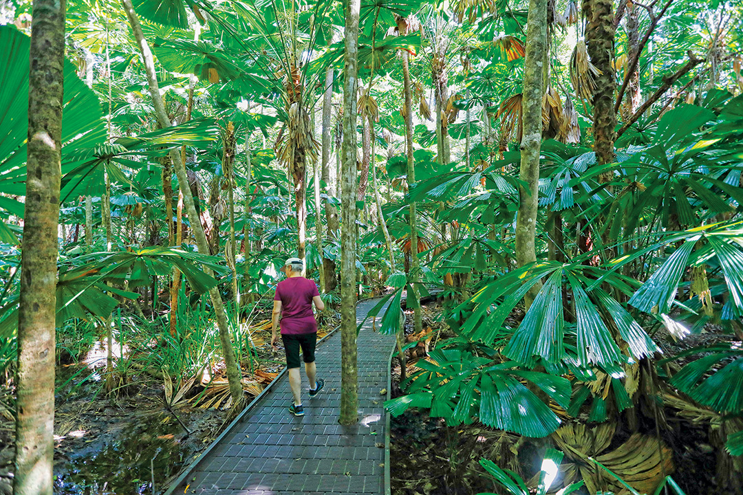
Adjacent to the Daintree Discovery Centre is the Jindalba circuit track, the southernmost of many walking tracks that dot the rainforest along the narrow coastal corridor from the river crossing to Cape Tribulation. The walks range from easy boardwalk strolls of 400m to half-day hikes up to 6km. There are two remote treks in the national park: the Manjal Jimalji (Devils Thumb) trail and the Mount Sorrow ridge trail. Both trails are classified grade four (difficult) and are suitable only for experienced walkers with above-average fitness and sound navigation skills.
The Queensland National Parks website and digital Daintree Discovery Guide have notes and maps for most of the popular walks, and you can download the (free) Destination Daintree Walks in Paradise booklet with comprehensive notes but no trail maps.
Commercial operators with ecotourism accreditation offer river cruises which provide excellent opportunities for birdwatching and wildlife photography at close quarters. Charters also explore the coastline with half-day snorkelling adventures on the Great Barrier Reef. Fishing is permitted in all tidal creeks in the national park, except Cooper Creek, but is prohibited in non-tidal creeks. A boat ramp on the Daintree River provides access to the estuary and offshore islands. Contact Queensland Primary Industries and Fisheries for information about licences, bag and size limits, and check Great Barrier Reef Marine Park zoning maps for restrictions on fishing activities.
Camping and accommodation
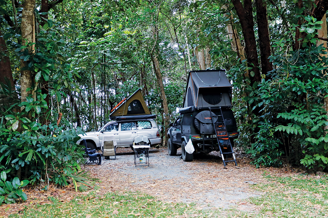
Noah Beach campground, 8km south of Cape Tribulation, is the only QPWS camping area in the national park. It has 15 campsites suitable for tents, small campervans and camper trailers but does not cater for caravans, campervans or motorhomes. Permits are required in advance and fees apply.
Outside the national park, camping and caravan accommodation (powered and unpowered) is available at many locations in the Daintree — along the river, in the rainforest and on the beachfront — all with the usual amenities and some with onsite eateries, bars and basic supplies. There is also a wide range of alternative accommodation that includes B&Bs, hostels, resorts, eco-retreats, holiday homes, farm-stays and budget cabins.
Mossman is the last major town south of the river where travellers can stock up on supplies and fuel. North of the river the only fuel outlet is at the Daintree Rainforest Village, which also has a small kiosk for takeaway food/drinks and basic supplies. The Daintree Village Hotel has a restaurant/cafe open for breakfast, lunch and dinner, seven days a week. At Cape Tribulation, the Friendly Grocer stocks a reasonable range of groceries, souvenirs, clothing, footwear and local tea and spices. Mason's Store and Bottleshop nearby sells takeaway alcohol, groceries, camping supplies, souvenirs and local products.
Contact details
Cape Tribulation Camping
Lot 11 Cape Tribulation Road, Cape Tribulation
P: 07 4098 0077
E: stay@capetribcamping.com.au
Daintree Discovery Centre
Lot 439 Tulip Oak Road, Cow Bay
P: 07 4098 9171
E: info@discoverthedaintree.com
Daintree Rainforest Village
2094 Cape Tribulation Road, Diwan
P: 0466 658 399
E: stay@daintreerainforestvillage.com.au
Daintree River Cruise Centre
2914 Mossman-Daintree Road, Daintree
P: 07 4098 6115
E: info@daintreerivercruisecentre.com.au
Daintree Siesta Accommodation & Campground (formerly Lync Haven)
1973 Cape Tribulation Road, Diwan
P: 07 4098 9155
E: welcome@daintreesiesta.com.au
Daintree Tourist Information Centre
5 Stewart Street, Daintree
P: 07 4098 6120
E: info@crocodileexpress.com
Ocean Safari — Safari Lodge
Cape Tribulation Road, Cape Tribulation
P: 07 4098 0006
E: lodge@oceansafari.com.au
Wet Tropics Management Authority
Cnr Grafton and Hartley Street, Cairns
P: 07 4241 0500
E: wettropics@wtma.qld.gov.au
THE NEXT STEP
If you want to learn the latest caravan news, find the most innovative new caravans and camping gear or get inspired to plan your next adventure to some of Australia's best getaway destinations, subscribe to our weekly newsletter. We promise to send you only the best content.
Related Articles:
Journey to the past in Maryborough, Queensland


