
There are more sides to the Snowy Mountains than the well-known ski runs and Kosciuszko summit walk. The Kosciuszko National Park covers a huge area of south-eastern New South Wales and explorations of portions of this area will reap rewards. This article does not relate to the months of ice and snow!
The car convoy snaked its way down the precipitous, rough road to the gaping mouth of the underground power station. In September 1960, my family with a 10-year-old me, had joined a Snowy Mountains Scheme car convoy, guided by an official head vehicle, to inspect the construction sites of some of the most spectacular features of the hydro-electric scheme. Long hours in the V8 Ford Customline revealed engineering marvels that I have been in awe of ever since. We even experienced Snowy life first-hand with lunches at remote construction camps such as Cabramurra, Australia’s highest town.
I have returned often since those early days to bushwalk, camp, cross-country ski and of course to revisit those wonders of engineering.
Snowy 2.0: A new era in hydro power
With the declaration of Snowy 2.0 announced a few years ago, I decided it was time to see what I could of the new pumped-hydro scheme. This was not the only reason for heading for the central-north region of the mountains around Kiandra, Cabramurra and Yarrangobilly. These areas suffered greatly during the 2020 bushfires, and I wanted to see how the mountains and the infrastructure were recovering, especially in relation to the many historic huts that were lost and have now been rebuilt.
Keeping this new hydro scheme in mind makes for a rewarding exploration of this central mountains area. Perhaps readers also remember car convoys more than 60 years ago or even being employed by the scheme which celebrated 75 years in 2024, with many retired workers returning for reunions.
 Tantangara Dam and Snowy 2.0 construction site
It is recommended to call at the Snowy Hydro Discovery Centre at North Cooma, before exploring the mountains. There are top class displays here including a detailed model of a current tunnel drilling machine. The real thing is over 150 metres long and resembles a worm from the Dune movies.
The best access for towing is from Cooma and along the Snowy Mountains Highway through Adaminaby to Kiandra. From Tumut in the north or from Khancoban in the south, the roads are sealed but they are winding and steep.
The most obvious evidence of Snowy 2.0 is the increased traffic on these once quiet roads. Cream coloured 4x4 utes buzz about like March flies, and you are bound to be caught behind a large semi, often carrying the essential curved concrete tunnel lining segments.
The best place to view the Snowy 2.0 developments is via the unsealed road to Tantangara Dam — but don’t tow the caravan along here. It’s a gravel road, mostly flat and around 20km from the Snowy Mountains Highway. Prior to the dam is the entrance to the Snowy 2.0 Temporary Camp in Tantangara with its five-flagpole private entry. The numerous long, red rooves of the workers accommodation can be seen below the road. No tents in the snow like there was 70 years ago!
 The Snowy 2.0 Temporary Camp in Tantangara
From the lookout at the dam wall, you can look across the lake to the huge construction site. Note the man-made mountain beginning to form to the right, from dumped tunnelling waste. This dam on the upper Murrumbidgee River was originally connected to Lake Eucumbene by a tunnel. The new Snowy 2.0 tunnel will also connect it to the new underground power station and eventually to the waters of Talbingo Dam.
This is one of the sites that my family also visited in September 1960, with the dam almost complete but still with the temporary timber bulkheads erected on the spillway crest. The work was completed in February 1961.
A private entry gate with the flag poles will be seen at the top of the Ravine Road on the Cabramurra Road which leads down to the power station site in the Yarrangobilly River Gorge.
The other visible evidence of the new Snowy scheme is the workers village of Marica, northward from Kiandra near Bullocks Hill. Here too, are the flag poles at the private gate. Pull over onto the locked Gooandra Trail for glimpses of Marica across the road in the trees.
The old scheme was very big on media presence, hence the convoys, signage, documentaries, tours, publications and so on. This kind of PR does not seem as important to the Snowy 2.0 scheme, and publications, information signage and the like are rare. The Gooandra Trail pull-off would be an ideal site for a formal car park and an information board to tell travellers what they are seeing over the road and beyond and what is going on beneath their feet.
Roadside huts
In this area of the park, evidence of the 2020 fires is all around. Snowy 2.0 was drastically affected by these fires. Dead trees line the roads and cover the landscape as far as can be seen. By now though, regrowth is starting to soften the view.
As you head to Kiandra from Cooma, two roadside huts invite attention. The first is Delanys Hut on the right. The short access road is indistinct and may not be suitable for van access. This stockman’s hut is not the original but a third incantation. The original burnt down in the 2003 fires and was rebuilt. This rebuild burnt down in 2020 and once again rebuilt in the image of the original. Non flush toilet available.
 The rebuilt Sawyers Hill roadside hut
A little way along the road is the second hut, the Sawyers Hill Rest House. This has easy offroad parking and is a great picnic spot. This too is the third hut on the site, having been burnt out twice. A non-flush toilet is available.
Kiandra
As you continue along the highway the vast Kiandra plains soon come into view. From the 1860s, all of this was goldfields, but nothing much remains now. Time and fires have done their work. The isolated little cemetery still exists on the left after crossing the Eucumbene River. It is worth a look.
Pull up at the restored Kiandra Courthouse and read the information sign. This beautiful old bluestone building from the goldrush era is only one of two now standing in Kiandra. There are no services here except a non-flush toilet.
 The rebuilt Kiandra Courthouse
The courthouse was once invisible as it was incorporated into the Kiandra Chalet and works building over the years. This disguise eventually came off the beautifully restored historic structure was revealed. Then came 2020 and the courthouse burnt down. Now restoration has brought it back for a third time.
The very interesting Kiandra Heritage Track self-guided walking trail starts at the courthouse and circles the old town site with information signs describing what was once located at each site. The town’s miners started the first Australian skiing activity here.
 Kiandra Heritage Track
Cabramurra
A left turn off the Snowy Mountain Highway after Kiandra will take you to Cabramurra, our highest town. Along the way is the Three Mile Dam campground Mount Selwyn ski fields. The Link Road route to Cabramurra is sealed but very twisting around the ridges. An alternative, suitable for towing, is via Kings Cross Road, which will take you across the high plateau and past the Selwyn Snow Resort. This road is unsealed and dusty but wide and mostly straight and flat with good views. Selwyn Snow Resort was also destroyed by the fires, but a new terminal has arisen. There are no services here outside ski season.
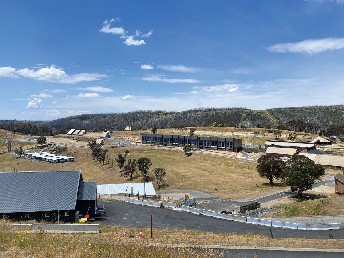
Cabramurra was all but destroyed in the 2020 Dunns Road fire. The public school went first, and dozens of family homes were burnt down. Only a handful of these unique single sloping roof houses remain now. The town is being rebuilt with a new staff medical centre, bushfire bunkers and a very large and prominent accommodation building for Snowy Hydro workers. The centre of town survived and the bistro there is very popular with locals and travellers.
In 1960, I remember having lunch in the workers canteen, located up near the present lookout. Cabramurra was then a town of demountable buildings. The town today can be visited by travellers in daytime only (9am–3pm). There is no public accommodation here.
The Cabramurra Lookout platform provides 360-degree views over the town and all the way to Victoria. The lookout is on a plateau with room to circle vans. Drinking water and picnic shelters are available and the public flush toilet is the best you’ll find this side of Kosciuszko.
The journey continues
To continue south from Cabramurra entails a very steep and winding sealed road (Snow Ridge Road) down to the spectacular Tumut Pond Dam – great for fishing and bush walking.
From here, there’s a similarly steep and winding sealed road (Tooma Road) heading up the other side of the valley. Around 9km from Tumut Pond Dam you’ll reach a roadside rebuilt hut. This is Bradley and O’Briens Hut, and the original burnt down in 2020. This is another good spot for a picnic or break.
Where to stay
Caravan parks
Caravan Parks are located outside the national park. These make good base camps for further exploring.
Alpine Tourist Park
2 Lett Street
Adaminaby NSW 2629
P: 0433 303 576
Rainbow Pines Tourist Park
Lucas Street
Old Adaminaby NSW 2629
P: 02 6454 2317
Khancoban Lakeside Caravan Park
1362 Alpine Way
Khancoban NSW 2642
P: 02 6076 9488
Talbingo Caravan Park
24 Whitty Street
Talbingo NSW 2720
P: 02 6949 5239
Kosciuszko Tourist Park
P: 02 6456 2224
Buckenderra Holiday Village
P: 02 6453 7242
P: 02 6454 2223
Campgrounds
All the following campgrounds are remote, peaceful, in Kosciuszko National Park and require bookings (P: 1300 072 757, E: parks.info@environment.nsw.gov.au). No camping fee applies, but there is a $6 booking fee. Double check open times, as many campgrounds in the area will close between the June and October long weekends (King’s Birthday and NSW Labour Day).
Three Mile Dam
The first spot to camp near Three Mile Dam is along Three Mile Dam Wall Access Road, just before the Kings Cross Road turnoff from Link Road. This access road leads to the gold rush era earthen dam wall. It’s a short rough road in with limited bush sites suitable for caravans on both sides of the road before going to far further on. There are picnic tables, fire pits, non-flush toilets and great water views.
 Three Mile Dam campground
The official Three Mile Dam campground is preferable for caravans. It’s a little further along Link Road and leads to the other side of the dam. It’s a good road in with caravan suitable bush sites in the trees on the right. You can camp with water views and facilities include barbecues, picnic tables, fire pits and non-flush toilets.
Bullocks Hill campground
Located north of Kiandra near the Marica Snowy 2.0 works town, there’s a short entry road along Bullocks Hill Trail and bush sites suitable for caravans. This campground is heavily used by horse riding groups, so there are usually numerous horse floats. Facilities include barbecues and non-flush toilets.
Yarrangobilly Village campground
This is the easiest access for caravans, with flat grassy natural sites along the riverbank on both sides of the bridge. Despite the name, there is no village or services available here. Facilities include picnic tables, fire pits and non-flush toilets. Please note, the campground is closed for upgrades until 12 April 2025 and then restricted camping until 30 June 2025.
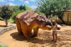
 Yarrangobilly Caves thermal pool
Nearby Yarrangobilly Caves has guided cave tours and 27-degree thermal swimming pool. Fees apply. The unsealed one-way cave entry and exit roads are unsuitable for caravans, so it’s a good idea to leave them back at the campground or nearby rest area.
Some other good national park campgrounds to check out include:
- Cooinbil Hut Campground: Cooinbil Road, Long Plain
- Geehi Flats Campground: Alpine Way, Geehi
- Island Bend Campground: Guthega Road, Island Bend
- Jounama Creek Campground: Jounama Creek Trail, Talbingo
- Tom Groggin Campground: Alpine Way, Murray Gorge
Fees will apply, and bookings can be made online.
Short walks to rebuilt huts
As with all alpine walks, weather conditions in Kosciuszko National Park can change quickly, and walkers must be well prepared.
The hut rebuilds took place from 2023 to 2025 with the wonderful work of the NSW National Parks and Wildlife Service with co-operation from the family descendants and the volunteer Kosciuszko Huts Association (KHA). The KHA always welcomes new members.
Four Mile Hut Walk
Allow approximately 3.5–4.5 hours to complete this moderate walk. The trail begins at the Selwyn Snow Resort, where you can park at the gate and follow the signposted trails. This walk features open snow gum terrain with some steep sections down to Four Mile Hut valley (you’ll turn onto Tabletop Trail prior to the hut). The original hut was built in 1937 during the gold rush and the 2024 rebuild is an amazing replica. Walk-in camping is available.
 Four Mile Hut ruins and rebuild
Round Mountain Hut walking track
Allow approximately 1.5 hours for this trail, or longer if you want extra time to enjoy the scenery. From Cabramurra, head south beyond Tumut Pond Dam to the Round Mountain Carpark just off Tooma Road. Park here, then follow the Round Mountain Trail and turn left at Farm Ridge Trail. It’s a short but steep descent to the 1930s hut site. The rebuild was completed in early 2025. Great views are obtained from the hut and along the track.
 Walkers on the Round Mountain Hut walking track
Linesmans Huts
Allow approximately 1.5–2 hours to complete this trail. The two huts are located on Fifteen Mile Spur and are the easiest of the remote rebuilt huts to reach. Park at the gate on the Happy Jacks Trail, a little before the roadside Bradley and O’Briens Hut. Follow the trail to the big left bend and then follow the grassy trail up to the right. Presto, the huts and amazing views. The originals were built for power line maintenance at different times from the 1950s. Most of these 2024 rebuilds were helicoptered in.
Vickerys Hut Walk
Allow approximately 3–4 hours for this trail; it’s a moderate to difficult route due to the steep descent down to the hut on the Jounama Creek valley floor. Take the Prosser Trail north of Yarrangobbilly along the Snowy Mountain Highway and park before the gate on the left where the Vickerys Trail begins. The original unique log cabin design was built around 1945 and the revuild completed in 2022. It’s a scenic creek side location, so sit and enjoy the location before making the trek back.
THE NEXT STEP
If you want to learn the latest caravan news, find the most innovative new caravans and camping gear or get inspired to plan your next road trip adventure to some of Australia's best getaway destinations, subscribe to our weekly newsletter. We promise to send you only the best content.
Related articles:
Waterfall Way: Is this NSW's most scenic road trip?
Head on a caravanning adventure in Kangaroo Valley, NSW

Explore the other side of the Snowy Mountains, NSW