
The best of the Barrington Tops National Park, NSW
With an abundance of natural beauty, waterfalls, walking trails, lookouts and much more, there's plenty to see and do in NSW's Barrington Tops National Park.
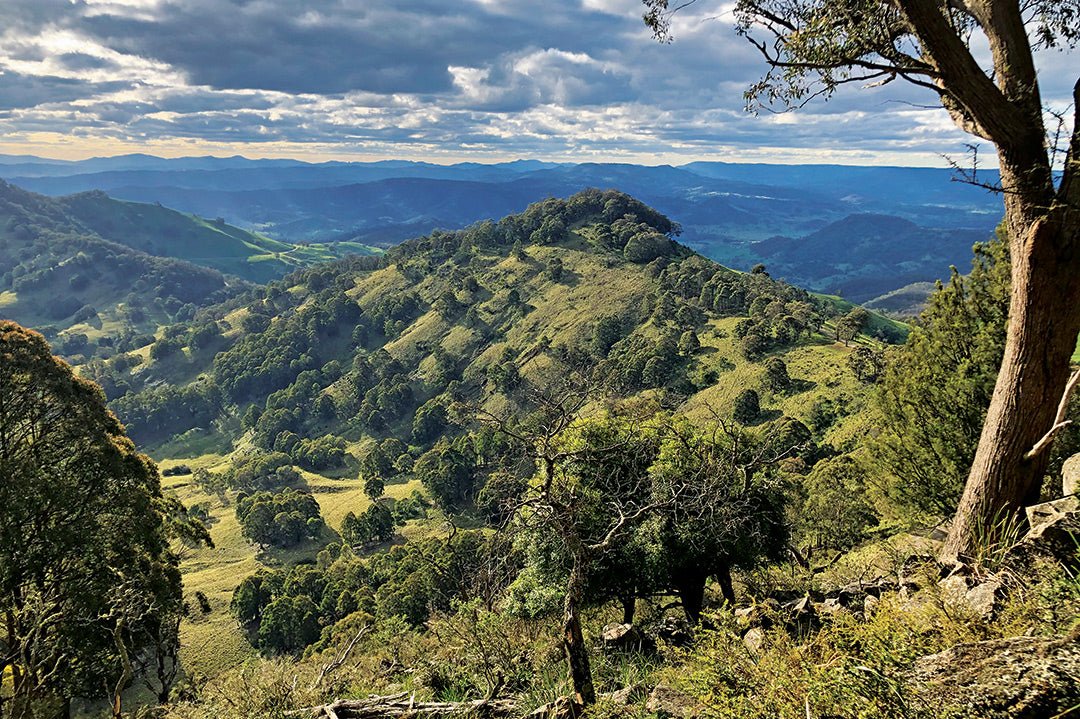
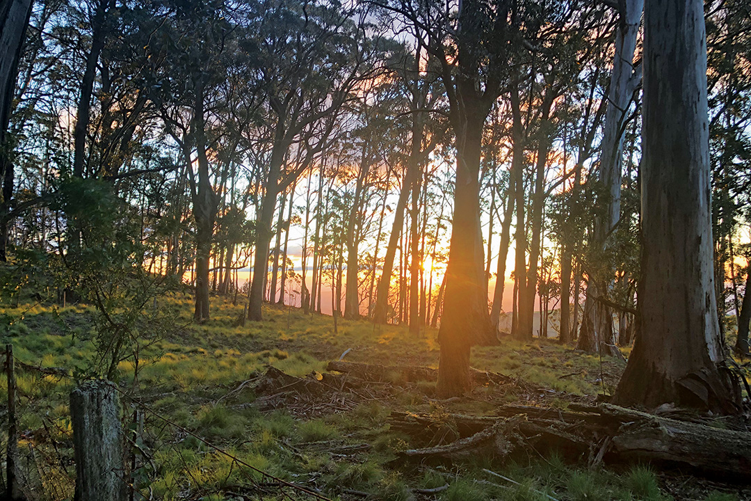
In centuries past, the Barrington Plateau formed the boundary of the Wonnarua, Birpai and Worimi people. The highest tableland outside the Australian Alps, the Barrington Range rises to 1586m. In August 2013, the Newcastle Herald reported that the World Heritage-listed Barrington Tops had also been nominated for inclusion as the eighth wonder of the world. Visitors should make the journey to the Tops to see for themselves why the area could be a world wonder and to explore some of the many driving routes and walking tracks.
The Tops rise above the Hunter-Manning regions of New South Wales and offer a wide variety of walks and drives. The roads up the eastern and western escarpments between the large towns of Scone and Gloucester are steep and mostly unsealed, but the route is suitable for standard cars, vans and trailers. Once on the plateau, the driving and walking trails are mostly flat. The ascent from Gloucester is now sealed almost to the top and is the best access if towing.
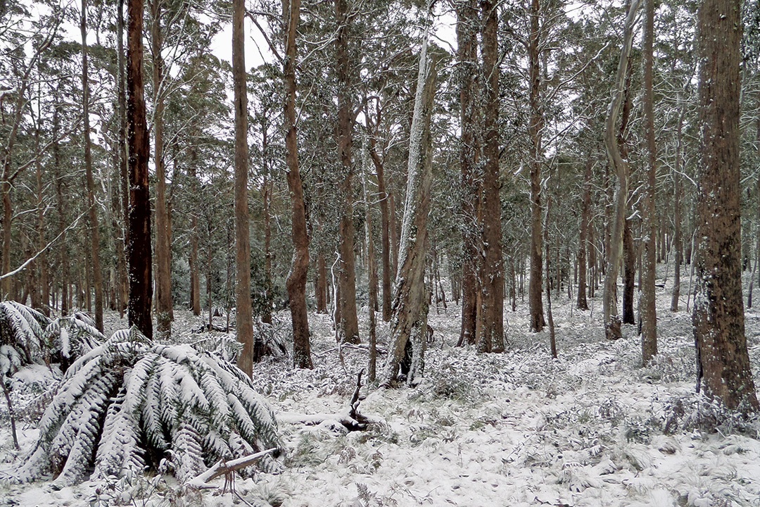
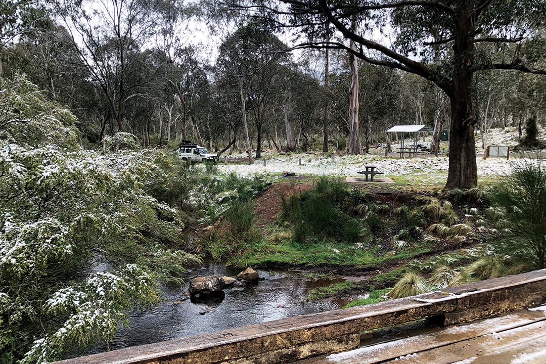
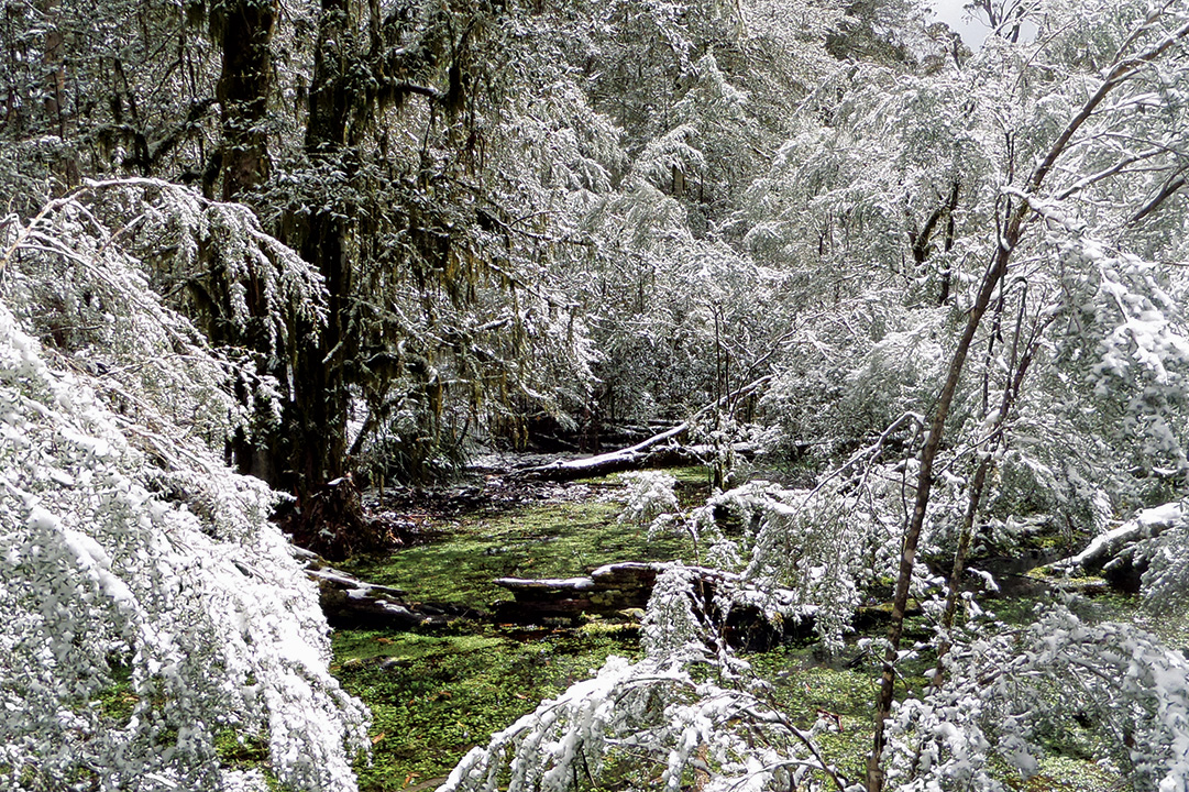
Barrington’s altitude, availability of water and great selection of campsites makes it a four-season venue. Summer can be pleasantly cool. Winter has the appeal of temporary snow, ice or frost without too much harsh exposure. In between can be just perfect.
As in all alpine regions, be prepared for changeable weather conditions. Exposed areas are rare but bleak winter weather can spoil the experiences of ill-equipped travellers. Winter snowfalls are possible and summer thunderstorms are probable.
To make the most of your time on the Tops, the following checklist of scenic attractions and great walks can be experienced along the route from the east via Gloucester and through to the west to the New England Highway at Scone.
Only 25 years ago, the sealed section of road finished on Copeland Tops. The road is now sealed almost all the way to the main plateau, stopping just below the first picnic area.
For visitors who are unsure about towing in such terrain and road conditions, a base camp in Gloucester is recommended while you explore the Tops and surrounds on day trips.
Cobark Lookout and Picnic Area
This new tallowwood lookout platform is the first to be encountered after the scenic drive to the Tops. It is located on the edge of the Barrington Tops State Forest and has roadside parking spaces, seating, and information.
The large picnic area that once extended from the current smaller Cobark Picnic Area is overgrown, but exploration will reveal long lost ruins of picnic tables and fireplaces out along the plateau.
Dilgry Circle Road
Accessed off Barrington Tops Forest Road, this ring road is usually in good condition for conventional vehicles and makes a suitable side trip with many varied features to enjoy. After winding its way past rivers, picnic areas and the lush landscape, the road returns you to the main Barrington Forest Road at Honeysuckle Picnic Area.
At the start of Dilgry Circle Road, one of the first places to check out is Banksia Picnic Area. Located beside Dilgry River it’s a beautiful shady rest area with leafy nooks and is a great spot for a foot paddle or short walk along the river.
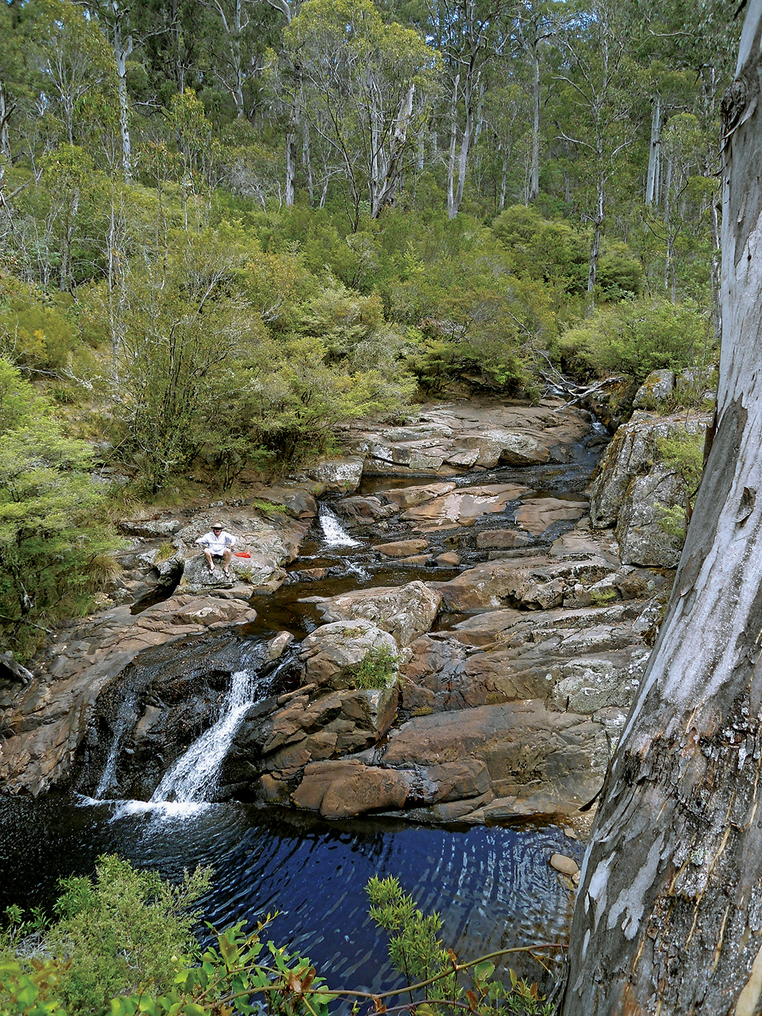
As you continue along Dilgry Circle Road you can take a short detour to Gummi Picnic Area by turning right onto Thunderbolts Trail and then left onto Gummi Road. This little picnic area is located above the wooden bridge that crosses Manning River. Walk across the bridge and a track is seen heading upstream along the bank. You can follow the rough high track or rock hop up the river for 10 minutes to the impressive Manning Falls, one of the best swimming holes on the Tops.
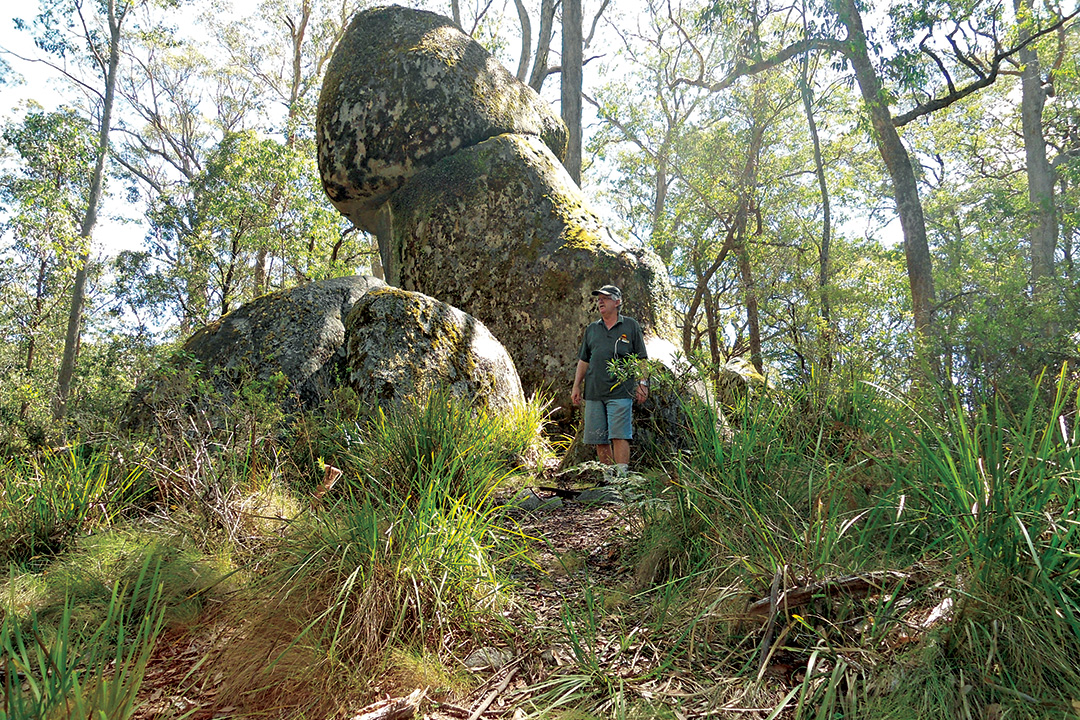
Returning to Dilgry Circle Road, The Rock is well worth a stop. It’s a small grassy car park on the left just before you reach Pheasant Creek Road. The Rock can be seen up above the trees on the right, and there is a short walking track that leads up to the huge granite formation.
Once you’ve finished this exploration, you’ll have reached the junction with Pheasant Creek Road. If you turn right and keep following this road, you’ll be led out of the forest and be on your way towards Tomalla and Hunter Springs. Not too far along this route you’ll come across the Manning River Camping Area which is a popular camping and picnic area just off Pheasant Creek Road.
Honeysuckle Picnic Area
If you turn left onto Pheasant Creek Road, you’ll continue the loop back to where you began. Stop in at Dilgry River Camping Area for a stop-over or head on to Honeysuckle Rest Area. This picnic area is located at the Pheasant Creek Road junction with Barrington Tops Forest Road. If your exploration time on the plateau is limited, Honeysuckle Walk, which leads off this rest area, takes less than 30 minutes and will allow you to experience all the main vegetation types you’ll find in the area, including the magnificent beech forest, ancient soft tree ferns, hanging moss and snow gums. The track is a circuit which descends to a bridge over a wet ferny gully where lyrebirds are often heard and seen. It is a wonderful experience to stand beneath one of the ancient beech trees and look up along its moss green trunk to the spreading canopy far above.
Thunderbolts Lookout
From Honeysuckle Picnic Area you can head back along Barrington Tops Forest Road towards Gloucester and complete the circuit.
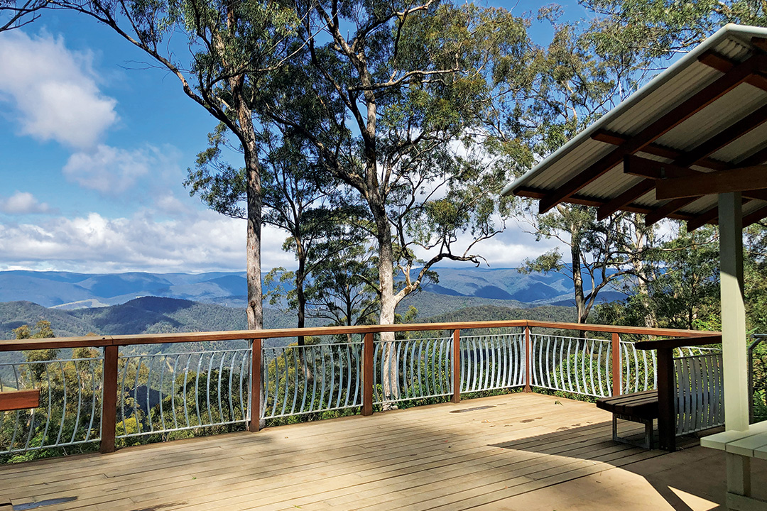
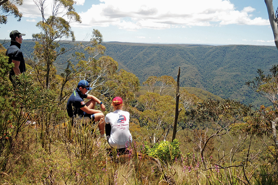
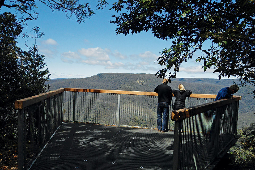
But to see more of the Barrington Tops, head southwest towards Thunderbolts Lookout. There’s a short side road on the left that is used for parking and a 300m walk to a spectacular escarpment view. The walk takes you through Antarctic beech forest and snow gum glades. The railed lookout provides panoramic views over the Moppy River gorge.
Devils Hole Lookout
Further down the road you’ll come to Devils Hole Lookout. This major picnic area has an information board, shelter shed, picnic tables and toilet. The 100m, paved walk to the lookout is suitable for wheelchairs and prams. The view here is similar to Thunderbolts Lookout but there is a protruding platform and railing. Your view is into the gaping gorge of the Moppy River or the Devils Hole. The flat-topped summit of Mount Carson is the prominent feature on the far side.
Opposite the picnic area is the Devils Hole campground. There are secluded nooks here by the head of the Dilgry River.
Barrington Trail
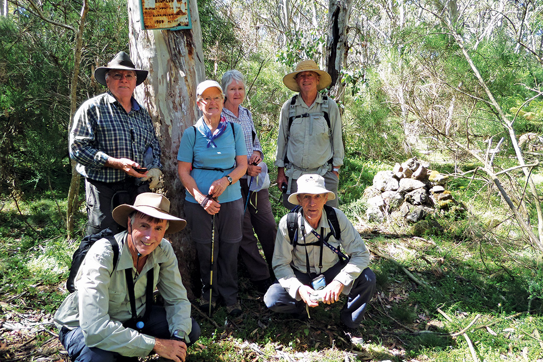
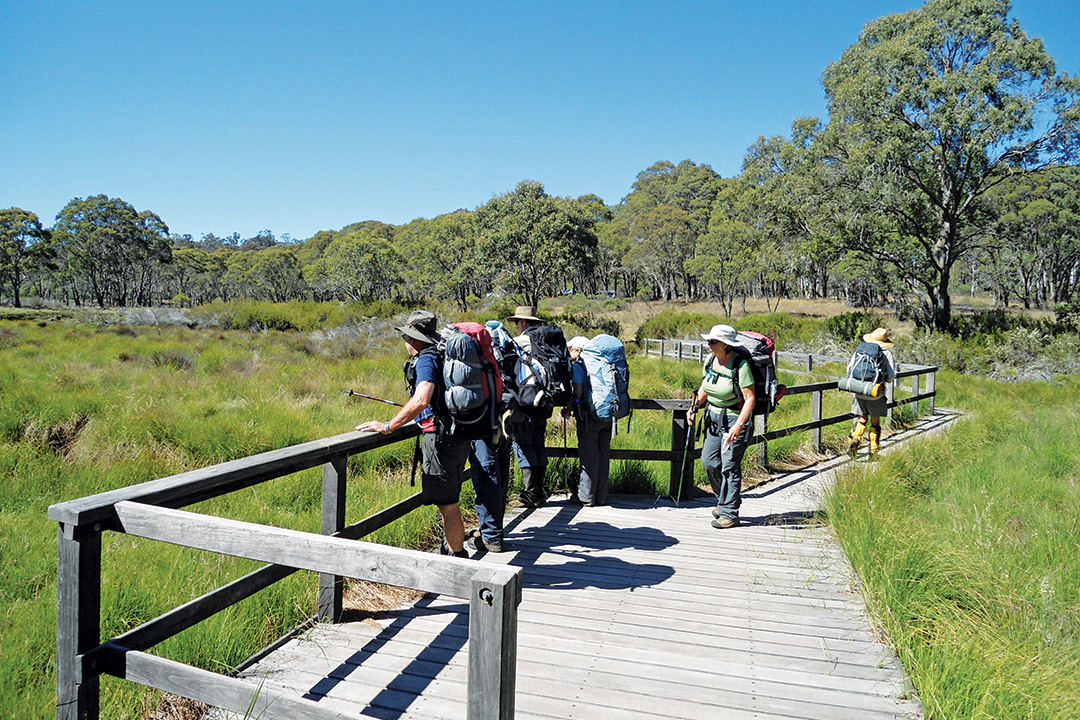
This left-hand turn off Barrington Tops Forest Road leads to a small picnic area and information sign. In warmer months, 4WD access is possible from here through to Little Murray Creek and on towards Junction Pools. This is also a great place to start the 5km hike to Little Murray. The Barrington Trail crosses the head of Polblue Creek then climbs the flank of Mount Polblue. The nearby concealed Polblue Trig is the second highest point on the plateau at 1577 metres. The highest is ahead on Brumlow Top at an altitude of 1586 metres. Both are scrubby and without views.
The track then descends to Little Murray Campground. This grassy flat with toilet and tables is open to 4WD camping (trailers suitable) in the warmer months but is only a walk-in site in winter or after heavy rain. The creek here is great for soaking your feet on a hot day or for cracking the ice on a cold day.
Polblue campground and picnic area
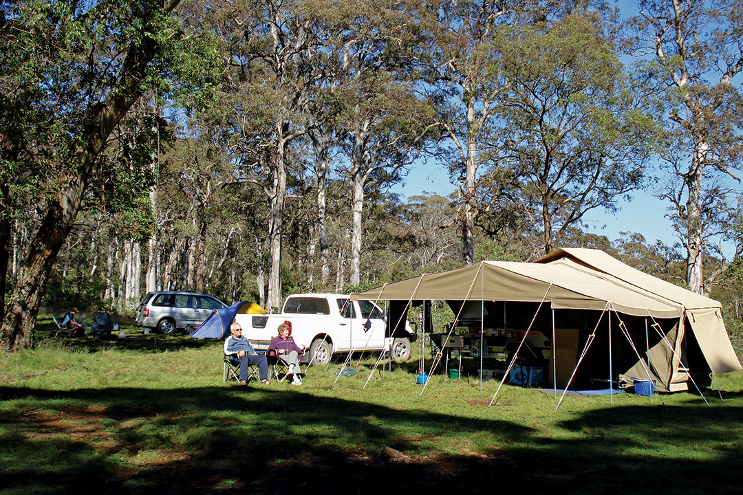
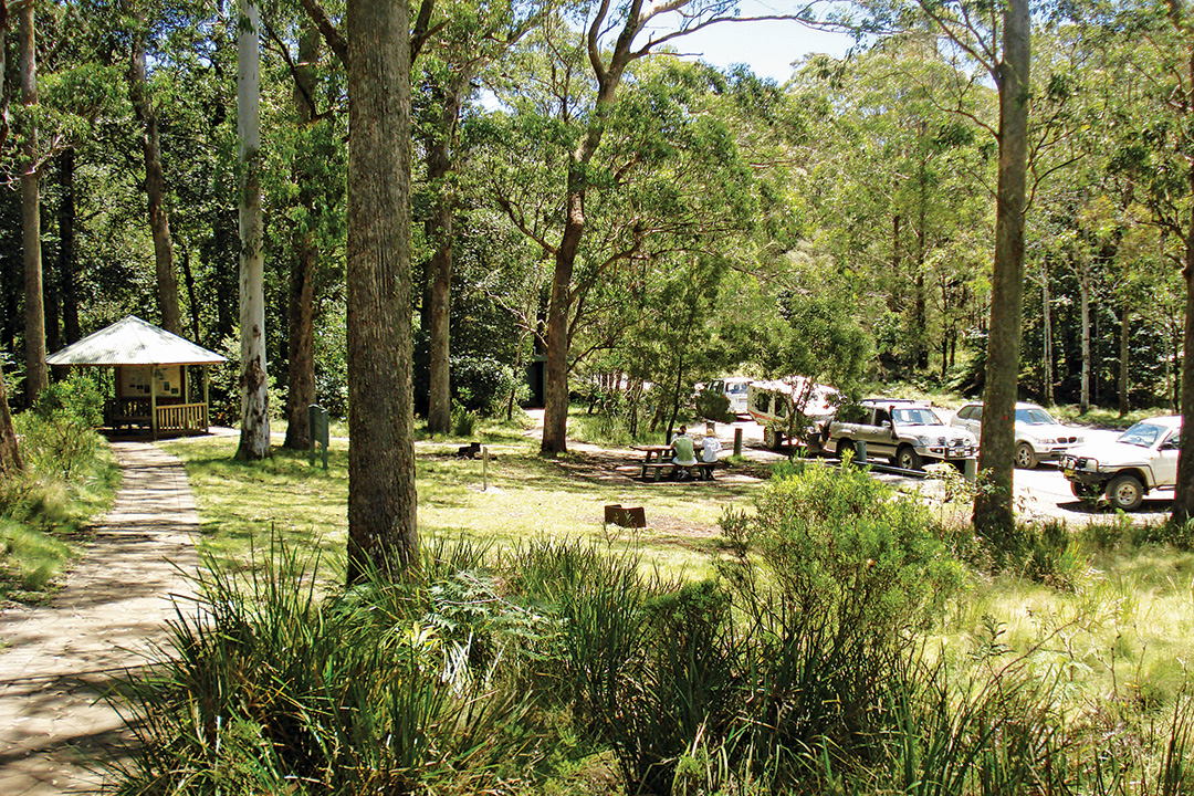
Located further along Barrington Tops Forest Road, Polblue campground and picnic area is another great spot to stop and appreciate the natural beauty of the Barrington Tops. This alpine landscape is ideal for camping with large flat spaces for setting up tents, trailers or vans, overlooking the wide sphagnum swamp. There are composting toilets, shelters, picnic tables, clean creek water and gas and wood barbecue facilities. Wood is scarce and cannot be collected in the National Park. This is Australia’s highest car-based campsite.
The main feature of the site is the swamp and the walking track that circles it. The track takes about an hour to complete. At the far end, a new bridge crosses the main creek and the track heads up into the trees and continues around the swamp and back to camp via some boardwalks.
A weed called Scotch broom is a very serious problem on Barrington Tops. It escaped from rural gardens many years ago and is smothering much of the native vegetation on the Tops. It is noticeable by its bright green colour and profuse yellow flowers. Various biological controls are being tried but it will take a long time to solve this natural disaster.
Polblue is an all-season camping area; although in winter it can be bleak, cold and misty. The road may also be gated for days due to snow, wet weather or wind damage. In summer you can watch the temperature drop by 10° Celsius as you climb to the plateau.
The Firs Picnic Area
From Polblue, the road continues along the plateau and into a working State Forest where logging trucks may be encountered. Don’t miss the turn into the dark mediaeval gloom of The Firs Picnic Area.
Horse Swamp campground
Just beyond The Firs is the right hand turn along the Tubrabucca Road. The secluded Horse Swamp campground is located a short distance down this road. A short steep walking track connects the camping area with the Polblue Falls Picnic Area.
Polblue Falls Picnic Area
You can also access the picnic area by road. A short well-formed track leads to a railed lookout overlooking the impressive cascades. An information sign here describes the importance of Barrington as a water source for the Hunter and Manning Valleys and that the Hunter River makes a journey of over 400km from the Tops to Newcastle Harbour.
A short side-track from the lookout track leads down to the falls and a notoriously cold swimming hole. This is the best swimming hole if camping at Polblue Swamp.
Source of the Hunter
The Tubrabucca Road continues through magnificent scenery around the source of the Hunter River near Barrington Trail junction and joins with the Pheasant Creek Road or the Dilgry Circle. Turn left off Tubrabucca Road onto Barrington Trail and a short distance after the junction you can turn right and follow the wide snow grass valley to the first springs of the Hunter.
Gologolies Picnic Area
Returning to Barrington Tops Forest Road, if you continue westwards, just prior to Dingo Gate you can turn right down Boundary Road to the secluded Gologolies Picnic Area. This is little visited now, and the decaying fireplace is all that remains, but it is a serene place to boil the billy beneath tall messmate trees. A short walk along the track leads to a wonderful view out of the forest across the rural lands of this remote corner of the Hunter Valley.
Dingo Gate
Moonan Outlook is located at the edge of the plateau just through the Dingo Gate. Here the Hunter Valley is spread out below with one of the most spectacular views from the Tops. There are picnic tables and wood barbecues. If camping at Polblue, drive out here for magnificent sunset views. You have now travelled about 72km from Gloucester.
The road now descends very steeply with sheer drops on one side, through rural pastureland to the valley floor at Moonan Brook. Soon after, the sealed road is reached which takes you back through Moonan Flat, Gundy and on to Scone or Aberdeen.
When to visit
Summer is the best time of year to visit Barrington Tops if you’re looking to escape the heat for a weekend getaway or longer exploration. But if you like a cold and hopefully cosy camp, the other seasons will appeal. However, it is worth noting that the roads can be closed after snow, heavy rain or wind.
Fast facts
Gloucester
Gloucester, located east of Barrington Tops, has branded itself as Barrington Tops' basecamp. This is a fair label as this large country town has all facilities and has the best access to the Tops, via Barrington and Copeland.
There’s a Woolworths for anyone wanting to stock up on supplies, and a service station to refuel. There is plenty of parkland for a picnic and the main street always seems busy with a bustling trade in the cafes and bakery.
Gloucester also provides access to the Gloucester Tops sector of Barrington Tops National Park (featuring many beautiful spots such as Gloucester Falls) and Copeland Tops National Park.
Further information:
-
Gloucester Visitor Information Centre
P: 02 6558 1408 -
Gloucester Office — NSW National Parks and Wildlife Service
P: 02 6538 5300
E: npws.barringtontops@environment.nsw.gov.au
Where to stay
-
Gloucester Holiday Park
Located in Denison Street, this caravan park is the ‘gateway to the Barrington Tops National Park’. There is a very short walk to parkland and shops. The parkland also has frontage to the Gloucester River.
P: 02 6558 1720 -
Gloucester River Campground
This is a basic NPWS campsite with caravan sites but no power. Bookings must be made online.
P: 02 6538 5300
E: npws.barringtontops@environment.nsw.gov.au -
Gloucester Tops Riverside Caravan Park
This caravan park also has Gloucester River frontage but is located in a much more remote area along the unsealed road to the Gloucester Tops sector of Barrington Tops National Park at a locality called Invergordon. Concrete fords need to be crossed which can cause problems after rain. A detour road is unsuitable for caravans.
P: 02 6558 3155
E: gloucestertops@gmail.com
Scone
This historic town is a major centre in the Upper Hunter Region and is known as the horse capital of Australia. Access to the Barrington Tops is via Gundy and Moonan Flat, but the unsealed dirt road becomes steep and narrow and much more difficult for towing than the Gloucester access.
The town can supply all needs for travellers, and it too has a Woolworths and service station.
Further information
-
Scone Visitor Information Centre
P: 02 6545 1300
E: sconevic@upperhunter.nsw.gov.au -
Scone Office and Depot — NSW National Parks and Wildlife Service
P: 02 6540 2300
E: barringtontops@environment.nsw.gov.au
Where to stay
-
Highway Caravan Park Scone
This caravan park is located on the northern side of town near McDonalds and offers old-fashioned country hospitality, facilities and powered and unpowered caravan sites.
P: 02 6545 1078
E: info@highwaycaravanparkscone.com.au -
Scone Caravan Park
Located in the heart of Scone, this caravan park has easy access to everything you need.
P: 02 6545 2024
E: enquiries@sconecaravanpark.com.au
Alternative accommodation
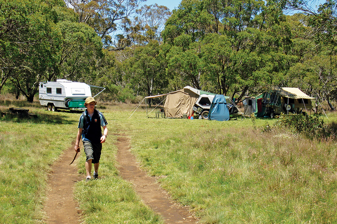
Campsites on the Barrington Tops now incur a fee. Camping areas include Polblue (best for vans), Devils Hole, Little Murray, Junction Pools, Horse Swamp and Gummi Camp.
Bookings are required either online or by phone (P: 1300 072 757).
THE NEXT STEP
If you want to learn the latest caravan news, find the most innovative new caravans and camping gear or get inspired to plan your next adventure to some of Australia's best getaway destinations, subscribe to our weekly newsletter. We promise to send you only the best content.
Related Articles:
3001 Things to See and Do Around Australia: Top 10 Destinations in NSW


