Murray River Country

AN AUSSIE ODYSSEY
A journey along this winding waterway is an odyssey with many facets — Indigenous culture, historic river ports and paddle steamers, pristine wetlands teeming with native wildlife, irrigated vineyards and orchards, and wide-open spaces with boundless opportunities for recreation and adventure.
THE MURRAY RIVER
High in the Australian Alps, just south of Mount Kosciuszko, the Indi Springs feed a runnel that trickles west through alpine meadows, gathering other streams and creeks as it descends the mountain ranges to form the Murray River. From these lofty headwaters, the Murray flows 2520km through broad alluvial valleys to its mouth on the Southern Ocean, at Goolwa in South Australia.
Along the way, it is joined by other major rivers, including the Geehi, Goulburn, Lachlan, Murrumbidgee and the Darling which brings with it water from the Culgoa, Balonne, Condamine, Warrego and Paroo Rivers in Queensland. Collectively, these rivers and their tributaries drain one of the world’s largest catchments — the Murray-Darling Basin — spanning more than one million square kilometres, about one-seventh of the Australian continent.
Although it is Australia’s longest river, the Murray ranks only 16th in the world, a third the length of the Nile. It carries a small fraction of the water of other comparably sized rivers and has a greatly variable flow. Below the Hume Dam at Albury-Wodonga, the Murray falls only 165m to sea level, flowing at a stately, meandering pace through a broad, occasionally shallow channel.
It has dried up completely on three occasions during extreme droughts, and a sandbar often forms at its mouth. However, it has flooded during extended rain events across the catchment, the most significant being in 1956, inundating many towns on the lower reaches in South Australia for up to six months.
For most of the time, the Murray is continuously navigable for 1986km, from Goolwa to Yarrawonga, the third longest navigable inland waterway in the world, after the Amazon and Nile. Vessels plying the Murray between New South Wales and Victoria do so entirely within the former state, as the colonial boundary was established at the top of the southern (Victorian) bank rather than mid-stream.
THE MALLEE
For 1200km, from Hume Dam to Wentworth at its confluence with the Darling, the Murray flows through a region known as The Mallee, named after a species of a dwarf gum tree (Eucalyptus dumosa), or white mallee, that flourishes on the low-lying sandplains. For most of its length through the region, the Murray is flanked by broad floodplains laced with an intricate network of anabranches, creeks and floodrunners that feed billabongs, wetlands and semipermanent lakes.
These varied ecosystems provide habitats for more than 1000 species of native plants and an array of fauna that includes over 300 species of birds. The Murray and its tributaries also support a rich assemblage of aquatic wildlife, such as the famous Murray cod, golden perch, turtles, crayfish and platypus.
CONSERVATION
More than one million hectares of public land in the Mallee and along the Murray River corridor are conserved in national parks and state reserves. In the east, the Barmah NP and Barmah-Millewa Forest protect the largest river red gum forest in the world. In the west, the Victorian Mallee Parks include the Murray-Sunset NP, Wyperfeld NP, and the Ramsar-listed lakes and wetlands of Hattah-Kulkyne NP. All are managed in a careful balance of environmental protection and recreational activities, such as camping, fishing, boating, canoeing, swimming, bushwalking, four-wheel driving and mountain biking.
INDIGENOUS HERITAGE

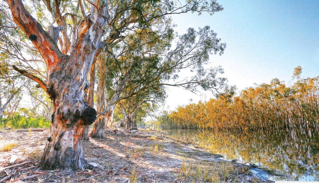
River red gums beside a lake in the Hattah-Kulkyne National Park
The Murray River flows through the traditional land of numerous Aboriginal nations, the largest of them including the Wiradjuri, Barkintji, Kaurna and Ngarrindjeri. For tens of thousands of years before white settlement, the bounty of the river and its floodplains provided sustenance to the Indigenous people and, being a dominant feature of their physical landscape, the Murray had a special significance in their spiritual culture. Many groups travelled hundreds of kilometres to gather at the Murray for ceremony, trade and the exchange of knowledge and lore. Evidence of their occupation exists today at thousands of locations that contain burial sites, fish traps, middens, utensils, tools, scarred trees and hearths.
EUROPEAN HISTORY
Hamilton Hume and William Hovell were the first Europeans to encounter the river when they crossed it near Albury in 1824. Six years later, Charles Sturt navigated the Murrumbidgee to its junction with the Murray, which he named in honour of Sir George Murray, the then British Secretary of State for War and the Colonies, and continued down the Murray to Lake Alexandrina and the river's mouth. In 1836, the river was explored by Thomas Mitchell from the Darling junction upstream to Swan Hill.
European settlers reached the Mallee in 1846, establishing pastoral runs along the Murray and Wimmera Rivers for sheep and cattle and wood cutting. After 1853, dozens of shallow-draft paddlesteamers plied the Murray carrying wool, wheat and other goods in a busy trade that saw the expansion of ports like Mildura, Swan Hill and Echuca into vibrant commercial hubs. River transport began to decline around the 1890s as roads and railways touched the Murray at numerous points, and bridges were established to connect with interstate networks.
IRRIGATION AND REGULATION
Irrigation from the Murray began at Mildura in 1887 with the introduction of a pumping station by Canadian William Chaffey, which greatly accelerated farming and settlement in that region. In 1918, Victoria, New South Wales, South Australia and the Federal Government formed the Murray River Commission (now Murray-Darling Basin Authority) to coordinate the construction of regulating infrastructure and to oversee water sharing arrangements between the Basin states (now including Queensland and the ACT).
During the next 60 years, four major dams, sixteen storage weirs and fifteen navigable locks were constructed along the Murray. Today, millions of people rely on these resources for power generation, domestic water consumption, agricultural irrigation and environmental conservation.
YARRAWONGA
Yarrawonga, 265km north-east of Melbourne, lies on the southern shore of Lake Mulwala, formed by the Yarrawonga Weir on the Murray River, and is linked to the sister town of Mulwala (NSW) by a bridge over the mouth of the lake. Boasting more sunshine hours annually than Brisbane, the twin towns are essentially a holiday resort and retirement centre.
The towns’ main tourist drawcard is the 6000-hectare lake, with foreshore parks, boat ramps and lakeside camping that make it a popular venue for swimming, boating, kayaking and fishing. Several vessels, including two paddle-boats, operate daily cruises on the lake. Other attractions include the Yarrawonga-Mulwala Pioneer Museum and the National Trust-listed Byramine Homestead, built in 1842 for Elizabeth Hume, the widow of explorer John Kennedy Hume who was murdered by bushrangers at Gunning in 1840.
ECHUCA
The regional city of Echuca stands on the Murray near its junction with the Campaspe River and the Goulburn River (Victoria’s largest). This conjunction, its proximity to Melbourne (220km north), and connection to the railway network all contributed to the town’s development as a thriving river port during the 19th century. Today, Echuca is the administrative centre of the Campaspe Shire and an important service centre for the surrounding agricultural region. It is connected with Moama (NSW) by an historic iron bridge (1878), and an adjacent dedicated rail bridge. Its principal industry is tourism, which earns the local economy about $250 million annually.
The city’s main attractions include the Port of Echuca Discovery Centre, focused on the Heritage-listed wharf precinct, the National Holden Motor Museum, and the world’s largest fleet of operating paddlesteamers, including the PS Adelaide built in 1866. Echuca also hosts a number of annual events, such as the Southern 80 (the largest waterski race in the world), the Riverboats Music Festival and the Winter Blues Festival.
SWAN HILL
With a population of more than 11,000, Swan Hill is one of the main provincial centres in the Mallee, 340km north-west of Melbourne. The Heritage-listed lift span bridge (1896) over the Murray carries travelers to the Murray Downs and Moulamein in New South Wales. The town began in 1847 as a punt crossing near the confluence with the Little Murray River and developed into a major river port serving the region’s pastoralists.
Swan Hill continues as a substantial service centre for irrigated farming that produces wheat, citrus fruits, grapes, fodder crops and maize. Vying with Tocumwal (NSW) as ‘The Home of the Big Cod’, Swan Hill has evolved into a popular tourist destination with attractions that include the excellent Pioneer Settlement on Horseshoe Bend, river cruises on PS Pyap (1896) and Tyntynder Homestead (1846), the first property established in the district and now classified by the National Trust. The town hosts the annual Swan Hill Region Food and Wine Festival in March.

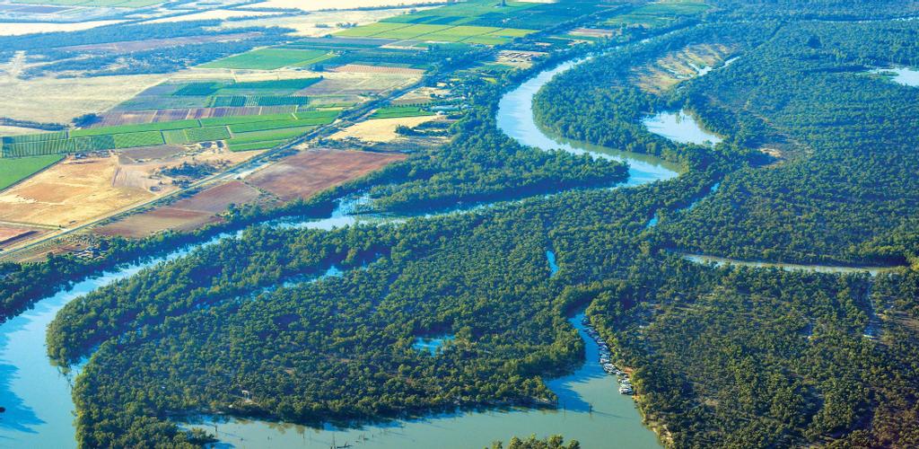
The Murray curves its way through the land
ROBINVALE
Northwest of Swan Hill along the Murray Valley Highway, travelers come to Boundary Bend at the confluence of the Murray and Murrumbidgee Rivers, and Robinvale 45km further on. This small service town was established in the 1920s and named in honour of Lieutenant George Robin Cuttle, a local boy who was killed in action during air combat over the Somme (France) in 1918. It is connected by a bridge to Euston on the other side of the river in New South Wales.
Surrounded on three sides by a meander in the Murray, Robinvale is a popular destination for swimming, camping and fishing. Local attractions include the Southern Cross Windmill (reputedly the largest windmill in the Southern Hemisphere), the Rural Life Museum, Robinswood Homestead (home of the Cuttle family) and Euston Weir and Lock 15 (with fish ladder).
MILDURA
Mildura stands on the south bank of the Murray, about halfway between Melbourne and Adelaide, 880km from the river’s mouth. It is the cultural and economic centre of the Sunraysia region, colloquially referred to as ‘Victoria's Food Bowl’ for its extensive dry-land farming and irrigated horticulture that produces more than 70 per cent of Australia's dried vine fruits, a quarter of the nation's citrus fruit and olives, and 75 per cent of its table grapes — generating nearly $3 billion in gross regional product.
Mildura’s riverside location, Mediterranean climate and many restaurants offering fine local cuisine make it a popular tourist destination. A key drawcard is the opportunity to cruise the river on one of the beautifully restored paddle steamers that comprise the local fleet. Other attractions include ‘Rio Vista’, the former home of William Chaffey, adjacent to the Arts Centre and Gallery, Old Mildura Homestead, the Weir and Lock 11, Chateau Mildura and Horticultural Museum.
The city also hosts many annual events, such as the Mildura Country Music Festival, the International Balloon Fiesta, the Jazz Food & Wine Festival, and the Mildura Masters fishing competition.


