
The End of the Rainbow
Like a proverbial pot of gold, the aptly named town of Rainbow Beach sits on the shore of sparkling Wide Bay at the end of a magnificent arc of multi-coloured sand cliffs. Only 240km north of Brisbane, the town is a sub-tropical holiday destination as well as the gateway to major conservation areas — world heritage Fraser Island, the Great Sandy Marine Park and the Cooloola Section of the Great Sandy National Park.
THE GREAT SANDY LANDSCAPE
Cooloola encompasses almost 62,000 hectares of spectacular coastline and hinterland between Wide Bay and Noosa Heads. From the Noosa River mouth, Teewah Beach stretches north for 60km to Double Island Point, from which Rainbow Beach sweeps westward to the township that shares its name. The northern end of Rainbow Beach is Inskip Point which, together with Hook Point on Fraser Island, form the entrance to the Great Sandy Strait. Inskip Peninsula separates the sheltered waters of Tin Can Inlet and the Strait to the west from Wide Bay and the Pacific Ocean to the east.
The Fraser Island and Cooloola landscapes were formed by sand borne by north-sweeping ocean currents that accumulated around volcanic headlands like Double Island Point. Changing sea levels and onshore winds carried loose sand inland for up to 35 kilometres, creating a series of overlapping dune fields of different ages, some more than 500,000 years old. Fraser Island is renowned as the world’s largest sand island, while Cooloola has the oldest and largest sequence of coastal dune systems in the world.
As the oceans fell to their present level, relentless wave action eroded the coast into steep cliffs, exposing the substrate in a glowing palette of yellows, oranges, reds, browns and black, derived from mineral oxides leached from the sand. The most spectacular cliffs are along Rainbow Beach and at Red Canyon on Teewah Beach. Their polychromatic splendor is best viewed in the morning light with a golden sunrise.
Another remarkable feature of the landscape is the Carlo Sandblow, just east of the township. Formed by a bare dunefield, the ‘sandblow’ covers more than 15 hectares terminating at a towering cliff above the beach. This lofty vantage point provides panoramic views of Wide Bay from Double Island Point to Inskip Peninsula and is an ideal launching zone for hang-gliders.
THE NATURAL ENVIRONMENT
The Cooloola region basks in a sub-tropical climate with balmy summers and mild winters. Rainfall, averaging 1500mm annually, nurtures more than 870 plant species, many found nowhere else. The coastal foredunes are held together by salt-tolerant creepers and spinifex, behind which hardy scrub stabilises the sand and protects small wattles and eucalypts from harsh winds. In these sheltered swales dry sclerophyll woodlands flourish and, further inland, are forests of red gum, bloodwood and blackbutt, the mainstay of a timber industry that laboured here for decades. These massive sentinels protect lush rainforests dominated by kauri pine, lilly pilly and strangler figs draped in vines, with an understorey of orchids, ferns and mosses. The drier western slopes are the domain of banksia heath, grassy plains and swampy lowlands, where wildflowers bloom during spring and summer.
These diverse communities provide habitats for a wide array of wildlife, including thousands of shorebirds migrating from other parts of the globe. Offshore, the Pacific waters teem with marine life.
FIRST INHABITANTS
The Great Sandy region is the traditional country of several Aboriginal tribes who occupied it for at least 6000 years before European contact. Fraser Island (K’gari) was home to the Butchulla people, from Inskip Point to Noosa were the Dulingbara, and the Kabi Kabi and Wakka Wakka lived further inland. Inskip Peninsula was a favoured camping area and meeting place where tribal groups gathered for ceremonies, trade and family business. Relics of their presence exist today at more than 500 sites, including numerous shell middens, stone artefacts, burial sites, scarred trees, stone quarries, grinding grooves, fish traps and bora rings.
EUROPEAN HISTORY
The Cooloola coast was sighted by James Cook in May 1770 (when he named Carlo Sandblow and Double Island Point) and explored in 1802 by Matthew Flinders, whose initial impressions were not positive. Flinders wrote of Fraser Island that, “nothing can be imagined more barren than this peninsula”. However, in 1842 explorer Andrew Petrie reported good pastoral lands and excellent forests in the area, attracting settlers to the area.
Timber-getters descended on the region in the 1860s. After the Gympie gold rush of 1867, demand for timber boomed and logging expanded to become the region's major industry. Increased coastal shipping prompted the construction of a lighthouse at Double Island Point in 1884.
Sandmining for rutile and zircon on Inskip Peninsula between 1965 and 1971 created the need for accommodation and an access road to inland service centres. The first allotments for the proposed Rainbow Beach resort town were sold in 1969, and a shop and motel soon followed. Opposition by conservation and community groups, however, brought an end to sandmining in the Great Sandy in 1976 and the subsequent declaration of national parks on Fraser Island and large parts of the Cooloola region. Fraser was listed as a World Heritage Area in 1992.
Once a mining camp, fishing village and retirement getaway, Rainbow Beach has become a bustling hub for eco-tourism. Capitalising on its proximity to world-class environments, the town attracts some 70,000 visitors annually.
SCENIC DRIVING
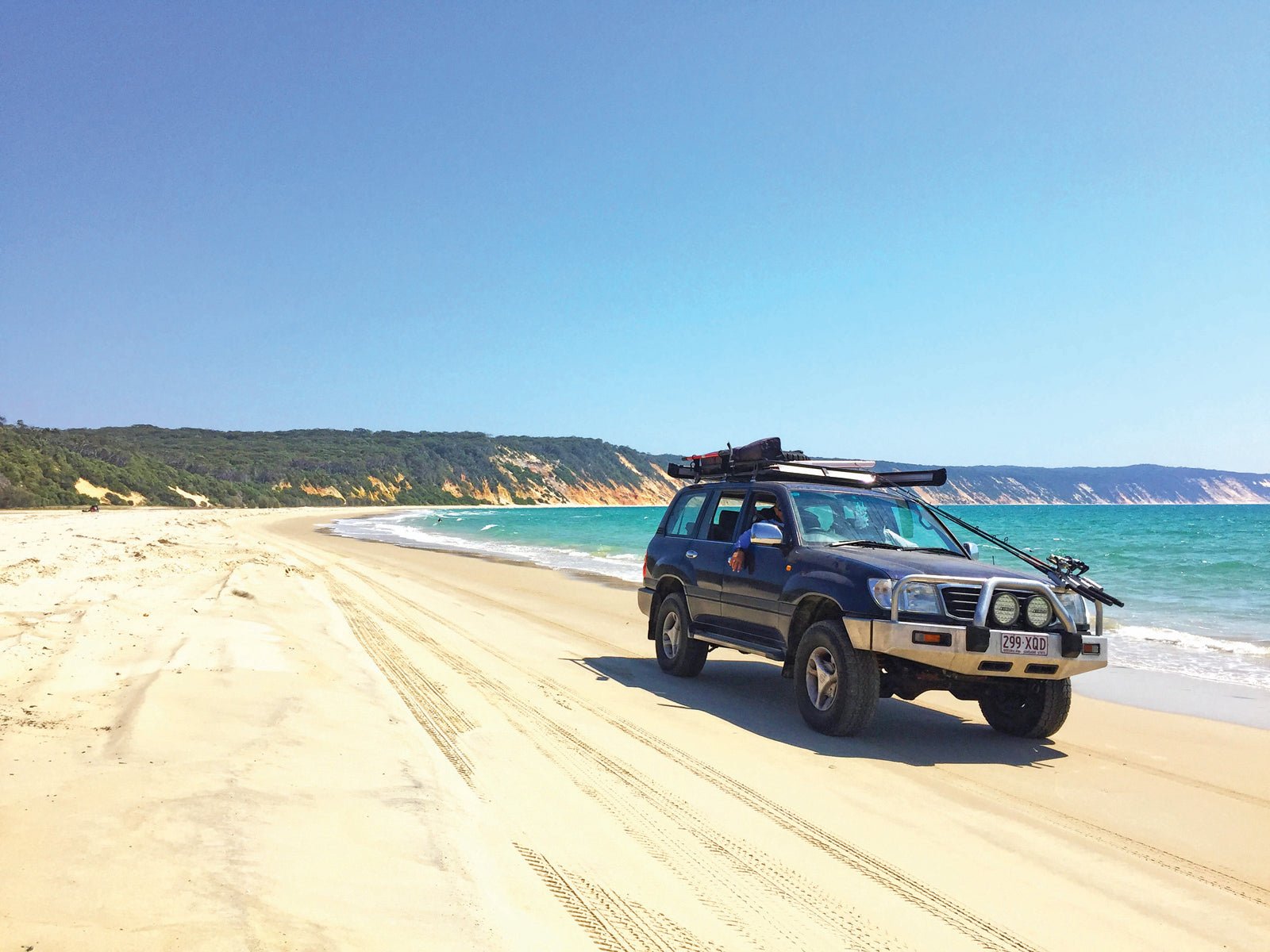
Cooloola is a major destination for 4WD enthusiasts. Off Rainbow Beach Road, 2WD vehicles can penetrate the park by a 3km unsealed road as far as Bymien Picnic Area. All other inland tracks are rough and sandy, only suitable for 4WD vehicles and high clearance camper trailers. All vehicles must be registered and have a vehicle access permit (VAP) for the Cooloola Recreation Area. VAPs are not required for Inskip, Bymien or Poverty Point.
Vehicle access to Teewah Beach is possible from Rainbow Beach, Noosa North Shore (near Tewantin), and via Freshwater Road and the Kings Bore track from Rainbow Beach Road. In normal conditions, both Rainbow and Teewah Beaches are suitable for 4WDs within three hours either side of low tide. However, storms and rough seas can cause erosion and landslides that render the beaches narrow and occasionally untrafficable. The Leisha Track connects the two beaches into a full day scenic drive from end to end.
FISHING
The Great Sandy region is one of the most popular recreational fishing areas in south-east Queensland, ranking second only to Moreton Bay. The coastal waters from Double Island Point to Inskip Peninsula and the Great Sandy Strait, including Tin Can Inlet, are within the Great Sandy Marine Park and bag limits, size and seasonal restrictions apply to some fish species. (For more information visit daf.qld.gov.au for rules and guidelines.) Fishing charters operate from Rainbow Beach into the Strait and offshore.
BUSHWALKING
Cooloola offers excellent bushwalking opportunities, through superb rainforests, open heathlands and inspiring coastal scenery. A number of short walks explore the northern section of Cooloola around Bymien Picnic Area, Poona Lake, Carlo Sandblow, Searys Creek and the spectacular sand cliffs of Rainbow Beach. A short drive from Freshwater camp along Teewah Beach ends at Double Island Point and a steep walk (2.2km return) up the southern side of the headland to the lighthouse, with fantastic 360-degree views. Middle-distance day walks include Rainbow Beach to Bymien Picnic Area (15km return) and from there to Lake Poona and Freshwater camp (17km return). An early start is recommended for the walk from Rainbow Beach (town) to Double Island Point (30km return, full day). For more adventurous and experienced hikers, the epic Cooloola Great Walk spans 102km (one way, five days) between Carlo Sandblow and Noosa North Shore, while a segment of it can be enjoyed along the Cooloola Wilderness Trail (48km one way, three to five days).
STAY WHILE YOU PLAY
The town caters well to holiday makers, with a comprehensive range of accommodation that includes beachside apartments, rental houses, B&Bs, hotels and motels. There are two caravan parks that make ideal bases from which to explore the region, while self-sufficient campers will find excellent beach or bush sites in the nearby recreation areas.
A member of the Top Tourist chain, the Rainbow Beach Holiday Village is located on the main street of the township (Rainbow Beach Road). A variety of self-contained accommodation is offered in two-bedroom Chalets ($160–190/night); Ocean View Spa Villas ($170–$200/night); two-bedroom Poolside Spa Villas ($165–$195); and Studio Villas ($130–$165). Large, grassy sites (powered and unpowered) overlooking the ocean are available for caravans ($49–$56/night), campervans and tents ($38–$53/night), all close to amenities.
South of the township, the Rainbow Beach Holiday Park stands on the eastern shore of Tin Can Bay at Carlo Point, ideally located for boaties and fishers close to a public boat ramp and the Carlo Point Marina. The spacious grounds contain more than 50 powered and unpowered sites ($30-$40/night). Travellers without vans or trailers are catered for in a range of self-contained accommodation that includes two-bedroom Spa Villas ($154/night), two-bedroom Villas ($129/night), one-bedroom Superior Cabins ($118/night), one-bedroom Budget Cabins ($107/night) and Ensuite Cabins ($89/night).
CAMPING
Camping near Rainbow Beach is available at locations ranging from developed sites to isolated bush camps with no facilities. Permits and pre-bookings are required for all areas and fees apply. A VAP may also be required. Capacity is limited and early bookings are recommended for peak periods.
Inskip Point Recreation Area
There are four camping areas here, all named after vessels associated with the region’s maritime history. None have fresh water or showers, though all have toilets and rubbish disposal facilities. The most southerly is S.S. Dorrigo, accessible by 2WD, though 4WD is recommended. The main road continues north, passing the turnoffs to the M.V. Natone and M.V. Beagle campgrounds, both only accessible by 4WD. The last campground is M.V. Sarawak, accessible by 2WD from the road or 4WD from the beach.
Freshwater camping area
Freshwater is 8km south of Double Island Point along Teewah Beach, set among attractive scribbly gum woodland about 500m inland from the beach. It offers 59 shady individual and group sites, suitable for tents, camper trailers and offroad caravans. Facilities include tap water (treat before use), hot showers (bring $1 coins) and flush toilets, with free gas barbecues and picnic shelters at the nearby day-use area. Generators and open fires are not permitted. There is no mobile phone coverage, but a pay phone is provided.
Teewah Beach camping area
Beach camping suitable for tents, offroad caravans and camper trailers with high clearance is permitted on a 15km stretch of vegetated dunes on Teewah Beach, about 3km south of Freshwater. There are no formally defined sites or facilities. Water obtained from pools, creeks or from sub-surface supplies is not suitable for drinking, cooking or showering. Tap water is available at Freshwater day-use area and should be treated before drinking. Campers should bring a portable toilet and dispose of toilet waste and rubbish at the facilities provided. Toilets and cold showers are also available at Freshwater day-use area. Campfires are permitted with untreated mill off-cuts as firewood, and generators may operate between 7am and 9pm.
Poverty Point camping area
Poverty Point offers undeveloped camping (with no facilities) overlooking the shallow eastern shore of Tin Can Inlet, about 12km south of Rainbow Beach. It’s accessible by boat from the inlet or by a sandy 4WD track off Rainbow Beach Road. The open camping area has no defined sites but is spacious enough for up to 24 people in tents or offroad camper trailers. Fires are permitted only in fire rings provided using untreated mill off-cuts as firewood. Generators are not permitted. Campers must bring drinking water, fuel or gas stove, rubbish bags and a portable toilet.
BIG RIGS AT RAINBOW
Official QPWS visitor guides warn that high-clearance 4WD vehicles with low-range capacity are essential for Cooloola’s sand tracks and beaches. Small caravans and camper trailers can get into some camping areas but must have high clearance.
Freshwater Road is narrow, with high berms close to the track in some places and limited opportunities for head-on traffic to pass. The track itself has long stretches of deep, loose sand, especially in dry conditions, and is quite rough in places. The last hill above Freshwater camp is a long, soft slope that would be difficult to climb with a heavy van.
Kings Bore Circuit is similar, with added features of washouts, difficult terrain and steep hills — all good 4WD fun but definitely not the place to take a big rig.
Driving on Teewah Beach at low tide is straightforward and presents few challenges to careful drivers with 4WD tow tugs and high-clearance rigs — the 50km run from Noosa North Shore to Double Island Point is wide and firm, with no exposed rocks and only a few shallow creek crossings. But the beach entry/exit point and access to Freshwater camp are marred by deep, soft sand that is heavily rutted by previous traffic.
Sites in the designated camping zone along Teewah Beach are set among dunes with limited space for manoeuvring a big rig. Access from the beach requires navigation of deep, soft sand which presents the same challenges as other access points.
At low tide, it is possible to access Freshwater camp via Rainbow Beach, crossing onto Teewah Beach by the Leisha Track. Access points at the township and both ends of the Leisha Track could be problematic with large, heavy vans. Rainbow Beach has the added feature of Mudlo Rocks, which can be impassable to all vehicles in some conditions.
In short, the inland tracks are no places for big rigs and, while the challenges of getting on and off the beaches are not insurmountable for the experienced in 4WDs, there is always the chance of getting stuck — if you do, you will earn the ire of other travellers and a hefty bill for the rescue.
The good news for big rigs is they can have their cake and eat it. Rainbow Beach is blessed with two well-appointed caravan parks that can easily accommodate the biggest vans close to civilisation but within striking distance of the many adventures Cooloola has to offer.
FAST FACTS
RAINBOW BEACH – CONTACTS
Rainbow Beach Tourist Centre
3/6 Rainbow Beach Road, Rainbow Beach
P: (07) 5486 3227
W: rainbowbeachinfo.com.au
Gympie Cooloola Tourism
Lake Alford, 24 Bruce Highway, Gympie
P: 1800 444 222
E: info@cooloola.org.au
W: cooloola.org.au
Noosa Visitor Information Centre
61 Hastings Street, Noosa Heads
P: (07) 5430 5000
E: info@visitnoosa.com.au
W: visitnoosa.com.au
Great Sandy Information Centre
240 Moorindil Street, Tewantin
P: 13 74 68
W: nprsr.qld.gov.au
Rainbow Beach Holiday Park
308 Carlo Road, Rainbow Beach
P: (07) 5486 3200
E: stay@rainbowbeachholidaypark.com.au
W: rainbowbeachholidaypark.com.au
Rainbow Beach Holiday Village
13 Rainbow Beach Road, Rainbow Beach
P: (07) 5486 3222
E: info@rainbowbeachholidaypark.com
W: rainbowbeachholidayvillage.com


