
Sandstone Country
Expedition National Park. It’s a name that fires the imagination, conjuring visions of intrepid explorers venturing into wild and unknown lands, pioneering trails across rugged ranges, fording rocky streams, clambering through boulder-strewn gorges bound by sheer sandstone cliffs, beguiled by myriad birds and rare animals, scaling lofty peaks to gaze upon vast open woodlands, and resting at day’s end beside a campfire under a star-filled sky. All of this and more awaits the modern-day offroader at this remote park in Queensland’s Central Highlands, about 660km north-west of Brisbane.
The park comprises three distinct sections straddling the Expedition Range — Robinson Gorge in the east, and Lonesome and Beilba in the west. With a combined area of just over 1000sqkm, Expedition is the second largest conservation area in the Sandstone Belt. Once part of Glenhaughton cattle station, the park is now the focus of self-reliant 4WDing, remote bush camping and nature-based recreation.
THE EXPEDITION LANDSCAPE
The Expedition Range is a rugged sandstone plateau formed about 240 million years ago from vast amounts of sand deposited in thick beds up to 240m deep, compressed by their own weight into stone — distinctive white Precipice Sandstone — then folded and lifted above the surrounding Bowen-Surat Basins. After eons of exposure, these plates of rock have eroded into a complex landscape riven by sheer cliffs and narrow canyons, of which the largest is Robinson Gorge.
The park protects the headwaters of several major watercourses. The Comet River drains the west of the range and flows north through Rolleston to join the Mackenzie River near Blackwater. Robinson Creek flows through its gorge in the east of the range and meets the Dawson River just north of Taroom. Near Duaringa, the Dawson joins the Fitzroy River which ultimately flows through Rockhampton to the Coral Sea.
The region’s climate is sub-tropical, with long hot summers when temperatures generally exceed 35 degrees, and short mild winters that commonly produce frosts. Rain falls mostly between November and March when monsoonal, occasionally cyclonic, systems may prevail over many days. Heavy rains over the Dawson River catchment in 2010–11 caused extensive flooding around Taroom and inundated the town of Theodore, forcing its complete evacuation.
THE NATURAL ENVIRONMENT
Expedition National Park conserves many different ecosystems, in which plant communities of the arid inland mix with those of the more humid regions to the east. More than 545 plant species have been recorded in the park, including some that are vulnerable or endangered.
Most of the park’s hot, dry plateau is timbered with open eucalypt woodlands interspersed with cypress pine, she-oak, budgeroo and native grasses. Within the sandy gorges, cabbage tree palms, bottlebrushes and wattles line the creeks, while in the moist, shady bases of cliffs ferns, mosses and orchids may be found. Cliff tops are fringed in heaths and a host of wildflowers that flourish at different times throughout the year. The exposed lowlands contain softwood vine scrub and patches of brigalow, an acacia shrub that once covered much of central Queensland but is now confined to isolated pockets across the sandstone bioregion.
These diverse plant communities provide habitats for a huge range of animal species — many of them rare — living here in isolated populations or at the western limit of their distribution. Among these are glossy black cockatoos, golden-tailed geckos, the Eastern pebble-mound mouse and the Northern quoll. Whiptail and brushtailed rock wallabies inhabit the gorges, and wallaroos may be seen on the Beilba hills. The birdlife is prolific: thrushes, whistlers and fantails are common throughout the forests; honeyeaters frequent the flowering bushes along the creeks; and rosellas, lorikeets and king parrots feed on eucalypt flowers, native figs and the fruit of cabbage tree palms. Populations of raptors, like the powerful owl and square-tailed kite, are also found here.
ABORIGINAL CULTURE
For many thousands of years before European settlement, the Expedition Range and Dawson Valley were the traditional lands of the Gungabula (Kongabulla) clan of the Yeeman (Iman) tribe — the Carpet Snake People. Evidence of their occupation exists at many sites, including images stencilled, painted and engraved, in secluded overhangs and rock shelters. Some stencils are of hunting and fighting implements, but others are full of meaning and purpose, symbolic of rituals and a deep spiritual connection to the land. Other culturally significant locations contain artefacts, burial sites and bora rings.
As Europeans settled pastoral leases and grazing runs during the early 1850s, the Yeeman joined with neighbouring tribes to vigorously oppose the invasion by waging a guerrilla war that lasted several years. One of the bloodiest chapters in these years of conflict was written on 27 October 1857 when a large group of Aboriginals attacked Hornet Bank Homestead, 40km west of Taroom, killing seven members of the Fraser family and three station workers. In the ensuing weeks, vigilantes and Native Police ranged across the surrounding districts, indiscriminately killing any Aboriginals they encountered, in numbers estimated at more than 300.
According to some historians, the ‘Hornet Bank Massacre’ and its aftermath shaped settler attitudes and government policies towards the Indigenous people of Queensland to the end of the 19th century. In a pattern of systematic dispossession repeated across the state, the Yeeman were forcibly removed from their ancestral lands to far-flung reserves and settlements. Despite this sad history, the Yeeman clans and culture survived and their traditional rights were recognised in a native title determination in 2016 covering almost 5,000sqkm, including parts of the Expedition NP.
EUROPEAN HISTORY
The first European to pass through the Expedition region was Ludwig Leichhardt in 1844. At the site of present-day Taroom, Leichhardt crossed the Dawson River and blazed a large coolibah tree with ‘LL44’ to record the waypoint. Although the blaze has long since disappeared, the tree remains a prominent tourist attraction on the town’s main street and is listed on the Queensland heritage register. Leichhardt also named many features of the landscape after members of his party, suppliers and financial backers.
On his return to Sydney in 1846, Leichhardt’s reports of rich pastures sparked a minor land boom as squatters moved to the valley to graze sheep. By the 1850s, Taroom settlement had developed at the junction of several tracks crossing the Dawson River and became a staging post between Roma and Rockhampton. Most of the surrounding country had been taken up for pastoral purposes. Glenhaughton was one of the largest sheep stations in the district, covering the area now included within Expedition NP and surrounding state forests. At its peak, the station employed 52 shepherds to tend more than 70,000 sheep, but spear-grass, dingoes and disease saw sheep replaced by cattle in the late 1890s.
After the First World War, much of the Dawson River corridor was subdivided under an irrigation scheme to provide returning soldiers with arable land for farming. However, the scheme was abandoned after a couple of years when it became apparent that the soil was unsuitable for farming and the soldier settlers had no agrarian skills. Cattle grazing, sorghum cropping, and timber continue as the shire’s economic mainstays, and several companies have begun coal seam gas production. With the establishment of the Expedition and Carnarvon Gorge National Parks, tourism also thrives in the region.
ROBINSON GORGE
Robinson Gorge is the largest of the park’s three sections and is named for its major feature — a spectacular gorge that snakes south for 14km between sheer sandstone cliffs that rise up to 100m. The gorge begins as a broad shallow basin and gradually narrows to its southern end at the aptly named ‘Cattle Dip’, a long, deep waterhole enclosed by vertical walls.
Getting to Robinson Gorge is an adventure that begins at Taroom. Eighteen kilometres north of the town, the route to the gorge leaves the highway at the Fitzroy Development Road and connects with Glenhaughton Road, which is followed west for about 90km through scenic countryside between Robinson Creek and the Murphy Range.
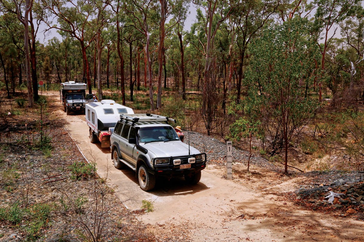
The signposted entrance to Expedition NP marks the beginning of a 16km 4WD track to Starkvale camping area that is suitable for high-clearance caravans and camper trailers but may become impassable to all vehicles in wet weather. The camping area is located next to a creek of the same name and offers about 20 undefined sites amid a grassy, open forest, with toilets, picnic tables and fire rings (byo wood). The creek may be dry and rainwater for the onsite tank is unreliable, so bring plenty of drinking water with you.
From Starkvale day use area, a narrow 2km track winds through the bush to an unfenced lookout perched atop a cliff overlooking a broad section of Robinson Gorge. The craggy faces of the cliff opposite the lookout glow in a palette of white, cream, yellow and orange which contrasts with the verdant valley below, where a straggle of boulders marks the course of Robinson Creek among the bottlebrush, vine thickets and cabbage palms. Near the lookout another trail descends steeply over loose rocky sections into the gorge, where it peters out with a scramble among the waterholes and scrub-covered boulders along the creek. Persevering with this natural obstacle course will reward the energetic hiker with magnificent views of the towering, multi-hued cliffs that echo with birdsong.
South of Starkvale, a 3.6km (return) track crosses open eucalypt woodland to an elongated spur that requires a steep climb through sandstone overhangs to Shepherds Peak (510m). The panoramic views at the top more than compensate for the slog there, but extreme care must be taken among the crevasses and unguarded cliffs. The trail continues down from Shepherds Peak to the remarkable Cattle Dip and winds its way back to the camping area via Starkvale Creek, Bottlebrush Waterhole and Carlia Gorge. Allow 5 hours for the entire loop. Alternatively, drive 2.7km from the camp to the Cattle Dip carpark and walk 600m to the lookout over that section of the gorge.
The Robinson Gorge adventure doesn’t end when you leave Starkvale. Visitors can return east to the Glenhaughton Road on the same route they entered the park, or they can head north on a scenic 4WD track for about 20km, crossing several watercourses, to the Mapala Road and continue another 70km to Bauhinia Downs on the Dawson Highway. In dry conditions, the 4WD track inside the park is firm and the creeks have little water, but rain may make the track boggy and running creeks may prove a challenge. The northerly route loops around to the Arcadia Valley Road that runs 120km through picturesque countryside, past Lake Nuga Nuga, to the Lonesome section.
LONESOME AND BEILBA
Returning to Taroom from Starkvale provides the shorter route to Expedition’s Lonesome and Beilba sections via a winding 100km back road through forested hills and rural properties to Injune. This small town is a service hub for local pastoralists and the southern gateway to Carnarvon NP, the largest and most spectacular conservation area in the Sandstone Belt.
Beilba is somewhat off the beaten track — it’s the most remote section of Expedition at the end of a plateau wedged between the Dawson River and Baffle Creek — on the upside, there’s a good chance you’ll have the whole place to yourself. The turn-off to Beilba is 26km north of Injune on the Carnarvon Development Road and follows the unsealed Fairview Road for 30km to its terminus in the park. The access road is generally suitable for all vehicles, except during wet weather when a 4WD is recommended. It is not suitable for large caravans, but high clearance offroad campers should get there with careful driving.
Before its annexation to the national park in 1993, the 4000ha Beilba section was part of a cattle station and evidence of this pastoral heritage can be seen in an old house, cattle yards, fences and dams. It was acquired to conserve an important corridor between the waterways and the spectacular sandstone escarpments that surround it. Overlooking the eastern end of the Carnarvon Range and the upper Arcadia Valley, the plateau is mostly covered by woodlands that become a riot of colour with wildflowers in late winter and spring. A get-away-from-it-all camping area, with views over a rocky gorge, has no facilities and campers must be self-sufficient. A network of driving tracks extend to several vantage points around the edge of the plateau.
If you’ve come from Starkvale via the northern route, the Arcadia Valley Road passes through the Lonesome section. Otherwise, it’s reached by turning off the Carnarvon Development Road 37km north of Injune and driving another 18km east on roads suitable for all vehicles. Before its gazettal as national park in 1972, Lonesome was a 3370ha portion of a cattle station that straddled the headwaters of the Dawson River west of the Expedition Range. Cattle still graze in some areas of the park and the weathered remains of fences, stock yards and a stockman’s hut can be seen among the brigalow. Lonesome’s impressive scenery includes ‘The Candlesticks’, sandstone pillars that rise majestically above the valley’s grassy plains. A camping area (no facilities) sits amid shady eucalypts on the banks of the Dawson River, and a lookout offers breathtaking views of the Arcadia Valley, the river and the nearby ranges.
FAST FACTS
Expedition National Park has three separate sections. Robinson Gorge is 90km north-west of Taroom and 116km south of Bauhinia Downs along gravel roads, the last 16km suitable only for 4WD vehicles. The Lonesome and Beilba sections are about 55km north of Injune via the Carnarvon Development Road and gravel access roads.
The unsealed roads may be impassable in wet weather. Check with the Department of Transport and Main Roads (13 19 40) or local councils for current conditions.
All sections of the national park are remote and mobile phone coverage is limited. Satellite phones can be used, and a Personal Locator Beacon is recommended for emergency situations. UHF Injune emergency repeater (for Lonesome and Beilba sections) is Channel 7. There is some access to Channel 5 UHF emergency repeater from the higher points of Robinson Gorge section.
Fuel and supplies are available at Taroom, Bauhinia Downs and Injune. There are no services within the national park, and the best time to visit is April–September.
Camping is available at Robinson Gorge (Starkvale camping area) suitable for high clearance offroad camper trailers, with toilets, fire rings (byo wood) and picnic tables; also at Lonesome and Beilba with no facilities. Permits are required and fees apply.
Alternative accommodation, including caravan parks, is available at Taroom and Injune. Pets are not permitted in the park.
TAROOM INFORMATION CENTRE
10 Yaldwyn Street. Taroom
P: (07) 4638 6113
E: tourism@banana.qld.gov.au
W: sandstonewonders.com
INJUNE INFORMATION CENTRE
32 Hutton Street, Injune
P: (07) 4626 0503
E: tourism@maranoa.qld.gov.au
BANANA SHIRE COUNCIL OFFICE
62 Valentine Plains Road, Biloela Qld 4715
P: (07) 4992 9500
E: tourism@banana.qld.gov.au
W: banana.qld.gov.au
QUEENSLAND PARKS AND WILDLIFE SERVICES
P: 13 74 68
E: qpws@des.qld.gov.au
W: npsr.qld.gov.au/parks/expedition


