
Named after the 17th century Italian painter, Salvator Rosa is a remote enclave tucked away in a corner of Queensland’s Ka Ka Mundi, Carnarvon National Park and it has a lot to offer for those prepared to make the effort to get there.
Salvator Rosa is one of seven sections of Queensland’s famed Carnarvon National Park, tucked away in a remote corner of the semi-arid Central Highlands. This small enclave lies nestled against the northern edge of a towering sandstone escarpment, part of the Carnarvon Range, surrounded on its other boundaries by agricultural and pastoral lands spanning three sparsely populated shires.
When Thomas Mitchell explored the region in July 1846 and beheld the ranges that resembled “gothic cathedrals in ruins” rising sharply from woodlands and streams, he declared “I never saw anything in nature come so near these creations of genius and imagination.” So moved was he by this “discovery worthy of the toils of a pilgrimage”, he named the place Salvator Rosa after the 17th century Italian painter noted for his romanticised landscapes of untamed nature.
This section of the national park is more than 800km northwest of Brisbane and several hours drive from the nearest towns, Tambo and Springsure, bestowing a sense of isolation that appeals to adventurers seeking to avoid the better known, and busier, Carnarvon Gorge. It has much to offer those willing to put in the effort to get there — serene camping in a woodland environment, swimming in the crystal-clear Nogoa River, bushwalks to unique sandstone formations and scenic four-wheel driving.
How to get to Salvator Rosa
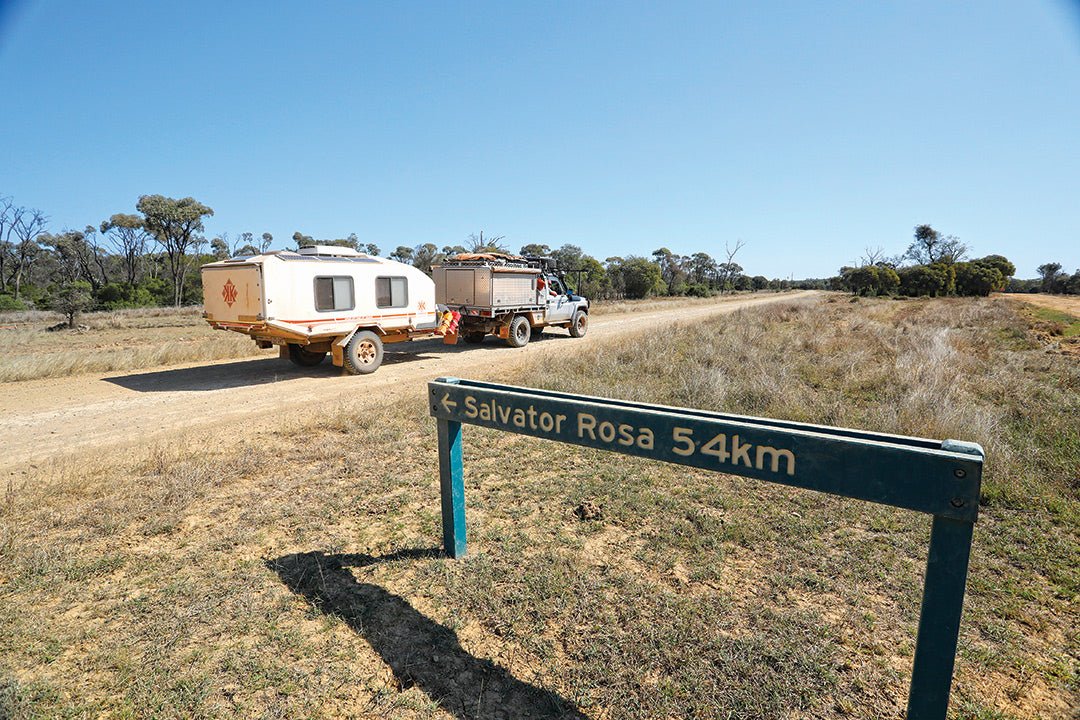
Getting to the Nogoa River camping area in the Salvator Rosa section is an adventure in itself, which you can begin from either Springsure in the east or Tambo in the west.
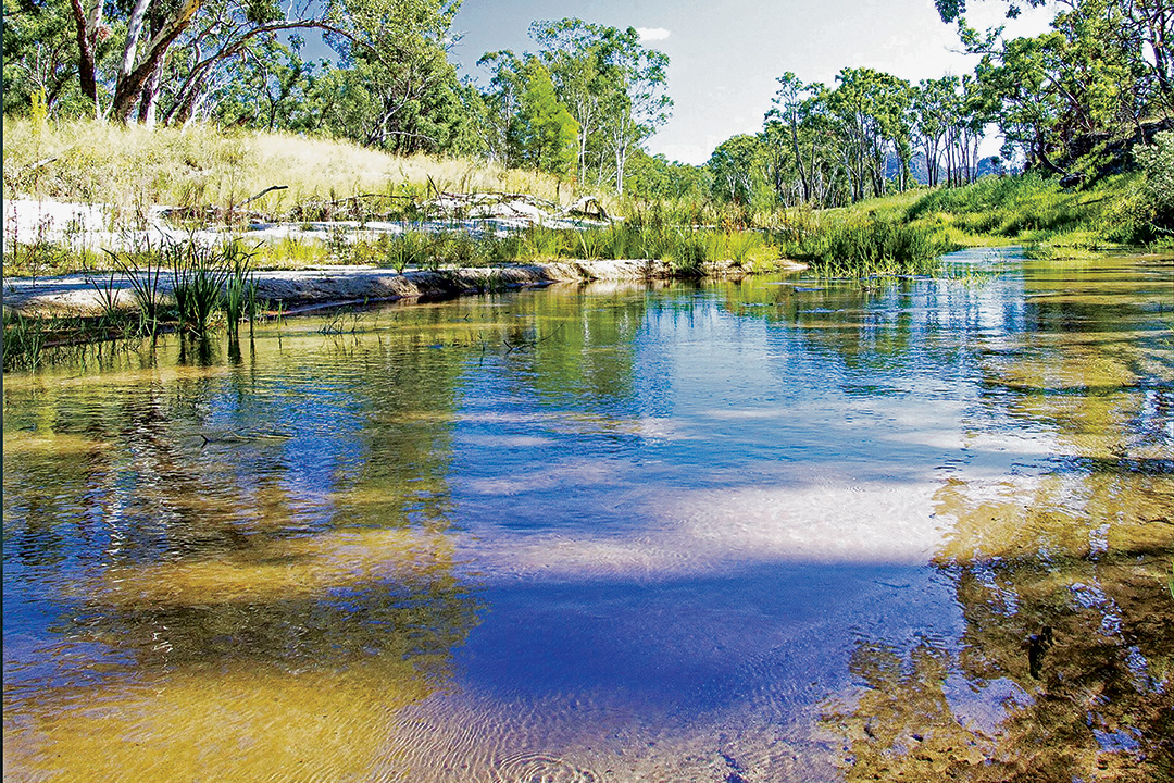
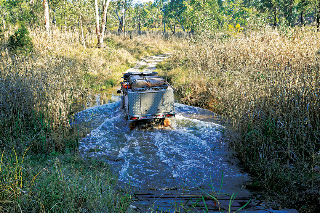 Crossing the Nogoa River to begin the scenic 4WD touring track
From Springsure, drive 113km west along the unsealed Dawson Development Road (DDR) to Mt Playfair Road (Wilderness Way) turnoff. Turn left and head south for 24km to Cungelella Road and follow this for another 29km to the park boundary. The camping area is 4km into the park on the banks of the Nogoa River.
From Tambo, there are two routes into the park. The conventional route heads north out of Tambo on the DDR towards Alpha. After 43km, turn right to stay on the DDR and drive east for 89km to the Mt Playfair Road and follow the route already described from there. The second route is for high clearance 4WDs only. Head south on the Landsborough Highway for 8km, then turn left onto Mt Playfair Road and follow this for 106km to the Cungelella Road turnoff.
Both routes from Tambo are quite scenic, with views of the sandstone escarpment beyond the trees that line the road, but Mt Playfair Road is quite rough and a 4WD is recommended. Cungelella Road and the park access road cross the Nogoa River floodplain and these black soil tracks can be impassable after heavy rain, and local creeks are subject to flooding. It’s a good idea to check with the Department of Transport and Main Roads (P: 13 19 40) for road conditions before setting out.
For some offroad driving advice, check out these articles:
- Tips from the experts: How to drive on corrugations
- Must know tips for outback travel and desert driving
Aboriginal heritage
Aboriginal people lived in the Carnarvon Range for more than 20,000 years before the arrival of white settlers, and the range’s sandstone plateau and gorges have great cultural and spiritual significance for several tribes. Material evidence of their occupation exists at many sites throughout the national park, and these are protected under Queensland law. Indigenous connections with the park are maintained through the involvement of Traditional Owners in the preservation of the cultural sites and joint management of the natural estate.
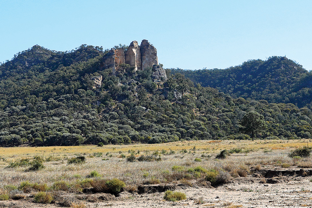 Sandstone outcrops along the escarpment approaching the Nogoa River
The western area encompassing Salvator Rosa forms part of the traditional lands of the Bidjara people, covering some 17,000sq km. In their culture, the Rainbow Serpent, Mundagurra, shaped the landscape and formed the waterways, including Carnarvon Gorge. Many other ancestor beings travelled through the land and were transformed into particular features and landmarks, where their spirits still reside. A Bidjara Dreamtime story tells of the Goori Goori, a flesh-eating bird larger than a wedgetail eagle, which lived at the headwaters of the Warrego River. To drive it away, Bidjara elders lit a fire under its nest while it was asleep. As its legs caught fire, the bird flew off, leaving a trail of sparks and burning feathers that formed the Milky Way.
European history
In 1844, Ludwig Leichhardt became the first European to travel through the area, east of Carnarvon Gorge, on his epic journey to the northern outpost at Port Essington (Cobourg Peninsula). Two years later, Thomas Mitchell explored to the west of Leichardt’s route, camping for some time on the Nogoa River in Salvator Rosa. Both explorers reported on the region’s permanent water, enticing settlers to take up pastoral leases in central Queensland. Their incursion was opposed by local Aboriginal tribes, who waged a hit-and-run guerrilla campaign that lasted two decades. This battle for resources was one of the bloodiest conflicts in Queensland’s colonial history.
The arrival of the native police gradually tipped the balance of power in favour of the newcomers and by the late 1870s the settlers were free to pursue their pastoral expansion. Sheep did not fare well on the plains of the sandstone belt and were replaced by cattle. Gold was discovered in the area and for a time Chinese miners operated in the high country.
During early settlement, the region attracted some nefarious characters who came here to avoid unwanted police attention. Place names still bear witness to their activities. Ward’s Canyon, in Carnarvon Gorge, was used by the Ward brothers, fur trappers who hunted local wildlife and stored their skins there. The notorious Kenniff brothers roamed the ranges duffing cattle and stealing horses, using ‘Kenniff Cave’ as their hideout on the Mount Moffatt plateau. Their murder of a local pastoralist and a policeman proved to be their undoing and brought their criminal pursuits to a sticky end.
Tourism in the region began in the 1930s after the Royal Geographical Society of Australasia promoted its natural values and scenic beauty. As pastoral leases lapsed or were surrendered, the state government aggregated 65,000 hectares of the leased land to form the Carnarvon Gorge National Park in 1932. Since then, the park has been expanded by the addition of other sections, including Salvator Rosa, to its present size of almost 30,000sq km, all managed by the Queensland Parks and Wildlife Service. Cropping and grazing continue as major land uses in the surrounding region.
Exploring the Carnarvon landscape
Carnarvon National Park lies within the Central Highlands Sandstone Belt, which straddles parts of the Bowen and Surat sedimentary basins. These were formed by sandy deposits on the bed of an ancient sea around 300 million years ago, then covered by igneous basalts about 30 million years ago. Later, tectonic forces in the earth’s crust raised these strata, draining the sea and exposing the rocks to the elements. Since then, wind and water have eroded the highlands into a landscape of immense natural beauty, a mosaic of basalt-capped tablelands, winding gorges, towering cliffs and spectacular sandstone monoliths. Some of the western sections around Salvator Rosa are of lower relief, unfolding into low undulating hills with rocky outcrops.
Rain soaks into the permeable sandstone to supply water to the Great Artesian Basin, which underlies about one-fifth of the Australian continent. In some places it resurfaces in springs to form wetlands and creeks. Salvator Rosa protects several spring complexes. Downstream of Mitchell Springs, the waters of Louisa Creek seep over peat bogs then sink into the sand and flow underground, resurfacing as Belinda Spring which feeds the Nogoa River. The Louisa Creek complex is the only natural feature of its type in the Central Highlands.
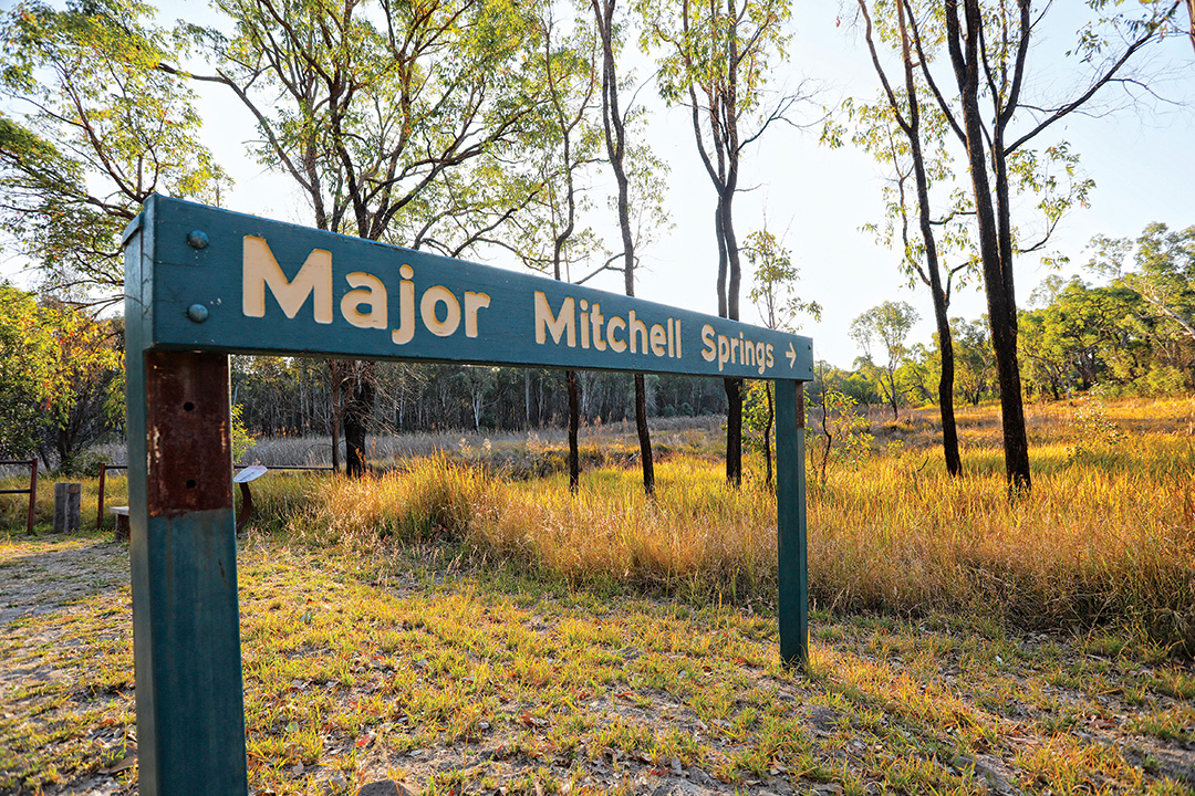 Mitchell Springs, named for Thomas Mitchell who camped near here in 1846
The Nogoa is one of five rivers with headwaters in the Carnarvon Range, leading to the region’s nickname of ‘The Home of the Rivers’. The Nogoa flows north and east for 570km to join the MacKenzie River, a major tributary of the Fitzroy River which ultimately flows into the Coral Sea east of Rockhampton. Collectively, these rivers form part of the largest catchment in Queensland.
The natural environment
The Central Highlands around Salvator Rosa have a sub-tropical climate that is usually stable and benign, but the region’s topography produces widely varied temperatures. Summer days generally exceed 35°C, while winter nights can fall to freezing point. Average yearly rainfall is 600–800mm, with most of it falling through the storm season of October to April.
Carnarvon National Park’s complex array of habitats and relatively high elevation and rainfall have produced an extremely rich diversity of plants and animals.
Salvator Rosa’s woodland and wetland ecosystems claim a share of the park’s 1180 plant species, of which 23 are considered rare or threatened, including the Homoranthus zeteticorum, a tall flowering shrub. The artesian springs in Salvator Rosa are among the most biodiverse in the state. At Mitchell Springs, permanent fresh water and dense stands of reeds provide a haven for frogs, fish, molluscs and freshwater shrimp. The wetlands also sustain larger animals that include some of the park’s 60 mammal and 210 bird species of birds that dwell in the surrounding eucalypt woodlands. Bats comprise about one-third of the mammal fauna. Reptiles are well represented in the park, with more than 90 species, most of them skinks and geckoes.
Camping options in Salvator Rosa
As Salvator Rosa is a little way off the beaten track, it would be a shame to go all that way and not spend a couple of days to see and do everything it has to offer. There is only one camping area in this section of the national park for an overnight stay and it’s suitable for tents, offroad camper trailers and campervans, without separately defined sites. Set beside the placid Nogoa River, the campground is surrounded by an open forest of river red gums, poplar box and rough-barked apple trees that ring to the sound of birdsong from dawn to dusk. Facilities include toilets, fireplaces (BYO wood) and picnic tables. Permits are required and fees apply. Find out more here.
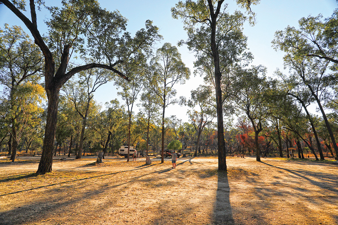
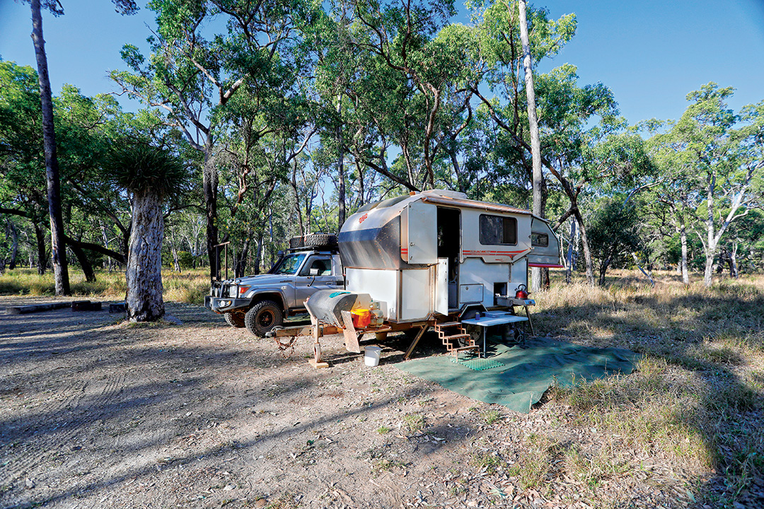 The Nogoa River camping area
Activities
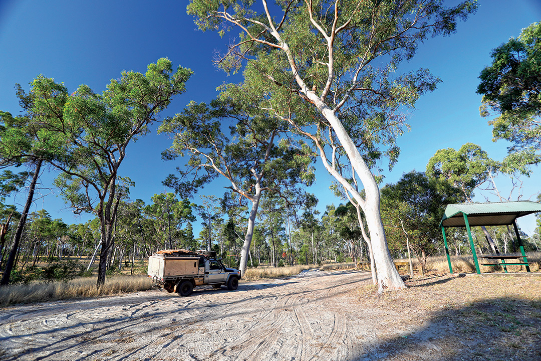
From the camp site a scenic 4WD (only) track continues across the river, with a steep bank on the northern entry/exit that has been reinforced with wooden planks to reduce erosion by vehicles. At this point the river is moderately deep with a gravel base. Beyond the river, the sandy track winds through open woodland and unusual sandstone formations for another 10km, until it terminates at a locked gate at Major Mitchell Springs.
From here, you return to the base camp along the same route. A short walk from the gate leads to the ‘Yard Site’, a collection of tumbledown fence posts and marks in the sandstone cliff wall where the cross posts used to enclose the stock yards. It was near this spot, in July 1846, that Thomas Mitchell and his party rested beside the ‘reedy rivulet’ while exploring the rugged sandstone ranges. He named the site Pyramids Camp, for the peaks in the nearby range overlooking the valley.
The scenic drive connects the trailheads for three bushwalks that explore the area’s natural attractions.
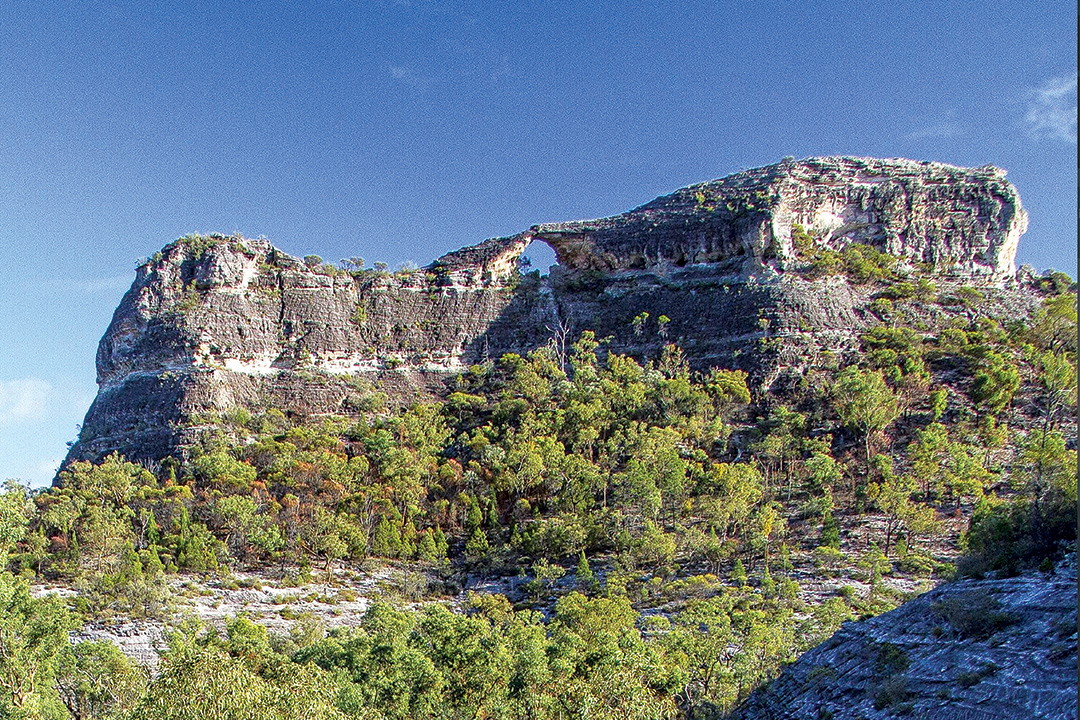 The unusual sandstone formation of Spyglass Peak
The first is the Hadrians Wall loop (950m, 20min), which begins at the Spyglass Peak car park and leads to a natural rock formation resembling the ramparts of a second-century Roman-built fortification. The track loops back to the carpark or continues on the Spyglass Peak circuit (2km return, 40min, Grade 4) leading to the base of the impressive Spyglass Peak, so named because of the 10m diameter hole that penetrates its summit.
 The Louisa Creek Junction day-use Area
A little further along the 4WD track, the day-use area at Louisa Creek Junction affords travellers the opportunity to rest at sheltered picnic tables. A short stroll leads to the junction of the creek and the Nogoa River, where a sandy beach makes for easy access to a crystal-clear swimming hole. Although Louisa Creek looks sedate here, at certain times of the year it contributes 10-million litres of water to the river every day.
 A pleasant swimming hole in the Nogoa River near camp
Next stop is the Homoranthus Hill walk (300m return, 20min), a short steep climb to a lookout with a 360-degree view of the park’s bluffs, spires and other spectacular rock formations. This hill is named after the rare shrub with dainty pink flowers that decorates the surrounding countryside. A short distance south of the hill, the 4WD track comes to Belinda Spring, whose cool, clear water bubbles over rocks amid clumps of ferns. If you’re lucky, you might see some of the red-backed fairy-wrens and plum-headed finches flittering about here.
Travel planner
Where:
About 800km northwest of Brisbane, via the unsealed Dawson Development Road (DDR) between Tambo and Springsure.
Access:
Smaller access roads connecting the DDR to the park are rough and may be impassable after heavy rain. Local creek crossings are prone to flooding. Four-wheel drive vehicles are recommended. Check road conditions with the Department of Transport and Main Roads (P: 13 19 40)
Best time to visit:
Between April and September, as the summers can be extremely hot.
Fuel and supplies:
From Tambo, Springsure and Alpha.
Camping:
Nogoa River camping area is the only campground in Salvator Rosa. Located by the Nogoa River, it is an open-plan campground with no designated designated sites, and is suitable for tents, offroad camper trailers and campervans. Facilities include toilets, fireplaces (BYO wood) and picnic tables. Permits are required and fees apply.
Things to do:
Scenic four-wheel driving, bushwalking, birdwatching.
Information and contacts:
Roma Visitor Information Centre
2 Riggers Road, Roma
P: 07 4624 0204
E: email tourism@maranoa.qld.gov.au
Central Highlands Visitor Information Centre
3 Clermont Street, Emerald
P: 07 4982 4142
E: emerald@chdc.com.au
THE NEXT STEP
If you want to learn the latest caravan news, find the most innovative new caravans and camping gear or get inspired to plan your next adventure to some of Australia's best getaway destinations, subscribe to our weekly newsletter. We promise to send you only the best content.
Related Articles:


Exploring Salvator Rosa in Carnarvon National Park, Qld