

The tiny town of Monto is only a speck on the map but it’s the gateway to one of central Queensland’s most impressive tourist destinations, Cania Gorge National Park.
Tucked away in a secluded corner of the North Burnett region, about 500km northwest of Brisbane, Cania Gorge embraces two principal features of outstanding beauty and interest — a 3000ha national park, noted for its towering sandstone cliffs and abundant wildlife, and the reservoir behind Cania Dam that is arguably one of the state’s best freshwater fishing hot spots.
Ancient origins
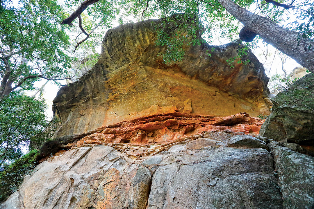
About 200 million years ago this part of central Queensland was covered by a shallow lake lying over granite bedrock that formed deep beneath the surface of the Earth. Into the lake streams and rivers deposited sand eroded from distant mountains. Over time, the sand and other sediments settled to form a thick blanket that was compressed into layers of colourful rock, a geographical formation called Precipice Sandstone. After the lake dried up, tectonic forces tilted the exposed rock layer, causing it to crack along a fault line. For 65 million years this fault caught run-off from rainwater and channelled it southward, eventually forming the winding course of Three Moon Creek. The watercourse gradually eroded the sandstone plate down to its granite bed and carved the wide gorge bounded by 70m cliffs we see today.
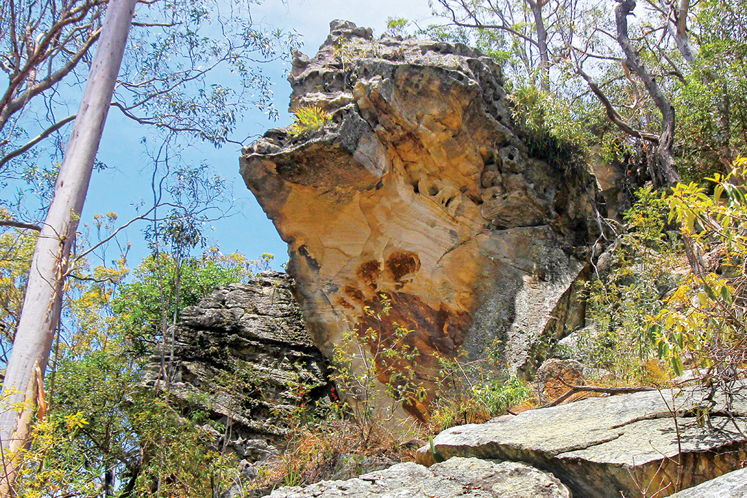
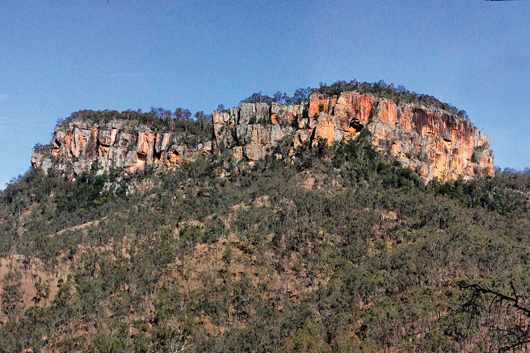 Mount Wacondee stands out from the escarpment near Cania Dam
The modern landscape
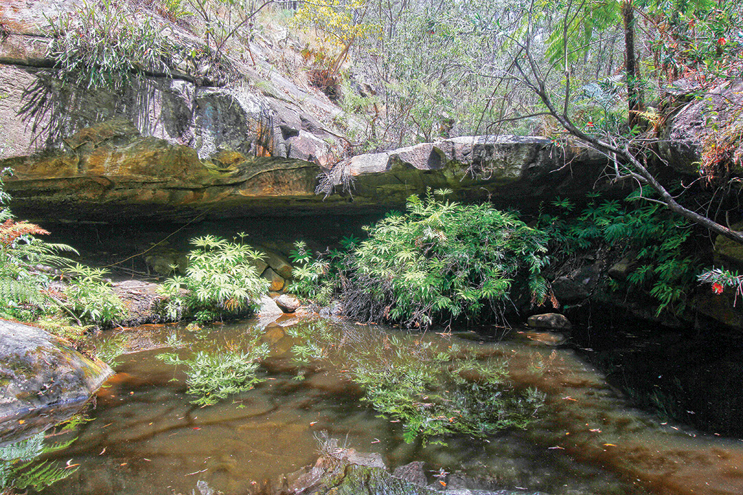
The park’s topography is dominated by the dramatic sandstone escarpments that enfold hidden gullies, and the elements continue to sculpt the gorge’s landscape. Fine particles of wind-blown sand scour caves into the exposed cliffs, while water dissolves the clay which holds the sandstone together. Water also finds its way into cracks and crevices in the rock, eventually causing large straight-sided blocks to break away from the cliffs. The porous sandstone acts like a sponge, retaining water deep within its layers until it gradually seeps out to feed Three Moon Creek which runs along the length of the gorge. The creek is a tributary of the Burnett River that flows into the Coral Sea at Bundaberg.
The natural environment
Cania Gorge National Park lies within the Brigalow Belt Bioregion, which covers a vast area of central Queensland where summers are dry and very hot, up to 42°C, and winters are mild with very cold nights. More than 150 different plant communities are found in the region, including brigalow forest, eucalypt woodland, cypress pine woodland, dry rainforest and grassland. Many of these communities are classed as threatened, due to extensive clearing, altered fire regimes and the effects of introduced species. Localised ecosystems within the gorge have evolved according to its contrasting topography and support more than 470 species of plants and animals.
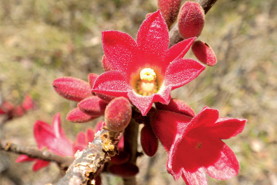 Rusty Kurrajong adorns the Cania bushland
Dense, semi-evergreen vine thickets (‘dry rainforest’) fringe the cliff bases and extend along the drainage lines of gullies, where cool, sheltered conditions support ferns, mosses and other plants dependent on the water seeping from the sandstone. On the exposed cliffs, plants such as silver elkhorns have special adaptations to help prevent moisture loss in the hot, dry conditions. The rugged plateau above the cliffs is dominated by eucalypt woodland with an understorey of acacias and native grasses. The slopes leading down to Three Moon Creek are covered by open forests of lemon-scented gums and narrow-leafed ironbarks, while the creek itself is lined with she-oaks and weeping bottlebrush.
These varied plant communities provide habitats for a rich diversity of wildlife, including more than 130 species of birds, ranging from dollarbirds, currawongs and kookaburras to king parrots, sulphur-crested cockatoos and regent bowerbirds. Peregrine falcons nest among the cliffs and wedge-tailed eagles are often seen soaring in the thermal updrafts overhead. Macropods are well-represented with several kinds of wallaby, rufous bettongs and long-nosed potoroos. The caves are home to colonies of sheathtail and bent-wing bats, and reptile species include lace monitors, tree snakes, rainbow skinks and the beautifully patterned spotted velvet gecko. Lungfish have been recorded in Three Moon Creek, while platypus live in waterholes below the dam wall.
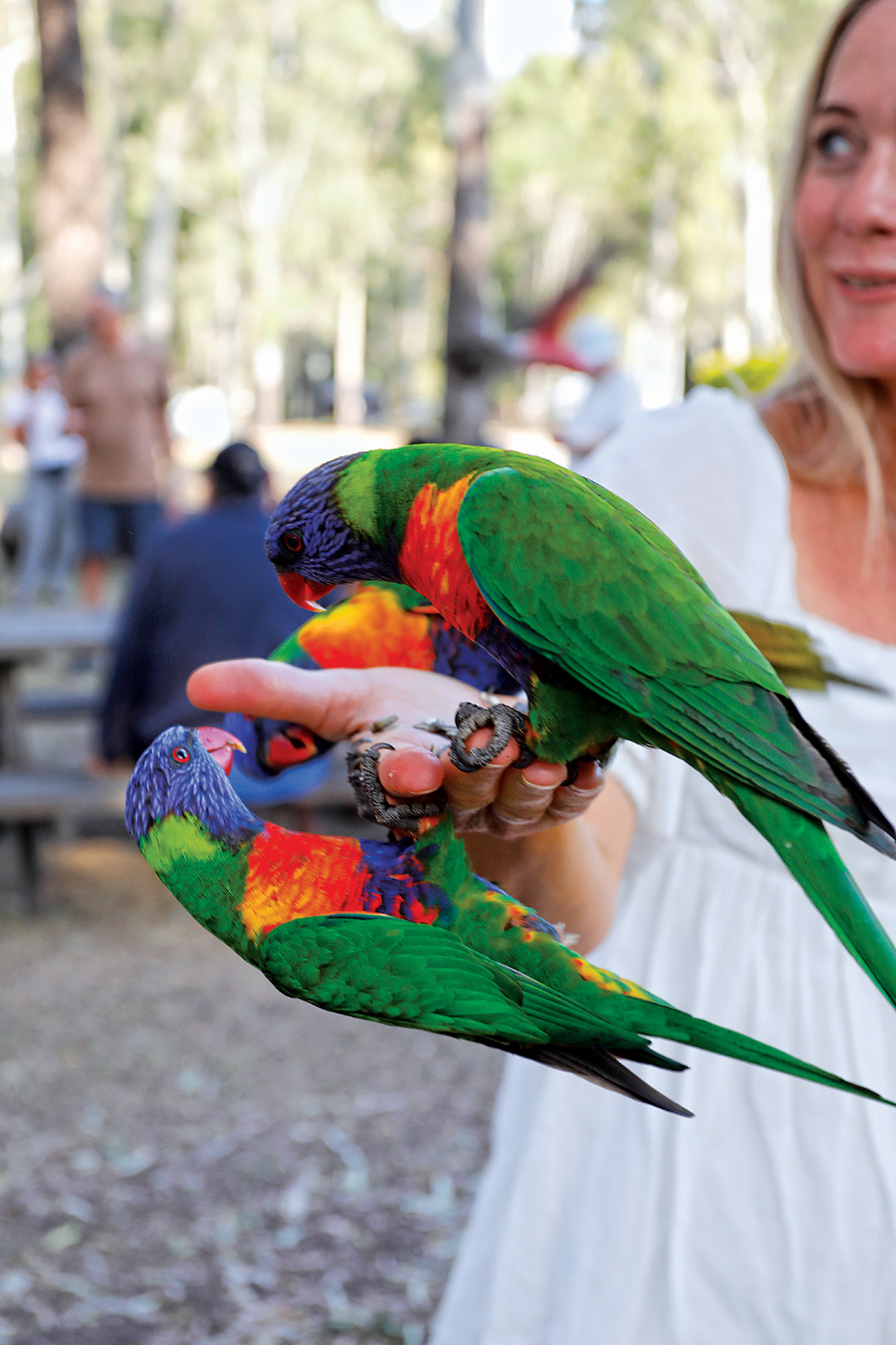 Rainbow lorikeets enjoy an afternoon feeding session
First Nations heritage
Aboriginal people have lived in Cania Gorge for at least 19,000 years, back to the height of the last Ice Age when Australia was a much colder and drier place than it is now. The gorge offered shelter in the caves and ready access to predictable water and abundant food resources. Occupation sites within the park, such as Grinding Groove Cave, contain hearths, bone fragments and stone artefacts. There are also nine recorded Aboriginal art sites in the park which, sadly, are not accessible to the public due to their weathered and fragile state. Paintings at these sites include handprints and images of animals and their tracks in a freehand style that is very different from the stencilled images found at Carnarvon National Park to the west. In 2017, the Federal Court made a determination granting native title to Bailai, Gurang, Gooreng Gooreng, Taribelang Bunda People over 4200sq km of the central Queensland region, including the national park.
 The climb to Giant's Chair Lookout
European history
Thomas Archer was the first European to explore the headwaters of the upper Burnett region in 1848, and soon returned with his brother, Charles, to establish a pastoral lease for grazing sheep. Other large pastoral holdings, including Cania Station, were established during the 1850s and ran sheep until 1883, when beef and dairy cattle were introduced.
The incursion of European settlers caused friction with the local Indigenous people as land seized for grazing denied access to their traditional food resources. Clashes were frequent and hostilities claimed many lives on both sides. It is estimated that between 1847 and 1853, 28 squatters and shepherds were killed as the Aboriginal people resisted European occupation. On each occasion, punitive raids were mounted to punish the tribes, until the Colonial Office was moved to place them under “official protection”.
In 1870, gold was discovered in Three Moon Creek, attracting miners and settlers who worked the Cania goldfield intermittently until about 1900. The original site of the diggings was flooded by construction of Cania Dam across the creek in the early 1980s. However, as many as 17 old mines remain within the park. One of these is the abandoned Shamrock Mine, where the remains of an old battery, mine shafts, processing sheds and mullock heaps can be seen along a short self-guided walk, together with interpretive signs that provide information about life on the goldfield.
 The Overhang is one of Cania’s many sandstone attractions
Dwindling gold reserves saw the end of mining in the early 1920s, as the local economy turned to dairy and beef cattle, forestry and cropping as the major industries. Monto was established in 1924 as the service town for local activities. By this time, the gorge’s spectacular scenery had been attracting bushwalkers and visitors for decades, and a scenic reserve was created around a popular picnic ground in 1924. The national park was gazetted in 1977 and expanded over the next ten years to its present size. Today, tourism is a major contributor to the local economy, with some 100,000 visitors to the gorge each year.
Bushwalking
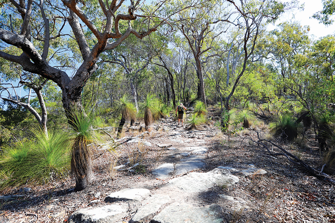
Around 21km of walking tracks are maintained within the park to enable visitors to explore the gorge’s natural beauty and view the abundant wildlife. The tracks range in length from the easy Picnic Area Circuit (300m return, 20min) which meanders through eucalypt woodland beside Three Moon Creek with views of the nearby cliffs, to the challenging Castle Mountain Lookout track (22km return, 7–8hr) along a fire trail that traverses the plateau above the gorge to a lookout with spectacular views over the dam and Lake Cania (this one is for experienced bushwalkers with a high level of fitness).
 Fern Tree Pool
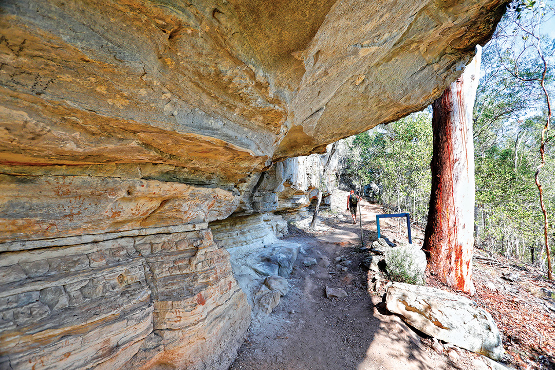 Along the walk to Bloodwood Cave
Each of the other walks visits at least one feature of the parks amazing geology — Big Foot Walk (1km return, 20min) features a large brown image of a four-toed foot on the white sandstone cliff; Two Storey Caves Circuit (1.3km return, 45min) meanders through sandstone monoliths and crevices filled with native orchids to a cave for roosting bats; Dragon Cave and Bloodwood Cave Walk (2.6km return, 1hr) so-called for the black mural of the mythical beast tattooed by leaching minerals onto the creamy-white walls; Dripping Rock and The Overhang walk (3.2km return, 2.5hr) passes a curved rock wall festooned with ferns and mosses nurtured by seeping water, to a large, eroded cavern at the base of a sandstone cliff protecting shaded pools and tall tree ferns; and Fern Tree Pool and Giant’s Chair Circuit (5.6km return, 3hr) which crosses Doctors Gully several times on the way to a fern-lined grotto before climbing the escarpment to a vantage point overlooking the valley.
 Big Foot at the head of the Doctors Gully walking trail
Cania Dam
In the early 1980s, an earth and rockfill embankment dam was constructed across Three Moon Creek to create a reservoir with a capacity of 89,000 megalitres covering more than 7sq km. North Burnett Regional Council manages a picturesque recreation and picnic area on the shore of Lake Cania, which is a a great place for fishing, boating, canoeing, swimming and water activities, made all the more enjoyable for the picture-perfect surroundings.
There are no boating restrictions on the lake but operators are reminded to read and obey the signs, look for hazards and other users, and stay clear of the dam wall by at least 200 metres. A dual lane concrete boat ramp is usable when the lake is around half full, and an alternative launch point may be accessed down a gravel track near the dam wall when water levels are low.
Lake Cania is one of the impoundments promoted by Fisheries Queensland and the Freshwater Fishing and Stocking Association of Queensland Inc (FFSAQ) for recreational freshwater fishing in the Wide Bay-Burnett region. It is one of 60 dams and weirs across Queensland that have been stocked with native fish — such as golden perch, barramundi, Australian bass and saratoga — under a scheme designed to provide a sustainable fishing option that reduces the pressure on wild fish stocks. Anglers over the age of 18 years must have a Stocked Impoundment Permit, which can be purchased online. Revenue from the Stocked Impoundment Permits Scheme (SIPS) supports volunteer groups to restock impoundments.
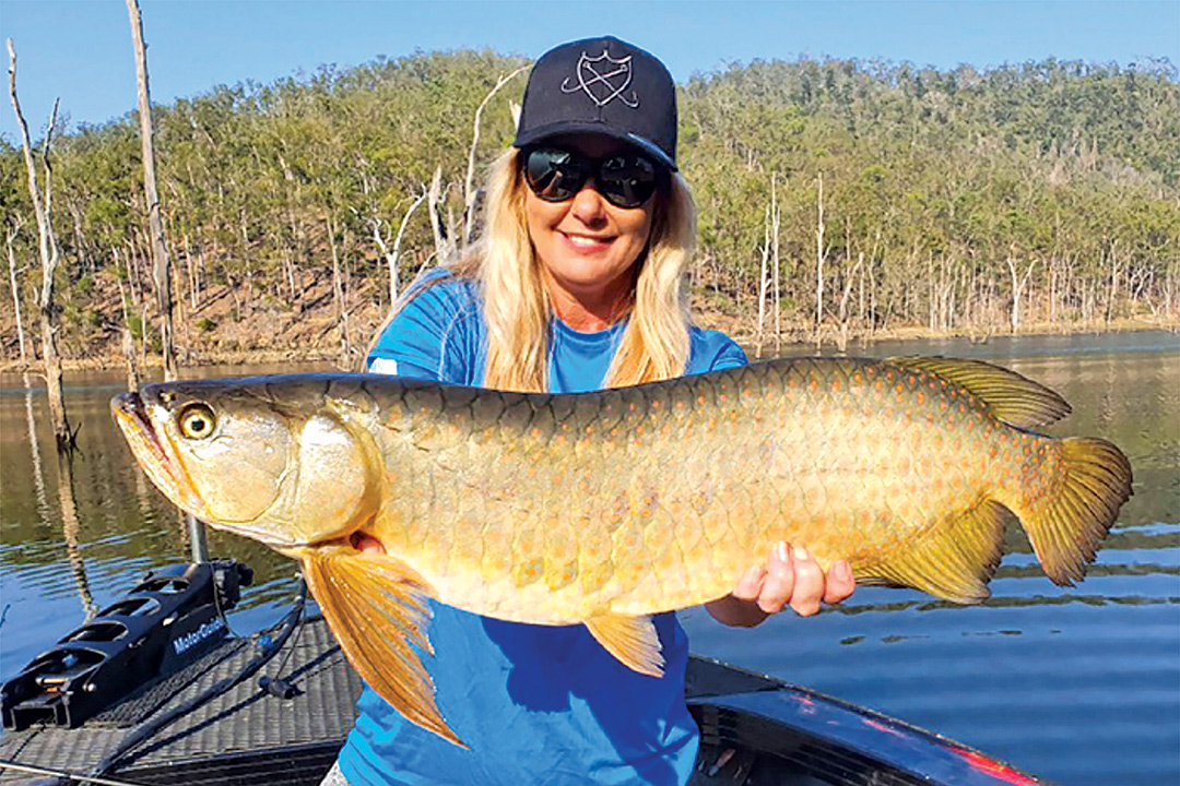 A good-sized saratoga hooked in Lake Cania
The Cania Dam Fish Stocking Association hosts the annual Lake Cania Freshwater Fishing Classic on the second weekend in November, offering prizes that have included an aluminium tinny (with motor and trailer) for adult competitors and a kayak package for juniors. For more information click this link. In another promotion sponsored by the Freshwater Fish Stocking Association of Queensland — the Fish ’n SIPS tagged fishing competition — a tagged 45cm Australian bass was landed by an angler at Lake Cania, earning him a prize of $5000. Tagged fish worth a total of $15,000 can still be caught.
Camping options
Camping is not permitted within the national park. However, there are two commercially-operated caravan parks within the gorge that cater for travellers to the area. Cania Gorge Tourist Retreat is a great spot near the southern entrance to the gorge, conveniently located near the trailheads for most of the walking tracks. The other is the BIG4 Cania Gorge Holiday Park at the northern end of the park access road, close to the dam and lake. Both have good facilities and a wide range of accommodation options to suit all budgets, from powered and unpowered camping to self-contained cabins and villas. Hotel, motel and caravan accommodation is also available in Monto.
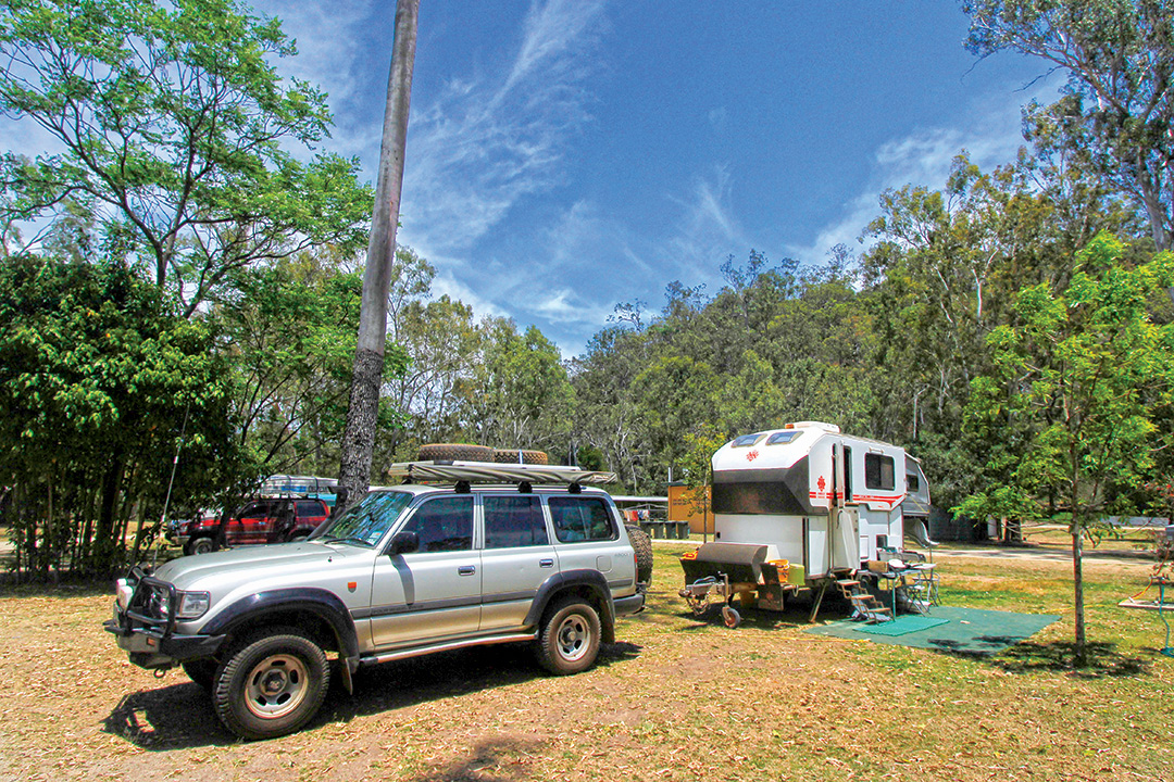 Sites at the Cania Gorge Tourist Retreat are spacious and grassy
With all this on offer, Cania Gorge has to be one of the best touring destinations in central Queensland, deserving of a stay of several days, whether for the bushwalking, the fishing or the sheer enjoyment of simply being there.
Travel planner:
Getting there
Cania Gorge National Park is 500km north-west of Brisbane and 225km west of Bundaberg. Cania Dam Road branches off the Burnett Highway, 12km north of Monto, and terminates at the Cania Dam picnic area (complete with barbecues, picnic tables, a playground and toilets). These good all-weather bitumen roads are suitable for conventional vehicles, camper trailers and caravans.
When to visit
The best time of year to visit Cania Gorge is between March and October when the weather is cooler, and especially in spring when wildflowers are abundant.
Fuel and supplies
Monto is the closest town for fuel and supplies.
Activities
Land-based activities within the national park: bushwalking, bird watching, picnicking and photography.
Water-based recreation on Lake Cania: fishing, boating, canoeing, swimming and other kinds of water sports.
Camping and accommodation
Camping is not permitted within the national park.
Commercially operated caravan and camping parks are located within the gorge at the Cania Gorge Tourist Retreat and the BIG4 Cania Gorge Holiday Park, both with good facilities and a wide range of accommodation options to suit all budgets, from powered/unpowered camping to self-contained cabins and villas. The BIG4 is situated closer to the lake and is better suited to fisherfolk with boats and families with kids, while the Retreat is quieter and located near the access points for most walking trails within the park.
Hotel, motel and caravan accommodation is also available in Monto.
More information
BIG4 Cania Gorge Holiday Park
P: 07 4333 4000
Cania Gorge Tourist Retreat
P: 07 4167 8110
North Burnett Regional Council
P: 1300 696 272
Queensland Parks and Forests Department of Environment, Science and Innovation
P: 13 74 68
THE NEXT STEP
If you want to learn the latest caravan news, find the most innovative new caravans and camping gear or get inspired to plan your next adventure to some of Australia's best getaway destinations, subscribe to our weekly newsletter. We promise to send you only the best content.
Related Articles:


Travel guide for Cania Gorge National Park, Qld