
Great Australian Bight
It is in our DNA to explore, to find places off the beaten track. It is what draws us to places such as the Kimberly and Cape York but few of us talk about the Great Australian Bight. One of the most remote, challenging and beautiful areas of Australia, a trip along its edge is a journey like no other.
Over a beer or written on the back of a napkin — no one can really remember when or why our plan was hatched to follow in the footsteps of some of Europe's early pioneers including Burke, Thijssen, Eyre and Sturt — but in late 2018 phone calls were made and a plan was set.
The team included Scott Brady, CEO of US-based Overland International, Rob Boegheim from Hema, Steve Moore and Clayton Parks from Redarc, Brad McCarthy from Maxtrax, photographer Matt Williams, Anna Shepherd on video and Tim van Duyl from Caravan World and Camper magazines. Our journey began in Brisbane with a quick bolt inland to Innamincka, SA, a fast-paced run down the Strzelecki and on to the Eyre Peninsula where the trip began in earnest.
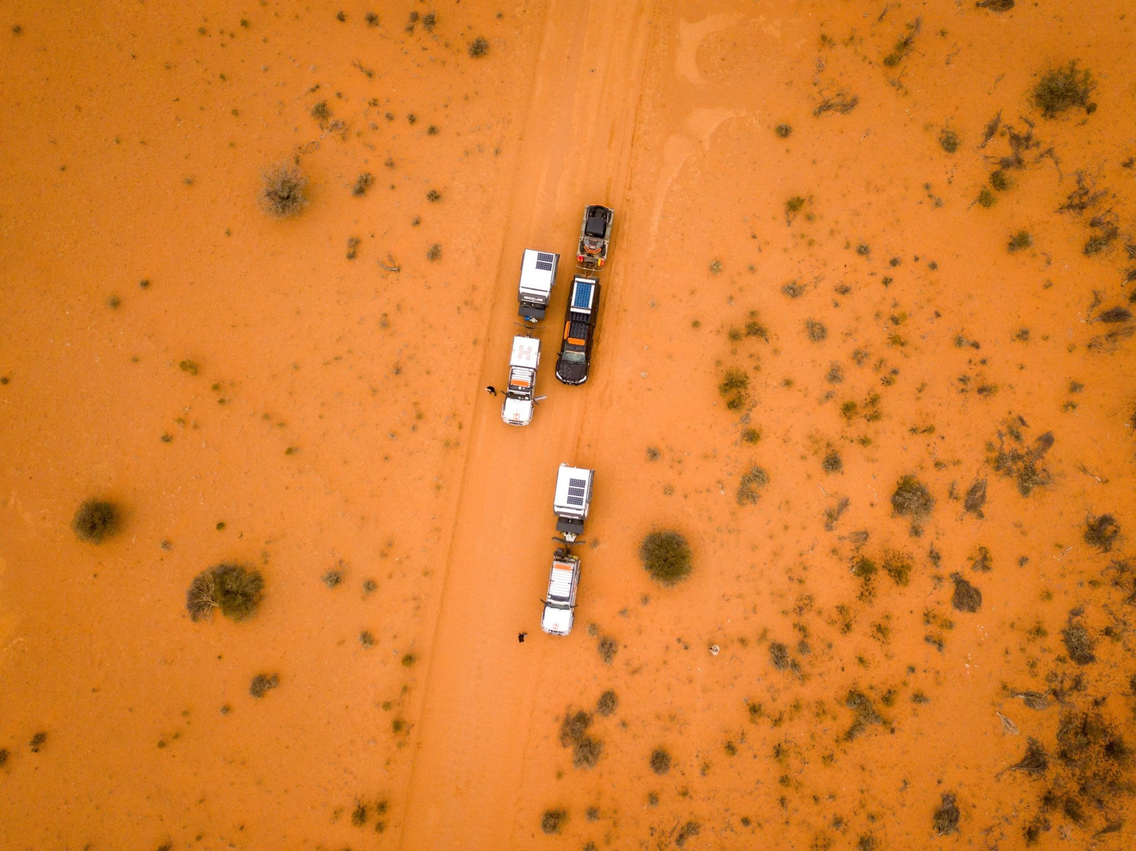
Each of us brought different expertise and excitement for the challenge but we also needed the right gear to survive the long hot days away from help. Hema provided a pair of LandCruisers set up for remote work with added fuel capacity, onboard water, extra electrical power, quality Cooper tyres and almost every piece of ARB protection and recovery gear on sale.
Behind the LandCruisers were two prototype campers from the innovators at Zone RV. You might think taking prototypes on a 9000km return trip that includes days offroad is a bad idea but with Cruisemaster suspension under the heavy-duty chassis and practically bulletproof bodies up top, their makers were confident this torture test was perfectly suited.
Brad from Maxtrax brought his favourite two toys; a highly modified six-wheel 200 Series LandCruiser, Polaris UTV and a suite of Maxtrax goodies including some prototypes of his own for R&D testing.
The Redarc lads came with the most town-focussed of the cars in a reasonably well set-up Hilux with added fuel capacity, a wealth of battery management and solar gear, added clearance from a small lift and better tyres.
GETTING INLAND
During planning, the team looked at Hema's guidebooks and route maps. What they showed was the gradual change from deep coastal greens to the soft reds of the centre near day two’s planned stop at Innamincka.
What they didn’t show was the experience of driving the Great Dividing Range or the suddenness and steepness of the climb into Toowoomba. Even the best guidebook cannot fully describe the realisation that you are in the heart of the red centre when Eulo approaches. Blink and you can miss the dramatic change.
We camped at the popular Noccundra Waterhole. At 1100km in from Brisbane, we do not recommend doing it in a day — stop half-way at Nindigully instead. Noccundra gave us our first taste of the inland sunset and it did not disappoint. The skies and sands reflected each other like a Hallmark postcard. The waterhole provided the right amount of cool air but also mozzies.
Noccundra is only a few hundred kilometres from Innamincka, itself only a half day from Arkaroola, SA, where we were to end day two but with one stop. Robert O’Hara Burke’s grave is a must-see for anyone who has read about Burke and Wills.
Just out of Innamincka, the area will raise the hairs on your arms as you contemplate his ill fated attempt at claiming the then rich reward of 2000 pounds for linking the north to the south through the centre. The tales of the inexperience and arrogance in the attempt makes any explorer feel a little unnerved, as we did.
FUELS WAY
Once at Innamincka we started to consider the coming off-grid days, searching for dwindling mobile reception (only Optus has good coverage), filling jerry cans, eating our last fresh pies and talking to friendly locals around the roadhouse. What was to follow was the Strzelecki and the Gammon Ranges.
Ignore GoogleMaps: read the Hema guidebook and know the Strzelecki can be done in a day. But be watchful for washouts and culverts (which tested our suspensions) and travel during the day as roaming livestock is hard to spot at night.
Our concern was the fuel consumption of the thirsty 70 Series, though trip leader Rob had accounted for it.
The Vulkathunha-Gammon Ranges to the north of the well-known Ikara-Flinders Ranges are the traditional country of the Adnyamathanha people, are steeped with history and offer amazing sunsets.
We found ourselves near Arkaroola with sights set on a bush camp in one of the many gorges near the wilderness sanctuary and caravan park. What we found was a lesson in planning, preparation and luck.
STRICKEN, WITH HOPE
As dusk approached, we came across a stricken Ford Ranger crawling out of a turnoff with a blown and nearly off-the-rim tyre. It wasn't a good look but the owner and his extended family were doing everything right.
The turnoff was from a bush camp where the driver had torn the sidewall out of another tyre. Down to no spares, they were headed to Arkaroola for repairs when disaster struck a second time. The distance was too great to walk so their plan was to drive with the second blow-out to a main road, camp on the roadside and wait for help to pass.
Between the cars we had enough seats and space to take the family and two ruined wheels and tyres up the final 30km to the village. Quick tip: If you have to abandon a vehicle, take all valuables and leave a note for the next passerby with your plans and, when you can, let the local ranger know so you aren’t the cause of a search party.
With plans changed we stayed the night at the Wilderness Village only to be woken by the wildest storm I’ve ever felt. The site was awash by 1am and those in swags suffering as gusts of winds challenged guy ropes and impromptu rivers washed boots away. I was dry, safe and secure in the roof-top tent atop my Zone though I did feel nervous about the lightning strikes...
Heading down the eastern side of the Ikara-Flinders ranges we pushed hard to make a date with Redarc a day before its new Adelaide factory was unveiled. A quick stop landed us a guided tour of the impressive facility, but we needed to push on as our starting point for the Great Australian Bight was seven hours away at the Spencer Gulf.
Everything up until now was just the precursor. Yes, there was testing undertaken and we explored areas unknown (see our feature length video on YouTube) but the name of this trip was The Great Australian Bight Expedition or GABE, not GABE plus thousands of kilometres from Brisbane via the Strzelecki and Adelaide.
THE STARTING LINE
Port Lincoln is a proper regional centre with an airport, seaport, plenty of vehicle and RV repair specialists and tourist attractions. We only stopped for fuel, fish and chips and a quick briefing; testing times were ahead.
A short drive south is Sleaford, a dune paradise where we practiced sand driving plus checked out the headland known as Whalers Way, the western point of the Bight.
Do yourself a favour and find your way there. To stay at Whalers Way you need to pay at the Port Lincoln visitors’ centre, leave a deposit for the gate key and promise to only leave footprints. We found ourselves over the well-known Red Banks at the southwestern point of the Eyre Peninsula. Here we got to relax for the first time though one afternoon and night will never be enough. We’ll be back.
IN THE DRINK
The Bight is known for its sea life. Back in the early days of European settlement, it was littered with whaling stations and ports servicing fishing and sea-based trade.
We got up close thanks to Baird Bay Ocean Eco Experience which took the team out for an unforgettable swim with sea lions and dolphins. The best time is late January to early February as the winds drop off but sea temps stay high. Nearby Coffin Bay and Venus Bay offer family fun activities and parks, and oyster beds open to pick your own plus great access to open water.
STEPPING OFF
Further along at Fowlers Bay we put our newfound confidence in sand driving to the test in the dunes that make the region famous. Turning off the main road and heading towards Point Fowler felt as though we were stepping off the edge of the world.
Up top of the dunes, before we could navigate down to the Point, we sampled the latest Maxtrax, the Xtreme. An update on the leading recovery aid, this has replaceable teeth designed to give before your tyres do but create a longer working life through easy replacement of teeth as they wear out. We eventually got out, the 2000kg Zone slowing progress a bit, and made it down to yet another hardly believable clifftop camp.
However, after being forced to test out the Maxtrax several times, we were never going to make it to the SA border and our planned stop at Eucla. Brad knew of a secret spot off the Old Eyre Highway marked as Koonalda Homestead. Like many once thriving farmsteads, Koonalda has fallen to disrepair. But with a pit toilet and flat ground, it had all we needed.
The strangest thing happened at Eucla, we fought over what time it was but on asking the locals, they suggested we check the clock. "Which one?" we asked when seeing three on the wall inside the cafe. We were met with a shrug. The stop runs on popular time: when it's popular, they stay open. When quiet, they close. I admire that lifestyle.
THE NULLARBOR
After what felt like hours of playing eye-spy and exclaiming when we saw a tree, we diverted to the coast to see one of the most controversial pieces of Australian infrastructure: the Dingo Fence. It feels like one side is more worn down than the other — perhaps from pests? We all wanted to follow it back to the highway but, with locked gates and warning signs of trespassing should we try to follow the obvious tracks back, it was the long way for us.
But we did get to stop at the Madura Roadhouse for a $5 shower, a quick spanner check of the campers and a restock of essentials ie pies and flavoured milk. Funny how you take a simple thing like a servo snack for granted until you don’t see one for days.
EYRE’S LEGACY
Not only is there a major highway, peninsula, lake and mountain named after him, Edward John Eyre’s name is also on the Eyre Bird Observatory. It’s a must-stop for twitchers, but the homestead and adjoining sheds are a historian’s dream, littered with artefacts from settlement days through to the whaling period and the observatory’s time as an animal watching hotspot.
Down to Kanidal Beach and west are marked tracks to Twilight Cove. Here we slept the best between the dunes under towering limestone cliffs with the sound and smell of the sea, and a clear starry night. A warning: the tracks down and out are marked as hazardous and it is not advised you take a trailer as we did. We managed but only through good driving, clear communication and a bit of luck.
Our plan was to head to Toolinna Cove via coastal tracks but a lack of easily identifiable tracks meant we were slow going so we turned back to the Old Telegraph Track running Madura to Isralite Bay plotted by Eyre. We were following in the footsteps of Eyre and companion Edward John Baxter who was killed during their expedition to Albany. It was surreal hearing tales of the journey through what felt like the harshest environment in Australia. The patch of land between Toolinna Cove and Baxter Cove was the most desolate I've seen. Dry, dead-looking scrub for miles and no wildlife bar the occasional bug. How anyone found enough water to manage weeks on end marching across it beats me. Pushing past the monument to Baxter, we had a rough night’s sleep at the cove named after him.
EXPECTED ISSUES
Until now we had been lucky with no breakdowns or mishaps aside from an over-friendly roo that pushed in the driver’s door of one LandCruiser. Until we left Baxter Cove.
First was Scott’s maiden puncture on an expedition — in the middle of the Tele was a good a spot as any. With no one seen in days, we could take our time without some hoon tooting horns at us to move. Almost immediately after, Brad tore a sidewall on his LandCruiser and the Polaris UTV, doubling as a scout vehicle, suffered the same fate. Three punctures in a few hours reminded us why we took no less than three spares per vehicle.
The day went slowly, as you’d expect with breakdowns, but it was fun to spot the old telegraph line poking out of the track and find ceramic isolators when stopping for a toilet break. Passing Toolina Cove late in the day, we realised how hard it would have been to make it here sooner. When 10pm rolled around we were still driving, still following in the footsteps of Eyre, now without his companion, Baxter. We were all quiet on the radios; partly from exhaustion and the need to concentrate in the dark on the narrow track but also in reflection of what we had managed compared to the feats of Eyre. It wasn't easy driving, it must have been hell on foot. From here, the end was close, a few days away and we expected to start seeing signs of humanity other than those of the early pioneers.
THE LAST LEGS
Bilbunya Dunes are well known, well explored and easy to access via Nuytsland. We shot our remaining footage while Brad did his best to crest the tallest dune in his UTV. He didn’t make it up, the gradient and length of the ascent too long and hard for even his dedicated offroad toy. We set up camp between the dunes again, this time with neighbours.
Breaking camp late in the day meant a short period in the drivers’ seat but still an epic one. From here, a blast back through the lower sections of Nuytsland opens out onto salt lakes skimming past Wattle Camp, a spot we heard was worth a look.
We stopped at the Telegraph Station ruins near Isralite Bay. It boggles the mind to imagine what the buildings were like at their peak. Today they are a skeleton of sandstone bricks and patchwork floorboards.
Point Malcolm was to be our next and last stop before Esperance. Marking the western most point in the Bight, it was a relieving moment for the team but at the same time, not the end. We still had the bulk of Cape Arid National Park to traverse plus a drive past the popular Cape Le Grand. We had managed 1600-odd km but still had a bit to go.
HOLIDAY PEOPLE
Cape Arid felt like a busy metro after our days bush, even if we only saw a few other travellers. Our dusty eyes, the greasy dirty look of our clothes and no doubt our smell must have been a sight to them but to us it was the same. These people were different to us.
We had to see Cape Le Grand but were a day behind schedule and had to drop our camera operators off in Esperance for arranged flights home before heading to the National Park for a night. Quick tip: book online months in advance. We were lucky but the bulk of drive-up travellers are turned away.
Cape Le Grand has outstanding amenities, hiking, beaches and vistas but also tourists, flocks of them Instagramming and hashtagging. It is hard to judge people for being so blown away with the region’s beauty but for us, it felt a bit deflating, we had conquered the Bight and followed in the steps of some of our most adventurous early pioneers only to arrive in a polished, commercially-orientated area.
Will we find an adventure like this again?


