
Exploring Overland
The Overlanders Way is a driving adventure stretching 1550 kilometres from Tennant Creek in the heart of the Northern Territory outback, to Townsville on the tropical Great Barrier Reef. It retraces the route of pioneering stockmen who drove herds of livestock from remote inland stations to bustling coastal markets for decades before the introduction of road trains and railways. These doughty cattlemen were known as ‘Overlanders’ and helped forge the quintessential Australian tradition of endurance and self-reliance while blazing stock routes through some of the Top End’s most challenging country.
No longer a stock route and instead a designated Strategic Touring Route, the Overlanders Way links the sealed Barkly and Flinders Highways, enabling modern-day travellers to complete the journey in just a few days.
But in true overlanding spirit, it should be undertaken in relaxed stages to fully experience the tour’s many attractions — dramatic landscapes, prehistoric treasures, Indigenous culture, pioneer history and friendly outback towns with a calendar jam-packed with festivals and events — all without leaving the blacktop.
TENNANT CREEK (NT)
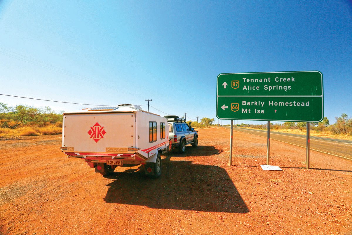
The journey begins at Tennant Creek at the Stuart Highway, itself near the western end of the Barkly Highway. With a population of around 3000, the town is one of the largest in the Northern Territory. It’s also one of the most isolated, being 1000km south of Darwin and 500km north of Alice Springs.
Explorer John McDouall Stuart passed through the area during his first attempted trans-continental expedition in 1860, naming a creek north of the present town site after his friend and financier, John Tennant. The creek and eponymous township lie in open mallee scrubland surrounded by rocky ranges that bask in a desert climate with temperatures often reaching 40 degrees.
The traditional owners of this area are the Warumungu Aboriginal people, whose stories and art are showcased at the award-winning Nyinkka Nyunyu Culture Centre in Tennant Creek. Several cultural sites significant to the Warumungu are located near the town, including Kunjarra (The Pebbles), a sacred women’s dancing site, and the spectacular granite boulder formations known as Karlu Karlu, or the Devil's Marbles.
In the 1930s, Tennant Creek was the scene of Australia's last gold rush and, for a time, it was the third-largest gold producer in Australia, earning the sobriquet ‘The Territory’s Heart of Gold’. Major mining companies still operate in the area and exploration continues for bauxite, lead-zinc-silver, and copper.
This mining heritage is presented at the town’s premier attraction in the form of the Battery Hill Mining Centre, incorporating the McLaughlin mineral collection and conducting underground tours of a purpose-built replica mine. The Centre also houses the Social History Museum, a fascinating insight into early Tennant Creek life, summed up in the slogan ‘Freedom, Fortitude, and Flies’.
Tennant Creek hosts annual events, such as the Desert Harmony Festival and the Barkly Campdraft and Rodeo, and is a way point on the World Solar Car Challenge held every second year. Travellers will find pleasant accommodation at the friendly Tennant Creek Caravan Park on the northern outskirts of town.
TENNANT CREEK TO THREE WAYS ROADHOUSE (25KM)
One of the area’s historic attractions, the Tennant Creek Telegraph Station, is located on a reserve 10km north of the town along the Stuart Highway.
A temporary wooden building was constructed on the site in 1872 to house a repeater station as part of the 3600km Overland Telegraph Line between Adelaide and Darwin. Within two years, the original structure was replaced by a complex of buildings made from local stone with corrugated iron roofing. Established near Tennant Creek, the station was an important waypoint for drovers, prospectors, and other travellers en route from Port Augusta to Darwin. In the 1890s, it was also a rations store distributing flour, sugar, tea, and blankets to local Indigenous people.
The main station building was closed in 1979 and now serves as a museum accessible with a key from the Tennant Creek Visitor Information Centre. Visitors may also view the reserve on a self-guided walk, aided by an information sheet, or join a ranger-guided tour between May and September.
A little further north, the Three Ways Roadhouse marks the junction of the Stuart and Barkly Highways. As well as fuel and takeaway food, the Roadhouse offers a shady caravan park and campground with amenities that include a camp kitchen, barbecues, and swimming pool.
Nearby stands the John Flynn Memorial. Erected in 1952, this impressive 8m sandstone obelisk pays homage to ‘Flynn of the Inland’, the Presbyterian minister who founded the Australian Inland Mission and pioneered the Flying Doctor Service.
THREE WAYS TO CAMOOWEAL (450KM)
From Three Ways, the Barkly Highway runs eastward across the Barkly Tableland, designated as Route 66 in the Northern Territory and National Route A2 in Queensland.
In 1861, William Landsborough explored these sprawling treeless plains and named them after Sir Henry Barkly, then Governor of Victoria. Covering more than 240,000sqkm, the Tableland’s fertile black soils are blanketed with golden Mitchell grass, which supports vast cattle stations stocked with Santa Gertrudis and Brahman cattle, the backbone of the Territory’s pastoral industry.
The highway follows a stock route once used for driving livestock to and from pastoral leases owned by cattle barons in western Queensland. During 1943, a road was constructed along the route by army engineers — just bitumen over graded substrate — as a wartime link between the eastern states and the Northern Territory. At the height of the war in the South West Pacific, ‘Tojo’s Highway’ carried over one thousand military vehicles a day with material and supplies to support Australia’s front line in the Top End.
Today, upgraded to a modern highway, the Barkly is still the only sealed road between Queensland and the Northern Territory and is heavily used by road trains and semi-trailers.
At the junction of the Barkly and Tablelands Highways, 186km east of Three Ways, stands the Barkly Homestead and its roadhouse. The only pit stop for travellers in the long haul across the Tableland, it's truly an outback oasis, providing welcome relief in the form of fuel, meals, and overnight accommodation. Caravanners can obtain powered sites with amenities including showers, camp kitchens, and laundry.
Approaching the western outskirts of Camooweal, the Barkly Highway crosses the Georgina River Bridge, opened in 2002 and built using an unusual arch design to avoid placing pylons into the river bed culturally significant to the local Dugalunji Indigenous people. At 417m, this new bridge is higher and longer than the old one to alleviate disruptions to transport when the Georgina floods during summer monsoons.
Queensland’s westernmost town, Camooweal is 14km inside the border, earning it the title of 'Gateway to the Northern Territory'. Although it’s almost 200km north-west of Mt Isa, it stands within the Mt Isa City Council region, itself covering a whopping 43,188sqkm, making the Barkly Highway that connects them the longest city road in the world.
Camooweal is also the self-styled ‘Droving Capital of Australia’, celebrating its historic links with the nation’s cattle industry at the ‘Drover's Camp’ on the eastern outskirts of town. Held annually in August, the Drover's Camp Festival comprises a calendar of regular rodeos, campdrafts, gymkhanas, and horse racing events throughout the year.
An impressive natural attraction close to town is the Camooweal Caves National Park, which conserves an extensive system of caverns and sinkholes that have evolved over that last 550 million years. The entrance to the park is 8km south of Camooweal along the Urandangi Road and is accessible by 4WD vehicles towing caravans, and conventional vehicles without vans in dry conditions. This road can be impassable after wet weather.
The Camooweal Caravan Park provides powered and unpowered sites in a shady, grassed area behind the Roadhouse, including some drive-through sites for big rigs and overnighters.
CAMOOWEAL TO MOUNT ISA (186KM)
Straddling the Leichhardt River on the edge of the ochre-red Selwyn Ranges, Mt Isa lies at the heart of an extensive mineral-rich region discovered in 1923 by prospector John Campbell Miles. Since then, ‘The Isa’ has become one of the world’s great mining cities and a cornerstone of the nation’s economic prosperity.
Mining is the town's raison d'etre, dominating both the skyline and local economy, employing around 4000 people — a quarter of the town's population. It is unlikely to expend its resources any time soon having mastered the extraction of valuable metals from low-grade ore, it does not feel like your average outback mining town. It’s the commercial, industrial and administrative centre for north-west Queensland with a strong sense of its identity, quality accommodation, good restaurants, and a host of attractions to occupy visitors for at least a week.
A good starting point is the ‘Outback at Isa’, which offers a Visitor Information Centre, the ‘Isa Experience’, and the Riversleigh Fossil Centre, which showcases 30-million-years-old fossils from one of the world's richest fossil fields near Boodjamulla National Park. The Isa Experience presents the region’s Kalkadoon Aboriginal heritage, the town’s cultural diversity and mining history, an ‘outback park’ of local flora, and a fish hatchery.
For an authentic underground mine experience, book a tour of the Hard Times Mine. For those who prefer the open air, head out to Lake Moondarra, 17km north of the city. This reservoir, formed by a dam on the Leichhardt River, is a popular recreation destination with facilities for picnics and water sports, and is home to the annual Barramundi Fishing Classic — the richest freshwater fishing event in Queensland.
As the ‘Rodeo Capital of Australia’, Mt Isa hosts the annual Mount Isa Rodeo and Mardi Gras in August, the largest rodeo event in the Southern Hemisphere, as well as street parties, music events, and market stalls.
Round off your stay in Isa with a panoramic view of the town at sunset from the Hilary Street Lookout — a glorious, blazing orange spectacle with the mine in silhouette above the twinkling city streetlights. It’s the perfect finale to the first half of the Overlanders Way.
CONTACTS
TENNANT CREEK VISITOR INFORMATION CENTRE
Peko Road, Battery Hill
P: (08) 8962 3388 or 1800 500 879
E: info@barklytourism.com.au
W: barklytourism.com.au
THREE WAYS ROADHOUSE
Corner Stuart and Barkly Highways, Tennant Creek
P: (08) 8962 2744 or 1800 448 163
E: threewaysrh@bigpond.com
W: threewaysroadhouse.com.au
BARKLY HOMESTEAD ROADHOUSE
Corner of Barkly and Tablelands Highways, Barkly Tablelands
P: (08) 8964 4549
E: barkly.homestead@bigpond.com
W: barklyhomestead.com.au
CAMOOWEAL ROADHOUSE CARAVAN PARK
Barkly Highway, Camooweal
P: (07) 4748 2155
E: camoowealroadhouse@live.com.au
W: camoowealroadhouse.net.au
OUTBACK AT ISA VISITOR CENTRE
19 Marian Street, Mount Isa QLD 4825
P: 07 4749 1555
W: mietv.com.au


