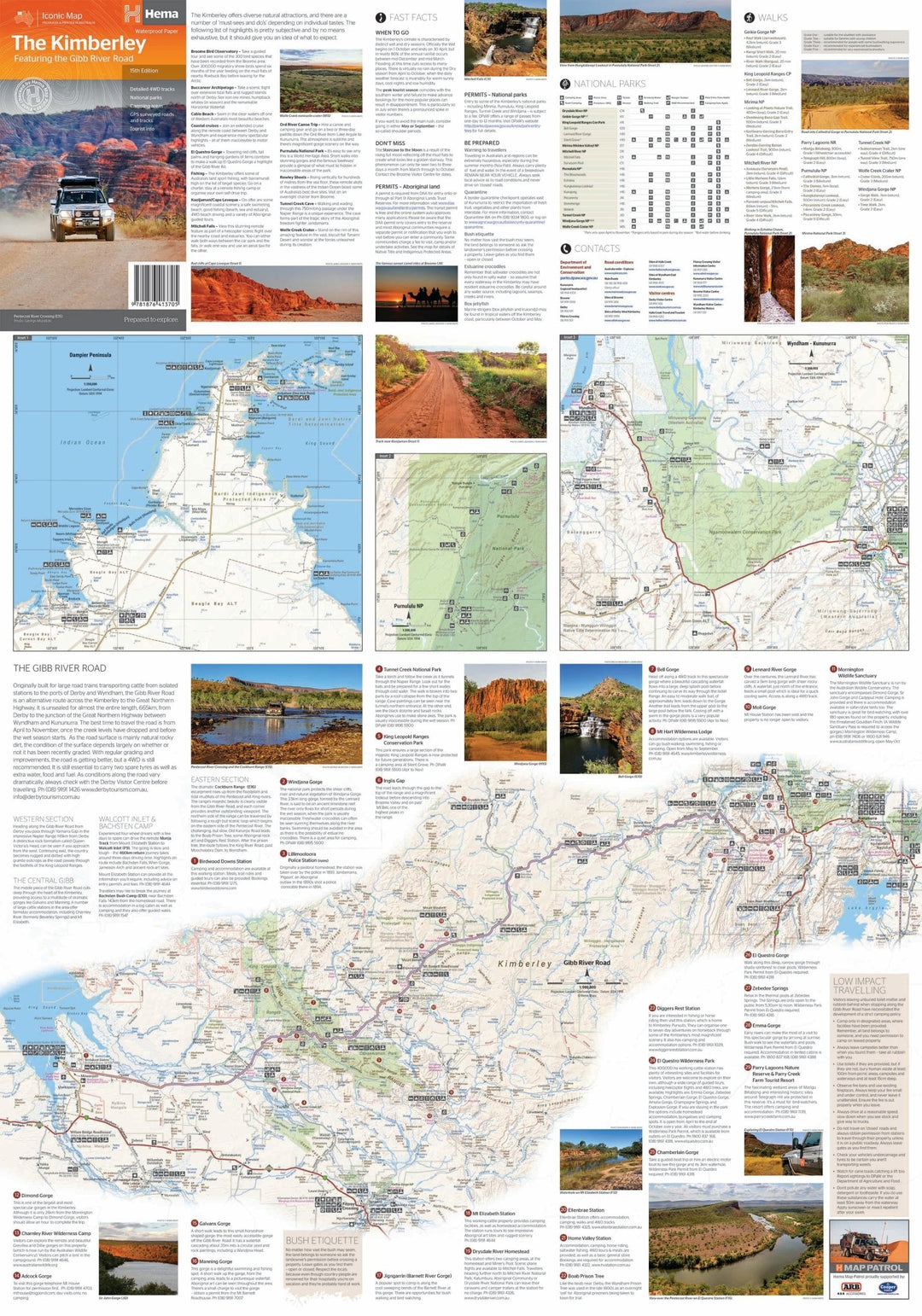
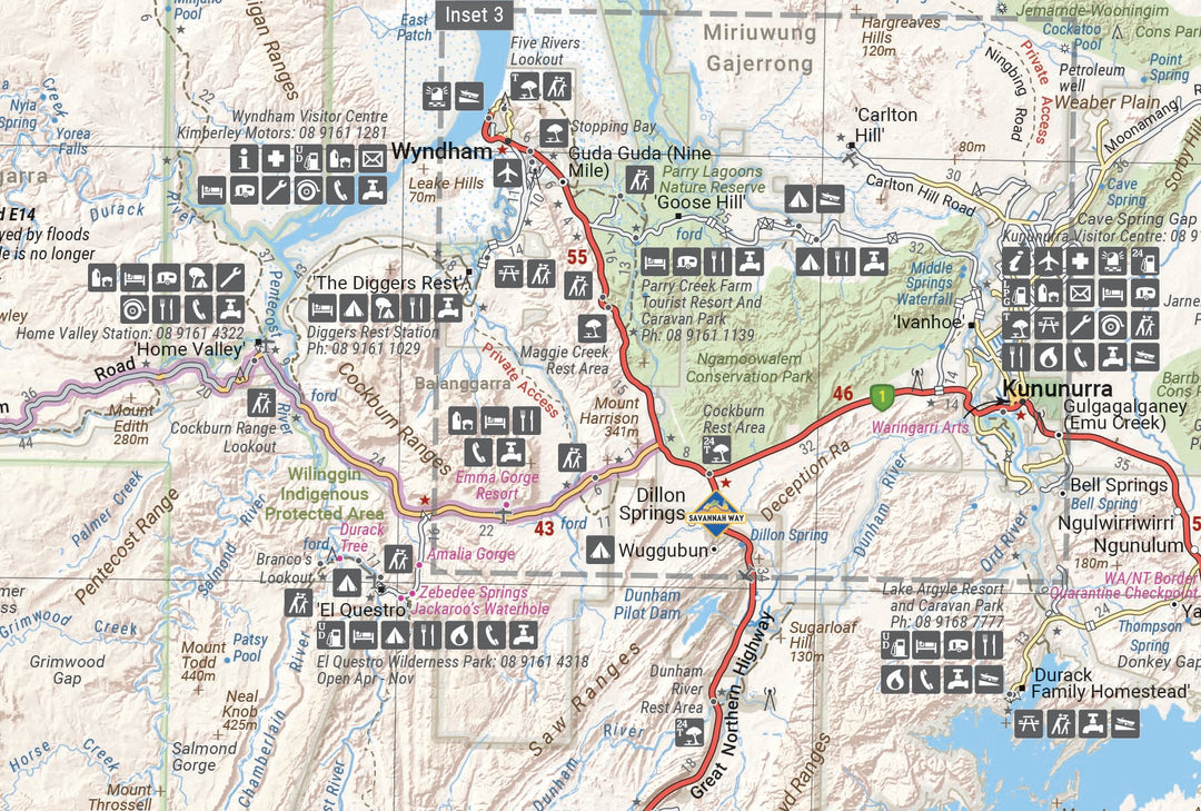
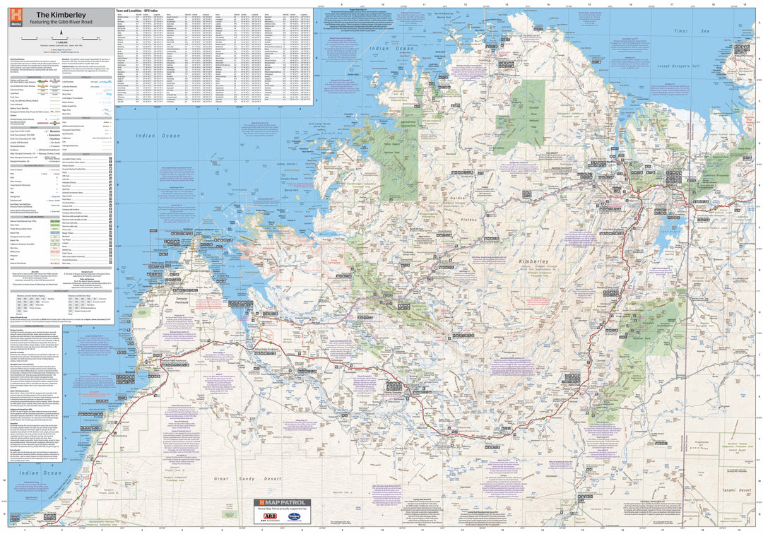
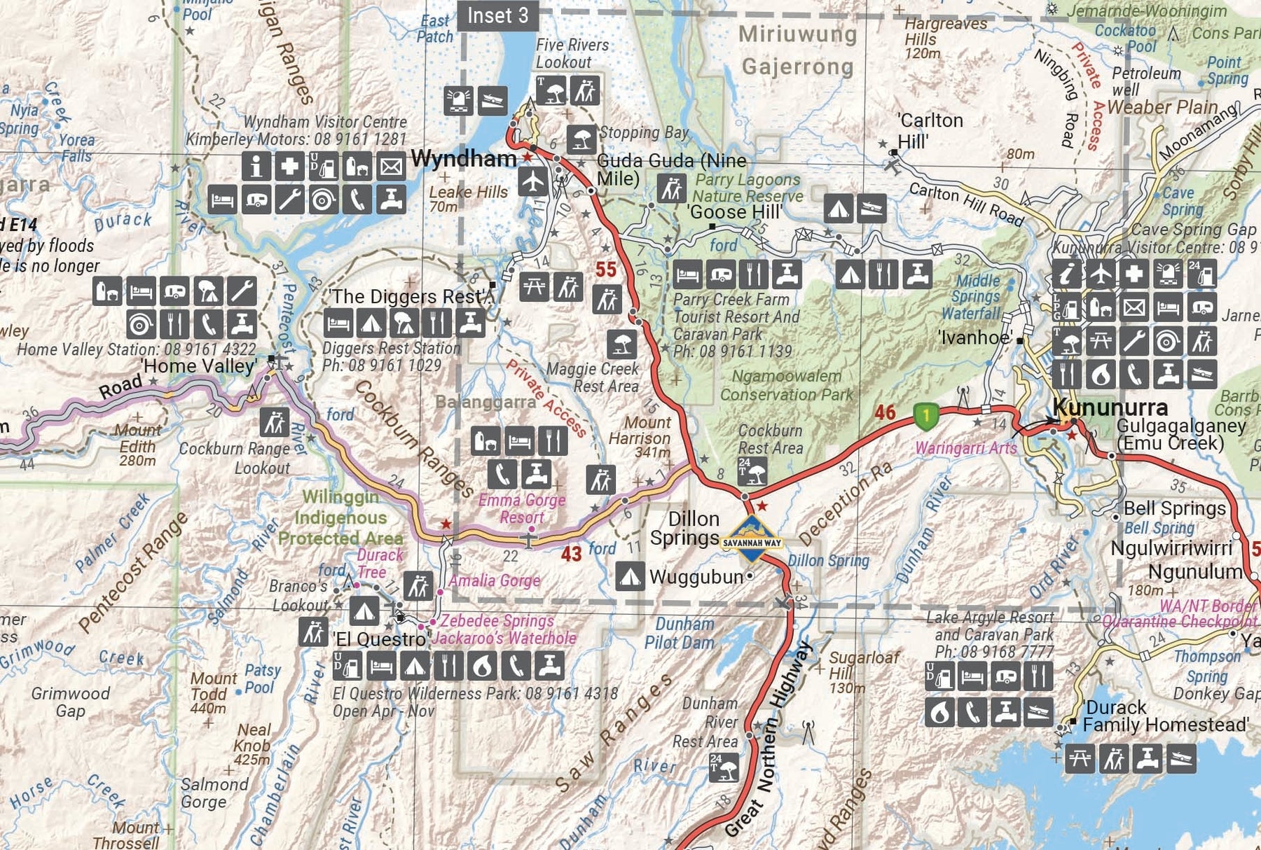
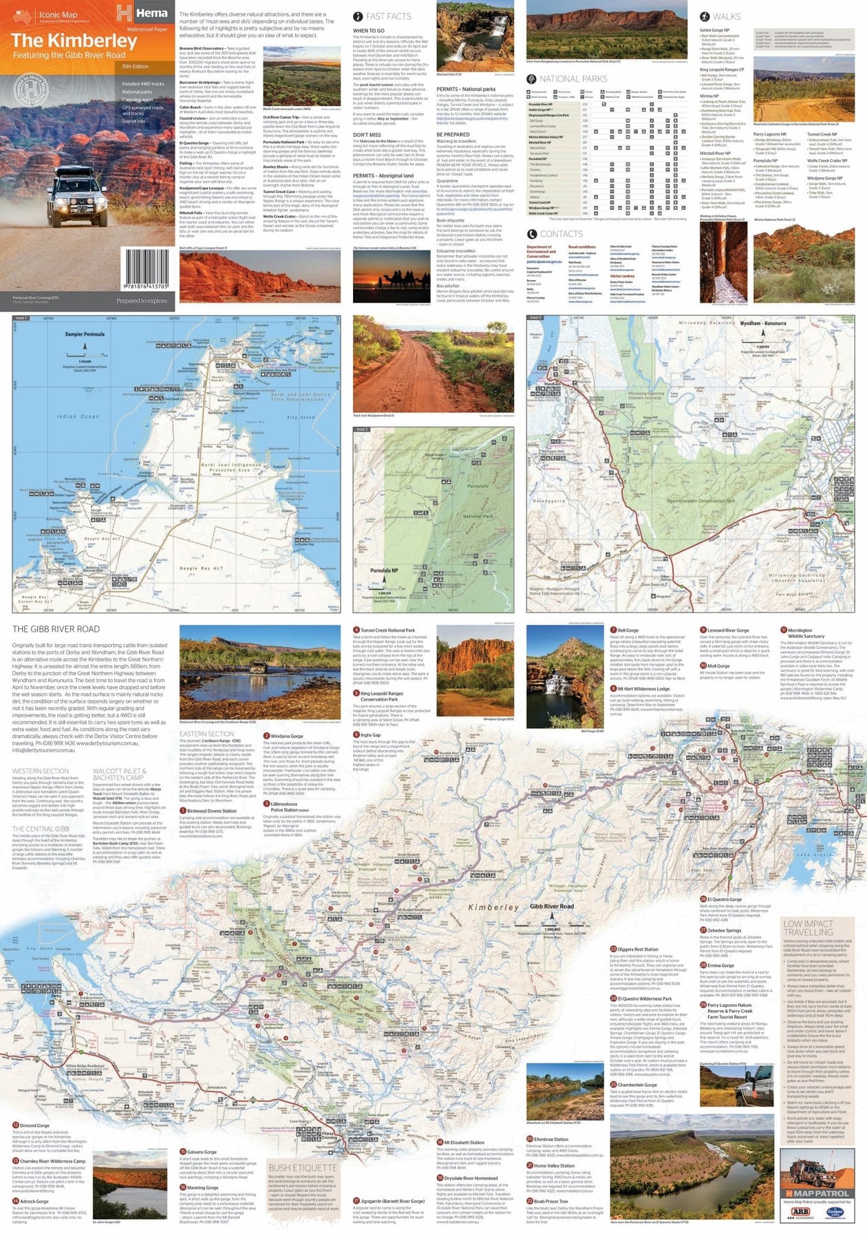
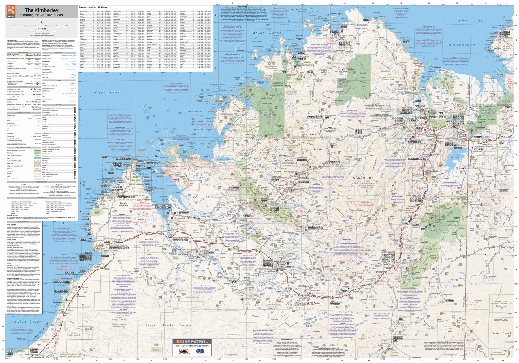
A regional map of the Kimberley that features the iconic Gibb River Road. On the reverse are inset maps for Purnululu National Park, the Dampier Peninsula and the Parry Creek area. Detailed trip coverage and drive detail for the Gibb River Road is featured as well, with inset mapping covering the journey and corresponding text to guide explorers.
This edition of Hema’s best-selling Kimberley map features Hema's iconic mapping and detailed points of interest. It combines Hema’s entire database of remote roads and 4WD tracks with touring points of interest and topographic information.
Also included are national park information and relevant contact details for pre-trip planning and use on the road or track.
Key Features
Waterproof paper
Detailed 4WD tracks
National parks
Camping areas
GPS surveyed roads & tracks
Key Specifications
Edition: 15th
Publication Date: 01/03/17
Scale: 1:1,100,000
Folded Size (WxHxD): 140mm x 250mm x 3mm
Flat Size (WxHxD): 700mm x 1000mm
Weight: 0.09kgs
Use collapsible tabs for more detailed information that will help customers make a purchasing decision.
Ex: Shipping and return policies, size guides, and other common questions.