Three Capes Track

Reaching the top of yet another stone stairway, I crossed the rock slab that caps Cape Hauy and peered over the edge. Protruding from the turbulent ocean below I saw the long, slender rock formation known as the Totem Pole. This remarkable geological feature and beacon of rock climbing lore was the final attraction on a four-day walk along the Three Capes Track; though it would take me another couple of hours to reach the true conclusion of the trail at Fortescue Bay, this was the point at which I felt the greatest satisfaction.
The Three Capes Track opened at the end of 2015, after five years of ongoing construction. The project entailed 48km of track, along with three hut sites and a series of artist-built stops known as ‘story seats’, which help to tell the tales of the region. Since then it’s become one of Tasmania’s most popular wilderness experiences, attracting thousands of visitors to the Tasman Peninsula each year to take in the spectacular scenery.
FERRIED AWAY
On a sunny Friday morning we made our way from Hobart to Port Arthur, where we checked in at the Three Capes desk before making our way down to the waterfront among our fellow hikers. It's necessary to book a spot on the track well in advance, on account of restricted numbers and high demand. Each day a small ferry traverses from Port Arthur Historic Site to Denmans Cove, a sheltered east-facing beach where Denmans Creek flows into the ocean, and where the track itself begins. A maximum of 48 people are able to set out on any given day, which requires two ferry-loads. Favourable conditions — including uncharacteristically-Tasmanian temperatures in the low-30s — allowed our brave captain to take us close to the dolerite sea-caves that dot the coast. He was even able to motor the vessel all the way into one of the larger caverns.
Once we bid farewell to our transport, my mother, girlfriend, uncle and aunt, two of my mum's friends and I ate a quick lunch then broke away from the larger group to take our first steps on the track. My girlfriend and I were by far the youngest in our group, at what I guessed to be about half of the average age. Due to the quality of the walk itself and the facilities along the way, the Three Capes Track is suitable for just about anyone who's game. Though there weren't any little tackers within our ranks, the trip is also popular among families with young kids. Of course, there is a level of fitness required, but it's well within reach of most.
FIRST STEPS
Day one served up a relatively leisurely 4km walk that took us to a stony beach named Surveyors Cove, and onward via a mellow ascent through eucalypt woodland and coastal heath to our first overnight stop. As we climbed sets of carefully crafted stone steps (the first of many we'd encounter), plodded along firm paths and boardwalks we caught views across the water to Cape Raoul. The story seats along the way referred us to an informative booklet we'd been given upon check-in, prompting us to consider the harsh remoteness encountered by the convicts transported to the area — a humbling thought.
COMFORTS AMONG BUTTONGRASS
We arrived at our first cabin-site, Surveyors, with plenty of daylight to spare, and were pointed in the direction of our allocated huts by the site's resident ranger. The sleeping arrangements consisted of a series of rooms that slept groups of four or eight people (the eight-person huts were split down the middle by a dividing wall), each with bunks furnished with surprisingly comfortable mattresses. We sat out on the deck as the afternoon sank into evening, relaxing on deck chairs and yoga mats, and getting to know some of the others in our group.
As hunger approached, we drifted into either of the two common rooms to work up a feed. Each of the common areas was equipped with solar-powered lights and USB charging points, gas cooktops, cookware, drinking water, a library of books and games and a gas heater (not that we needed it). When you add to that some of the nicest gravity lavatories I've ever encountered, you wouldn't exactly say we were roughing it.
At 6pm our ranger gave a quick talk, filling us in on some details of the surrounding wildlife, the history of the track and other useful information.
Once darkness fell it wasn't long until we clambered into our bunks in anticipation of an early start the next day, with the aim of covering the 11km leg before temperatures rose into the mid-30s.
A HOT DAY'S WALK
Eager hikers departed camp in the golden morning light, headed toward the pair of short, steep climbs that began day two. Arthurs Peak and Crescent Mountain treated us to broad views of Crescent Bay and Mount Brown, before we descended to the windswept heathland of the Ellerwey Valley (pronounced ell-are-we, as in 'where the hell are we?').
By this point the sun was making its presence known and the exposure of the coastline could be felt. Though the heat hastened our dash for the distant tree line, I could imagine just how slow-going and difficult this terrain had been for the ambitious rock climbers Reg Williams and Tim Christie who attempted to break a trail out to Cape Pillar to access unclimbed sea cliffs in the 1960s.
The day's story seats explored a wide range of subjects, including the ecology of the coastline and the geological processes that produced such spectacular dolerite cliffs. Around lunchtime we wandered into camp Munro, which featured dramatic views over the Munro Bight and was furnished with a pair of gravity-fed showers — a popular facility after such a morning. Clean, well fed and beginning to feel the combined physical effect of stone steps and weighty packs, it seemed as though everyone slept well that night.
LONGER, LIGHTER
On the third day we left our heavy packs at camp Munro and set off for Cape Pillar with day packs in tow. After the trip to the cape and back we were to pick up our packs and head another 3km to the next camp. We had a total distance of 19km to cover on day three, so the lighter load was greatly appreciated.
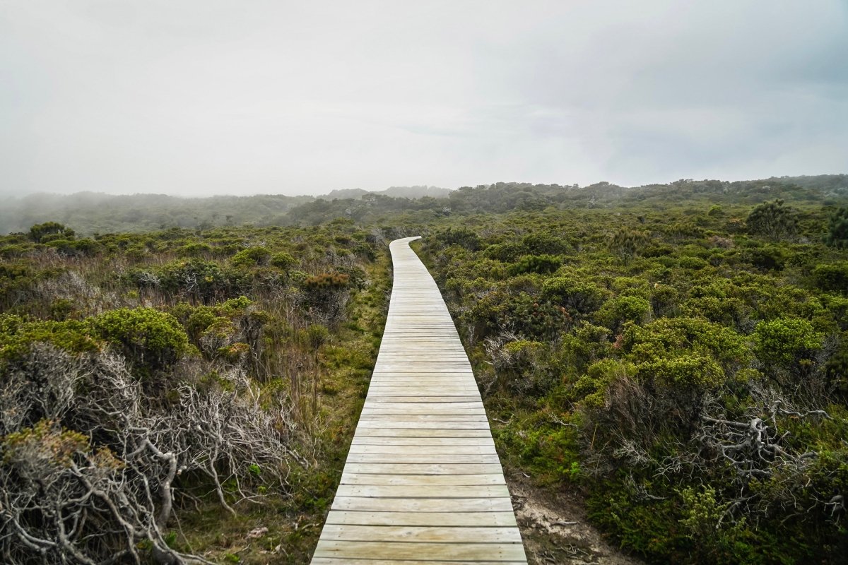
A chilly morning felt distinctly more Tasmanian than the previous days, but a thick mist that hung in the trees had me slightly worried how much we'd be able to see once we reached the cliffs that tumble into the Tasman Sea. This leg of the trip held some of the most dramatic scenery, which we didn't want to miss.
Ocean breezes trailed ribbons of mist across the heathland as we neared the cliffs. The occasional clear patch held promise, although the misty scrub-land was a charming experience in its own story-book kind of way. By the time the track wound its way into open clifftop areas the mist had drifted off and the towering rock walls could be seen in their full splendour. As we wandered along, often-times surprisingly close to the edge, we got our first glimpses of Tasman Island and its lonely lighthouse.
The stories along the way were tales of resilience and tragedy; lighthouse operators and their families who lived in isolation on the island and ships that were wrecked on the remorseless coastline. But once we'd soaked in the scenery from atop The Blade, the jolly seals lounging below at the Seal Spa prompted smiles all round. A little further and we were at the eastern tip of Cape Pillar, looking down at Cathedral Rock. As if to mark the beginning of our return from the Cape, the mist returned to accompany us back through the heath. On the way back we slowed to enjoy the antics of the busy little honey-eaters and thrush as they went about their business, and were treated to an up-close encounter with a peregrine falcon perched proudly on a boardwalk railing.
GET TO STEPPIN'
On our fourth and final day we emerged from the peaceful camp Retakunna to tackle Mount Fortescue. Heading up the 482m mini-mountain we were enclosed by mosses and lush greenery beneath the canopy of a rainforest — or more correctly, wet eucalypt forest. The ever-changing variety of vegetation and habitat encountered along the walk managed to keep any symptoms of monotony at bay. Not to mention the wildlife; there were chubby little pademelon wallabies all over the place, a number of quick-moving critters I didn't get a great look at, the odd echidna, plenty of cubed wombat scat (unfortunately we didn't spot the depositors) and a whole host of reptiles.
Upon reaching the summit of Fortescue we took a moment to catch our breath before pushing on to a track junction leading to Cape Hauy. At that point we were presented with a choice; tackle the short but steep track out to the Cape, or continue directly to the finish at Fortescue Bay.
The added bonus of being able to leave my pack at the junction was more than enough motivation for me to tackle the stairs (so many stairs!) out to Cape Hauy.
The 2km round trip was given an expected return time of two hours. As generous as that seemed, I quickly realised why it was so, and was surprised that the ranger at Retakunna had breezed over exactly how demanding this section was. Nevertheless, the quality of the track and the steep stone stairs made it a more manageable exercise than it would have otherwise been. Understandably, not all of our party opted to take the detour, but as a somewhat more conditioned hiker I was very glad I did.
I lingered at the tip of the cape, looking out to the breathtaking cliffs and leaned over to gaze at the Totem Pole. But eventually, it was time to turn back and head for the beach.
Before long I emerged into the camping area at Fortescue Bay and rejoined friends and family who'd staggered throughout the day. All that was left to do was lounge on the beach in the warm sunshine as we waited for the bus that would take us back to Port Arthur — which would proceed to drop other hikers as far as Hobart. With a couple of hours left, a dip in the icy Tasman waters and a snack from the little shop was a perfect way to conclude a wonderful trip.


