
The World in a Grain of Sand
The oft-forgotten Limestone Coast is shamefully unsung in the treasure chest of national tourism. With more than 60 conservation and national parks, a World Heritage Site, and around 25,000 hectares of native forest reserve, plus relics and living history on the side of human interest, it’s about time this region was given some credit.
For Adelaideans, the spectacular scenery and unrivalled access to secluded coastline presents a perfect long weekend’s recreation.
For travellers making their way from Adelaide to Melbourne, or vice versa, the sandy stretch can be an exciting detour from the bituminised mundanity of the Dukes Highway.
Summer is your best bet here but, as we recently discovered, you can hack it in winter too. If you fill up the fourbie and head here in off season, you might just have the best parts to yourself.
WILDLIFE: REAL AND FIBREGLASS
When travelling south along the Princes Highway from Adelaide, your first Limestone Coast attraction will be the 130km stretch of saltwater lagoons known as the Coorong. You’ll slide into a scenic drive alongside the water system, backed by low-lying dunes that separate it from the ocean.
To get more intimate with the Coorong, you can venture into the National Park via various tracks, including the Salt Creek Scenic Drive, or even cross the Coorong at Tea Tree Crossing or 42, 32 and 28 Mile Crossings. During our visit, Tea Tree Crossing was experiencing tidal flooding. We weren’t keen on exposing the Mitsi’s brakes to salt damage, but it’s not always like this. Sam has been here, years ago, and played cricket on the bone-dry pan.
In summer, when you can cross, it’s a great way to access exclusive mulloway fishing on the surf beach (bring rod holders and fish the gutters). Alternatively, you can explore the park on foot — the Nukan Kungan Hike is a good-lookin’ 25km overnighter.
Birdlife is naturally attracted to the still, shallow waterways and hydrophytic vegetation of the Coorong. Swans, geese, fowls, ibis, stilts, and every duck known to man are common in the area. Rarer birds, such as the Far Eastern Curlew and Terek Sandpiper, have been spotted too, so bring your binoculars.
You won’t need them for the Coorong’s cornerstore bird, the pelican. A short nature walk to the Jack Point Pelican Observatory offers views to pelican breeding zones.
Further east is Kingston SE, home of Larry the Lobster, another of 'Straya’s big things. Unlike most, which lead peaceful existences of little controversy, Larry has precipitated a few squabbles.
Since the erection of the 17m fibreglass crustacean in 1979, Larry has passed like a hot potato between several owners. At one point, despite expensive ($50,000) crowdfunded steam cleaning and repainting efforts, he was left on the market for six straight years. Around 2015, Larry was earmarked for relocation to Western Australia and in 2018 the logistics were arranged. But a 2500km move would’ve been no fair way to treat a 40-year-old, spindly fellow, so a local farming magnate purchased the lobster at the eleventh hour.
After you’ve said hello to Larry, you’d best check out the Kingston Jetty at the northern end of the long foreshore, and Cape Jaffa Lighthouse at the southern end. The Granites, a group of small inselbergs with rounded tops exposed above the ocean, are also well worth a visit and are only 15 minutes from the town.
Wombats thrive in the lush, grassy surrounds of Kingston SE, and while they may not quite ‘flip your car’ as we’ve heard, it pays to slow down after dark. At night, cars regularly drive a good 40km/h below the speed limit with spotlights beaming to avoid a collision.
A CRUMBLY COAST
Still travelling southbound, Robe is the first coastal town where you start to notice the prominence of limestone, and the subsequent fragility caused by this sedimentary rock. Even the illustrious Robe Obelisk (a photographer’s delight at sundown) is perched atop a crumbling limestone cliff.
The landmark was originally positioned here so boats could identify the headland from sea but, over the years, water and wind has taken to the erosion-susceptible land underneath the beacon. The stone pillar is getting a little raggedy nowadays, but its teetering-on-the-edge location means it is often referred to as “the riskiest paint job in South Australia”. Some add that the Obelisk is due to fall any day now — consider that a worthy excuse for a spontaneous holiday.
The Robe Coastal Walk allows you to trek atop these rugged cliffs at a safe remove and peer at the many caves, stacks and bridges that have developed over time through decay. The path eventually leads you back into town, where The Adventurous Spoon and Mahalia Coffee (the real Mahalia roaster, not just a retailer) both get our tick of approval for a caffeine kick.
Around the corner from the golden cliffs is Robe’s Long Beach, a highlight of the area. Most of the time, this strip features relatively hard sand and, especially at low tide, is easily accessible — we saw a 2WD Holden Cruze drive onto the beach with ease. With more than 12km of blinding white sand, you’re sure to find your own private spot looking out into Guichen Bay.
For those who need a little more in their beach driving adventures, Little Dip Conservation Park is five minutes from Robe’s town centre and offers a sudden, somewhat unexpected oasis for offroad enthusiasts.
Only two roads in the park are suitable for 2WD vehicles — the rest are 4WD exclusive. These tracks interweave towering dunes grown with illustrious native shrub, and pass by and along secluded beaches, inland lakes and lagoons.
As you navigate the sandy playground, you’ll come across isolated coves, karst limestone formations and radical waves (not to be surfed by the faint-hearted or reef-averse). But the drives themselves are long enough, fun enough, and abundant enough to be the principal attraction.
SURF AND SALMON
Continuing along the coast, you next stumble upon the surfside town of Beachport. As you enter, the Beachport Jetty is unmissable. It extends some 772m into Rivoli Bay yet isn’t quite long enough to score the title of ‘Longest Jetty in South Australia’, falling short of Port Germein.
A highlight of Beachport is the Bowman Scenic Drive which follows rugged cliffs, sandy shores and undulating dunes between the town and Beachport Conservation Park. Along the way, you can stop for lookouts to Cape Martin Lighthouse, Penguin Island, and the Pool of Siloam (a buoyant salt lake). At the end of the drive, the bitumen turns to sand and you enter Beachport Conservation Park, a sandy expanse of coast mirroring Little Dip, only with softer sand again.
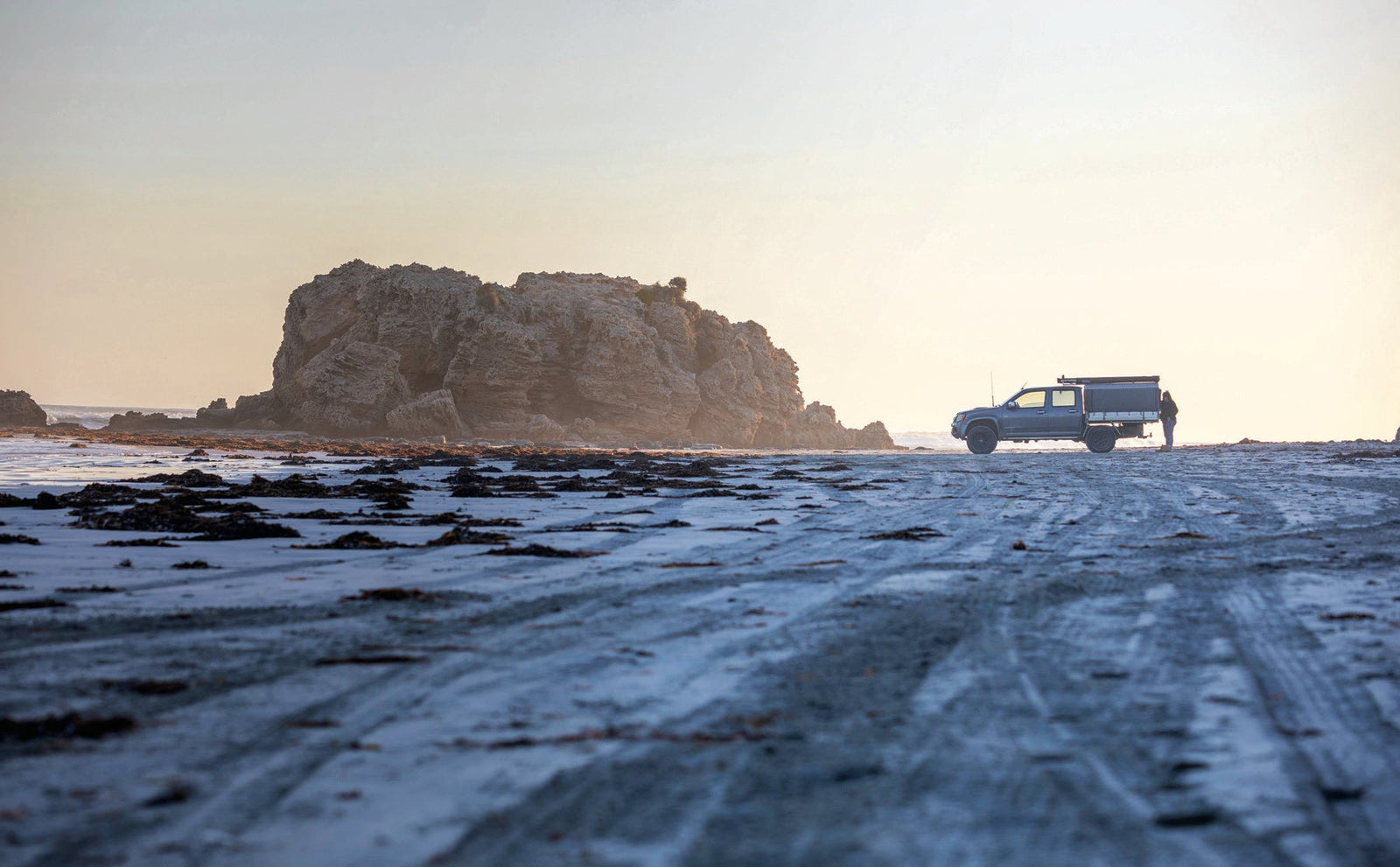
Before hitting the Victorian border, you will pass by Canunda National Park between the towns of Southend and Carpenter Rocks. Thanks to predominantly 4WD access, the park is quiet and plays host to an exclusive party of keen fishermen and bush campers. If you’re willing to bounce along the 40km stretch of beach, dodging blue sea and embedded limestone as you go, you can easily find some reef or sand to shotgun for the day. With little competition around, you’re a fair chance to bag out on Australian salmon. Use shiny lures if the water is clear, and pilchards or squid if it’s not. Mulloway, bronze whaler sharks, gummy sharks, and stingrays are also up for grabs.
A must-not-miss campground at Cape Banks Lighthouse will have you nestled among low gum trees and marvelling at the historic lighthouse through the window of your own tent. When it turns dark, the operational structure sends out sequences of flashing light to pierce the dense fog of sea spray. From camp, you can either drive or walk down to the rusty wreck of the Pisces Star, which will be part submerged or spewed up on the shore according to the tides.
Other wrecks in the vicinity include in the Admella and the Edith Haviland, but these are only visible with a snorkel or oxygen tank. Clearly, this is an area of treacherous waters, hence the lighthouse, built in the early 1880s, more than 18m above sea-level and visible as far out as 16–19km.
SHAKING IN YOUR BOOTS
As if the distinctive nature of the coast isn’t enough to excite the geologically minded, there are more whacky land features as you head inland. En route to Mount Gambier, a small detour to Mount Schank provides a flashback to the once-explosive landscape. As you approach the regional hub across flat farming land, you’ll see it grow larger on the horizon — an enormous volcanic cinder cone.
There’s a steep walking trail up the edge of the 100m-high (158m above sea level) dormant volcano which goes on to circumnavigate the crater’s rim. When you reach the top of the staircase, you have 360-degree views into the crater and the surrounding region.
Mount Gambier itself has essentially been built around and between volcanic remnants and ancient topographical features. Most notably among the landmarks are crater lakes, sinkholes and caves. The Blue Lake boasts a pronounced cobalt blue colour for most of the year and holds high-quality artesian drinking water in its 75m deep bowl. Nearby is the less-blue Valley Lake, still with equally scenic vistas, and a 4.5km loop hike around the water’s edge and up to the Centenary Tower.
The Umpherston Sinkhole is perhaps the most peculiar attraction. The sinkhole formed when the ceiling of an underground cave collapsed, sometime outside of living memory. In 1886, James Umpherston beautified the sinkhole with its very own sunken garden. We found it both laughable and remarkable that this piece of ecological beauty rests between an industrial park and a Maccas.
Nearby to Mount Gambier, the Piccaninnie Ponds are a renowned cave-diving destination with crystal clear waters and aquatic flora. Also close, the Naracoorte Caves — the only World Heritage Site in South Australia — are recognised for preserving Australia’s most complete fossil record for over 500,000 years. Tours of the caves can be booked at naracoortecaves.sa.gov.au from $10.50 per adult. Adventure caving is also available.
BAG OF MIXED GOODIES
It’s when we were wrapping up on the Limestone Coast, heading home via the wine towns of Nangwarry, Penola and Coonawarra, that we reflected on the richly diverse landscape we had spent the prior few days in — from salty swamp, surf beaches, and shrubby dunes; to caves, cliffs, and craters; and now swaddled in vineyards on either side of the Riddoch Highway.
Where else can you float in a lagoon, offroad over some dunes, catch a few waves or a fish (or both), and then have a picnic in a volcanic crater, all in the same day? What’s more, the region is continually transforming. With morphing dunes, variably filled lagoons, and eroding limestone, there will always be something new to cock your eyebrow at when you visit the Limestone Coast.
TIPS FOR DUNE AND BEACH DRIVING
- Bring a deflator and let down your tyres. Going to 15–20psi, or even as low as 10psi, will increase the surface area of your tyres and reduce the risk of bogging.
- When driving on soft sand, keep your momentum and stay in the same gear. Of course, don’t speed, and make sure to lower your pace just before cresting a dune so you don’t get airborne.
- Bring a sand flag if you’ve got one. Otherwise consider honking just before cresting a dune, or not playing music so you have a better chance of hearing oncoming traffic.
- Favour existing tracks, as the sand will be more firmly packed here, and you should be able to gauge whether the last driver made it through alright with that line.
- If you find yourself stuck, don’t continue to accelerate, you’ll only dig a deeper trench. Try to reverse out and if that fails, either lower your tyre pressures further, dig an exit ramp, or crack out the recovery tracks (eg. MaxTrax). If all else fails, it pays to have UHF radio and to carry a snatch strap in case a potential saviour hasn’t got one, nor a winch.
- Drive in High Four but consider Low Range for particularly soft sand and for hill climbs and descents.
- Avoid turning across tracks. Making a U-turn on soft sand is likely to get you in trouble; reverse in a straight line if needed.
- Avoid creek or water crossings where you can. If you have to cross, investigate on foot first to assess plausibility and to identify any risky areas.
- Generally, aim to drive on more firm-packed sand. Disconcertingly, this may mean driving closer to the water.
- Secure your load. Beach driving can get bumpy!
- Stay on the tracks. Not only does this conserve the natural environment and vulnerable scrub, but it limits your chances of getting into strife.
FAST FACTS
WHERE TO STAY
Self-contained RVs can take advantage of free RV parks in Carpenter Rocks and Pinks Beach, plus there is a popular foreshore campground in Kingston SE for just $10 for 48 hours.
Coorong National Park, Little Dip Conservation Park, Beachport Conservation Park and Canunda National Park all contain coastal/bush campgrounds with sites available to be booked on parks.sa.gov.au for $16 per night.
BIG4 also has holiday parks in Mount Gambier and Naracoorte, with sites starting from $25 per night. Visit big4.com.au to book.
WHEN TO TRAVEL
In the basking heat of summer, the Limestone Coast truly comes to life. Swimming, surf fishing, boating, and guilt-free ‘lying on the shore doing absolutely nothing’ days are prime between December and February. However, you might need to wait in a longer queue for the Robe
Ice-Cream Shop and some campgrounds will also attract rowdy crowds on Friday and Saturday nights.
Although winter camping comes with its challenges, you shouldn’t rule out the Limestone Coast during these months. Between April and May, the Coonawarra wine region is in full golden bloom before it turns to a lush green. Fishing in estuaries is also hot, as the first decent rains flush them out.
Despite travelling in late May, we managed to secure four sunny days and starry nights in a row. This made for extraordinarily cold evenings and nights (our dishwashing liquid was frozen when we awoke one morning), but there’s nothing a toasty campfire can’t fix. Plus, there was no one to shame our unsightly thermal outfits in the otherwise empty campgrounds.


