DESTINATION SAVANNAH WAY: PART II
· Leichhardt River Falls
· Seeing jabiru in their natural setting
· Karumba sunset
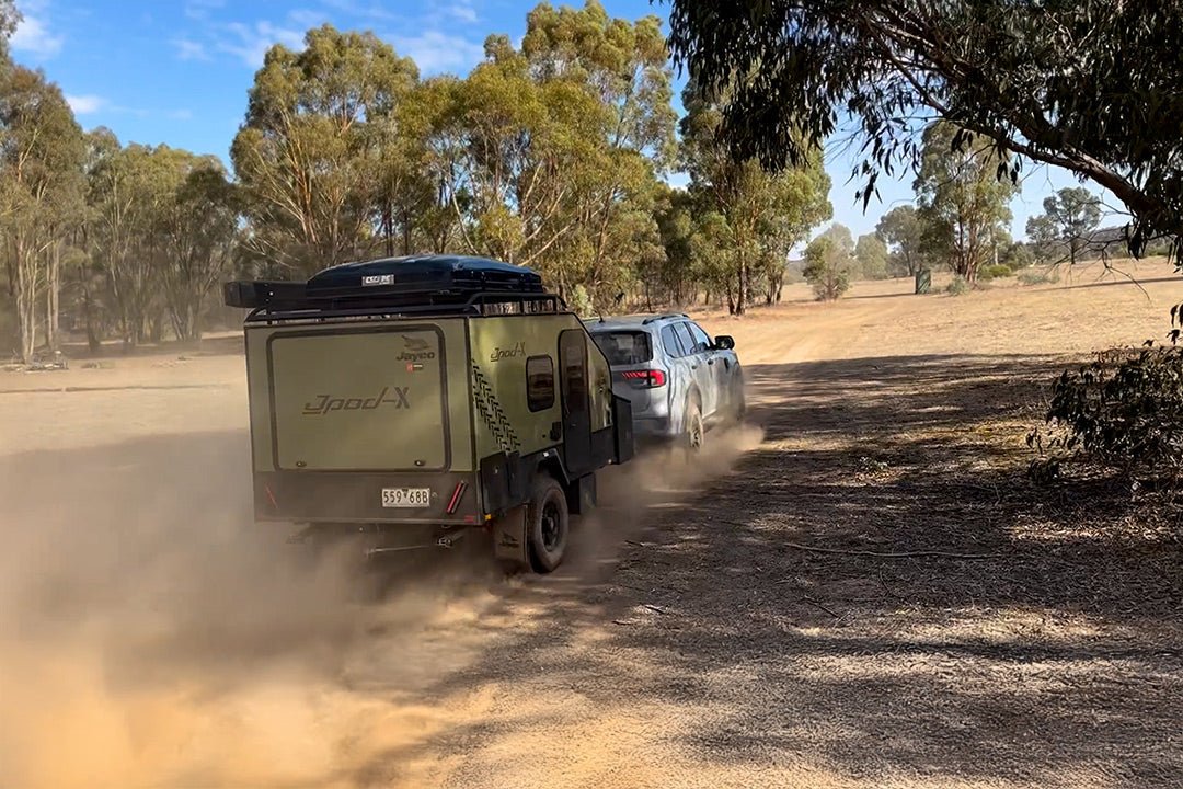
After leaving King Ash Bay, NT, we retraced our steps to Borroloola to top up our supplies. Upon joining the Savannah Way, however, we soon realised that reports about the poor condition of the road hadn’t been exaggerated. For the first 30km, the unsealed Wollogarang Road was very rough and corrugated. After that, there were a few good stretches where we could get up to about 60km/h, while other stretches slowed us down to about 20km. But the one thing that was constant was the thick bull dust.
It was somewhere along this first stage of the Savannah Way that one of our caravan’s corner jacks malfunctioned. The leg dropped down, resulting in the main leg bending and rendering it useless. Maybe someone should have read the instructions that advise against travelling with them in the ‘down’ position… We also had one of the safety chain D-shackles come loose and fall off. We counted ourselves fairly lucky that these were the only two incidents on our trip as many who travel this stretch of road don’t fare nearly as well. We’ve heard some serious tales of woe from drivers and the cost of repairs in these parts can really poke a hole in the budget. It pays to have a well-maintained and equipped vehicle and RV for this kind of adventure.
RIVER RUN
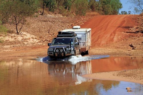
We arrived at Robinson River, which is one of the major rivers in this region, by mid-afternoon and set up camp above the main crossing. We had only driven 105km east of Borroloola but it seemed a lot further. After setting up the van in a fairly level spot, we took a stroll down to the river and found a beautiful, clear running stream. We also took the chance to walk across the river to check for holes or anything that might cause a problem for our crossing in the morning. Our dog Murphy had a good swim in the shallows but we kept a keen eye out for crocs.
When we returned to the van, a young couple was getting their camper trailer set up not far from our van. Karen and Tony Sharp had travelled up from Melbourne and were on their way across to the coast. Being an energetic couple, they had gathered firewood and set up a campfire and invited us to join them a little later. After dinner, we spent quite some time enjoying the balmy evening, swapping travel stories and relaxing by the cheery glow of the fire. One thing they did enjoy was the fact that we had our dog with us, as they were missing their own pets.
They left early the next morning as they were heading to the Cape and only had six weeks before they had to be back at work in Melbourne.
The next day started with the river crossing and, by the end of the day, I had lost count of the number of creeks and rivers we had been through. Some were fairly deep and some were swift flowing, but none of them caused any great problem. Each crossing just served to wash off the dust from the previous section of road.
HELLS GATE
We crossed the NT/Qld border at Wollogarang, 59km north-west of Hells Gate, and the road conditions really deteriorated from there. The conditions were far worse than anything we had encountered on NT roads and forced us to slow to a crawl in places. When we encountered a vehicle coming from the opposite direction, we had to stop until the dust cleared before continuing. We were quite happy when we saw a sign announcing that we had reached Hells Gate… but then began wondering if this point was the entry to or exit from Hell – we hoped it was the latter. Having had a taxing day’s drive, we decided to stay at the roadhouse, where unpowered sites were $20 and the flies were free. The attendant told us to “stop anywhere you like and watch out for the cows”. Being one of the first campers in, we managed to avoid the cows and even find a little shade.
By the time the sun was setting, we were joined by a range of other vehicles. There were a couple of big offroad vans, some camper trailers, a few tents, a Hi-Ace campervan and a tiny A’van being towed by a Subaru AWD wagon. The couple in the A’van said they’d had no real problems, having driven very slowly through many of the rough patches. We were impressed that they hadn’t been put off by the reputation of this road as being one of the roughest anywhere in the country.
TO LEICHHARDT FALLS
The road heading east of Hells Gate – known as the Great Top Road – was only slightly better than what we had encountered to the west. A few patches were a little less corrugated but that’s about all. A couple of creeks and the Nicholson River had to be crossed before reaching the Aboriginal lands of Doomadgee, about 90km from Hells Gate. It was still early in the day, so we pushed on to Burketown. We had been told by other travellers that there was good camping at Leichhardt Falls and, as we spent some time at Burketown on an earlier trip, we just did a short drive around town and headed on to the Leichhardt River. It was good to see that work was underway on the rebuilding of the historic Burketown Hotel that burnt down earlier this year.
It was also good to find that the road to Leichhardt Falls had been sealed. When we were last there, the road was atrocious. We remembered it as one of the worst stretches we had ever driven. This time, it took no time at all to cover the 80km and we were scouting a site at the falls by mid-afternoon.
To our delight, we found many options for camping and chose a spot that overlooked the falls on the western side of the river. A wide concrete causeway provided access across the river, dividing the campground into two distinct regions. On the eastern side there are some shade trees, and sites are mostly on sand. On the side that we chose, the sites are nearly all on broad, rock slabs. There were some large boulders to be negotiated but, once we were set up, we were very pleased with our camp on the rocks.
Although the volume of water falling over the face of the cliff was not huge, it remained an awesome sight. We imagined how this place would look during the rainy season, when this river must be a raging torrent. Perhaps we will return after some rain, though that could prove problematic as during the wet season many of the roads are closed.
The sunrise from our perch high above the river was beautiful, as we could look right down the length of the river to watch the golden light spreading along the stream. Because of the possibility of crocodiles, Murphy the dog had to be content with a swim in one of the rock pools along the causeway.
ARRIVING IN NORMANTON
By now, we had only 150km left to reach Normanton and complete our Savannah Way adventure. We still had a few creeks to cross, as well as the Bynoe and mighty Flinders rivers.
We arrived early enough into Normanton to make a start on the clean-up of the van and get some washing done. We stayed at Normanton Tourist Park in town, around the corner from the Purple Pub. The park has hot artesian baths and a resort-style swimming pool. The park was nice and quiet and we booked an extra day to just relax after the corrugations and dust of the Savannah Way.
We couldn’t pass up the chance to see another beautiful Karumba sunset so, late one afternoon, we took the short drive out to the point to join in the daily ritual of fish and chips on the beach while watching another magic light show.
Murphy didn’t seem impressed when we introduced him to the life-sized replica of Krys, the monster crocodile located in the main street.
After a brief visit to Normanton Station to see the Gulflander, a train that operates between Normanton and Croydon, depart on its morning journey and to wave goodbye to its excited passengers, we also said farewell to Normanton to begin the next leg of our trip toward the coast. Stay tuned.
FAST FACTS
- Hells Gate earned its name in the late 1800s when police would provide escorts for settlers wanting to head further west but would not go past the rocky escarpments due to the threat of attacks by Aborigines. Facilities at Hells Gate Roadhouse include unpowered sites, toilets and showers, a laundry, and fuel is available. Phone (07) 4745 8258 for more information.
- Doomadgee is an Aboriginal community and has alcohol restrictions. For more information, visit www.alcoholimits.qld.gov.au or phone 1300 789 000.
- Camping is available at the Doomadgee Roadhouse. Phone (07) 4745 8298.
- Burketown is the oldest settlement in the gulf. It is considered the barramundi capital of Australia. This is where the unusual cloud formations known as Morning Glory can sometimes be seen between September and November.
- For more information, phone the Burketown Visitor Information Centre on (07) 4745 5111.
- Burketown Caravan Park is located on Sloman Street, Burketown, (07) 4745 5118,
www.burketowncaravanpark.net.au - Normanton Tourist Park is at 14 Brown Street, Normanton, (07) 4745 1319,
www.normantontouristpark.com.au - Normanton Visitor Information Centre: (07) 4745 1065.
- You will find plenty of good information and advice about the Savannah Way at www.savannahway.com.au
Originally published in Caravan World 512, March 2013.