
Seeing Red
The Red Centre tends to be one of those bucket list destinations every Aussie has noted, but often files in the ‘I’ll do it one day’ category. Uluru will always be there, right?
Well, very likely, yes — at least in our lifetime and many more lifetimes after that. But after finally ‘getting around’ to visiting the Red Centre, I feel there should be more of a sense of urgency, for the simple fact that this sacred, wild and dusty landscape is something that will be etched in your mind as one of the most incredible places on Earth. The best part? It’s right on our doorstep. And the Red Centre Way road trip from Alice Springs to Uluru offers a neat five-day (or more) itinerary that ticks off some of the best sights Central Australia has to offer.
FIRST STOP: ALICE
Alice Springs is where the Red Centre Way kicks off. We arrive from the East MacDonnell Ranges so start our trip by ducking into Yeperenye (Emily and Jessie Gaps Nature Park), 15km east of Alice. The two gaps are in close proximity and are important cultural sites to the Eastern Arrernte people — particularly in relation to the caterpillar Dreaming story that carries through to the west of Alice. It’s a good introduction to and reminder of the spiritual significance of the sites dotted throughout the Red Centre, which hold intense value rather than simply beauty.
Once in Alice, we come to appreciate the land further with a visit to the Alice Springs Desert Park, where daily tours educate visitors about various topics including local bush tucker and desert survival techniques. You can easily spend half a day here, if not longer.
Come nightfall, we drive 15 minutes out of town to learn about the glittering stars at Earth Sanctuary, an educational centre that runs astronomy tours, taking advantage of some of the world’s darkest skies. We’re lucky to visit on one of the darkest nights (the moon was but a sliver) and, for the first time, I see (with the help of a high-powered laser pointer) the ‘dark emu’, which features in Indigenous storytelling across the country.
We opt to spend a couple of days in Alice, and hip laneway cafe, called 'Page 27', quickly becomes our favourite breakfast and coffee spot, while the ‘The Bakery’ takes the crown for fresh gourmet sandwiches for lunch (the crowds outside both cafes suggest they’re a few other people’s favourites too). Sangas packed on our second day, we hit the road and head west to experience Alice’s natural wonders.
CRUISING THE WEST
The key attractions of the West MacDonnell Ranges (Tjoritja) almost feel a little too convenient. It’s as though nature planned the national park with tourists in mind, lining up chasms, gorges, gaps and vistas along a 160-kilometre westward stretch from Alice. But when we meet a local, he explains that, viewed from above, the deep divots of the gorges make the ranges look like a giant caterpillar, and the sights piece together parts of the Arrernte people’s caterpillar Dreamtime story. I later search for an aerial view on Google — yep, there’s the caterpillar.
The first stop along the trail is Simpson’s Gap, where we walk to the summit for the best views as an icy wind whips around us (indeed, the Red Centre can be scorching in summer, but temperatures can drop at other times of the year). We greet people as they pass, and go on to greet the same parties many times over throughout the day. That’s the thing about a convenient strip of natural attractions — nearly everyone follows the same itinerary.
In train with our new mates, we nip in and out of Standley Chasm and Ellery Creek Big Hole (which I imagine would have been ideal for a refreshing dip had the weather been a touch warmer), followed by Serpentine Gorge. We see a sign to a lookout at Serpentine, so clamber up the steep rock face to be rewarded with sweeping views of the ranges and plains below. When we pass a couple huffing and puffing up the hill on our way down, who ask if it’s worth the climb, we offer a resounding yes.
The day’s highlight, however, is Ormiston Gorge. We walk along a sandy riverbed and stare up at rust-coloured cliffs that reflect in the calm waterhole below. Stairs lead to a steel viewing platform for an alternative view, and we regret not having enough time to continue along the Ghost Gum Walk that wraps around the gorge. Though we backtrack to Alice Springs, if I were to pick a spot to pull up for the night, Ormiston would be it.
Like us, many people pack the sights into a day, but you can certainly linger in the area for two days or more, especially if you want to add some hikes to your itinerary. Many places have long vehicle parking, and some have camping facilities, so you can drop anchor at your favourite stop and enjoy the after-hours serenity when the day-trippers depart.
A GLIMPSE OF THE PAST
The following day, we take Larapinta Drive out of Alice Springs to Ntaria. The town, formerly called Hermannsburg, is best known as the birthplace of Aboriginal watercolour artist Albert Namatjira. It’s also home to the Hermannsburg Mission, which was established by German Lutheran missionaries in 1877, and operated until 1982.
The drive takes around 90 minutes, and we end up spending a similar amount of time wandering around the historic precinct’s old buildings, including a tannery, school house and dormitories. The old Lutheran mission has a fascinating story, and it’s hard to determine whether, on balance, it helped or hindered the local population — a little of column A, and a little of column B, I suspect.
The mission provided a refuge for the local Indigenous Peoples during frontier conflicts in Central Australia, as well as education and employment opportunities. However, the local population was expected to renounce their cultural practices in return and adopt Christianity. Unlike other missions, which banned Indigenous languages, the missionaries at Hermannsburg embraced them and transcribed religious texts into the local Aranda (now called ‘Arrarnta’) language. Art was also encouraged, and inspired the works of Namatjira and his disciples.
Much of the history has been told from the perspective of white missionaries, but I’m told that, to this day, the local population is proud of its Lutheran traditions, and we see a number of locals leaving the nearby church as we depart, following a Sunday service.
Nearby is Hermannsburg Potters, a gallery space and shop that showcases handmade ceramics created by Western Arrarnta artists. We realise upon arrival, however, that it’s closed on weekends. Bummer.
RAINBOW ROCKS AND CANYONS
We backtrack to Alice Springs from Hermannsburg and head south to Rainbow Valley the next day. This deviates from the Red Centre Way, but may be necessary if the Mereenie Loop is impassable by caravans.
Going to Rainbow Valley isn’t a bad thing though, as the intense red and ochre rock formation decorated with bands of white is spectacular, and the nearby claypan — a vast, crackled surface that looks like an out-of-date Easter egg — is equally impressive.
Our next major stop is Kings Creek Station, and we arrive just as the sun begins to cast a warm orange glow over the George Gill Range. A flock of camels stands gawking at us from a fenced area beside the driveway and a lone donkey munches lazily on a tuft of hay.
Kings Creek Station is a working camel and cattle farm (try the camel burger, it’s worth the hype), though, under new ownership, the focus is on tourism. While we don’t have time to do the buggy tour that scoots (rather quickly, I’m told) across the property, the bloke camping next to us attests that it’s a winner. We do however join the one-hour Karrke Aborignal Cultural tour, which operates two kilometres down the highway, and offers interesting insights into the cultural practices of Central Australia’s First Nations peoples.
A 30-minute drive from the station is Kings Canyon Resort, which provides easy access to Kings Canyon itself. We rise early on our first morning at the resort to take a guided tour with AAT Kings at sunrise. The uneven steps leading up to the canyon rim are steep, but it gets the toughest part of the 6km circuit out of the way quickly, and the calf burn subsides with the view of the sun cracking over the mountains. The scenery just gets better from there as we wander through huge domes of rock and past quiet waterholes. Our guide even explains how to make superglue out of spinifex. Though I hope to never find myself ‘unstuck’ in the desert, I file the information away in the back of my mind, just in case.
AN AUSTRALIAN ICON
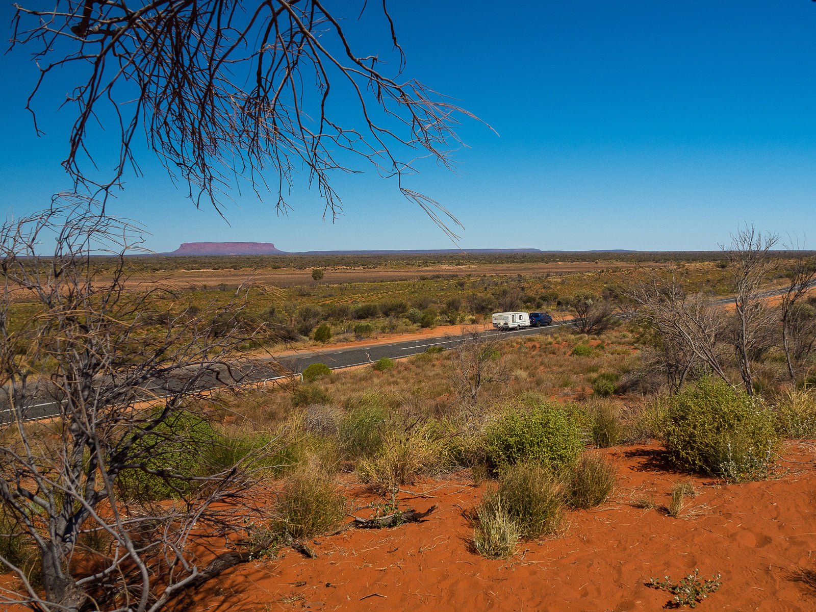
Around one and a half hour’s drive from Kings Canyon, Mount Conner — a.k.a. Fuluru — comes into view. The flat-topped monolith often fools passers-by into thinking they’ve spotted Australia’s most iconic rock, as it hovers a dusty pink in the distance against an otherwise flat landscape. Though it’s not the rock most people hit the highway for, it’s worth a photo stop.
Within another two hours, the real Uluru begins to intermittently pop up on the horizon, before ducking behind the hills and trees. As we drive closer to Yulara, the town that borders Uluru-Kata Tjuta National Park, the almost 350m-high rock becomes very much front and centre, and its true size becomes apparent when we do the 10km base walk. She’s big alright, and makes you feel like a bug sizing up a buffalo as you crick your neck to take in her complex patterns and textures.
The thing with Uluru is that there are so many angles to view it from, and the colour shifts from vibrant orange, to soft purple, to a moody mauve, depending on the time of day. So it’s worth gazing at the monolith on multiple occasions from multiple vantage points.
To watch the colours changing at sunset, we join the Sounds of Silence — an outdoor, white-tablecoth buffet dinner that begins with a drop-off at a viewing platform, where we enjoy bubbles and canapés as the sun drops, eventually casting a dark shadow over Uluru.
Along with the dinner, the darkness also comes to life at Bruce Munro’s Field of Light exhibition. The installation (which requires a pre-purchased ticket to visit) is made up of 50,000 stems of light — like neon flowers popping up in a field — set over 12 acres. It’s mesmerising to wander around as the lights slowly fade from pink into purple into red and into blue.
Flowers made of light are cool, but it’s hard to beat the sight of real flowers, particularly when they bloom en masse against a desert landscape, as we witnessed at Kata Tjuta (the Olgas), Uluru’s lesser-known but no less impressive sister, 40km west.
Kata Tjuta means ‘many heads’ in the Anangu language — fittingly describing the knobbly appearance of the 36 domes that protrude from the earth. While a viewing platform next to the main road provides an excellent landscape view, the best way to get up close to Kata Tjuta is to do the 7km Valley of the Winds walk. That’s where the wildflowers come in. As we traverse the sometimes steep and narrow path, we pass blankets of fluffy purple and white flowers, swaying in the breeze like pompoms on sticks. Backlit by the sun, they give the ancient landscape an ethereal feel, and, in some ways, the whole of the Red Centre feels like something otherworldly — jaw-droppingly beautiful, discernibly spiritual, and undeniably sacred. That’s why it shouldn’t be pushed to the end of the bucket list. The time to go is now.
FAST FACTS
- Need to Know: The full Red Centre Way loop includes the unsealed Mereenie Loop, which links the West MacDonnell Ranges to Kings Canyon. The road requires a permit from a visitor information centre or select accommodation providers, and you need to check if the road is suitable for caravans, as conditions regularly change. An alternative route requires backtracking to Alice Springs, and taking the sealed Stuart and Lasseter highways.
- Eat and Drink: If you eat anywhere in Alice Springs, make it celebrity chef Jimmy Shu’s South-east Asian restaurant, Hanuman. For beers, head to Alice Springs Brewing Co. At Uluru, a number of dining options are located within the Ayres Rock Resort precinct. Try Ilkari for a buffet feast or Gecko’s for something more casual.


