
Into the wilderness of Garig Gunak Barlu National Park, NT
Join Chris Whitelaw as he journeys through the untamed beauty of Garig Gunak Barlu National Park in West Arnhem Land.
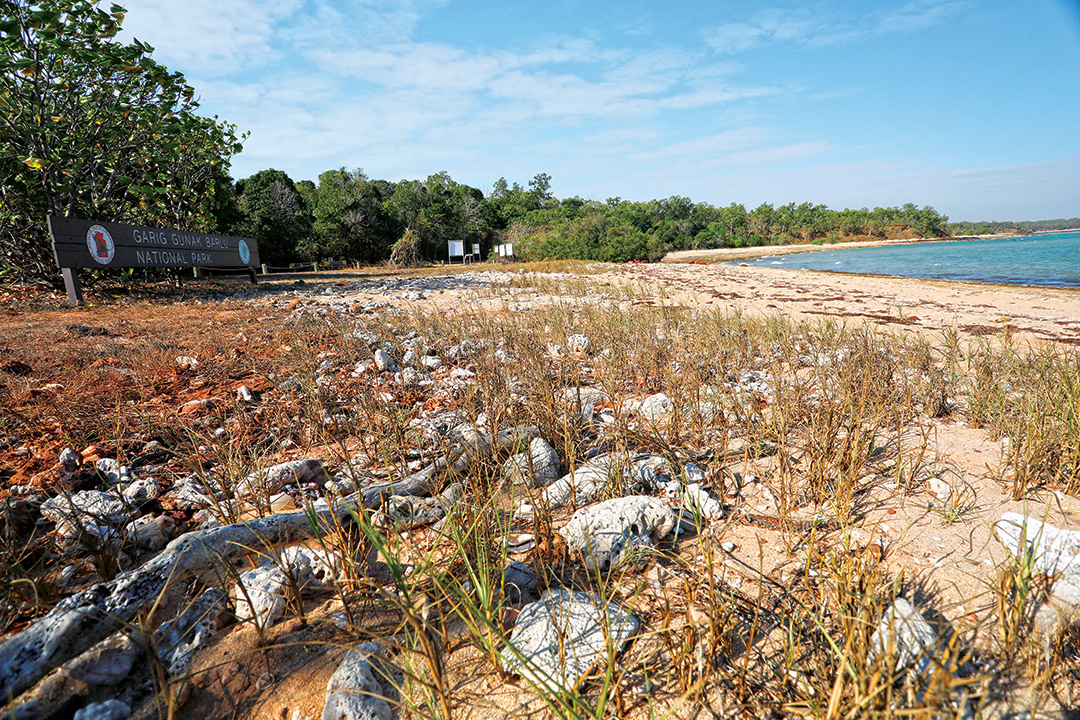
West Arnhem Land covers almost 50,000sq km, from the eastern border of Kakadu National Park and the East Alligator River to Cape Stewart and the catchments of the Liverpool, Mann, Cadell and Blyth Rivers. Though geographically part of Arnhem Land, the remote Cobourg Peninsula is conserved as the separate Garig Gunak Barlu National Park, administered by the Parks and Wildlife Commission of the Northern Territory.
Before the arrival of Europeans, the region was the home of many different tribal groups, including the Gagudju. Today, the main languages spoken are Kunwinjku in the west, around the town of Gunbalanya, and Kuninjku in the east toward the town of Maningrida. Although minor cultural differences distinguish the two groups, traditional beliefs remain important to both, with Ngalyod, the Rainbow Serpent, playing an important part in their art and traditions.
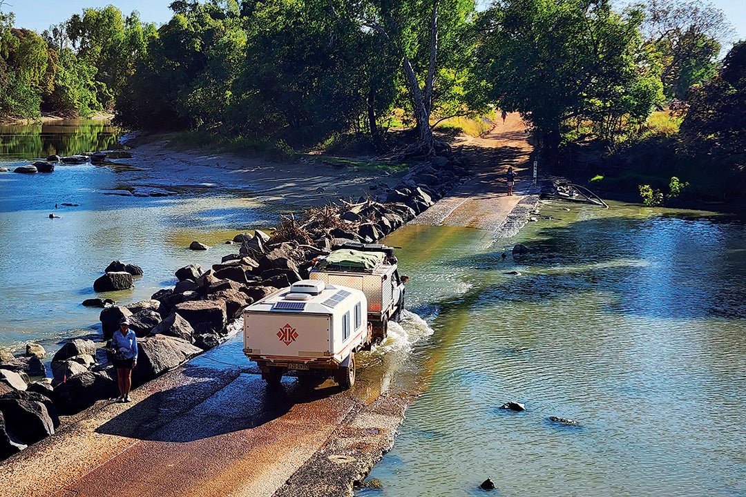
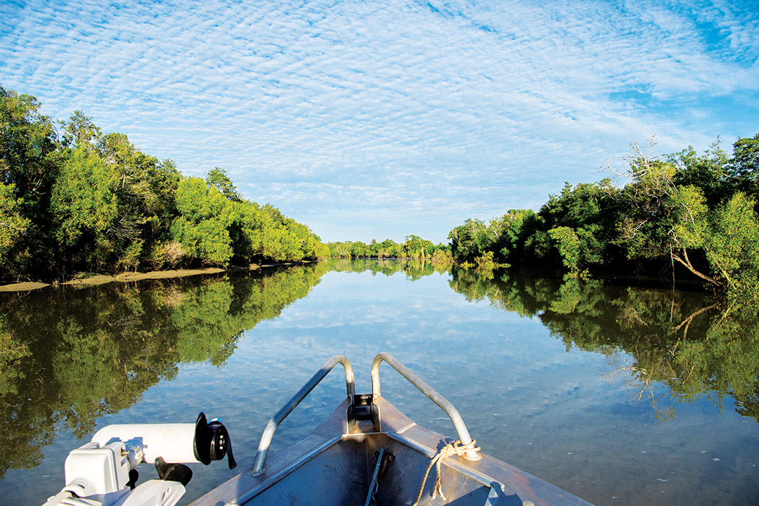
The national park can be accessed by road, air or sea. Overland road access is a journey of about 300km beginning at Cahills Crossing over the East Alligator River. The river can be a formidable obstacle at any time of the year — a swollen, brown torrent in the wet season and, in the dry season, a seven-metre tide makes the concrete causeway impassable until the river ebbs. For thousands of years before the arrival of Europeans, Aboriginal people crossed here on a major trade and communication route. The crossing now bears the name of Patrick ‘Paddy’ Cahill, one of the area’s early settlers.
Getting there
Beyond Cahills Crossing, the route first passes through 'Stone Country' (Kuwarddewardde), outliers of the Arnhem Plateau, with its ancient landscape of rugged sandstone terrain, deep plunging gorges and a forbidding escarpment that looms in the east over the surrounding lowlands. The black soil plains extending from the base of the escarpment are chequered with billabongs and swamps which form the headwaters of huge river systems. These provide habitats for a wide variety of fish, waterfowl and land animals that are game for traditional hunting and foraging still practised today.
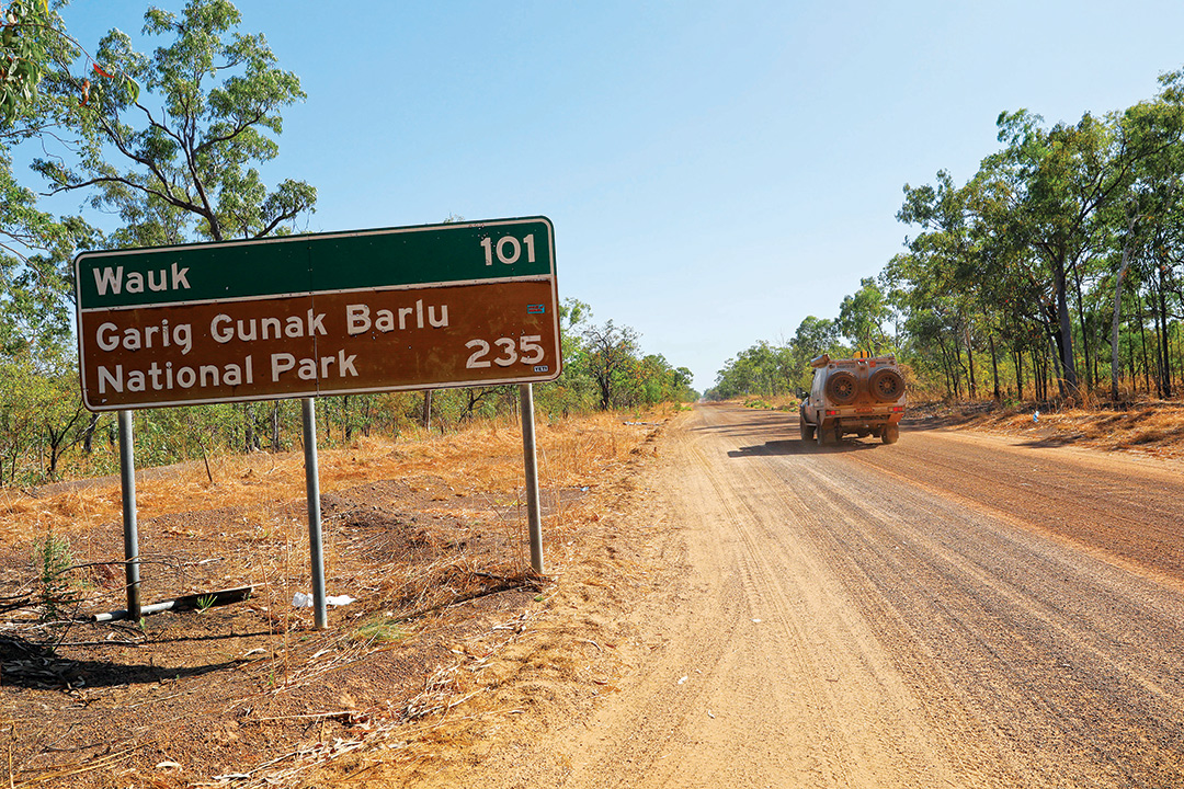
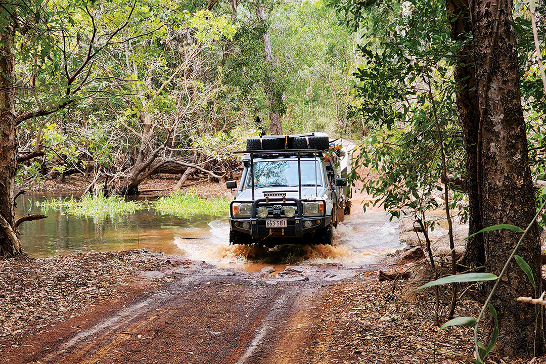
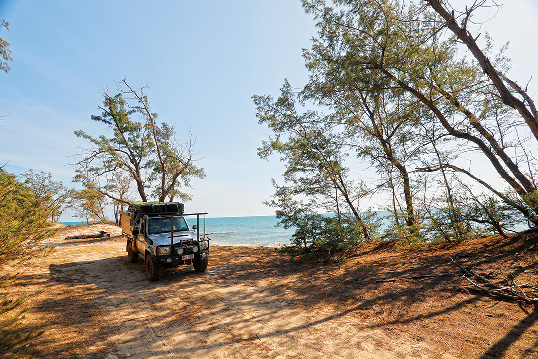
Only one road leads to the Black Point Ranger Station and camping area in the national park, via Mangardubu and Murgenella. It’s unsealed all the way, narrow, dusty and corrugated, with blind corners, dangerous bends and a couple of creek crossings. It’s only passable in the dry season. For this journey, high-clearance 4WD vehicles and offroad-capable trailers are highly recommended. Caravans are considered unsuitable. No fuel or mechanical services are available after Gunbalanya (near Cahill’s Crossing), so be sure to carry enough fuel for driving around the park and the return trip.
A private charter flight from Darwin will take about an hour to the airstrip at Black Point, but this is 2km from the campground and there is no public transport within the park. The peninsula is 150 nautical miles from Darwin, a voyage of about two sailing days. Scenic anchorages abound among the many coves and inlets. The best time to sail is between August and October when east to southeast winds prevail. Cyclones can occur between November and April.
Whatever your means of travel, you’ll need a special permit (Parks Pass) from NT Parks to visit the national park. These can be obtained online but allow up to two weeks for processing. This exclusive permit includes permission from the Northern Land Council to travel across the intervening Aboriginal land.
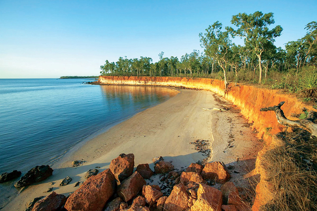
The national park encompasses the entire secluded Cobourg Peninsula at the remote western tip of Arnhem Land, about 220km northeast of Darwin as the crow flies. It was formed by joining the former Gurig National Park and the adjacent waters of the Cobourg Marine Park, now collectively spanning 4500sq km. Facing the Arafura Sea to the north and the Van Diemen Gulf in the south, the peninsula’s coastline is deeply indented by numerous coves and bays, interspersed with spectacular beaches, mangrove tidal flats and towering red cliffs. The hinterland is a spectacular wilderness of sand dunes and coastal grasslands, paperbark swamps and freshwater lagoons, eucalypt woodlands, pockets of lush monsoon rainforest and stands of distinctive Kentish palms.
Diverse ecosystems
This complex mosaic of wet and dry ecosystems provides habitats for the diverse and abundant wildlife — wallabies and wallaroos, bandicoots and bats, dingoes and possums, and more than 200 kinds of birds. The park is also home to the world’s largest wild herd of banteng, cattle that are endangered in their native Indonesia. Other rare imports include Timor ponies and Sambar deer, introduced by British settlers in the 1800s and still thriving today.
The sparkling turquoise waters surrounding the park teem with marine life. The marine park is a known hot spot for sponge diversity and 136 species of hard coral have been identified around the Peninsula. Thirty-five species of mangrove have been recorded in the park, restricted to narrow strips along the northern bays and creeks, with larger communities on the protected southern coastline. Rock oysters and mud crabs also thrive in the intertidal zones. The park’s abundant inshore seagrass beds support one of the most significant populations of dugong in the Territory, with numbers estimated to be in excess of 1000 animals. They also act as nursery areas for many species of fish, crustaceans and trepang.
Six species of marine turtle — green, flatback, olive ridley, loggerhead, leatherback and hawksbill — inhabit these waters. They breed mainly between May and October and nest on numerous beaches around the Peninsula. The offshore islands host rookeries for significant numbers of seabirds, such as crested and black-naped terns.
Some 465 kinds of fish are known to inhabit the park’s intertidal zone, inshore waters and reefs. Higher order predators including killer whales, small-toothed whales and dolphins (bottlenose, Indo-Pacific humpback, Irrawaddy and spinner) are common in the Arafura Sea, which is a major trawling ground for the Northern Prawn Fishery. Many dangerous creatures also inhabit these waters, including sharks, stingrays, saltwater crocodiles, sea snakes and box jellyfish, which make swimming a very risky pastime that is actively discouraged by park rangers.
Cultural heritage
The park lies within the clan estates of Iwaidja-speaking Aboriginal people — the Agalda, Madjunbalmi, Muran and Ngaindjagar — whose material and spiritual links to the peninsula’s land and sea date back more than 40,000 years. Today, the peninsula is virtually uninhabited, with a small population of approximately 30 living in five outstations along or close to the northern coast, at Araru Point, Adbinae (Trepang Bay), Gumuragi (Reef Point), Meriah (Raffles Bay) and Irgul Point. The park is jointly managed by a board consisting of local Aboriginal people and NT government representatives.
Macassan trepang fishermen visited the area regularly for 400 years until they were turned away by the South Australian government in the early 1900s. In 1818, Phillip Parker King explored the north coast, and his surveys determined the locations of later settlements attempted by the British in northern Australia: Fort Dundas, Fort Wellington and Victoria Settlement. He named the peninsula after Queen Victoria's uncle, Prince Leopold of Saxe-Coburg, and the bay Port Essington after his friend, Vice Admiral Sir William Essington.
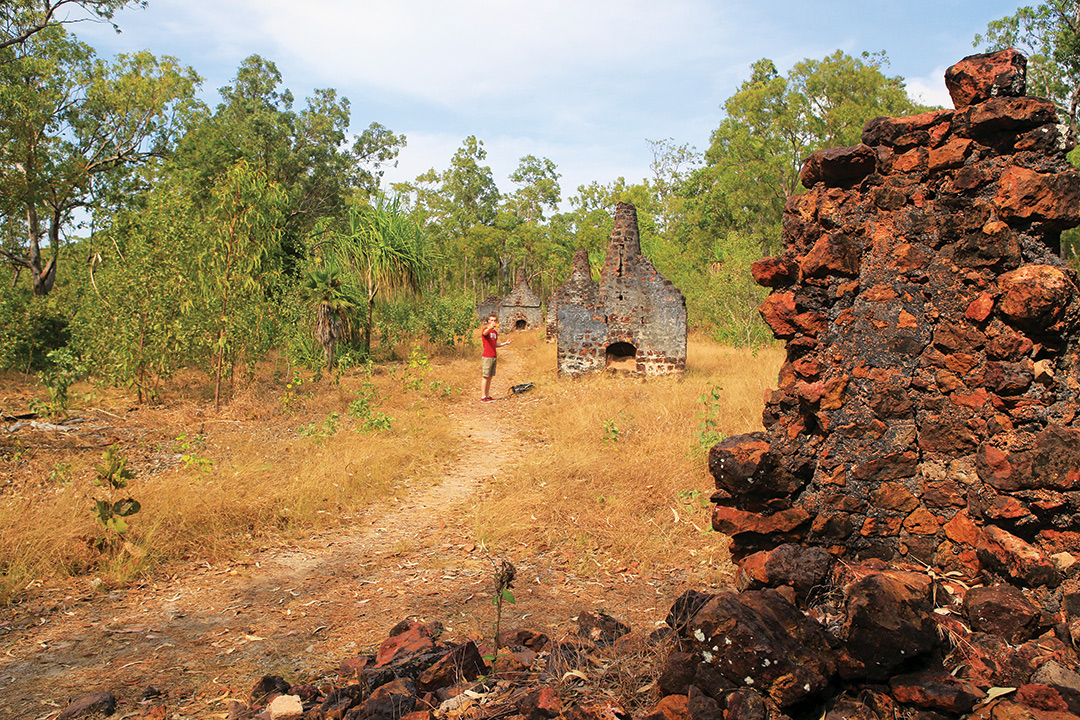
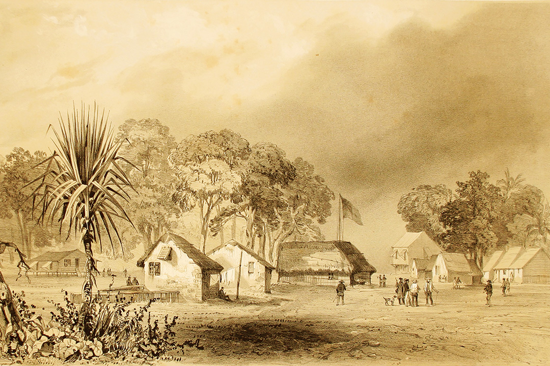
Fearing Dutch expansion in the East Indies, the British decided to establish military settlements along Australia’s northern coastline to secure its claim to sovereignty. The first attempt on Cobourg was made at Fort Wellington (Raffles Bay) in 1827, but it was a dismal failure and was abandoned after only two years. In 1838, a second settlement, Victoria Settlement, was established at Port Essington. It lasted 10 years before it finally succumbed to cyclones, tropical disease, lack of fresh water and supplies, and hostility from the local Aboriginal people. It was abandoned in 1849.
The stone ruins of the Victoria Settlement are accessible today only by a short (25km) boat ride from the Black Point ranger station, or on a commercial tour. Armed with a map produced by NT Parks, visitors can walk (3.7km / 2hr) around this eerie place that bears poignant testimony to the desperate hardships faced by the early colonists.
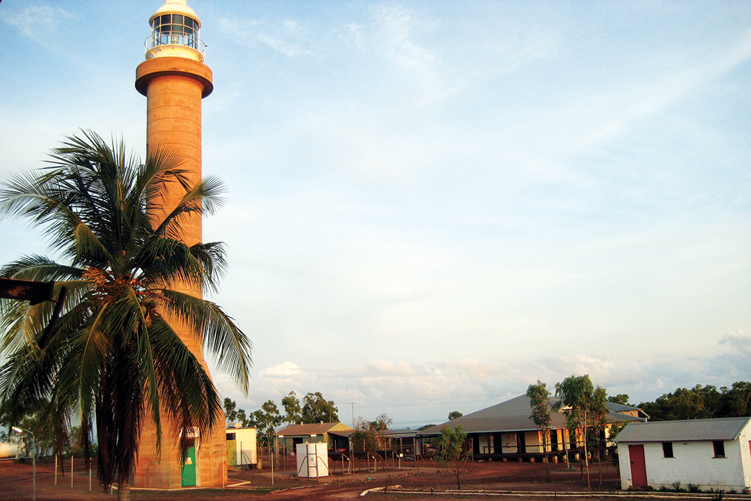
Long after Victoria Settlement was abandoned, the peninsula continued to be used by pearlers, trepang fishermen, pastoralists, salt gatherers, buffalo shooters and timber cutters. The only structure of historical significance that remains intact is the heritage-listed lighthouse at Cape Don on the extreme western tip of the peninsula. Constructed in 1917 to a height of 28m, the light served as a vital navigation aid to shipping through the Dundas Strait on the way to Darwin. It was automated and de-manned in 1983. The lighthouse complex is accessible by 4WD vehicles during the dry season, as well as by air and boat. Although the tower is closed to the public, the head lighthouse keeper's house is available for accommodation as part of the Cobourg Coastal Camp.
An adventurer’s playground
A wealth of recreational activities await visitors to the Garig Gunak Barlu National Park — scenic four-wheel driving, bushwalking, beachcombing, boating, fishing, bird watching and photography, not to mention a host of tour operators and safaris by commercial operators.
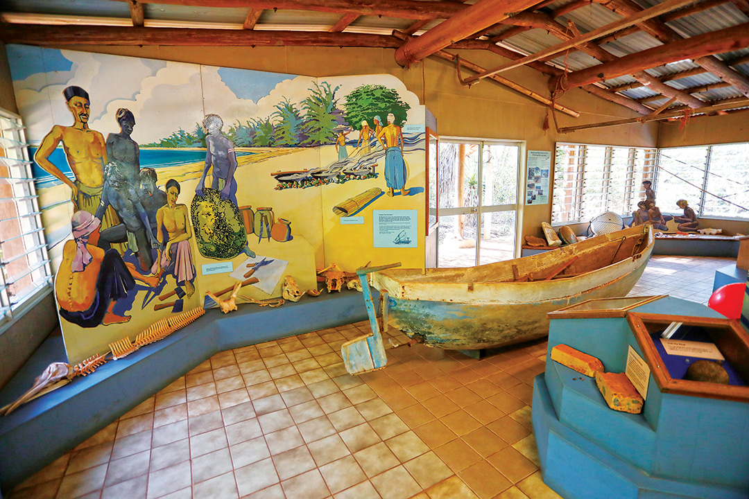
The Black Point Cultural Centre at the ranger station offers a unique insight into the park’s Aboriginal culture and rich history through displays, artefacts, maps and information panels.
Nearby, the shady Wetland Walk (1.5km / 1hr) encircles a small freshwater wetland and follows a sandy road to Smith Point where an old beacon, built by British marines in the 1830s, still stands. The walk along the beach in either direction is very enjoyable but keep an eye out for crocodiles.
The Cobourg Peninsula is considered to be one of the best locations in the Top End for world-class recreational and sport fishing. Coastal waters teem with Spanish mackerel, barracuda, giant trevally, queenfish, snapper, jewfish, coral trout and a variety of reef fish within a kilometre of shore. In the tidal creeks, estuaries and mangrove-lined billabongs barramundi, mangrove jack and threadfin salmon lie waiting for the serious angler. Launching and retrieval of boats is only permitted at the boat ramp at Black Point Ranger Station. Beach launching is not permitted; the jetty is unsafe and is closed. Based at Cobourg Coastal Camp, Cobourg Fishing Safaris offer fly in/fly out fishing packages and guided tours of Victoria Settlement.
Where to stay
Camping in the national park is only permitted in the two designated camping areas at Smith Point. There are no powered sites, but generators may be used in Campground 2. Facilities include showers, composting toilets, barbecues, tables and limited amounts of bore water. Camping fees apply.
There are beach huts for rent at Smith Point and tourist accommodation at Cape Don and Seven Spirit Bay Wilderness Lodge.
Cobourg Coastal Camp
In addition to the Cape Don Lighthouse accommodation, Cobourg Coastal Camp also offers eight tents on raised decks for a luxury safari-style camp. Communal facilities include a large open-air dining area, commercial-style kitchen, dining and lounge areas, and hot showers and toilets.
Contact details
For more information, permits and bookings, contact the following:
Black Point Culture Centre
P: 08 8999 4814
E: parkmanagement.pwcnt@nt.gov.au
Cobourg Coastal Camp
P: 08 8927 5500
Garig Gunak Barlu National Park
P: 08 8999 4555
NT parks pass
P: 08 8999 4555
E: parkmanagement.pwcnt@nt.gov.au
Seven Spirit Bay Wilderness Lodge
P: 1800 688 222
Venture North Safaris
P: 08 8927 5500
E: info@venturenorth.com.au
THE NEXT STEP
Are you ready to experience the freedom of the open road? Don't wait - Find your dream getaway now!
RELATED ARTICLES:
Where to go in outback Australia: Top 8 destinations


