Wilsons Promontory, Vic: The best things to see and do
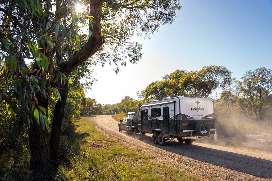
A favourite summer haunt for Victorians, Wilsons Promontory offers travellers the chance to visit the southernmost point of mainland Australia and explore secluded beaches, coastal wilderness and mountain trails.
The sky is angry. Saltwater spittle stings my face as the boat hurtles across a monochrome sea greyer than the brooding clouds. The skipper kills the engine, and we drift alongside a granite boulder field extending across the ocean like a natural causeway to nowhere. About 12,000 years ago, this granite shelf was the start of a land bridge to Tasmania. Today, there’s nothing beyond it but the cold, treacherous waters of Bass Strait.
If you’ve ever stood at the tip of Cape York in Qld, at Steep Point or Cape Byron (on the western and easternmost extremities of Australia), this is another one for your bucket list. South Point, the nondescript big toe on the windswept shores of Victoria’s Wilsons Promontory, is the southernmost point of mainland Australia. To get here, you can either hoof it 19km on an overland trail or take the easy route and visit by boat. Cruises with Pennicott Wilderness Journeys (promcruises.com.au) not only save you a hefty hike, but also provide an ocean-side window into Victoria’s oldest national park, also home to the state’s largest marine park.
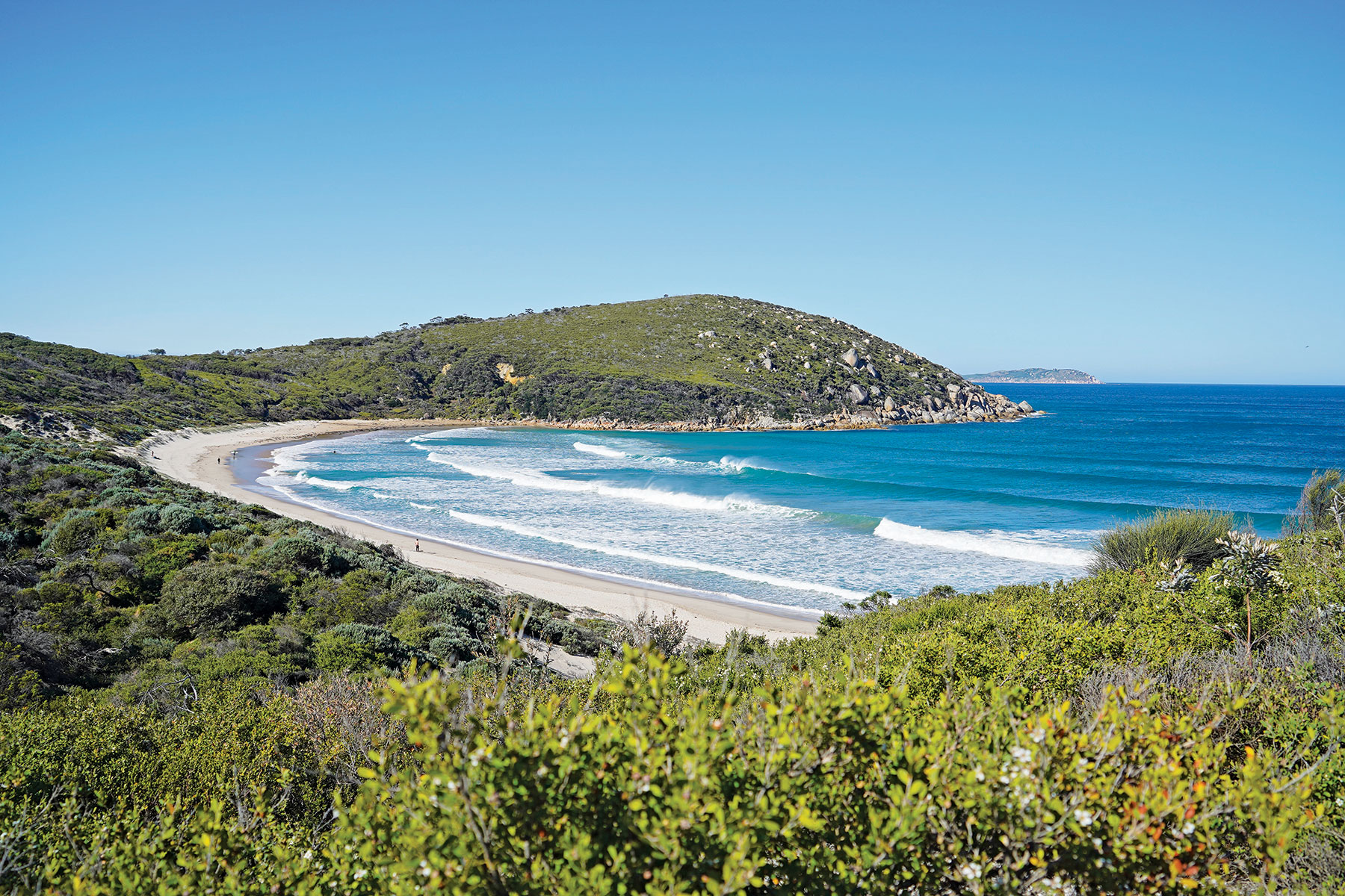
Wilsons Promontory National Park (Yiruk/Wamoon) dangles like a beehive off the coast of South Gippsland, connected to the mainland by a sandy isthmus. The 50,000ha park, about 210km southeast of Melbourne, is a wilderness colossus, beloved for its glinting white-sand beaches, rouged granite boulders and craggy peaks. It’s landscapes — heathland, wetlands, sand drifts and eucalypt forests — are furrowed with walking trails that have made the Prom a favourite holiday destination for Melburnians for generations. Yet, despite its magnetism to a whole gamut of bushwalkers, surfers, boaters, naturalists and photographers, the Prom remains remarkably undeveloped. There’s only one road in and one main campground, which is at Tidal River, sandwiched between the river and the 1.6km swathe of Norman Beach and lorded over by the lofty summit of Mount Oberon.
Back in time
Wilsons Promontory is the Traditional Land of the Boon Wurrung, Bunurong and Gunaikurnai Peoples, who first inhabited the area more than 6000 years ago, drawn to its abundant natural resources. When Europeans arrived, the land and sea were pillaged — for seals, whales, timber, tin and grazing. In the 1880s, early field naturalists started campaigning for the Prom to become a national park, and by the turn of the century the first nature reserves were declared. Battered by bushfires and floods in recent years, the Prom remains an enduring natural wilderness, preserved in the vision of those early eco-warriors as a ‘summer haunt of lovers of nature and scenery’.
The Prom also has wartime significance. In WWII, this remote coastal pocket was used as a top-secret training facility for thousands of Australian and New Zealand elite commandos in preparation for covert missions in the Pacific islands. There’s a memorial honouring their service at the entrance to the Tidal River Campground.
Of sand and summits
The Prom is a paradise of paradoxes. A place where pristine beaches invite lazy days, yet the rugged mountains beckon you to lace up your hiking boots. Some of the best beaches are easily accessed on foot, so you can get idle and active on the one excursion. There are more than 30 marked walking trails, many starting at the campground. In summer, aim to set out early in the day, then you can plonk on the beach in the afternoon, when the shallow river and broad foreshore morph into a riot of kayaks, Eskies, beach cricket and neoprene-clad kids. The river is much warmer than the sea and watching teenagers leap off the footbridge from behind the pages of a good book is one of the best ways to round out the day.
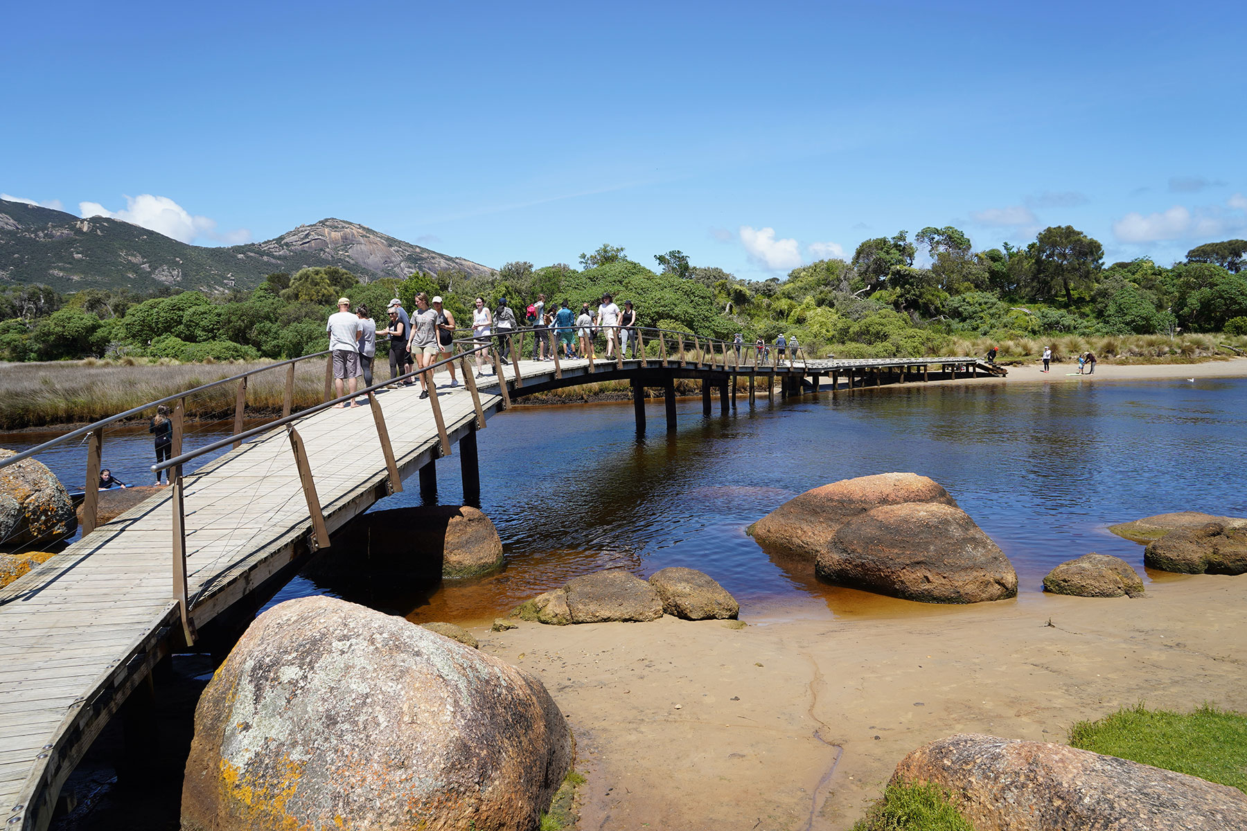
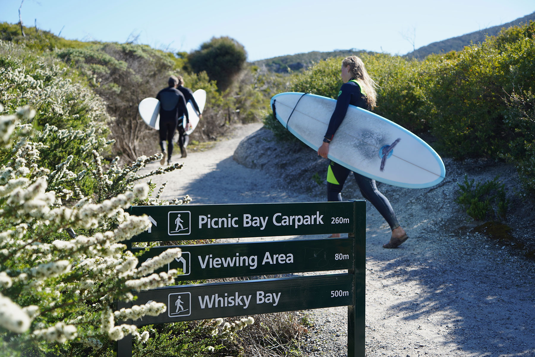
The footbridge is also the starting point for various coastal walks, ranging from the gentle 1km Loo-Errn Track along a boardwalk skirting the river’s southern banks, to the 12.4km return Three Bays Walk, connecting the park’s spectacular trio of western inlets — Squeaky Beach, Picnic Bay and Whisky Bay. This walk can be completed one way with a car shuffle at Whisky Bay (allow two hours) or in sections as there is a carpark at each beach. Squeaky Beach (4.2km return) is one of the Prom’s most popular walks and suitable for kids. We tackle it with our five-year-old in tow, who can achieve remarkable distances with a bag of lolly snakes for encouragement. Crossing the footbridge, the trail traces the river towards the sea, climbing high on the headland before peeling right and descending through exposed heathland to Leonard Bay, bookended by voluptuous granite boulders. We take the 700m (one way) detour to Pillar Point and scramble up the giant granite rock face for panoramic views across Norman and Leonard bays and out to the Glennie Islands. At Squeaky Beach — the Prom’s most photographed swathe of sand — we make music as we walk thanks to the rounded grains of quartz sand that squeak underfoot. If you want a beach without crowds, take the 8.2km return trail from Tidal River east over Norman Point to Little Oberon Bay (closed for repairs during our visit).
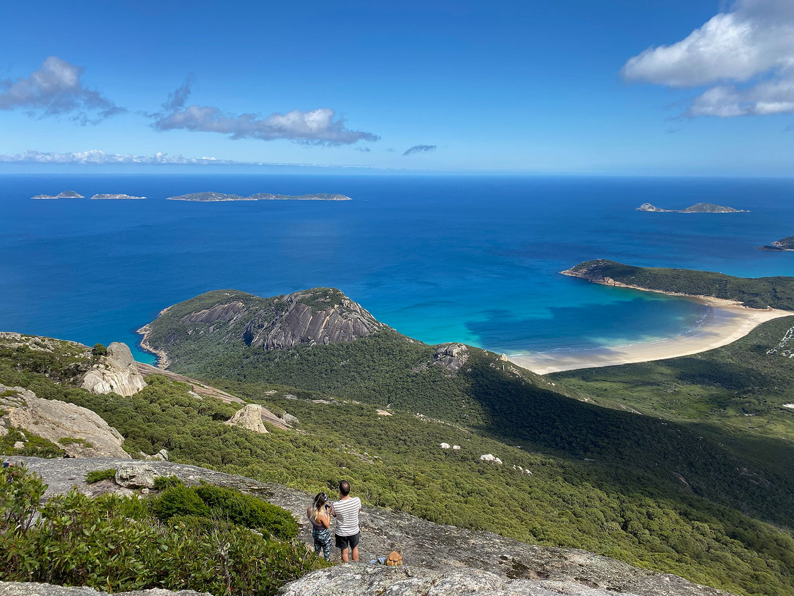
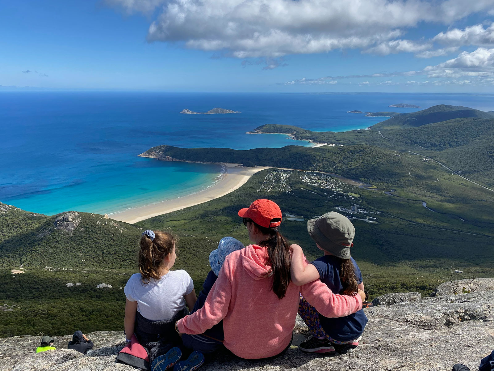
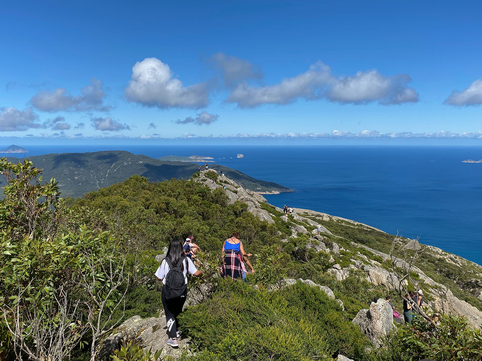
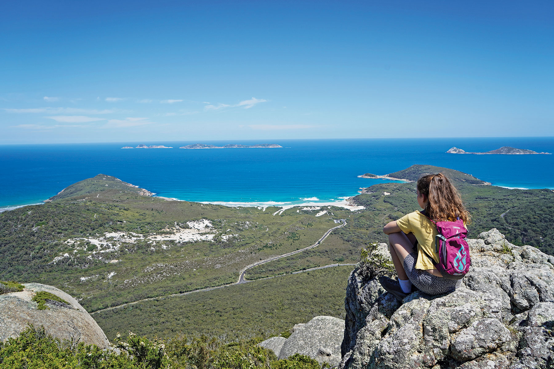
For a more strenuous walk, tackle Mount Oberon — one of the park’s highest peaks at 558m. The 6.8km return trek starts at the Telegraph Saddle Carpark, 4km east of Tidal River, and winds up a vehicle access road, past soaring eucalypts and tree ferns. The gravel path is wide and steep but reasonably easy-going (friends have done it with a pram) until you reach the communications towers, then the final push is up over rocky, uneven steps and stairs. At the top enjoy 360-degree views extending from the inland forested peaks to the sapphire-jewelled curves of the coastline.
Mount Oberon is something of a trophy walk and everyone of able fitness should do it, however I prefer Mount Bishop (319m). It’s not as tall as Oberon but the vistas over the Tidal River valley and bays are comparable and the walk itself is much more enjoyable. You can drive to Lilly Pilly Gully Carpark and start the 7.4km return trail there, but we opt for the scenic Lilly Pilly Link Track (1km), which starts at the campground and wends above the northern banks of Tidal River. The summit walk climbs through temperate rainforest thick with stringybark, tree ferns and grass trees, across trickling gullies and past moss-sheathed boulders, as whip birds add to the chorus of panting hikers. A couple of hundred metres from the summit, a rock platform the size of a helipad forms a clearing, offering an eye-popping outlook to Mount Oberon. The jury is out whether this view is better than the summit.
Cruise views
Watching the procession of bright-yellow amphibious boats clamber along the sand to their launch on Norman Beach is a twice-daily spectacle in summer. For non-boaters, a cruise with Pennicott Wilderness Journeys is the only way to get out on the water, see seal colonies and explore some of the Prom’s 13 islands. Be prepared for all weather conditions, even on a warm summer’s day, and do take advantage of the supplied full-length, red hooded raincoats, even if they have you looking like an extra from The Handmaid’s Tale. When we set off — propelled into the water by big retractable wheels — it’s a warm, blue-sky day. We motor south, tracing the craggy coastline past Oberon and Little Oberon bays. The white sand coves and topaz sea have a whiff of the Mediterranean. A bait ball of feverishly schooling fish shimmers like a disco ball beneath the water’s surface. We idle at Sea Eagle Bay and skipper Sam points out a giant nest atop a towering granite pillar. The nest has been there for half a century, he says, outliving the white-bellied sea eagles that first built it.
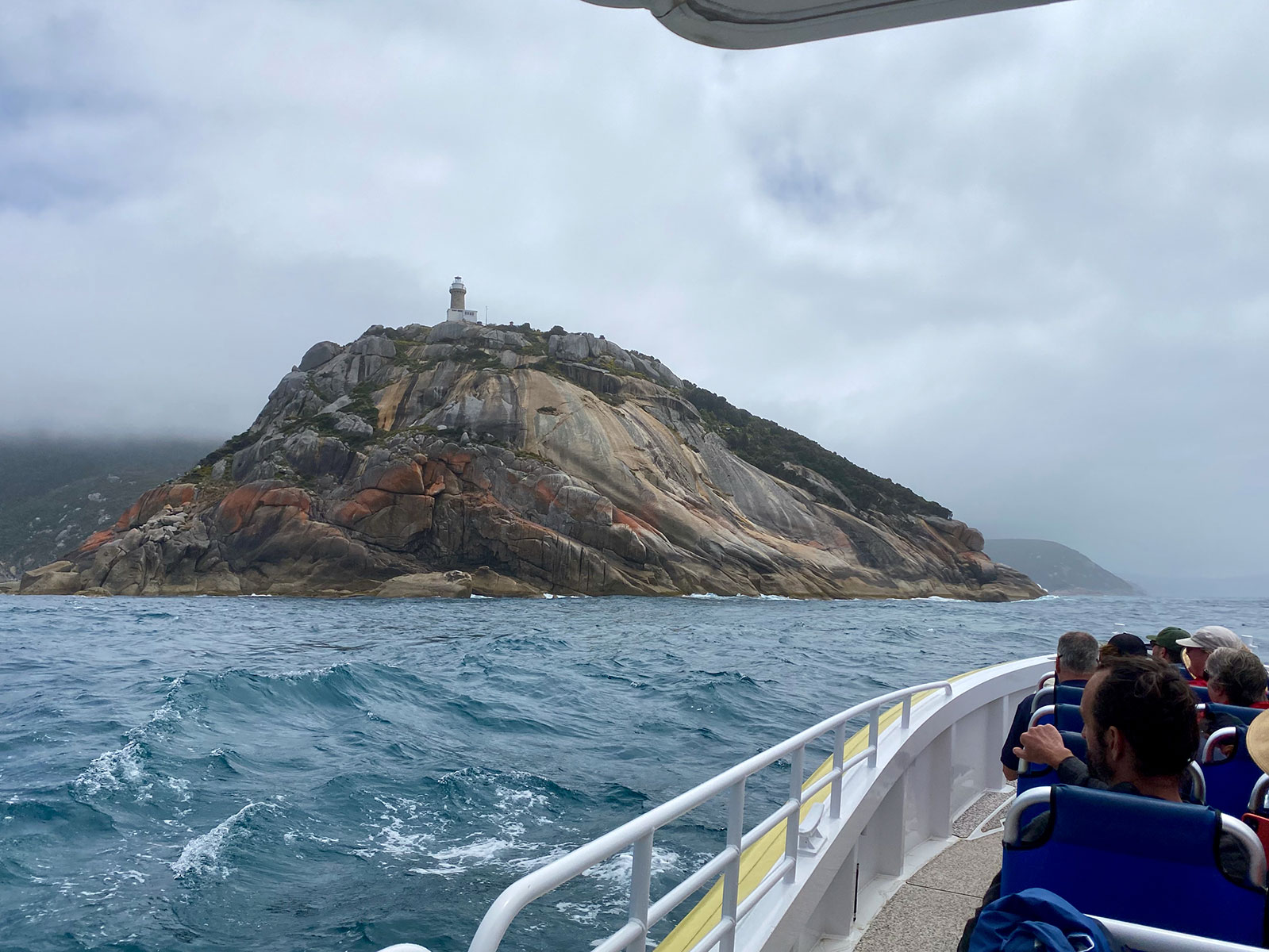
As we draw further south towards South Point, the weather turns. A pall of menacing clouds pins the boat between a slate sea. Fortunately, the wind is mild and we’re able to round the granite bluff and sidle up to Wilsons Promontory Lightstation, built with convict labour in 1859 and the southernmost settlement on the Australian mainland. Cut into the cliff are the remnants of a winch and stairs where ships delivered six monthly supplies. A black faced cormorant wheels overhead and a lone seal lolls in the water. There’s plenty more to come.
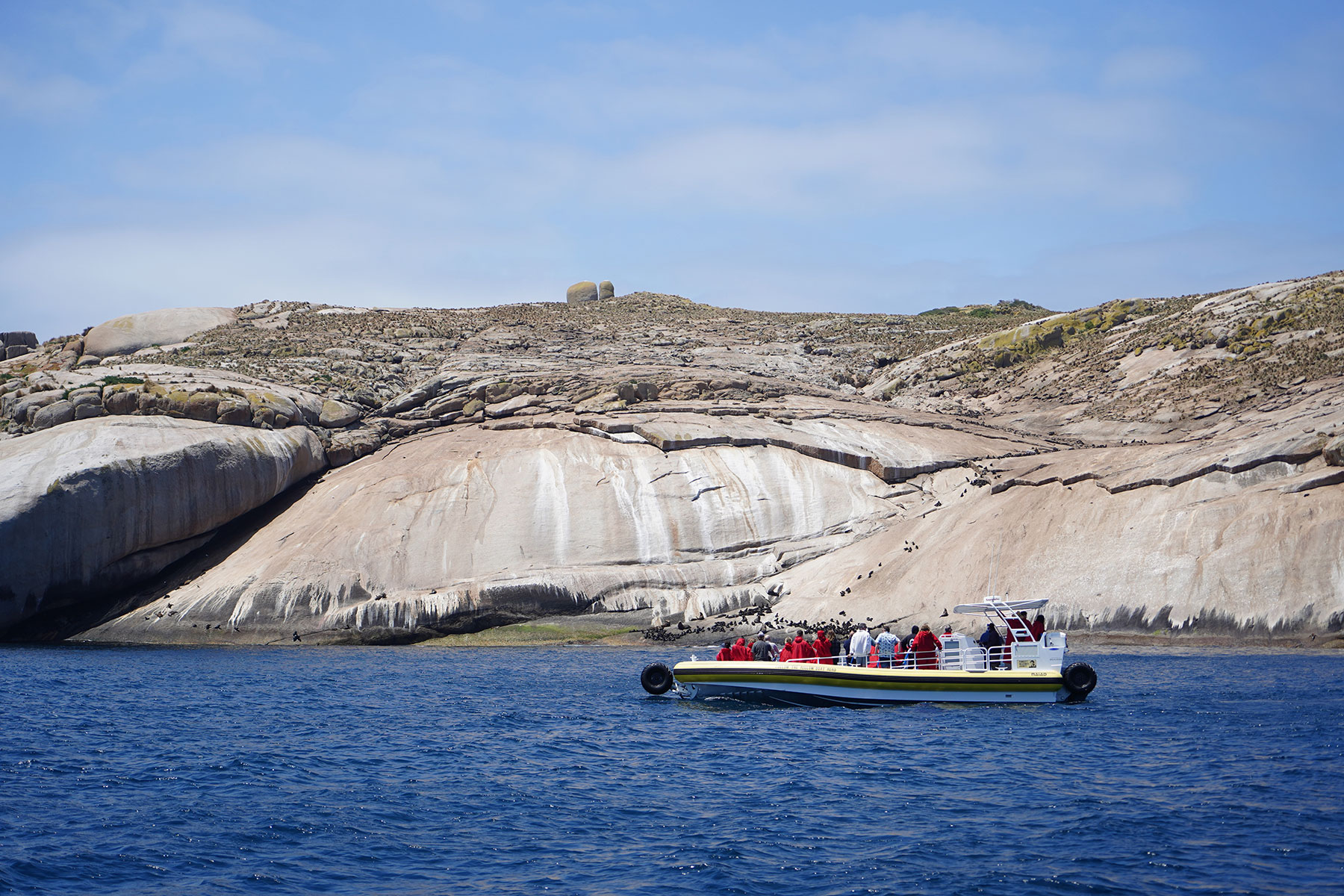
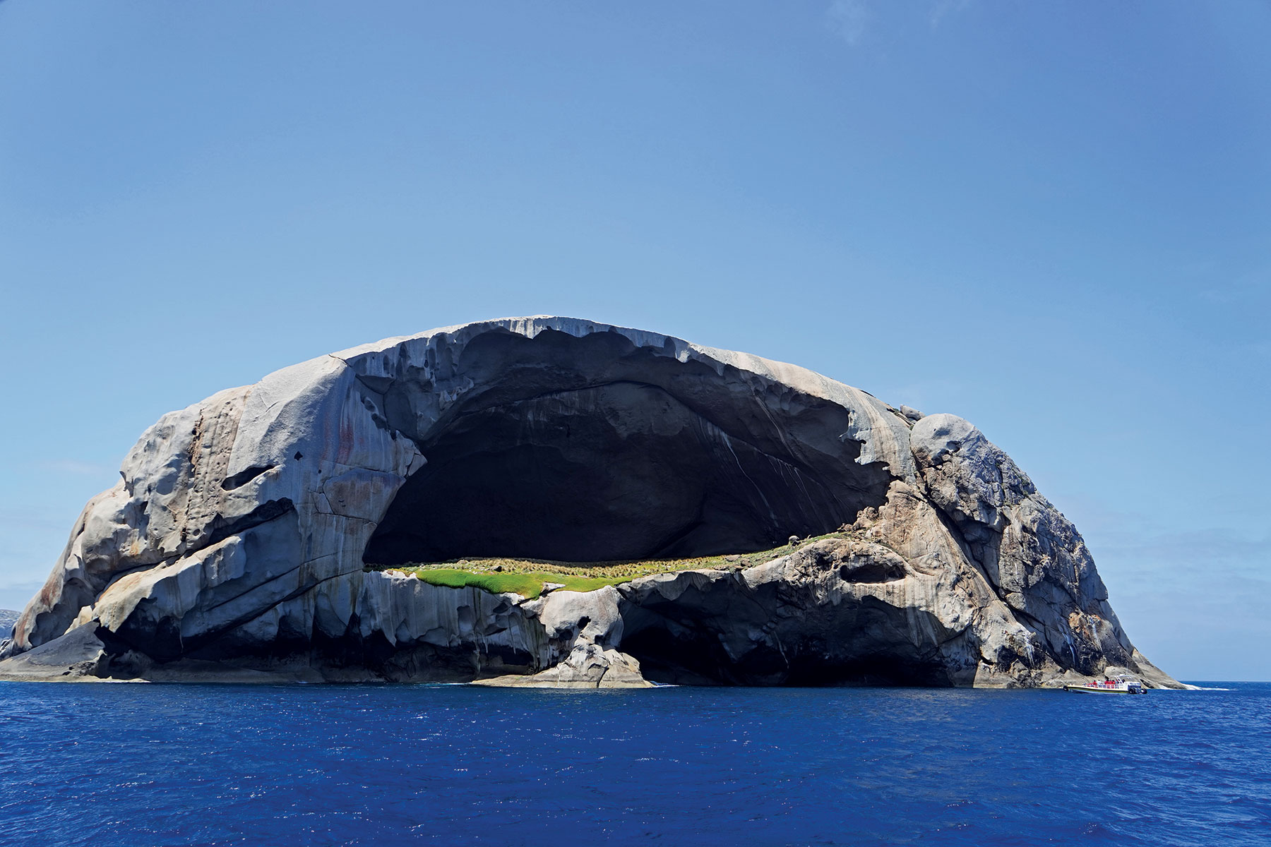
The boat retreats north, back towards Tidal River, the clouds evaporate and we’re back in blazing sunshine and on the lookout for seals. Some 9,000 Australian fur seals live at the Prom, sharing the offshore islands with little penguins, fairy prions and silver and Pacific gulls. I smell the seals before I see them. A pungent stench betrays a colony basking on a scrap of boulders in the water. The highlight of the cruise comes when we approach Skull Rock, an almost cartoonish monolith rearing out of the ocean, with a hollowed-out grassy amphitheatre yawning at its centre. The boat bobs in the island’s shadows as playful seal pups dart and pirouette through the water – so clear you can make out their impish white faces beneath the surface. Soon it’s time to motor back to Norman Beach and rumble back up onto the sand. But I’m not yet ready to leave.
Fast facts
Stay
Unless you’re hiking overnight, there’s only one place to stay in the heart of Wilsons Prom and that’s the Tidal River Campground. The sprawling Parks Victoria-managed park has 484 sites divided between two sections — riverside and beach facing. Only 20 sites are powered, but the best ones are unpowered. (Cabins are available for non-camping friends and family.) There are plenty of water taps to refill your tanks and sullage traps for disposing of grey water, and there’s even a charging station for 240V devices. Book here.
Food and activities
If you fancy a night off the pans, the Prom Takeaway sells fish and chips, burgers, ice-creams, wraps and salads, while the adjoining Tidal River General Store stocks the essentials, souvenirs and camping supplies. Book a seat at the open-air cinema in summer and take advantage of free ranger-guided walks and activities during school holidays.
Need to know
The nearest fuel is at Yanakie, 37km west of Tidal River, so come prepared. During peak periods, including summer school holidays and long weekends, the road to Telegraph Saddle carpark (starting point for the Mount Oberon Track) is closed. Free shuttle buses instead ferry hikers to and from the campground. Beware of the wombats. They are extremely friendly, and I have seen them tear through canvas to get at food!
Head here for more information about Wilsons Prom.
THE NEXT STEP
Are you ready to experience the freedom of the open road? Don't wait - Find your dream getaway now!