
Travel to East Gippsland Region

Metung to Marlo
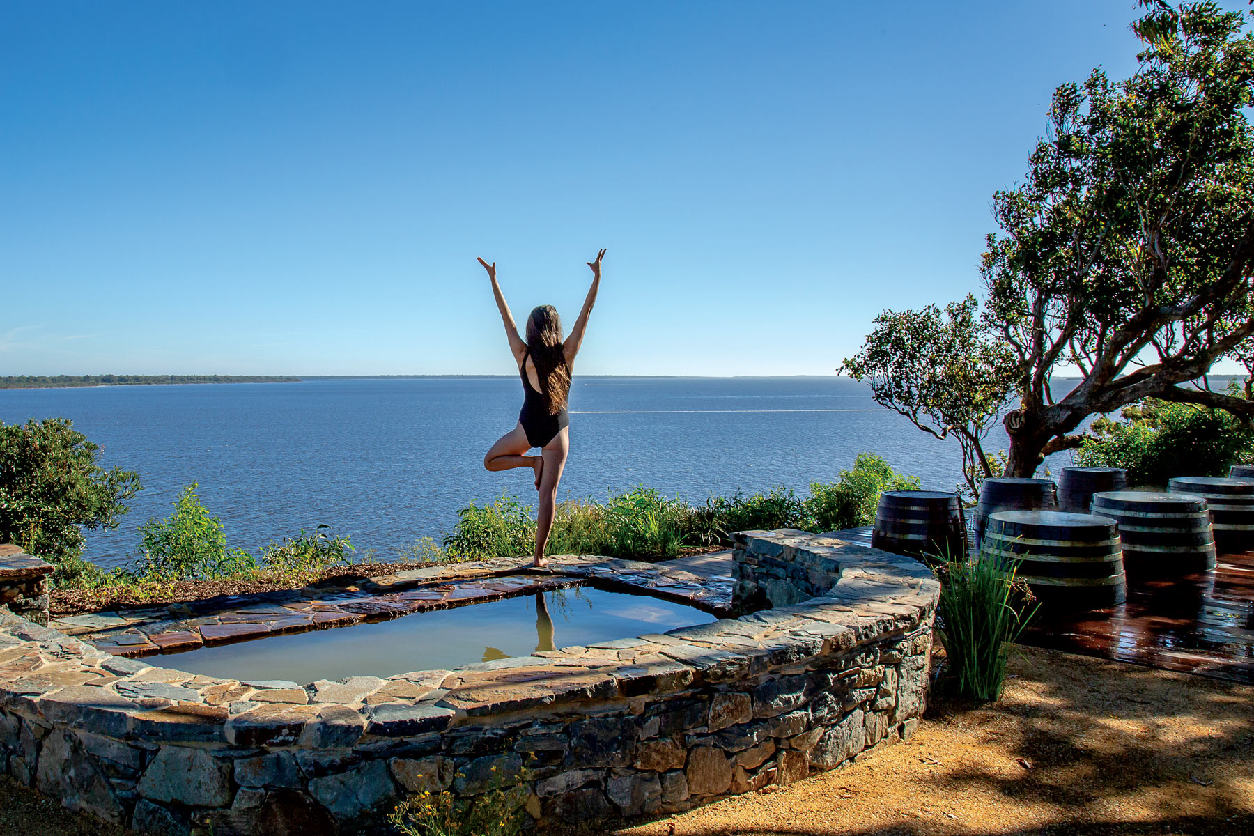
In the 1970s, Metung became the home of Victoria’s first hot springs bathing experience, which locals called the Hot Pools. The public pools, which closed in 1996, were fed by a 500m deep bore originally drilled for oil in the 1920s, which produced geothermal mineral water at a balmy 45°C.
The warm waters will be flowing again soon in this upmarket village, 313km east of Melbourne, with the development of Metung Hot Springs, due to open to the public in spring. The team behind the Peninsula Hot Springs has joined forces with locals Rachel and Adrian Bromage to develop the $100 million springs, which feature glorious views of tranquil Lake King.
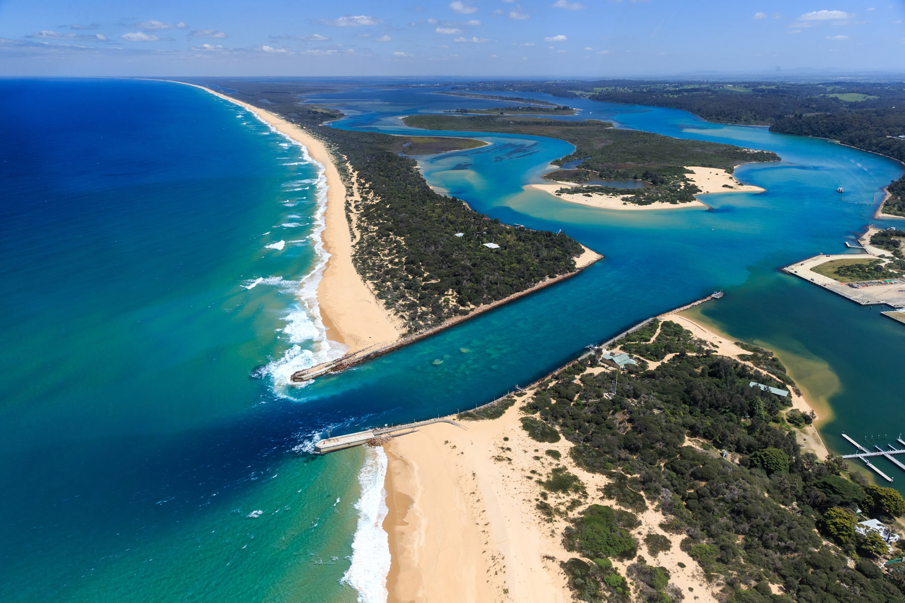
Lake King is one of three main lakes – along with Lake Victoria and Lake Wellington – that form the Gippsland Lakes, a network of lakes, marshes and lagoons covering more than 600sq km that make up Australia’s largest and most beautiful inland waterways.
Surrounded on three sides by water, Metung is the showpiece town of the lakes, a coastal town of million-dollar houses and boat jetties clustered with pleasure craft.
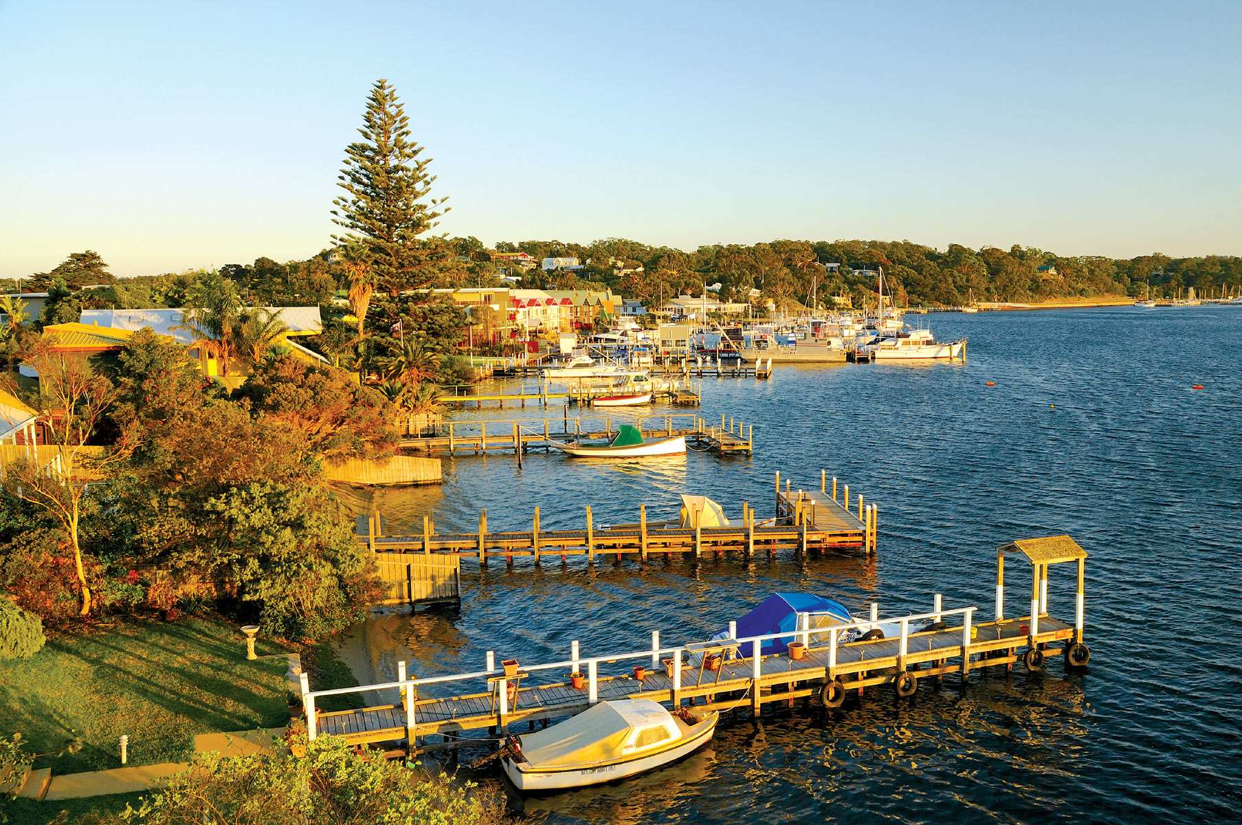
Known as Rosherville back in the days when it was a popular holiday spot for Gippsland’s gentry and well-heeled Melburnians, who travelled to Sale by train and then steamer to Metung, the town is situated on the shores of Bancroft’s Bay.
The Rosherville Hotel was built in 1870, and has been Metung’s epicentre ever since. Today the Metung Hotel sits on the same prominent site on the water’s edge.
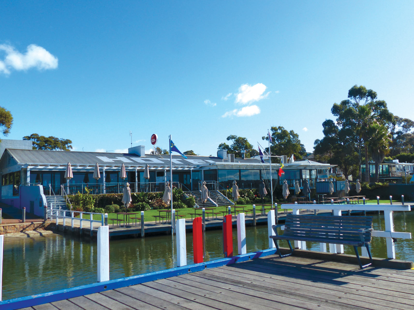
Locals and visitors amble into town along wooden boardwalks while watching pelicans catching their prey, before retiring to the Metung Hotel to dine on anything from contemporary fusion cuisine to traditional pub classics.
Some may recall the days when Metung featured a caravan park. But land here became so expensive it was no longer viable, and caravanners now stay at nearby Swan Reach, which has two parks. Swan Reach is just 9km north of Metung, an easy drive for a wallow at Metung Hot Springs, which will feature seven hot springs pools, two cold plunge pools, geothermal showers, and relaxation lounges.
It’s a 20km drive north of Metung to busier Lakes Entrance, which has been unashamedly geared towards tourism since holidaymakers called it by its original name, Cunninghame, in the 1870s.
By the dawn of the 20th century the town, situated at the entrance to the Gippsland Lakes and the northern end of Victoria’s magnificent Ninety Mile Beach, boasted many guest houses catering to holidaymakers. These days there’s no end of motels, apartments and caravan and camping parks to choose from in the town, renamed Lakes Entrance in 1915.
Lakes Entrance is home to one of Australia’s largest commercial fishing fleets, and is a good place to stock up on fresh seafood, sold straight from fishing boats.
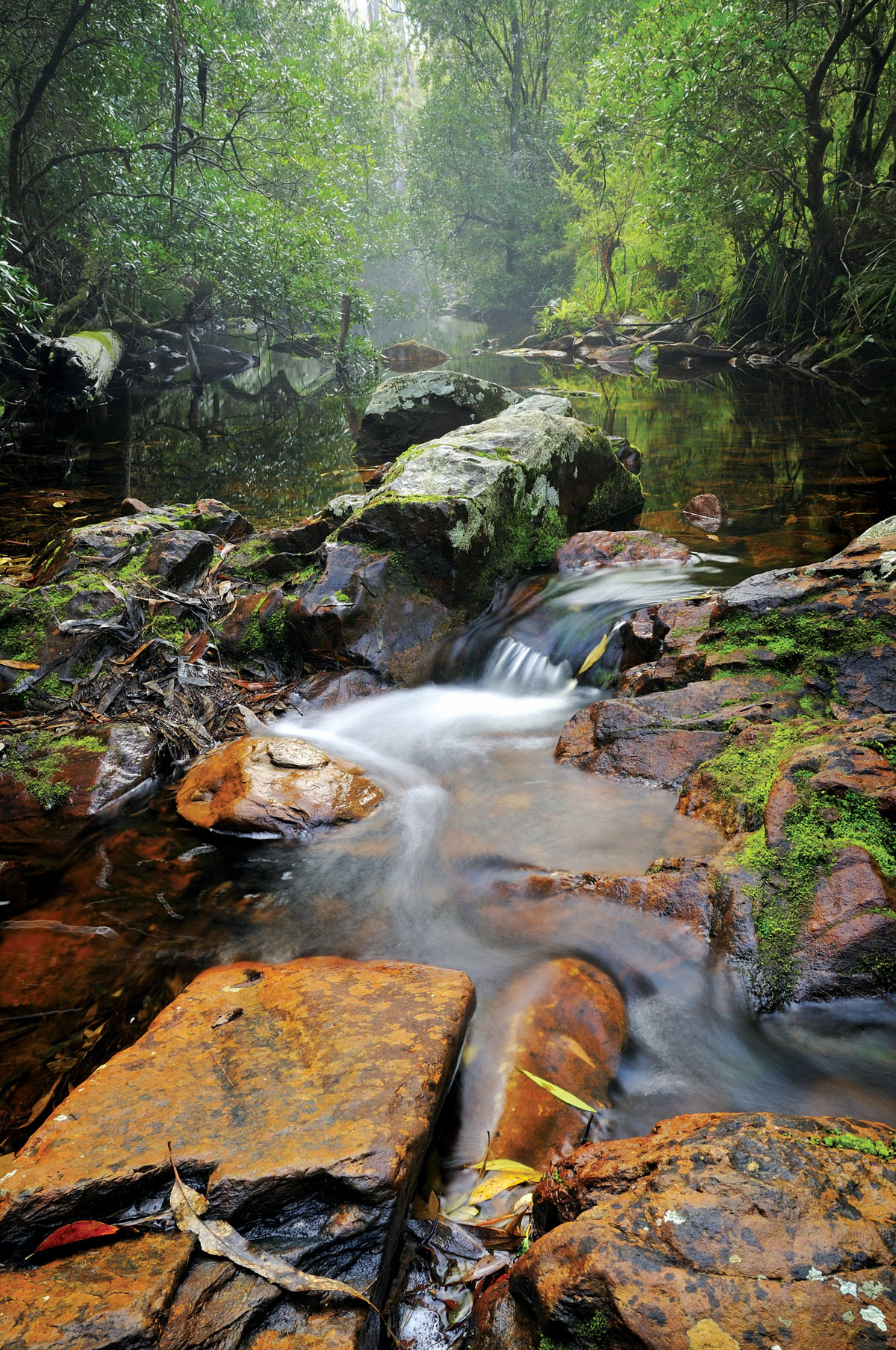
From Lakes Entrance it’s 46km north to Lake Tyers, driving through countryside that is surprisingly verdant in autumn, following the hot summer months. Lake Tyers is confusingly made up of the lake itself, the small town of Lake Tyers Beach, and the Aboriginal Trust land known as Bung Yardna, which is not accessible to the general public.
Originally the land of the Gunaikurnai people, Bung Yardna became home to Aborigines from across Victoria who were forcibly removed from their homelands during the 1800s. This region contains many Aboriginal sites, including shell middens, scarred trees, occupation sites, burials and axe-grinding grooves. The Bataluk Cultural Trail follows traditional routes used by the Gunaikurnai for more than 30,000 years, extending from Sale through Mitchell River National Park to Cape Conran.
The Lake Tyers State Park, which covers 7,100ha, extends from Lake Tyers Beach to Mount Nowa. Tall eucalypt forests surround the northern shores of the lake, and a sand spit divides placid lake waters from the pounding waters of Bass Strait.
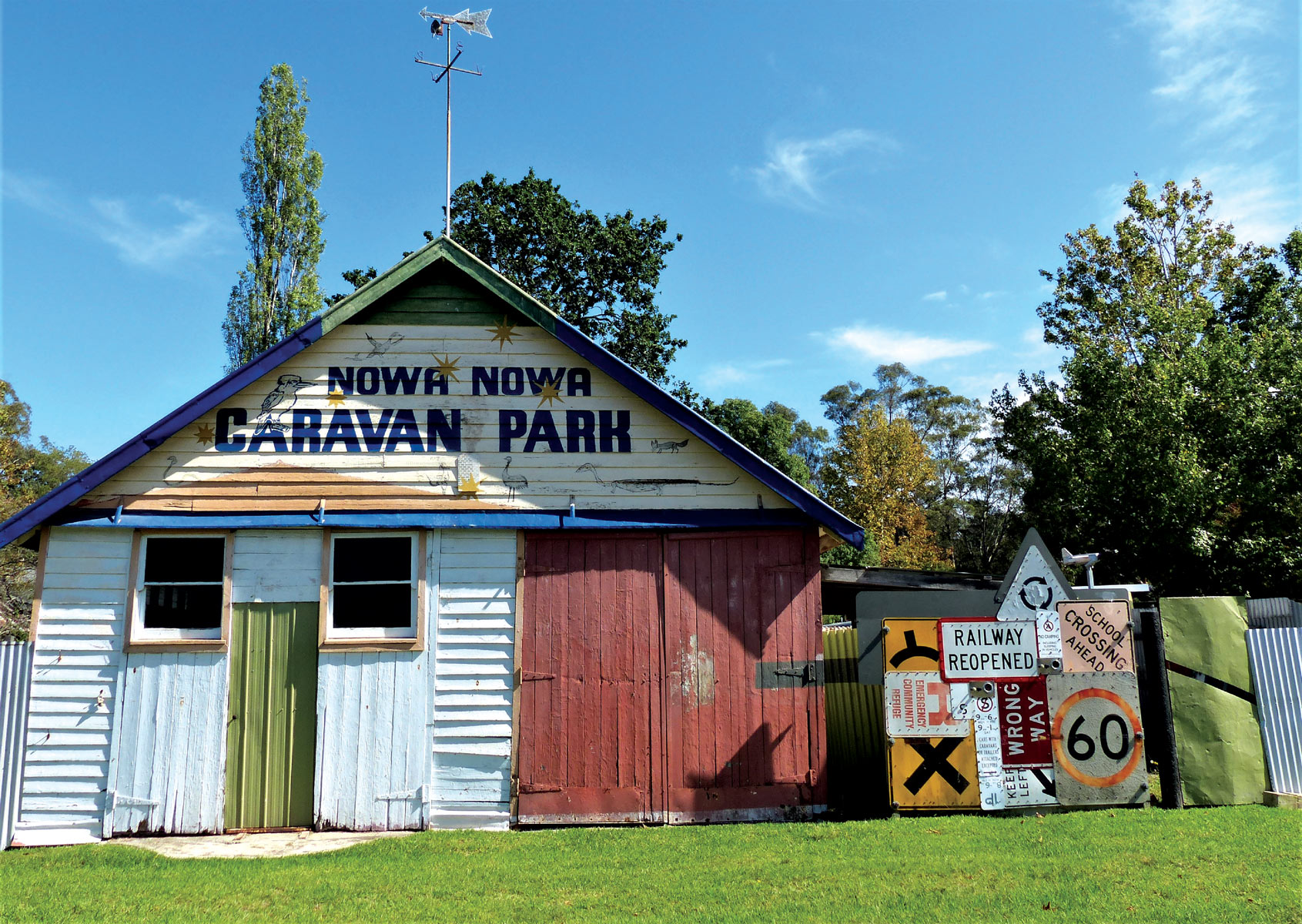
From Lake Tyers it’s 20km north by road to Nowa Nowa, an historic timber town that is now home to several art galleries and a funky caravan park. A network of hiking trails at Nowa Nowa include the 1.2km Sculpture Walk; 1.4km Boggy Creek Walk, and 4.3km Rail Ramble on part of the East Gippsland Rail Trail, which takes you to an old trestle bridge.
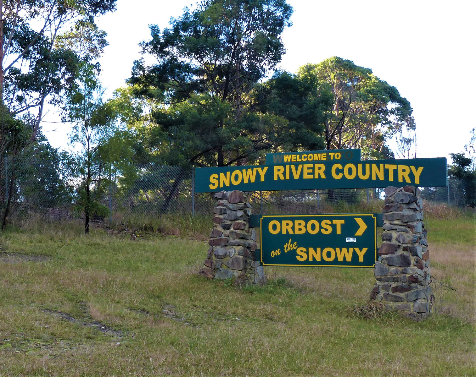
Orbost, 40km east of Nowa Nowa, is a small town with a big history: situated on the legendary Snowy River, the area around Orbost was settled in the 1840s, and the town from the 1870s. This bustling country town has a rich history of riverboats and steamers, gold, agriculture and timber milling, and is ideal for a pitstop. Orbost features several historic buildings, some cheery cafes, a couple of bakeries, a butcher, two pubs, and two supermarkets.
The Snowy River starts as an icy mountain stream on the slopes of Mount Kosciuszko in NSW, flowing northwards before swinging south into Victoria and entering the sea at the sleepy seaside town of Marlo, 500km from its source.
Marlo, 15km downstream from Orbost, boasts sheltered waters ideal for river, estuary, lake and ocean fishing, where anglers reel in mullet, silver trevally, flathead and bream. Fisherfolk cast a line at the town’s jetty, where the sunsets are simply spectacular, as they are from the deck of the Marlo Hotel.
The Marlo Hotel has been an institution in these remote parts since it was established in 1886, when the town was busy with steamers and schooners ferrying agricultural produce between Orbost and Melbourne. Perched on a hill overlooking the silvery Snowy River estuary, this venerable tavern features wide verandas where alfresco dining includes local beef and seafood. On the menu may be Lakes Entrance scallops, Pambula oysters, big local steaks, and the piece de resistance – a rich seafood chowder of local prawns, scallops, mussels and calamari.
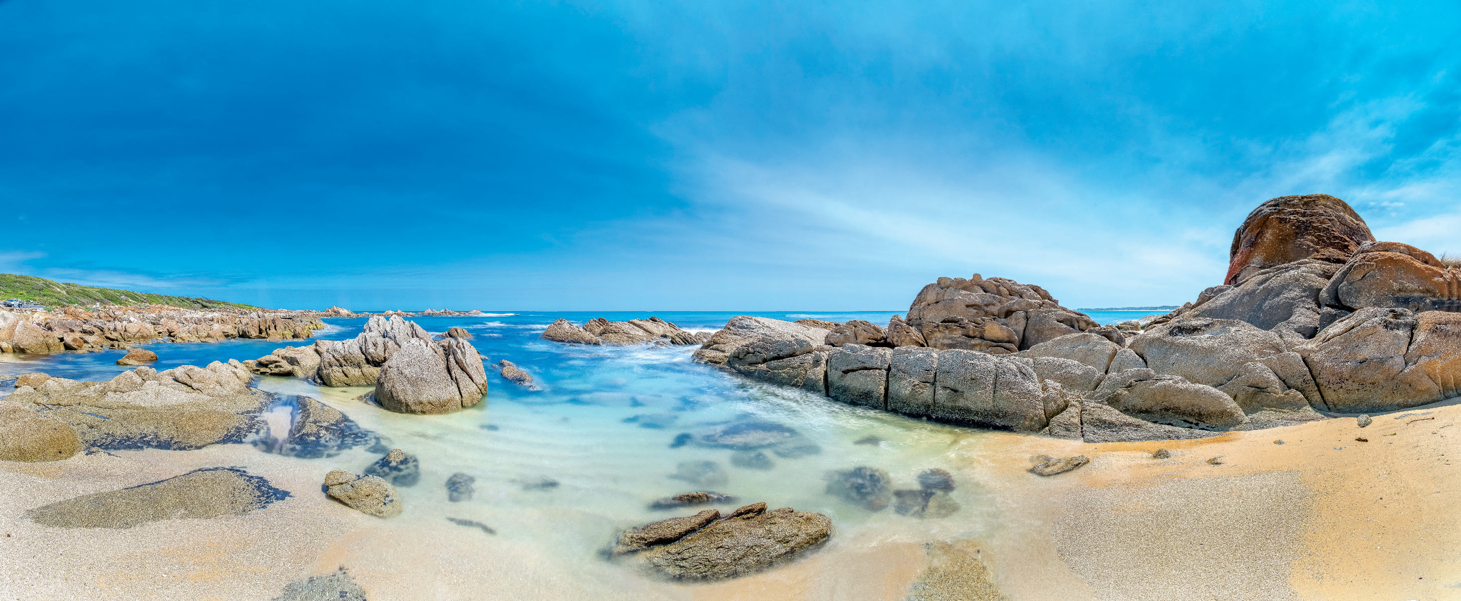
Many enjoying dining at the Marlo Hotel have driven 18km from Cape Conran’s Banksia Bluff campground. This campground forms part of the Cape Conran Coastal Park, 11,700ha of heathlands and woodlands fronting 60km of ruggedly beautiful Bass Strait beaches.
In 1881 the cargo steamer SS Ridge Park, laden with essentials for the region’s pioneers – which included French wine and German pianos - struck the aptly-named Beware Reef, 5km offshore from Cape Conran. Those who perished in the shipwreck are buried at Sailors Grave, a sheltered cove at the southern end of spectacular East Cape Beach near Banksia Bluff. Despite its unhappy past, Sailors Grave is popular for a picnic and splash in sparkling waters in a locale that’s been popular for millennia - there are Aboriginal shell middens nearby.
Run by Parks Victoria, Banksia Bluff is made up campsites, some cosy cabins and a lodge where up to 17 can slumber – all nestled amid hectares of banksia, scented paperbark, southern mahogany and tea trees that are home to multitudes of birds including kookaburras, rosellas and honeyeaters.
From our campsite it’s a few minutes stroll to the long sweep of East Cape Beach, where we set off for a seaside saunter. Pelicans, petrels, oystercatchers, Pacific gulls, cormorants, egrets, osprey and sea eagles call the region home, and we see some of them as we stroll along the pristine sweep of pearly-white sands.
This veritable eden supports around 300 recorded plant species and is a protected habitat for a whole slew of wildlife, including wombat, wallaby, echidna, platypus, bandicoot, sugar glider, potoroo and Australian fur seal.
The Conran Nature Trail winds to sandy beaches, rock pools, woodlands, lookouts and boardwalks, and gravel roads wind through dense bush to isolated spots such as the Yeerung River, popular for kayaking along tea-coloured waters.
Marlo to Mallacoota
From Cape Conran it’s 17km north along the Cabbage Tree-Conran Road to the Princes Highway, and from here 9km north to Manorina and the turnoff to Bemm River, population 70, situated on the shores of Sydenham Inlet. This secluded spot, regarded as among East Gippsland’s premier fishing destinations, is also a favourite with birdwatchers and bushwalkers, who appreciate the natural beauty and prolific wildlife.
Nestled between the inlet and the sea, Bemm River has a pub, a store and a caravan park. No petrol is sold here, so it’s wise to stock up before visiting.
Back on the Princes Highway, witnessing the extent of the 2019-2020 bushfires while driving amid this hilly, heavily-forested region is staggering. But the majority of the region boasts a profusion of vivid green regrowth on the trees that is simply remarkable: eucalypts are specialists at surviving, recovering and thriving again after a fire, and a verdant green canopy now covers much of northern East Gippsland.
Bellbird Creek, north of Manorina, is home to the isolated Bellbird Hotel, which was first established in the 1920s. Gary Swinton purchased the historic pub, set amid lush temperate rainforest and gurgling creeks, in 2019. Two weeks after he and his son moved into the charming old hotel the bushfires struck.
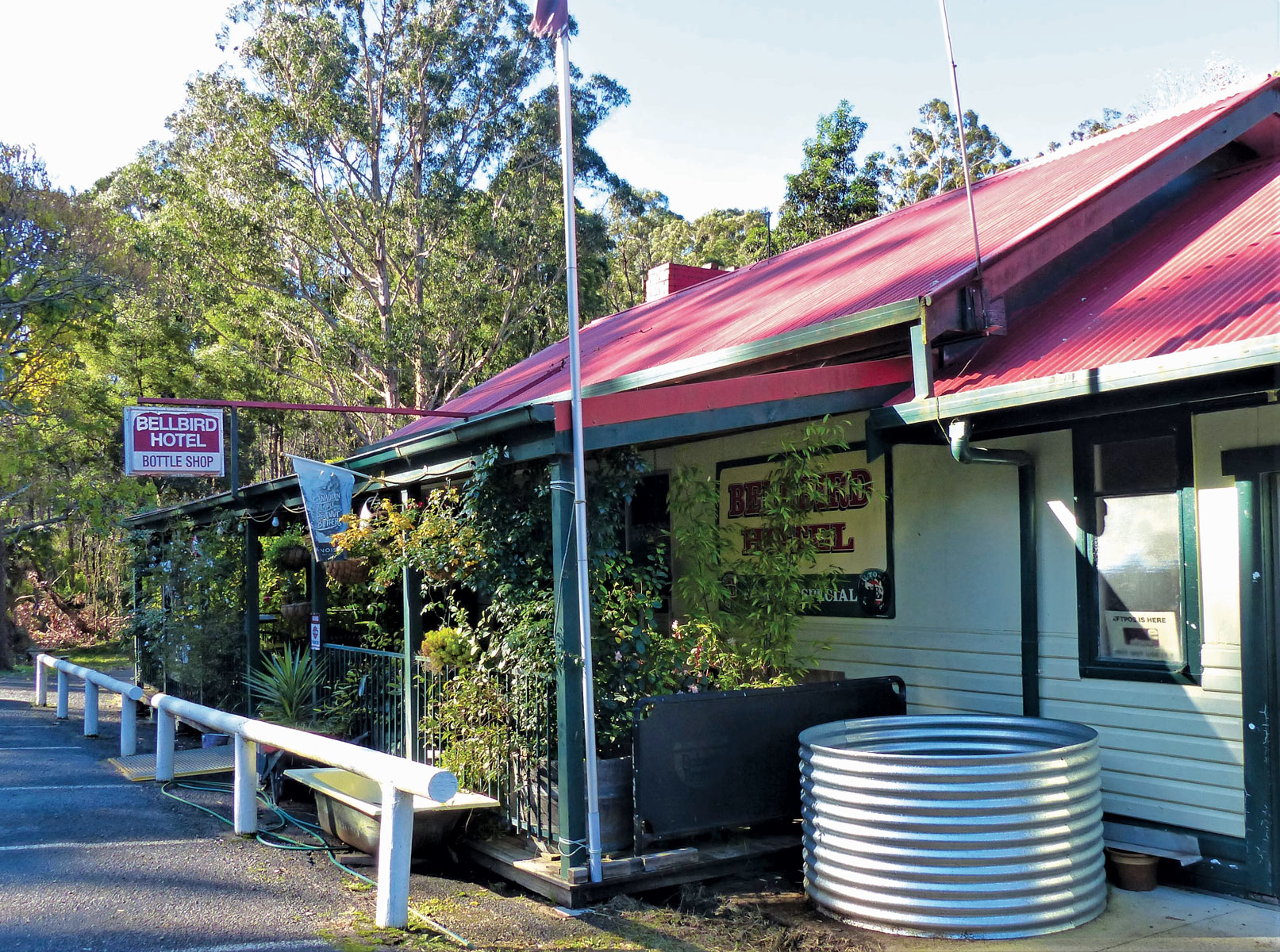
Swinton stated, “Bellbird Creek was at the epicentre of the fires. There’s a huge sprinkler system on the roof, and we fired it up before we had to leave. It saved the hotel.”
Just over three weeks after the fires, the first case of Covid-19 was recorded in Australia. And, like so many businesses across the country over the next two years, the Bellbird Hotel was affected. Today at this oasis in the bush, lyrebirds continue to sleep on the front veranda, bellbirds and king parrots serenade from the trees, and centuries-old tree ferns are flourishing.
“Tree ferns are incredibly hardy; new fronds appeared in no time after the fires,” said Swinton.
The Bellbird Hotel will be closed until October, when Swinton will reopen the doors to serve seafood baskets, chicken parmas, Thai green curries – and icy cold beer. Caravanners are welcome to stay for free at any time amid the rainforest at the rear of the hotel, and have a yarn with Swinton at his mini-garden of eden.
Cann River, 37km north of Bellbird Creek, is a busy petrol refuelling spot on the Princes Highway, and an ideal place to explore the 88,355ha Croajingolong National Park, which stretches around 100km from Sydenham Inlet at Bemm River to the NSW border. More than 300 species of birds sing across the forests of Croajingolong, including cockatoos, kingfishers, bowerbirds, emu-wrens, lyrebirds and lorikeets.
Victoria’s east coast is a whale migration highway, and humpbacks and southern right whales are the most commonly seen whales along Australia’s coastline. Each year between April and November, humpback whales can be seen migrating north to subtropical waters where they mate and give birth after a summer of feeding on krill in Antarctic waters. The majority of humpbacks in Australian waters migrate north from June to August, and back towards the Southern Ocean from September to November.
Southern right whales are similar to humpbacks in that they feed in Antarctica in the summer and then migrate north to Australia to breed and give birth. Thousands of whales pass along this coast during annual migrations, and late October and November are great viewing months.
Croajingolong National Park is accessed from a maze of gravel roads from multiple points along the Princes Highway, including Wingan Inlet Beach, 46km north of Cann River (including 34km of gravel road).
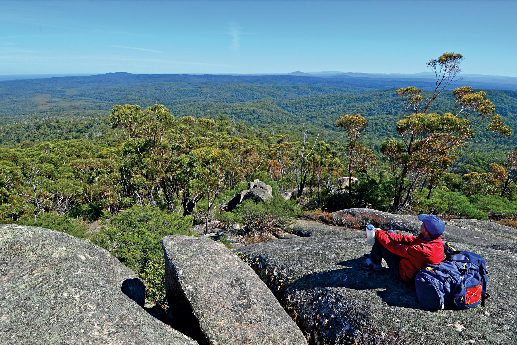
Croajingolong National Park from Mt Everard
At this remote spot the golden sands of Wingan Beach curve along the coast, a camping area is nestled amid eucalyptus trees and, offshore, a colony of fur seals sunbathe on a cluster of rocks called The Skerries. From here hiking trails lead to Lake Elusive, colourful with wildflowers in spring and summer, along the coast to Rame Head, and through fern gullies to the cascading Wingan Rapids.
The coast is dotted with campsites such as Wingan, including Shipwreck Creek, 15km south of Mallacoota. Mallacoota lies 24km off the Princes Highway in the heart of a genuine wilderness coast. Turning onto the C6I7 at Genoa on the Princes Highway, it’s a windy drive through the forest to Mallacoota via lovely Gipsy Point on the Genoa River.
On New Year’s Eve 2020, more than 4,000 people huddled under blood-red skies on the foreshore at Mallacoota as apocalyptic images of the town, surrounded by raging bushfires, were broadcast around the world.
With roads cut off, residents and holidaymakers were stranded in the coastal town, 630km south of Sydney, 515km northeast of Melbourne, and the inferno culminated in a dramatic Navy rescue by sea.
Today, tranquil waters sparkle in the sun in this remote corner of East Gippsland as fishing boats and tinnies ply the pristine waters of Mallacoota Inlet. Mallacoota Inlet boasts 322km of shoreline – about 40 per cent more than Port Phillip Bay – fed by 12 rivers, creeks and streams. Mallacoota is situated on the southwest side of Mallacoota Inlet, close to where it empties into Bass Strait.
While some sections of the town were lost during the fires, with 120 homes razed, today Mallacoota looks much like it did pre-fires; a laid-back village with a quiet main street (off-season) that includes the Mallacoota Hotel, the heart of this popular holiday haven since 1925.
Virtually the entire foreshore of town is given over to camping. The main foreshore between Captain Stevenson’s Point and Coull’s Inlet is like an extended waterfront caravan park, where campers relax and enjoy water views and spectacular sunsets.
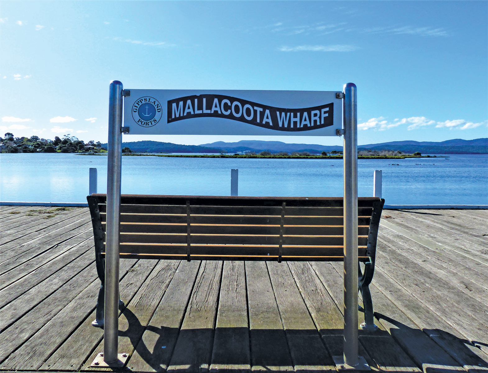
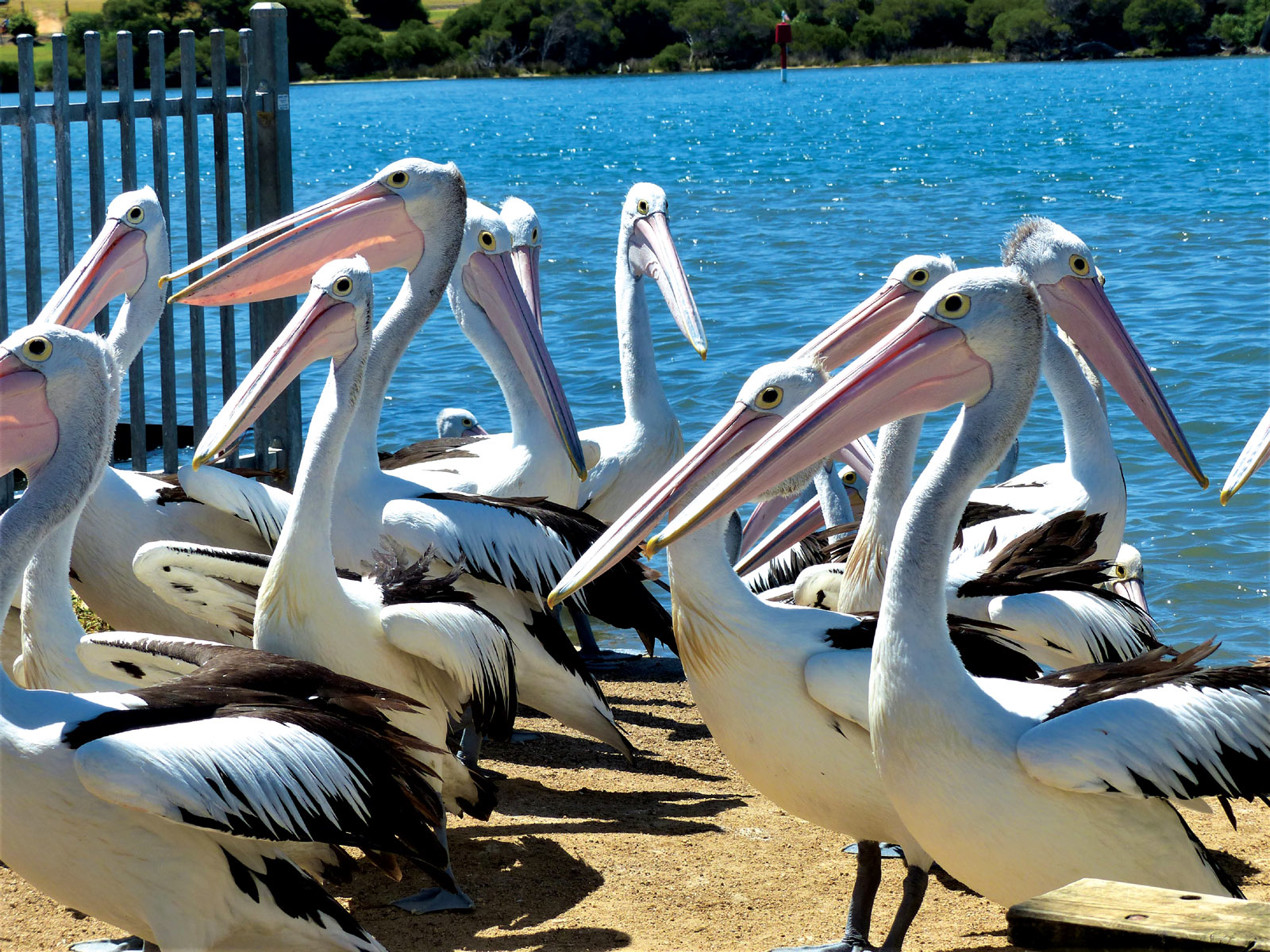
Mallacoota is popular for its pristine waterways, sweeping ocean beaches including Betka, Quarry and Secret Beach, and fishing – Mallacoota Inlet is renowned for whiting, flathead, snapper and bream. At Mallacoota Wharf, fisherfolk clean their catch, surrounded by clusters of prancing pelicans who tussle over the leftovers.
Blessed with Victoria’s warmest winter temperatures, Mallacoota is, like the rest of East Gippsland, open for business, and just the place for a well-earned dose of serenity.
Where to Stay
Swan Reach Holiday Park, set amid 6ha of gardens, has powered sites from $25 per night. Swimming pool, camp kitchen, kids playground.
Lealow on the Tambo caravan park at Johnsonville, midway between Bairnsdale and Lakes Entrance, has powered ensuite sites from $40 per night. Situated on a rural property on the Tambo River.
Lake Tyres Camp and Caravan Park has powered sites from $33.50 per double. Winter discounts June, July, August. Kitchen/dining facility; easy lake access, general store and Water Wheel Tavern over the road.
Nowa Nowa Caravan Park, nestled on the shores of Boggy Creek, has powered sites from $35 per double. Quirky, private retreat-style park with lots of artworks, collection of retro vans, stroll to lakeside, general store and pub.
Marlo Caravan Park and Motel has powered sites from $38 per double. Peaceful, grassed sites, children’s play area, fire pit, spa and deck where you can have a cooling ale while watching the sun set. Stroll over the road to the Marlo Hotel. Winter specials available.
Cape Conran Banksia Bluff sites from $19.30 per double. A ballot system is used to allocate campsites for peak periods. Advance bookings and payment required year-round.
Bemm River Caravan Park has powered sites from $35 per night. Camp kitchen with electric barbecues, 50m to Lake Edge, pet friendly.
Mallacoota Foreshore Holiday Park has powered sites from $26.50 per double per night (waterfront sites $34). Camp kitchen, playgrounds, BBQs.
Free camping
Genoa Camp Park, right on the Genoa River, has free camping in the grassed area with plenty of shade. Flushing toilet, no showers, BBQ areas.
Bellbird Hotel, 3872 Princes Hwy, Bellbird Creek, has free camping at the rear of the hotel,
Cann River Rainforest Caravan Park has free camping for up to 48 hours. Basic utilities in the amenities block, pet-friendly, no powered sites available, eastgippsland.vic.gov.au.


