Camperdown, Victoria: Volcanic plains, lakes and much more
Intense volcanic activity over the millennia has created unique landscapes across western Victoria, particularly in the region around Camperdown, part of the world’s third largest volcanic plains.
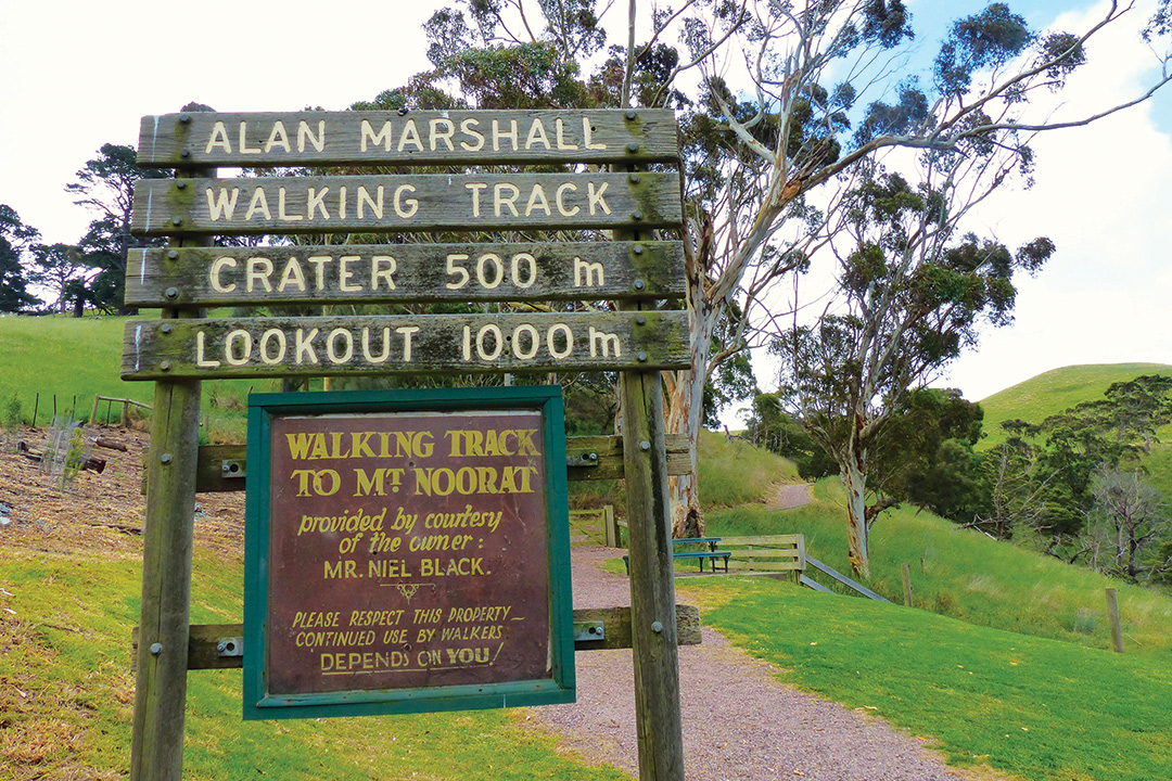
Generations of Australians knew Mount Noorat, one of Victoria’s best-preserved volcanoes, as Mount Turalla, which played a major role in Alan Marshall’s much-loved 1955 fictionalised autobiography I Can Jump Puddles.
Noorat is a small town on the Terang-Mortlake Road, 211km west of Melbourne. Alan Marshall was born there in 1902 at the rear of the Bee-Hive Store, which still stands in the town’s main street.
Over the road is the Noorat Primary School, built of stone in 1873. Alan Marshall attended school there, and related events of his school day memories and the people he met in his book, which sold more than three-million copies worldwide.
The Alan Marshall Walking Track is a 2.4km hike to the crater and summit of Mount Noorat, where trekkers are rewarded with sweeping views across the western Victorian volcanic plains. Marshall, who contracted polio at the age of six, climbed it on crutches.
Volcanic landscape
Since the dawn of its formation, the surface of planet earth has been moulded and reshaped by volcanoes.
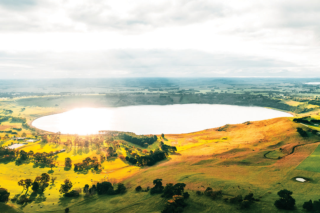
Although the volcanic plains across Victoria’s southwest were built up by sporadic volcanic eruptions over a period of around five million years, they are known geologically as Newer Volcanics. Covering an area of some 20,000sq km, this region is known as the Newer Volcanic Province, containing Australia’s youngest volcanoes.
Across this fascinating region more than 400 volcanoes and lava vents erupting over the earth’s fiery past have strewn the landscape with volcanic cones and craters, creating tranquil lakes, wetlands and waterfalls.
Some volcanoes last erupted 4000 to 20,000 years ago, with visible eruption points at Mounts Noorat, Elephant, Porndon, Gellibrand, Widderin, Shadwell and Leura.
Mount Leura and Mount Sugarloaf are part of a large volcanic complex known as Leura Maar, formed about 20,000 years ago by a series of major eruptions. Leura and Sugarloaf dominate the town of Camperdown, a bustling regional metropolis 21km east of Noorat.
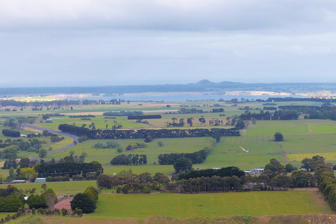
From the summit of Mount Leura there are amazing views across the volcanic plains — an undulating patchwork of pasturelands with volcanos punctuating the horizon, as well as shimmering blue crater lakes including Lake Corangamite, Bullen Merri, Gnotuk, Keilambete and Purrumbete. On clear days you can see as far as the Grampians mountain range and the Otway Ranges.
The Mount Leura Complex is listed by the National Trust as a state significant landscape and nationally significant geological feature.
During volcanic eruptions, stones from lava flows were strewn across the landscape and, long before European settlement, First Nations Australians used stone for semi-permanent dwellings, channels linking wetlands, weirs, wind breaks and fish traps.
The Djargurd Wurrung people are the traditional owners of the land around Camperdown. For tens of thousands of years, they occupied the area as a semi-nomadic hunter gatherer society.
The Djargurd Wurrung consisted of 12 clans, sharing a common language and strong cultural and family links, but each with its own territory and traditions. The Camperdown area was the territory of the Liwura Gundidj clan.
The first European settlers to arrive were the Manifold brothers — John, Peter and Thomas. After discovering the region’s rich volcanic soils during an exploratory trip in 1838, the English-born Manifolds relocated from their property near Geelong in 1839, building a hut on the northern side of Lake Purrumbete.
Today Lake Purrumbete is one of Victoria’s most popular freshwater fishing destinations, legendary among anglers for its trophy brown trout.
Lake Purrumbete is the only lake in mainland Australian to stock tiger trout and cheetah trout. Other varieties caught here include chinook salmon, redfin, brown trout, rainbow trout and brook trout.
Following the Manifolds’ arrival other settlers soon followed, and by the 1840s most of the land in the region had been taken up. A small township called Timboon grew about 2km north of present-day Camperdown, but the site was considered too swampy.
While Camperdown, established from the 1850s, grew into a service centre for wealthy pastoralists, the Djargurd Wurrung were forced or pressured to move to a mission at Framlingham, about 50km west of Camperdown. In 1970, under the Aboriginal Lands Act, the mission and surrounding land were finally returned to the traditional custodians.
Dry stone walls
As the land was cleared and settled, great swathes of cattle and sheep grazed across fertile, fenceless plains.
But when gold was discovered in Victoria in 1851 many squatters found themselves in a spot of bother as their jackaroos and shepherds abandoned their jobs and rushed to the goldfields.
“We are hard up for shepherds,” wrote pastoralist William Forlonge in 1851. “As the men’s time expires they all slope for the diggings. £50 is now being given for shepherds when they are to be got.”
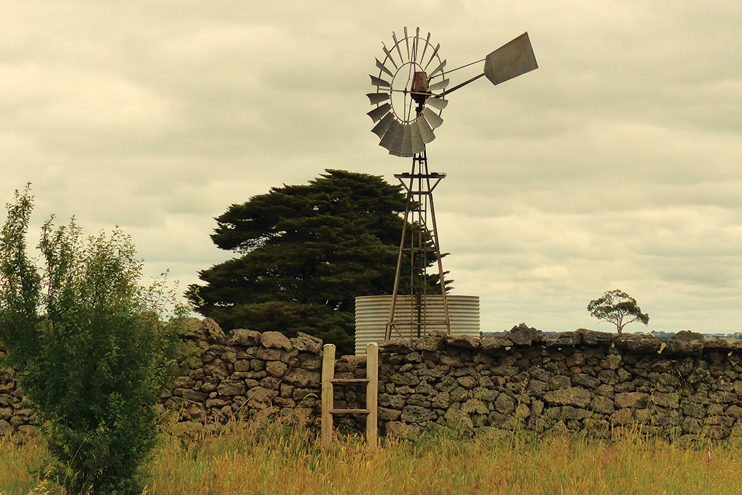
Fencing was desperately needed, but metal materials were expensive. What the early settlers had in abundance was stone — the land was littered with stones that, as molten lava, had bubbled to the surface during volcanic eruptions over the millennia. Thus, the backbreaking work of clearing land and erecting dry stone walls came to the fore.
Today western Victoria has around 3000km of dry stone walls. Driving country roads there are networks of stone walls everywhere — you could almost be in Scotland or Ireland.
Dry stone walling is an ancient craft. Ireland’s oldest walls, the Céide fields of County Mayo, were built around 5800 years ago. Teams of wallers who hailed from Ireland, Scotland, Wales, Cornwall and Devon plied their skills in this region, and taught the locals how to construct dry stone walls.
In the heyday of construction, wallers usually worked in teams, with apprentices serving at least two years collecting stones. Pluggers would follow and fill small gaps.
The walls created boundaries between public and private land, subdivided properties, separated sheep from cattle, stock from crops, and enclosed and protected early homesteads and gardens.
Rabbits were introduced to western Victoria in 1859 when settler Thomas Austin released 13 European wild rabbits on his estate, Barwon Park near Winchelsea. The rabbits had been specially collected and sent to him by a relative in England.
With abundant food sources and a lack of predators, the rabbits bred like — well, rabbits — and the scourge raced across the landscape. By 1866 hunters bagged 14,000 rabbits on the Barwon Park estate alone; by the late 1940s Australia’s rabbit population had increased to some 600 million.
A war against rabbits was waged across the country. Across the western district rabbit-proof dry-stone walls were built, or existing walls modified with overhanging copestone to try and make them rabbit-proof.
Stone walls still divide paddocks and farms across rolling hills and plains and are tended to this day by the descendants of the people who built them.
Gracious Camperdown
You can learn much about this fascinating region at Camperdown’s Visitor Information Centre, housed in the former circa 1886 courthouse, where volunteers provide an information pack about the many attractions in the area, and where local art adorns the walls.
Over the road is the town’s imposing 31.4 metre-high Gothic clocktower, a grand structure erected in 1896 which protrudes high above an avenue of Dutch elm trees which surround it in the main street. The impressive clock tower has drums that must be wound up once a week to keep the historic timepiece running.
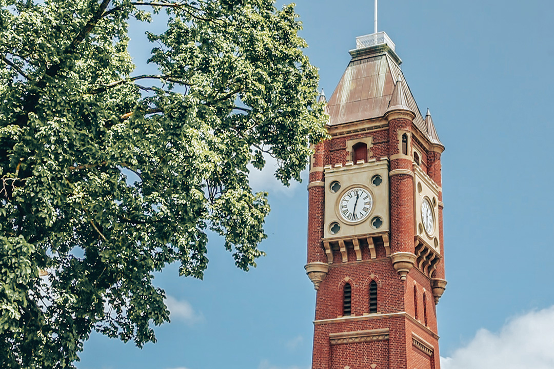 The clocktower at Camperdown (Image Great Ocean Road Tourism)
Camperdown’s main street boasts a magnificent 2km long avenue of more than 500 elms dating from the 1870s, 250 of which are listed on the Victoria Heritage register, so there are ample spots to savour the shade over a freshly brewed cuppa.
Heritage buildings along the main thoroughfare include the post office (1863 and still in use today); IOOF Hall (1896), several historic hotels and, just off the main street in Bath Street, the splendid Theatre Royal, an Art Deco beauty dating from 1927.
There are cafes aplenty in town, and other eateries include bakeries, hotels and the popular BP 24-hour roadhouse, where homemade scones and sausage rolls, big roast dinners and steaks, and equally big burgers are served and why trucks are always parked here. The homemade passionfruit sponge cake made by Darren at DJ’s Cafe in the main street attracts hungry diners too.
People travel from far and wide visit Camperdown to rummage through the town’s three opportunity shops — the Lifeline shop is so popular it’s open seven days a week — and six antique stores, all crammed with collectibles.
Camperdown is a gracious town, its wide streets, some also boasting shady elms, featuring many fine Victorian and Edwardian houses.
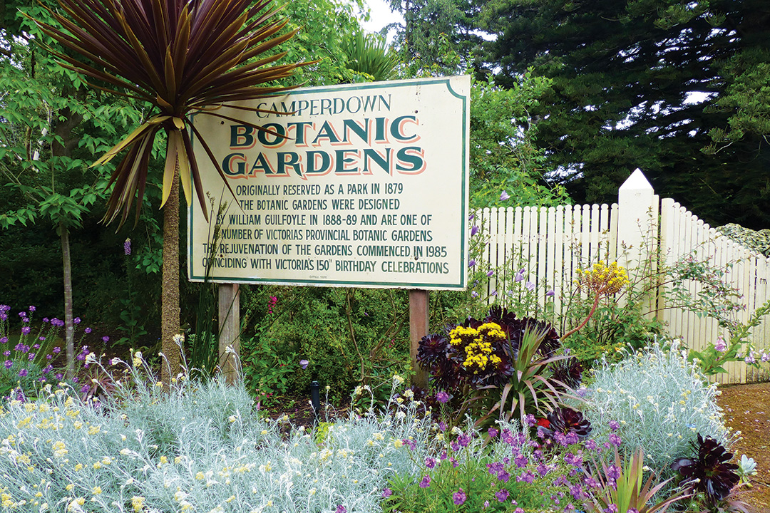
The lovely Camperdown Botanic Gardens, dating from the 1870s, lie above the two volcanic craters of Lake Bullen Merri and Lake Gnotuk.
Designed by legendary botanist and landscape gardener William Guilfoyle (1840-1912), the manicured gardens, resplendent with flowering plants, contain an array of historic trees including some rare examples of Himalayan oak.
Exploring the countryside and small villages around Camperdown you happen across one treasure after another.
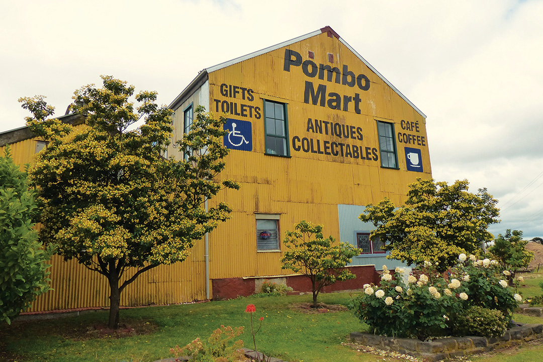
At Pomborneit North is the enormous Pombo Mart, housed in a former butter factory, which is crammed to the rafters with anything collectible imaginable, from lampshades, meat mincers, clocks, sideboards and dolls to old Phantom comics, and requires some time to scrutinise. Fortunately, there’s also a cafe for some timeout from fossicking.
At Lake Purrumbete, 8km down the road, we discover the Lake Edge Cafe, perched alone amid verdant paddocks right on the lake. The cafe was once the Homerton State School, which dates from 1875, and was moved to this tranquil spot nine years ago by owner Lois Dupleix.
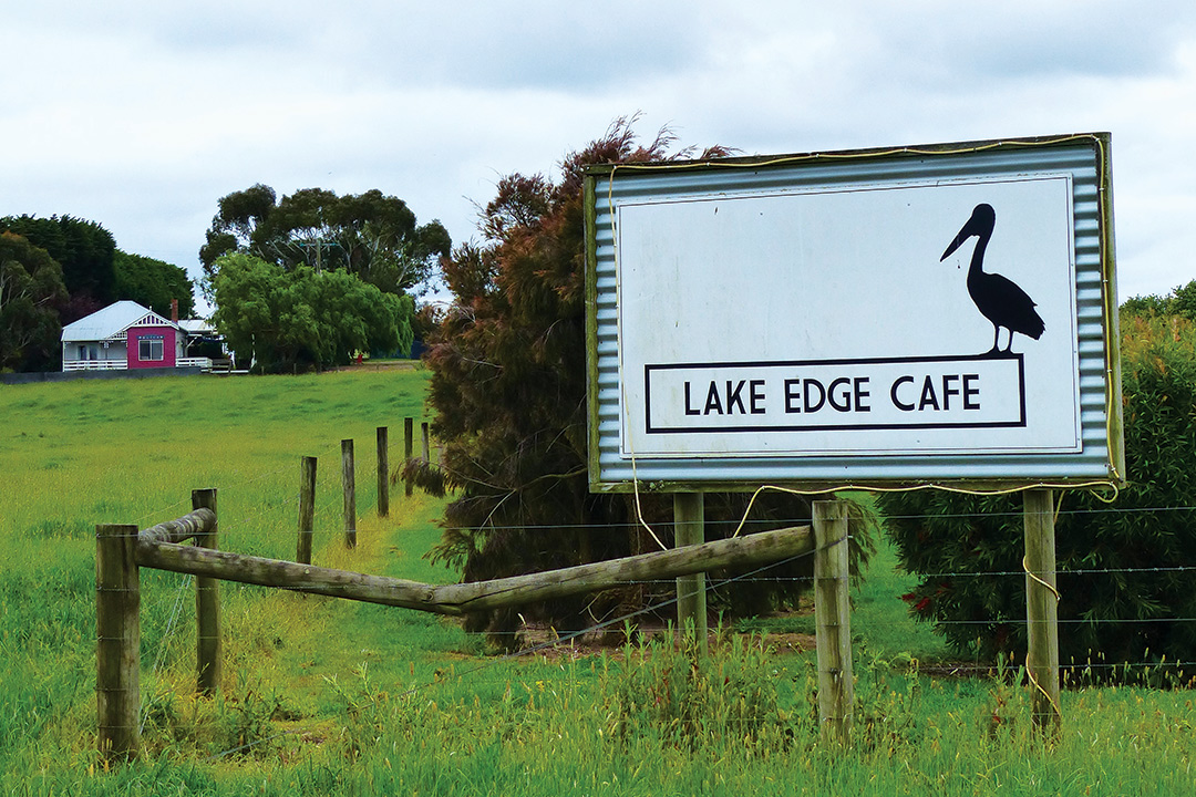
The cafe lies on part of Lois’ family farm, run by her son Jeremy. “I moved here with Mum and Dad when I was 14 years-old,” said Lois as the quaint cafe begins to fill with lunchtime diners. Although the café stands alone in this rural area, 10km southeast of Camperdown, almost every table is already reserved.
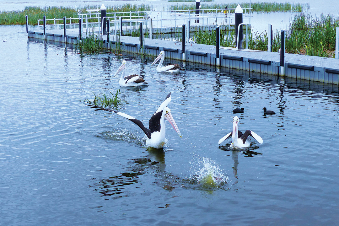
We soon know why; everything on the menu at this great little cafe is homemade, and the dining is very good indeed. Later, sipping coffee on the balcony, we watch swans glide by, and waterbirds splash on shimmering blue lake waters.
“This region is so beautiful I decided I wanted to share it with the rest of the world, so I moved the old schoolhouse here and opened the cafe,” said Lois.
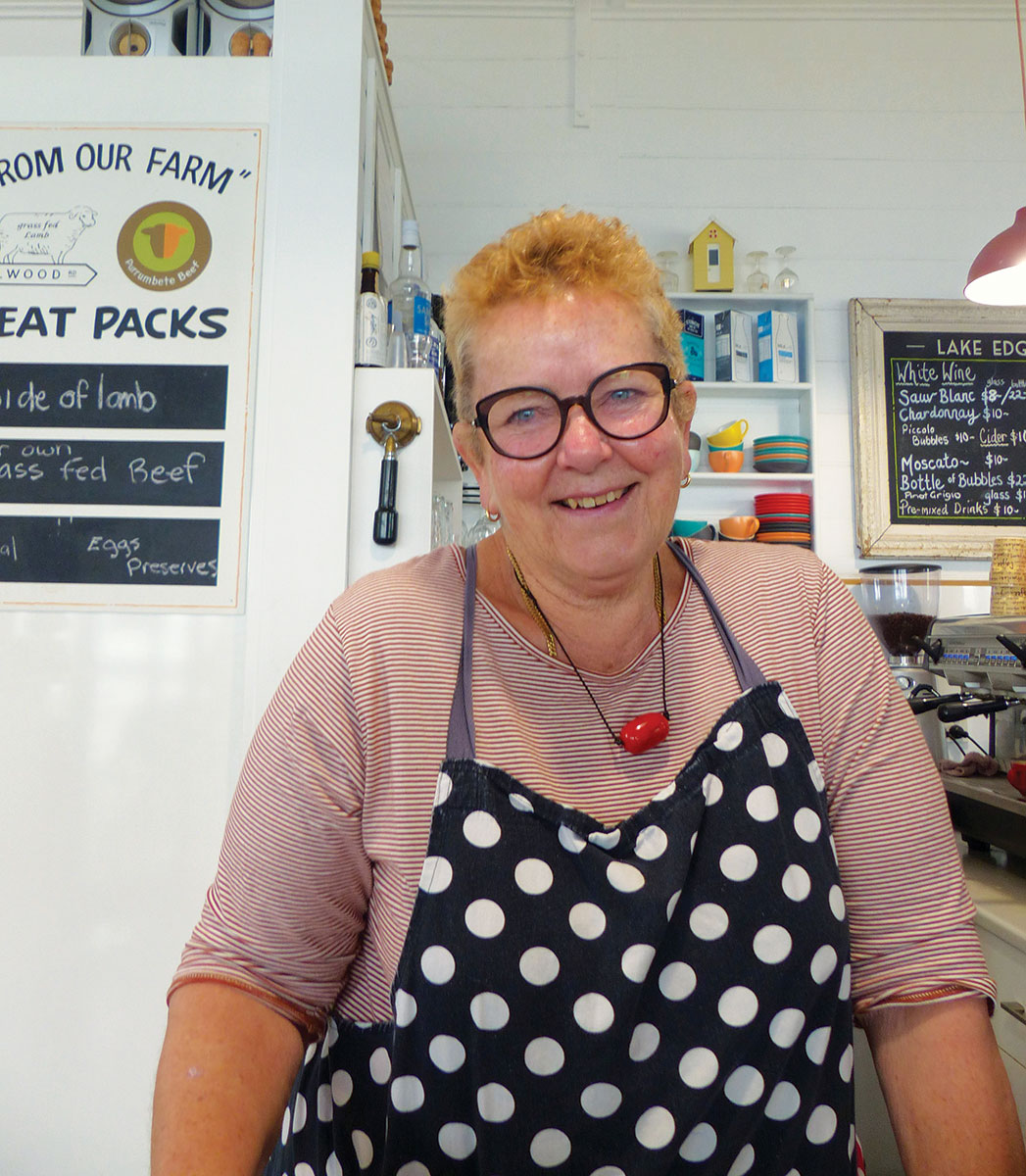 Lake Edge Cafe owner Lois Dupleix
Fast facts
- The Camperdown Information Centre is open daily from 9am-3pm, closed Christmas Day. Information includes local dry stone wall touring routes. 179 Manifold Street, Camperdown.
- Visitors can tour the Camperdown Clock Tower by appointment. Phone 03 5593 3144 or email courthousecamperdown@gmail.com.
- Isla Paasse, and enthusiastic media volunteer at Camperdown Information Centre, says that caravanners travelling in a group can arrange a tour of the town prior to arrival by phoning 03 5593 3144. Donation of $5 per person appreciated.
- The Lake Edge Cafe is open from 10am–4pm, Tuesday to Saturday. 658 Purrumbete Estate Road, Lake Purrumbete.
For more information on Camperdown and surrounds visit Great Ocean Road Regional Tourism.
Stay
- Lake Purrumbete Caravan Park, situated on the foreshore at the lake’s southern end, has powered caravan sites from $45 per double per night. The park has mooring facilities, jetties, a boat ramp and tackle store, and is pet friendly.
- Lakes and Craters Holiday Park, situated high on a hill between Lake Bullen Merri and Lake Gnotuk, has powered sites from $40 per night. Adjacent to Camperdown’s Botanic Gardens, camp kitchen, grassed and shaded sites, children’s playground.
Keep the adventure going
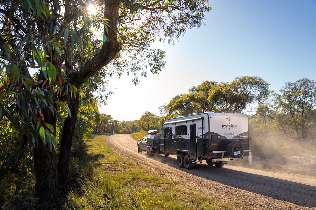
If you're heading further west on a Great Ocean Road trip, some other local areas to visit are Mount Shadwell, Budj Bim National Park and Mount Napier.
THE NEXT STEP
Are you ready to experience the freedom of the open road? Don't wait - Find your dream getaway now!